Sat-Sun: Non-working days
Customer
Roslesinforg
Project's objective
Provision of information support services for the Customer with processed remote sensing data (satellite imagery) on the territory of several forest districts: Zelenchuksky forestry of the Karachay-Cherkess Republic; Shegarsky and Pervomaisk forestry of Tomsk region; Kurbinsky Forestry Republic of Buryatia; Volgograd, Leshchevsky, Sredneahtubinsky forestries of the Volgograd region.
Work description
Specialists of the Innoter LLC selected and ordered an archival space survey for the indicated territories, satisfying the technical specifications provided by the customer:
-
guaranteed full coverage of objects;
-
the area covered by space imagery with a spatial resolution of not less than 0.5-2.5 m (depending on the specific area) is 100% of the total area of work;
-
multispectral shooting range, at least four spectral channels (RGB + NIR);
-
maximum cloud cover should not exceed 5% per object;
-
The range of the viewing angle is: 0-30º. The range of angles of the sun is 25-80º;
-
shooting period: snowless periods of 2013 – 2016;
-
image processing level: primary radiometric and geometric processing, correction of systematic sensor errors, including panoramic distortions, distortions caused by the rotation and curvature of the Earth, fluctuation of the satellite orbital height, fusion of panchromatic and multispectral images, obtaining a color image with high spatial resolution, saving in a single file all image channels, orthorectification in the UTM projection on the WGS84 ellipsoid;
-
the standard error of the binding must not exceed 10 meters;
-
radiometric resolution of 16 bits;
-
color-synthesized complex images (RGB + NIR);
-
projection – UTM (WGS84).
In addition, the satellite images provided to the customer underwent additional processing, including radiometric and geometric processing, correction of systematic sensor errors, geometric correction by orbital parameters, additional orthorectification according to SRTM-90.
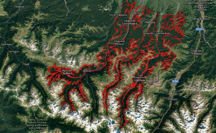
Zelenchukskoye forestry of the Karachay-Cherkess Republic (766 km2)
General scheme of the territory of objects of work

The total area is 76,585 hectares.
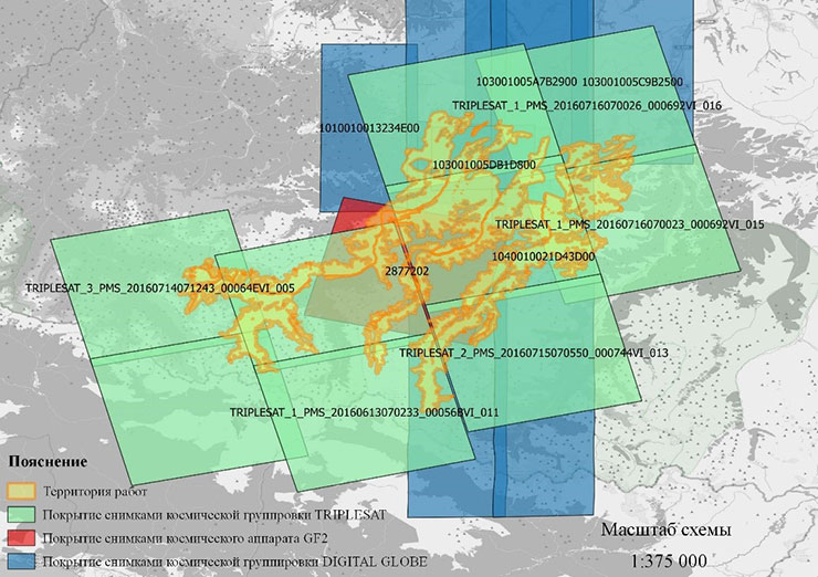
Location of satellite data on the territory

The area covered by space imagery is 76,585 hectares

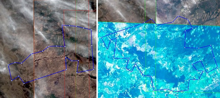
Location of space images on Pervomaisky forestry (1126 km2) district 1 (left), district 2 (right)
Results
As a result of the fulfillment of contractual obligations, Innoter LLC fully satisfied the requirements of the Federal State Budgetary Institution Roslesinforg in terms of providing remote sensing data to the imposing territory of several forest ranges. FSBI "Roslesinforg" and other end users of digital information – the Federal Forestry Agency (Rosleshoz) and branches of the FSBI "Roslesinforg" – this allowed us to update the information for future use in forestry in the planning, taxation, etc.
Need for consultation?
Fill the form and we will contact you
