of geospatial solutions
Sat-Sun: Non-working days
Customer
Research & Production Company Jena Instrument Ltd.
Project's objective
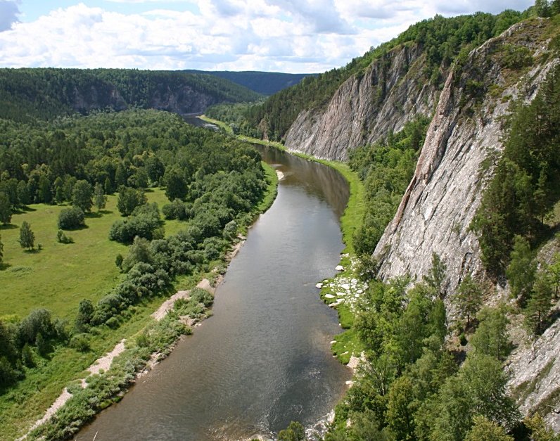
The purpose of the work is to cover the data of the space survey of the water areas of the inland waterways and adjacent areas with the subsequent creation of orthophotomaps for the preparation and updating of electronic navigation charts (ENC).
The complex of works is regulated by the Terms of Reference for the co-execution of work on the topic: “Carrying out a complex of works on creating and updating navigation data databases for cartographic support of inland waterways using signals from the GLONASS navigation satellite system, promising global navigation satellite systems and their functional additions.
Rivers: Neva, Suda, Svir, Belaya, Chusovaya, Cylva, Vyatka, Kama, Volga
Completed work


Work description
To perform work on the coverage of specified areas with high-resolution satellite images, space imagery materials obtained from the WorldView-1, WorldView-2 and GeoEye-1 satellites were used. In accordance with the terms of reference, the selection of satellite images to cover specified areas of GDP was carried out according to the following criteria:
-
Archival data must be created no earlier than 2010;
-
Archival materials should be selected based on the results of pan-chromatic and multispectral ultra-high-resolution satellite imagery (0.5-0.7 meters) from the WorldView-1, WorldView-2, and GeoEye-1 satellites of the landfill sites;
-
cloudiness in the photographs should not exceed 15%;
-
The season for taking pictures is summer, as well as autumn and spring, with the exception of the flood peaks;
-
the angle of deviation from the nadir should not exceed 30⁰.
Works on photogrammetric processing of space survey materials were carried out by using the PHOTOMOD software package version 5.2 and included:
-
project creation;
-
a set of tie points;
-
creation of digital elevation models at specified sites;
-
equalization of blocks of space images;
-
control of the accuracy of orthophoto images;
-
the construction of orthophoto images and the creation of orthophotomaps;
-
control of the accuracy of the created orthophotos.
Output products:
In the program module "Mosaic" orthophoto images were built, from which mosaic geolocated orthophoto images (orthophotomaps) were collected in the program module "PHOTOMODGeomosaic" with the following parameters:
-
geometric resolution 0.5 0.7 m;
-
dimensions 5x5 km2;
-
data volumes do not exceed 140 MB;
-
panchromatic mode;
-
WGS-84 / UTM coordinate system;
-
GeoTIFF bitmap format;
-
georeference data format TFW.
Results
The output product, including all schemes, was transferred to the customer. The output parameters of the created orthophotomaps comply with the requirements of the technical specifications and can be used to compile and update the ENC.
Need for consultation?
Fill the form and we will contact you
Sat-Sun: Non-working days