of geospatial solutions
Sat-Sun: Non-working days
Project's objective
Ensuring the search for ore gold within the Karymshinsky ore field of remote space and structural-formational foundations.Completed work
Work description
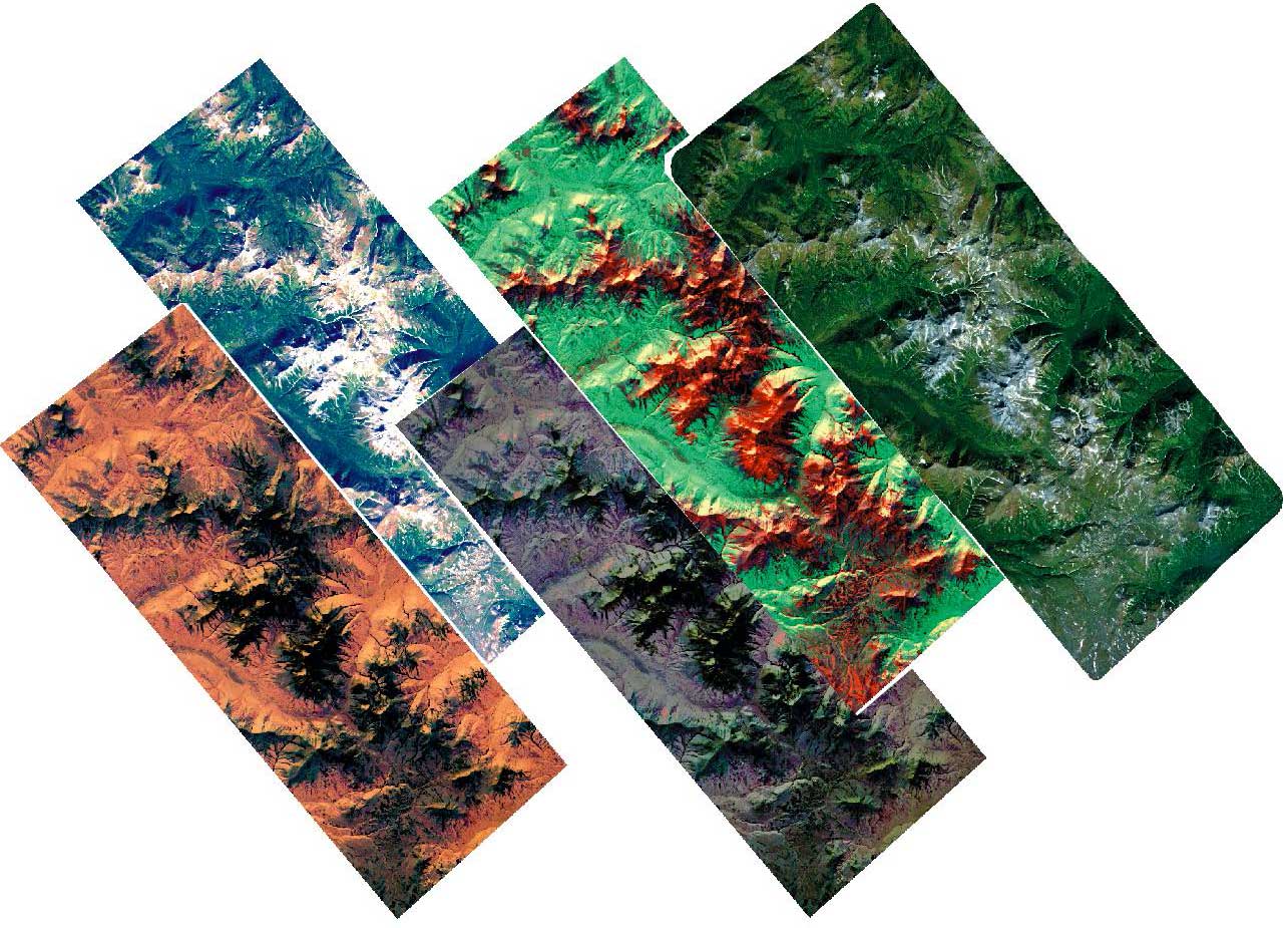
To create ortho-cosmophotoplans on a scale of 1: 100,000, it is recommended to use multispectral imagery materials of medium spatial resolution from the Landsat-8 satellite as source materials.
It is recommended to use multispectral high-resolution satellite images from the SPOT-6 satellite as source materials for creating 1:25 000 ortho-cosmophotoplans. It is recommended to use multispectral ultra-high-resolution satellite images from the WorldView-2 as source materials for creating 1: 5 000 ortho-cosmophotoplans.

Ortho-cosmophotoplan of the Karymshinsky ore field.
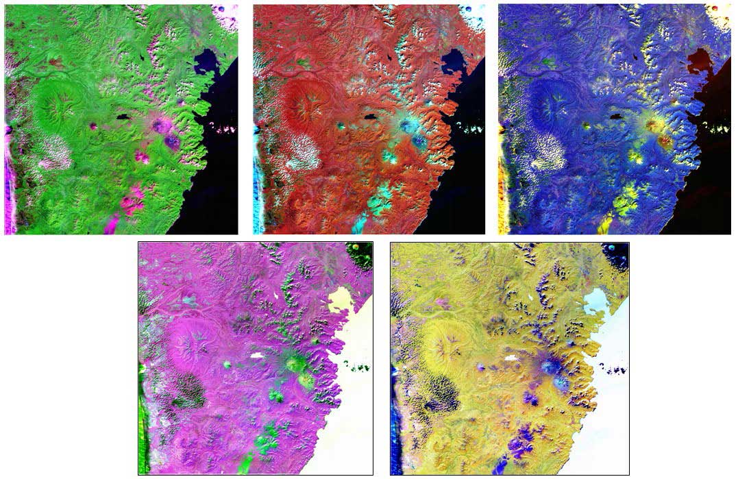
Radiometric and geometric (including orthorectification) correction of remote-sensing materials, transformation into a Gauss-Kruger / Krasovsky / Pulkovo-42 topographic base projection, synthesis of composites and multiplicative combination of materials of different spectral ranges and PAN, graphic editing, prepress preparation and printing of ortho-cosmos photographs. Orthorectification was carried out according to the model of relief available to the performer. According to the MDZ and SRTM data, 3D models of territories are synthesized at all scale levels. Created MDZ and relief preparations that were used in the process of expert interpretation, in order to increase its effectiveness.
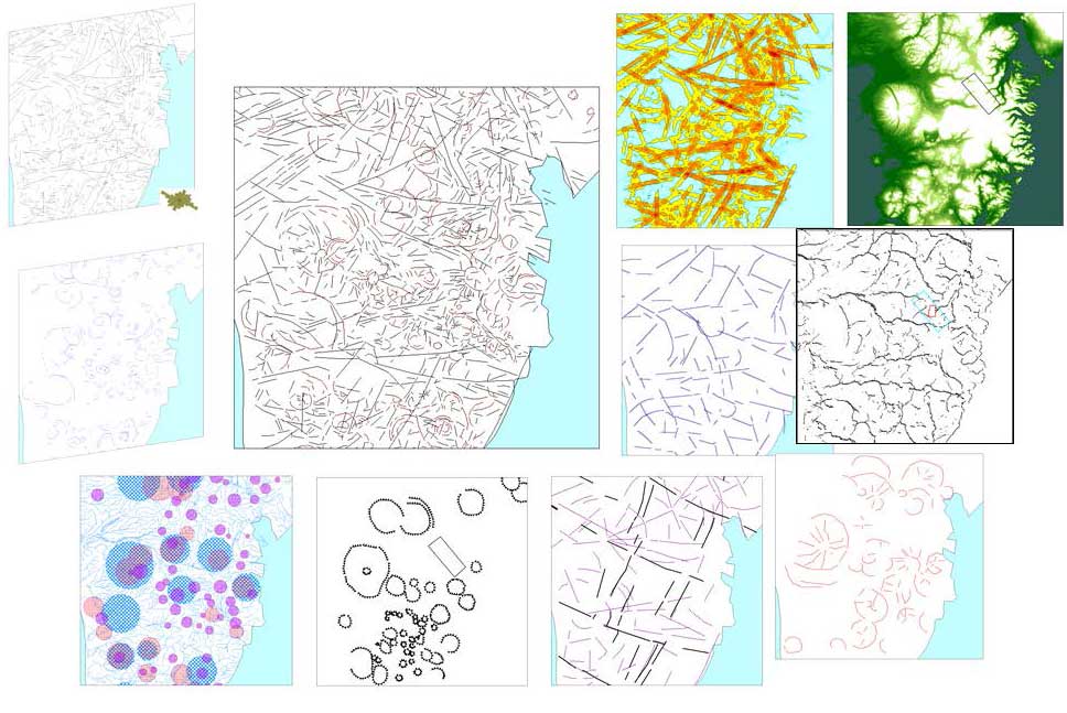
Thematic cameral interpretation of the entire set of materials of the DO, with the involvement of stock materials, and basing on its results the structural-tectonic schemes of the Banno-Karymshinsky ore cluster and the Karymshinsky ore field were compiled.
A report was drawn up containing sections on the methods of work, the characteristics of the materials used and the results of work, including structural zoning and forecasting recommendations.
Results
The customer has received the following results:
1. The distance base of 1: 100 000, 1:25 000, 1: 5 000 scales, including:
-
Ortho-cosmophotoplan (composite in visible, infrared and panchromatic ranges), at a given scale, covering the area of the ore cluster according to the coordinates specified in the statement of work.
-
3D model (with anaglyphic coding of the relief) at a given scale, covering the area of the ore cluster according to the coordinates specified in the statement of work.
2. Preparations of digital relief and materials of remote sensing corresponding to each of the scale levels used, including 1: 100 000, 1:25 000 and 1: 5 000.
3. The structural-tectonic scheme of the Banno-Karymshinsky ore cluster at a scale of 1:50 000, based on the results of the interpretation of the set of materials of the DO with the involvement of stock materials.
4. The structural-tectonic scheme of the Karymshinsky ore field on a scale of 1:10 000, compiled basing on the results of the interpretation of a set of materials of the DO with the involvement of stock materials.
5. Report with forward-looking recommendations.
Need for consultation?
Fill the form and we will contact you
Sat-Sun: Non-working days