Sat-Sun: Non-working days
Customer
A company engaged in the development of geographic information systems (GIS)
Project's objective
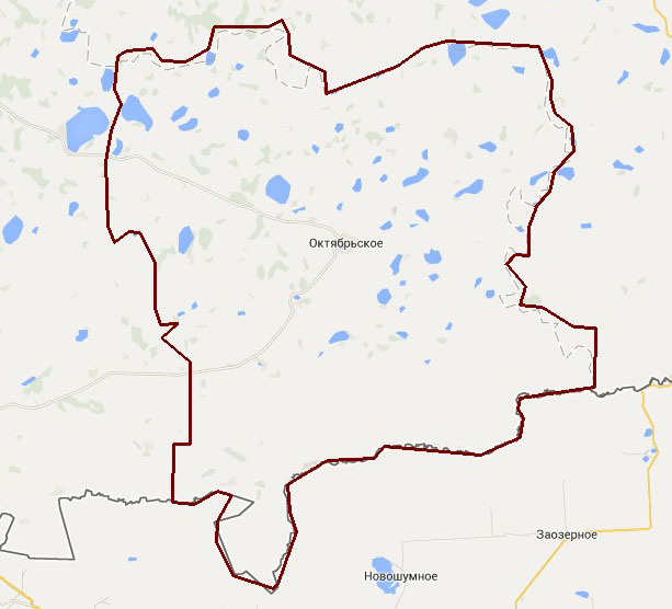
Production of thematic photo maps based on the materials of the space survey from the RapidEye satellite on 4612 sq. km. of the territory of the Oktyabrsky district, Chelyabinsk oblast.Work description
A new survey was ordered for the area of interest that meets certain requirements for creating thematic photo maps. “RapidEye” spacecraft with a spatial resolution not worse than 5 m in the nadir was chosen as the supplier of images. In 2014, images were collected that contain an infrared channel (NIR), necessary for deciphering vegetation, with cloudiness and permissible slope parameters of 10% and 35 °, respectively.

The layout of the territory of the October district.
At the second stage, thematic interpretation of materials of space shooting was carried out. The following objects and characteristics of the territory were identified by indirect and direct signs in the photographs:
-
vegetation types;
-
types of forest communities;
-
agricultural lands, overgrown with vegetation;
-
cutting downs;
-
geological outcrops of natural and artificial origin;
-
built-up areas.
The data of the primary interpretation was structured, in accordance with this, attribute tables were compiled containing the necessary semantics. The resulting vector layers are uploaded to the ESRI Shapefile format. The main software used was QGIS cross-platform geo-information system. The composition of the attribute information:
-
vegetation type;
-
forest community view;
-
composition of valuable objects of flora and fauna;
-
age of cutting, presence and age of landings;
-
the genesis of the outcrops (erosion, landslide, scree, river accumulation, mining), the lithological composition of the outcrops, natural and scientific value (yes / no), conservation status (installed / not installed, status type (nature monument), name of the protected areas);
-
type of building (residential urban type, residential rural type, country type, production and logistics, transport).
Results
The result of the provision of services was the production of thematic photo maps based on materials from the space imagery from the RapidEye spacecraft (“digital geospatial data / CHD”) obtained as a result of a new space shooting. The data package delivered to the customer included:
-
Geolocated orthorectified space images;
-
Geo-information database;
-
Explanatory note to the created materials.
Need for consultation?
Fill the form and we will contact you
