Remote geological exploration of copper porphyry deposit
Remote geological exploration of copper porphyry deposit
01
About the project
Remote geological exploration of a copper porphyry deposit in the area of the Customer's interest based on medium resolution remote sensing (RS) materials and identification of ore prospective areas based on the results of spectral analysis.
Industry
Spatial data
Customer
Confidentially
End date
06/20/2023
02
Project goal
Remote geological exploration of a copper porphyry deposit in the area of the Customer's interest based on medium resolution remote sensing (RS) materials and identification of ore prospective areas based on the results of spectral analysis
03
Completed works
Selecting materials for space imaging within the Customer's area of interest;
Preliminary processing of remote sensing data (RS data) in specialized software;
Creating a map base at a scale of 1:50,000.
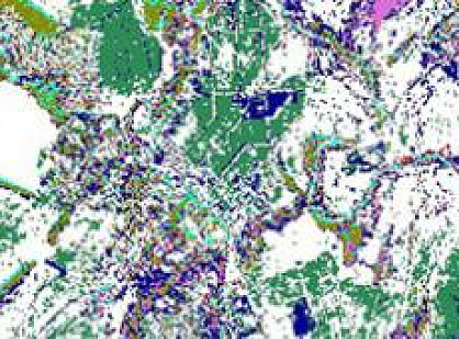
Spectral analysis of high and medium-resolution satellite images using mineral indices;
Interpreting the data obtained from spectral analysis of satellite images.
Source Materials
Medium spatial resolution satellite images from Sentinel-2, ASTER, Landsat, GF, and Kanopus satellites were selected and used as source materials for the project.
Performed Tasks
The key factor for the successful execution of such work is the use of the SWIR (Short-Wave Infrared) imaging range. The human eye can only perceive a small portion of radiation, from 400 to 700 nm. However, existing RS satellites can capture images in the range of 250 to 15,000 nm. Based on multispectral imaging data, extensive research is conducted in the fields of environmental monitoring, geology, hydrology, and more. SWIR stands out among all spectral ranges, enabling the mapping of rock formations and minerals.
The selected satellite images within the customer's area underwent preliminary processing in specialized software ENVI. The preprocessing of images is crucial, as it directly affects the final results of the work.
Preprocessing includes the following steps:
Extracting the image area within the boundaries specified by the Customer;
Atmospheric and radiometric correction;
Normalization of image pixel values;
Subtraction of vegetation and cloud masks from the image fragment;
And more.
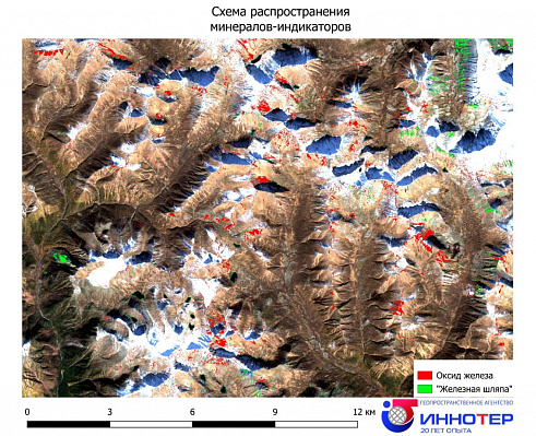
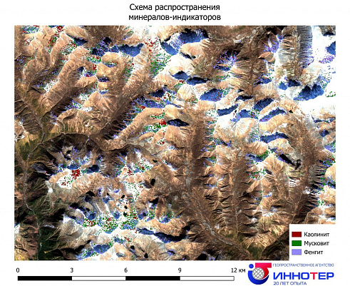
The next key stage involves selecting a spectral library and calculating mineral indices for image analysis. For this project, the reference library of USGS minerals and the proprietary library of GEO Innovator LLC were chosen. Mineral indices such as kaolinite, phengite, muscovite, quartz, iron, etc., were calculated as indicators of copper-porphyry deposits.
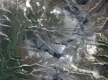
* The presented sections do not correspond to the project's areas and are provided solely for visualization purposes.
Remote Geological Survey.jpg
Remote Geological Survey 2.jpg
Remote Geological Survey 3.jpg
04
Result
Prospective areas of gold-copper ore deposits were identified, some of which were also identified based on the results of previous research by other contractors.
The obtained results using remote sensing methods were compared by the Customer with earlier results from other studies (including geophysics and fieldwork), with a matching percentage of 76%.
Two areas were deemed non-prospective, 6 areas were identified as new prospective sites, and 16 areas matched with previously identified prospective sites. Prioritization of the areas for further research was conducted.
The area of the identified sites ranges from 74 hectares (0.74 square kilometers) to 473 hectares (4.73 square kilometers).
The Customer will continue working with GEO INNOTER LTD on this project, acquiring new high-resolution visible range and high-resolution SWIR (Short-Wave Infrared) range satellite imagery, as well as Chinese hyperspectral satellite imagery for the next phase of the project.
Key Success Factors
The main factors contributing to the success of such projects include GEO INNOTER LTD proprietary methodology in implementing geological exploration projects, a team of specialists in the selection and processing of satellite imagery, cartographers, programmers, as well as a highly qualified team of experts with extensive experience in solving geological exploration and mineral resource exploration tasks.
Need satellite imagery or help choosing the right data?
Describe your task, area of interest, and desired outcome. We will check data
availability, assess new acquisition options, and propose the optimal solution in terms of timelines, cost,
and quality.
Fast feedback during business hours
We will select the best data for your task
Confidentiality guaranteed
Discuss the project
clients who trust us
25+ years in the geodata market
Мы используем Яндекс.Метрика и собственные Сookies для обеспечения наилучшего
опыта работы на нашем сайте, персонализации сайта для наших пользователей и аналитики.
Продолжая использовать сайт вы соглашаетесь с условиями
Пользовательского соглашения.
Request a call
Leave your contact details — we will get back to you during business hours, clarify the task and suggest suitable data or services.
Write to e-mail
Send a message, technical specification or task description. We will review your request and reply to the specified e-mail.
Fill in the order form
Describe the area, object and imagery requirements. We will check archive availability, the possibility of a new acquisition and offer a suitable option.
Order software
Order TK
Your application is accepted
We will contact you during working hours.
Выбрать город
Россия
Другие страны
Белоруссия
Contact via WeChat
Feliks Fokin
Open WeChat and scan the QR code to add the contact. On a phone, save the code and select it in the WeChat scanner.