Sat-Sun: Non-working days
Customer
Land management organization
Project's objective
Delivery of new space imagery and the creation of orthophotomaps in areas located on the territory of the Tomsk and Tyumen regions, with a total area of 3175 sq. km for land survey and cadastral works.
Work description
According to the terms of reference, the first step in the execution of the contract was the order of a new survey with the spacecraft Pleiades-1A / 1B in the territory of interest. Considering the large amount of data for which delivery was required, as well as various meteorological conditions in the Tyumen and Tomsk regions, all work was carried out on time, ahead of the terms of reference of the technical task.
Requirements for the ordered shooting:
-
Completeness: color image with a resolution of 0.5 meters.
-
Processing Level: Primery.
-
The maximum allowable percentage of cloudiness in the area of interest is 15%.
-
The angle of deviation from the shooting nadir – up to 30 °

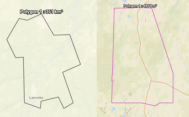
Archinsky-Urmansky districts (left) and Karamovskoye (right) districts
The second stage was the creation of orthophotomaps based on the resulting Pleiades-1A / 1B satellite. The planned accuracy of the creation of an orthophotomap on the territory, provided by the planning-altitude points and the matrix of heights with the required accuracy, made the standard deviation (standard error) 1.5 meters. The plan-altitude points and the matrix of heights provided the customer. Creation of orthophotomaps was carried out in the local coordinate system, the transition keys to which were provided by the customer.
The last stage was cutting orthophotomaps into fragments of 500 MB each.
Results
Innoter fulfilled its obligations and supplied the customer with remote sensing materials, including images from the Pleiades-1A / 1B satellites, as well as orthophotomaps based on them for a total area of 3175 km². According to the results of all the above photogrammetric works, a report was submitted in electronic form.
Need for consultation?
Fill the form and we will contact you
