Sat-Sun: Non-working days
Customer
Roscartography
Project's objective
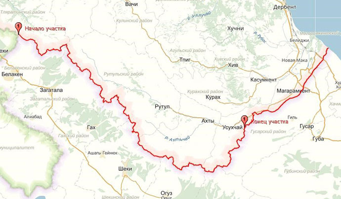
The aim of the project was to provide remote sensing data to perform topographic and geodetic works during the demarcation of the Russian-Azerbaijani state border on a total area of 1112 km2 (278 km in length).
Work description
The Pleiades space stereo photographs were provided to the customer based on the results of the new territory survey – a color synthesized image with a resolution of at least 70 cm. Each stereo pair was obtained from one orbit of the spacecraft.
At the same time, the materials of the new space survey met the following parameters:
-
radiometric resolution, bit / pixel – 10-12;
-
processing level – Primary;
-
data presentation format – GeoTIFF;
-
presence of clouds is not more than 10%;
-
tilt angle of shooting no more than 10 °;
-
the angle of the sun is at least 20 °.

Russian-Azerbaijani state border with a length of 278 km.
Results
As a result of the fulfillment of the contract, the customer qualitatively carried out the demarcation of the state border between Azerbaijan and the Russian Federation basing on new space stereo filming.
Need for consultation?
Fill the form and we will contact you
