Sat-Sun: Non-working days
Customer
Research and Production Center
Project's objective
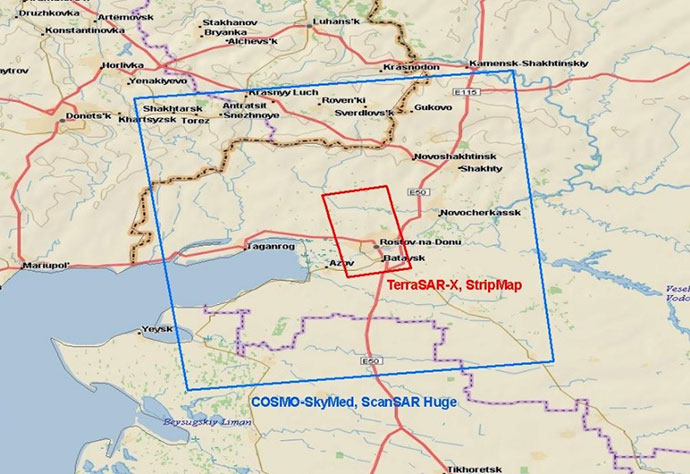
Receiving remote sensing radar data of from TerraSAR-X (StripMap) and COSMO-SkyMed (ScanSAR Huge) satellites to the territory of the Rostov oblast.
Work description
Within the framework of this order, we have selected the radar data from the TerraSAR-X (StripMap) and COSMO-SkyMed (ScanSAR Huge) satellites that had met the following customer’s requirements for the surveying parameters:
-
Resolution – 3 meters for TerraSAR-X (StripMap) and 100 meters for COSMO-SkyMed (ScanSAR Huge);
-
Polarization VV;
-
Processing level – radiometric, sensory and geometric corrections, geolocation;
-
Date of shooting – May 23, 2014
-
The area of the scene for images from the TerraSAR-X satellite is 1500 square meters. km; for images from the COSMO-SkyMed spacecraft – 40000 sq. km.

The scheme of scenes’ layout
Results
In the course of analyzing the availability of archived images for May 23, 2014, satellite images of TerraSAR-X (StripMap) and COSMO-SkyMed (ScanSAR Huge) were selected to satisfy customer requirements.
Need for consultation?
Fill the form and we will contact you
