of geospatial solutions
Sat-Sun: Non-working days
Customer
Federal State Budgetary Institution "All-Russian Scientific Research Institute of Medicinal and Aromatic Plants"
Project's objective
In the framework of the customer’s technical assignment, filming, photogrammetric works (creating an orthophotomap), automatic interpretation were carried out.
Completed work
Work description
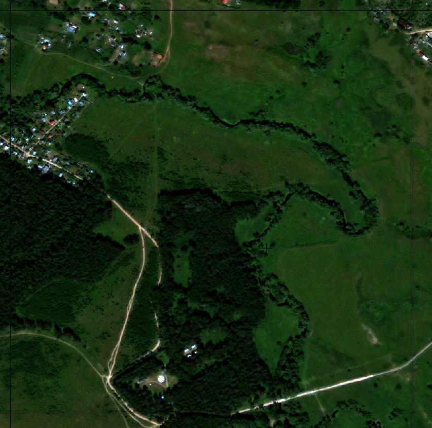
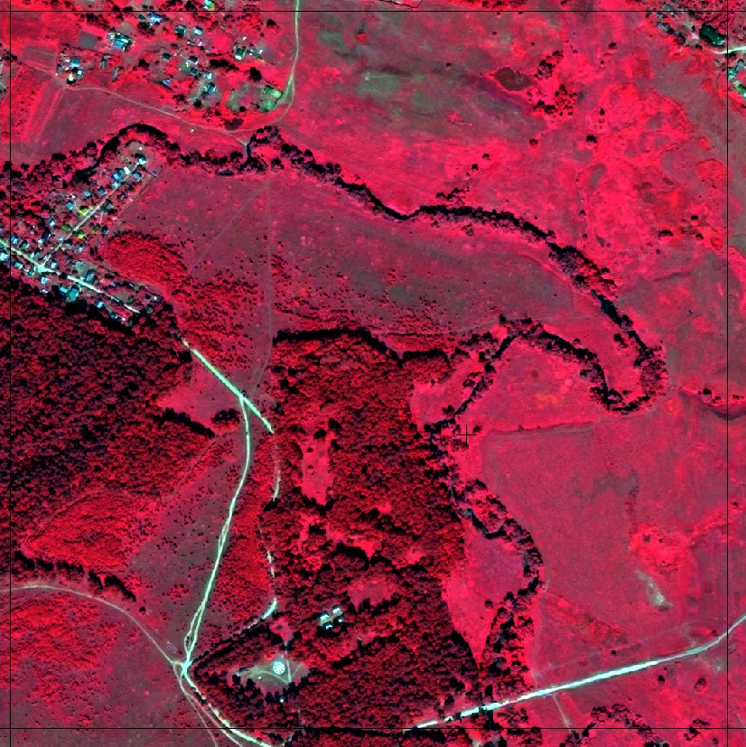
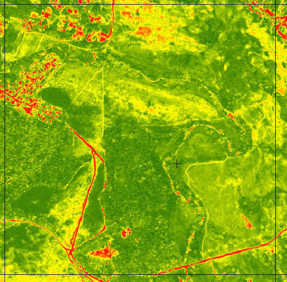
Filming: The WorldView-2 archived image was used. The whole complex of photogrammetric works on the creation of an orthorectified mosaic plan was carried out by using the PHOTOMOD version 6 of the program and included:- Preparation of planned high-altitude binding (space imagery materials obtained from the WorldView-2 spacecraft contain a geometric model that allows you to snap a picture with an accuracy of CE90 = 5 m at tilt angles of up to 30 degrees);
- Preparation of digital elevation models;
- Adjustment of the image (WorldView-2 image adjustment was performed using the RPC geometry model provided with the image);
- Creating an orthorectified image (Equalized materials of space imagery are geometrically corrected by orthorectification using the nearest neighbor method using equalization results and a digital elevation model)
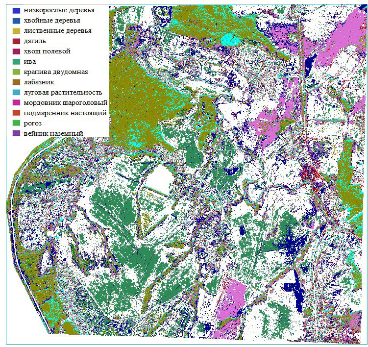
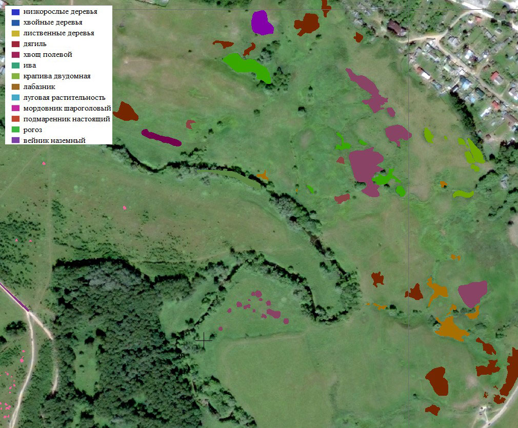
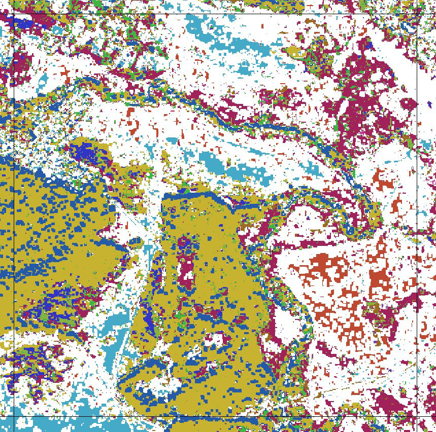
Creation of an electronic map: The whole complex of works of creating an electronic map was carried out in the software of the ESRI company: ENVI, ArcMap. Several controlled classification tasks were performed in the ENVI software package. In GIS "ArcMap" works on creating a printed layout were performed.
- The purpose of automatic decryption was to create an electronic map of medicinal plants satisfying the conditions:
- Full coverage of the area of interest
- Maximum compliance with field survey results
- The classifier should contain certain plants: horsetail, cattail, willow-herb, medicinal dagger, ground reed, etc.
Classification was performed using the "Neural Networks" algorithm. The results of the classification are presented in the figure.
Results
The results of the work showed that it is possible to use the multispectral data of ultrahigh resolution for searching and evaluating stocks of medicinal plants, creating an electronic map.
Despite a positive result, a few difficulties arise with the classification of plants localized into groups whose area is less than 4 square meters.
Problems arose with the plant "rogoz". The difficulty of classification lies in the poor standard of this plant. Within this standard, there are different stages of plant development and forbs.
In general, the results are positive. In the future, in these studies, to obtain a higher result, it is necessary to consider the peculiarities of the vegetation of the desired plants, the peculiarities of their localization into groups and the area of the reference areas.
Need for consultation?
Fill the form and we will contact you
Sat-Sun: Non-working days