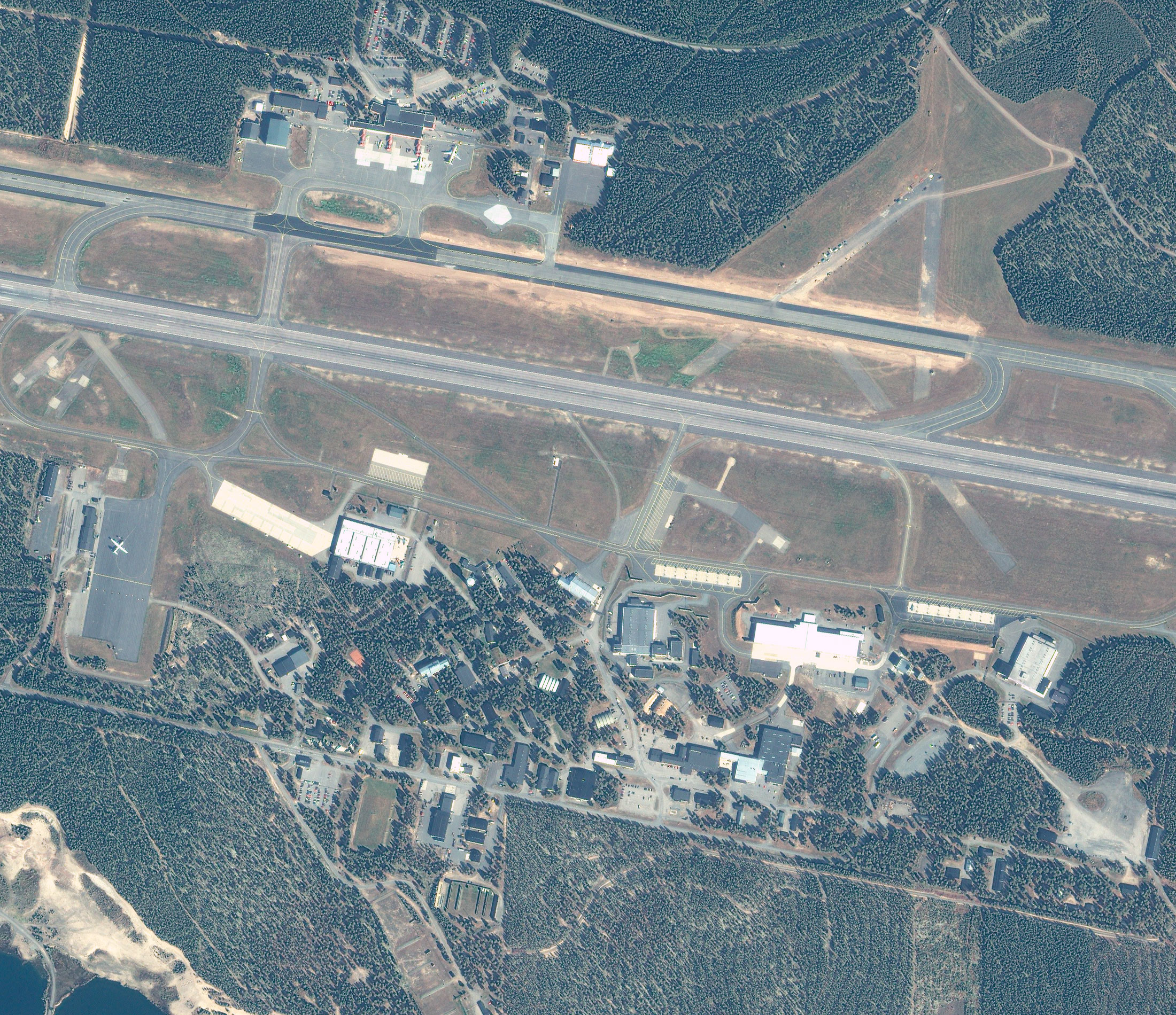
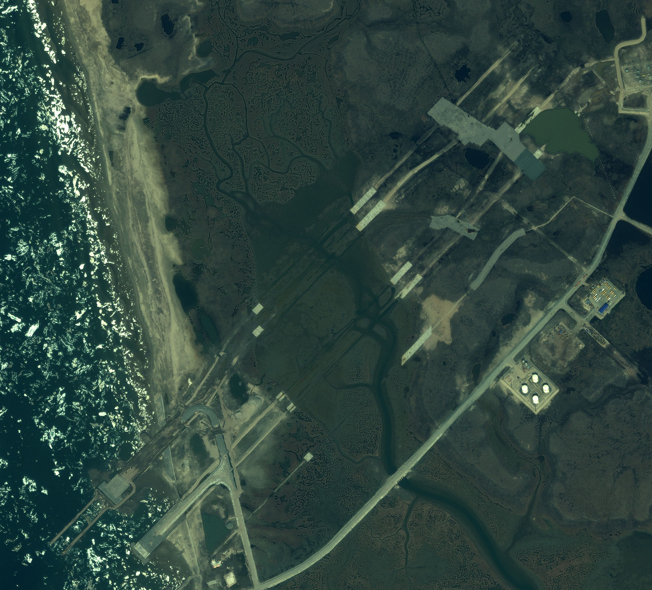
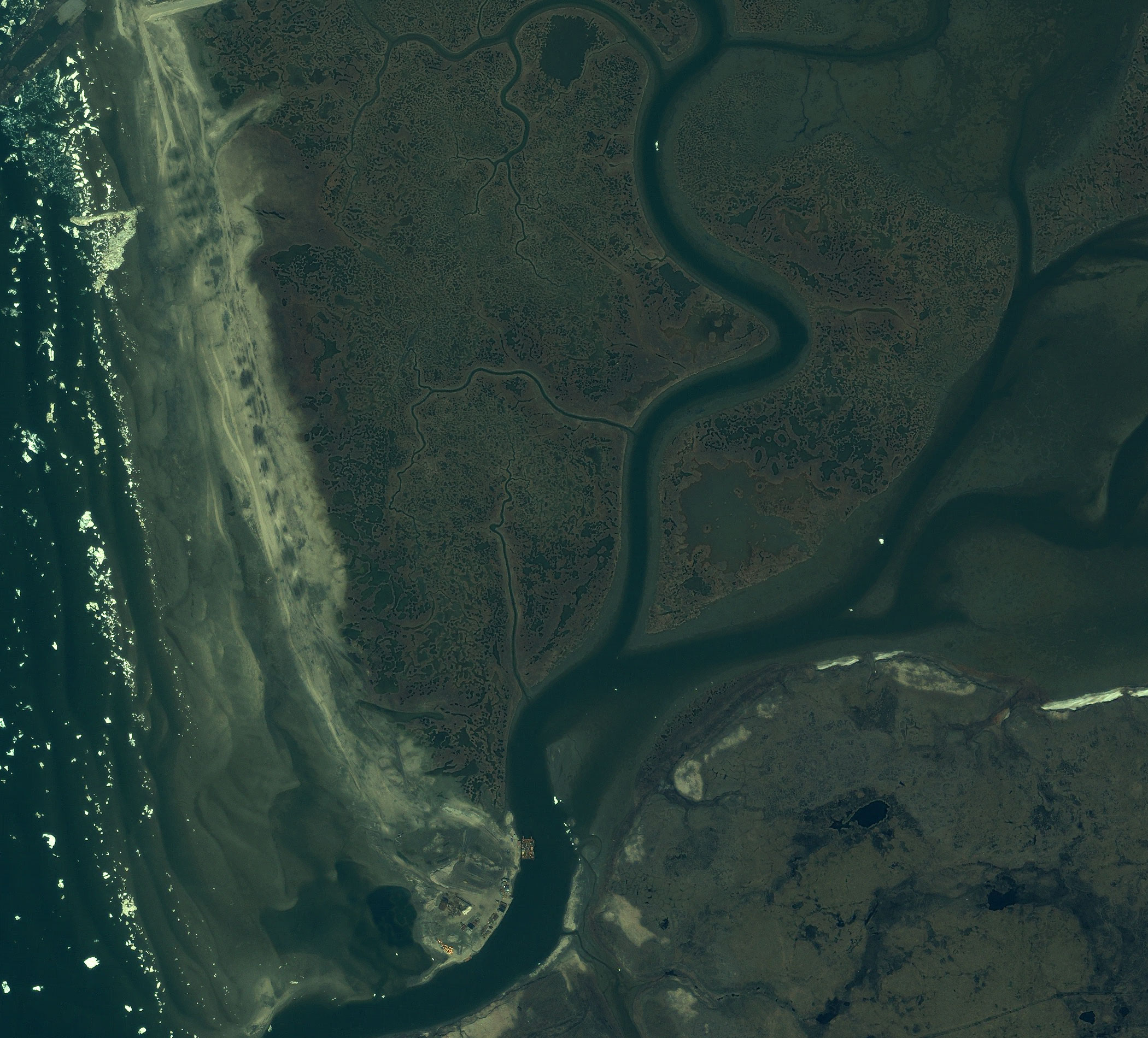
Spacecraft design and mission details
|
Name |
IKONOS |
|---|---|
|
Country |
USA |
|
Developer |
Lockheed Martin, Eastman, Rayteon |
|
Operator |
DigitalGlobe |
|
Launch vehicle |
Athena-2 |
|
Launch date |
24 September 1999 |
|
Launch site |
Vandenberg Air Force Base, California |
|
Date of deactivation |
31 March 2015 |
|
Orbit: Type |
Sun-synchronous |
|
Mission duration, years |
15 years, 6 months, 6 days |
|
Revisit frequency, days |
~ 3 |
|
Spacecraft dimensions, m |
1,83 × 1,57 |
|
Power, W |
600 |
|
Mass, kg |
726 |
Specifications
| Sensor bands |
Panchromatic: 530–930 nm 8 Multispectral: Blue: 450–520 nm Green: 510–600 nm Red: 630–700 nm Near-IR: 760–850 nm |
|---|---|
| Dynamic range, bits per pixel |
11 |
| Sensor resolution, m |
Panchromatic Nadir: 0,82 m Multispectral Nadir: 3,2 m |
| Swath width, km | At nadir: 11,3 km |
| Horizontal accuracy (CE90%) |
15 meter CE90 (specification) 9 meter CE90 (measured) |
| Onboard storage | 80 Gb |
| Image transmission, Mbit/s | 320 |
Collection scenarios:
- Long strip: 360 × 11,3 km
- Large Area Collect: 112 × 51 km
- Multiple Point Targets: 11 × 11 km
- Stereo Area Collect: 120 × 11 km
Products
DigitalGlobe offers products of various tier: Geo, GeoProfessional, GeoStereo. Customers can choose and order a product type that fits their needs better.Geo – this type of products intends for manual interpretation and analysis of the satellite imagery. The imagery goes through radiometric correction and minimal geometric correction according to the calibrating parameters of the camera. Then the customer receives the imagery with all necessary information for the photogrammetric processing, including a rigorous sensor model and rational polynomial coefficients (RPC). All Geo products are map-projected, rectified to a datum and map projection system.
GeoProfessional – intended for customers who need a ready-for-use product with high geometric accuracy. All GeoProfessional products are orthorectified and have a radiometric and geometric correction, including considering the influence of the relief of the surface according to the existing DEM. Customers receive the products in the UTM coordinate system, but it also can be supplied in another system, depending on the customer’s wish. GeoProfessional products are available in two types with different accuracy: Precision and Precision Plus. Products are created basing on the imagery collected with a 0-45° off-nadir angle.
GeoStereo – high-resolution stereo pair collected in the same orbital pass, minimizing changes in lighting or scene content. DigitalGlobe provides the stereo imagery pairs with a RPC camera model file. The RPC file provides camera model data to popular software packages for block adjustment, photogrammetric extraction of three-dimensional feature coordinates; DTMs and orthorectification suitable for DEM generation and other photogrammetric operations.
Each stereo pair contains images collected at an off-nadir angle between 0 and 30 degree. A satellite collects stereo pairs with 30-45 degrees convergence (0.54 to 0.83 base-to-height ratio). The GeoStereo products have a minimum horizontal accuracy of 15 meters CE90 and a vertical accuracy of 22 meters LE90.
| Product | Geo | GeoProfessional | GeoStereo |
|---|---|---|---|
| Radiometric correction | Yes | Yes | Yes |
| Geometric correction | Yes | Yes | Yes |
| Georeferencing | Yes | - | - |
| Orthorectification | - | Yes | Yes |
|
Horizontal accuracy (CE90%), m |
15 |
1:12000 – 10 |
1:20000 – 15 |
|
Vertical accuracy (LE90%), m |
- | - |
1:20000 – 2 |
| Datum | WGS84, NAD83 | ||
| Projections | UTM, other projections | ||
| Spectral bands | Panchromatic, multispectral (4 bands) or Bundle (PAN+4 bands); Natural colours: Infra-red; Synthesized (PAN+4 bands) | ||
| Minimum order size, km2 | Archive data – 49 | ||
| Delivery formats | GeoTIFF 1.0, NITF 2.1 or NITF2.0 | ||
| Delivery method | CD, DVD, Hard Drive, FTP | ||
Applications:
- Creation and update of maps and plans;
- Creation of DTMs;
- Engineering survey for construction works of oil and gas facilities;
- Inventory of forests and forest management;
- Monitoring of the crops’ state, yield forecasting;
- Creation of maps for urban planning purposes;
- Emergency monitoring;
- Researches.