
Spacecraft design and mission details
|
Name |
TerraSAR-X and TanDEM-X |
|
Country |
Germany |
|
Developer |
DLR, Airbus Defence and Space (ex-EADS Astrium) |
|
Operator |
Astrium GEO-Information Services (an international company, established on the basis of Spot Image and Infoterra) |
|
Launch vehicle |
Dnepr 1 |
|
Launch date |
15 June 2007 and 21 June 2010 |
|
Launch site |
Baikonur Cosmodrome |
|
Date of deactivation |
- |
|
Orbit:Type Altitude, km Inclination, deg. |
Sun-synchronous 514,8 97,44 |
|
Mission duration, years |
11 |
|
Power, W |
800 |
|
Mass, kg |
1230 and 1340 |
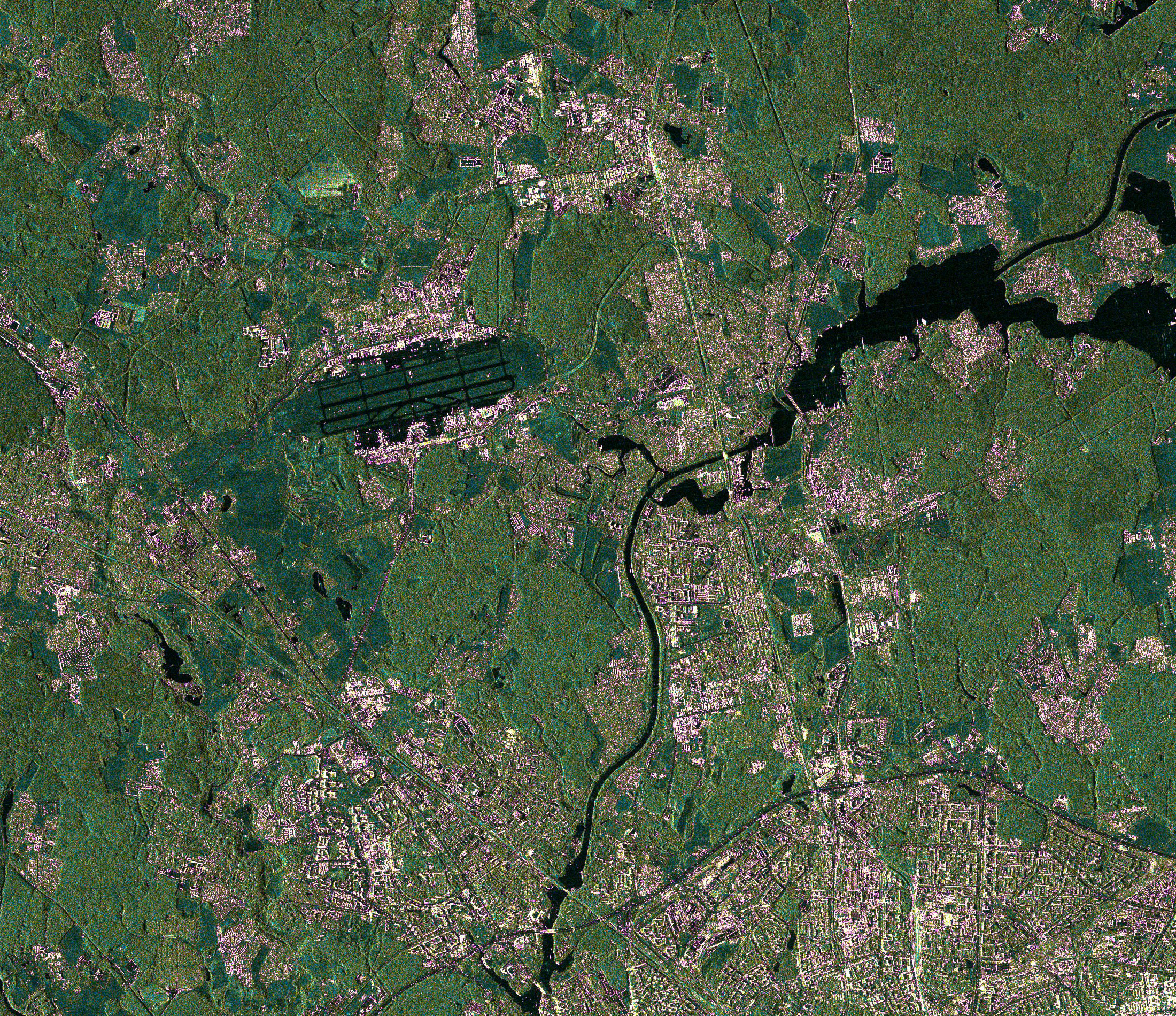
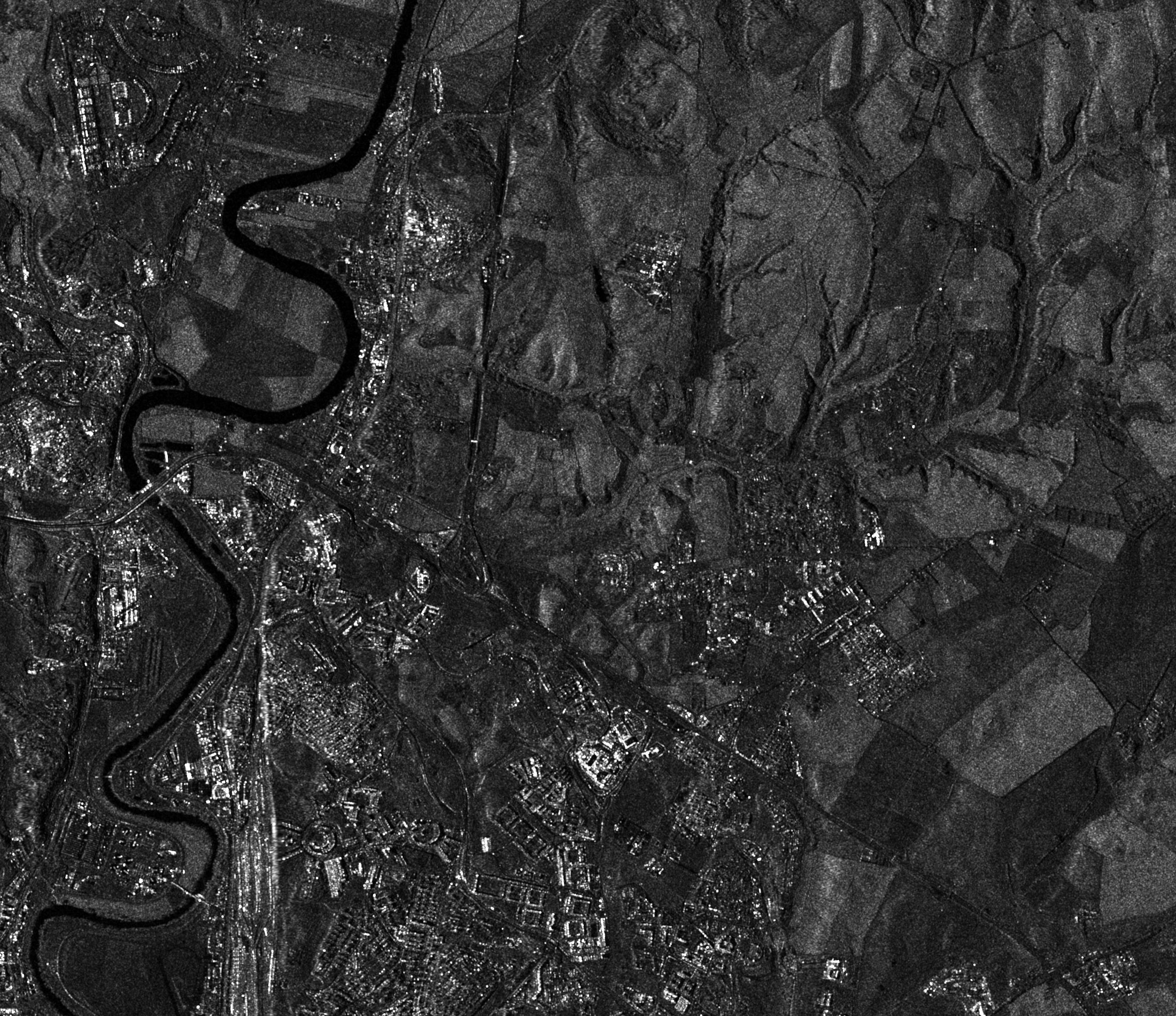
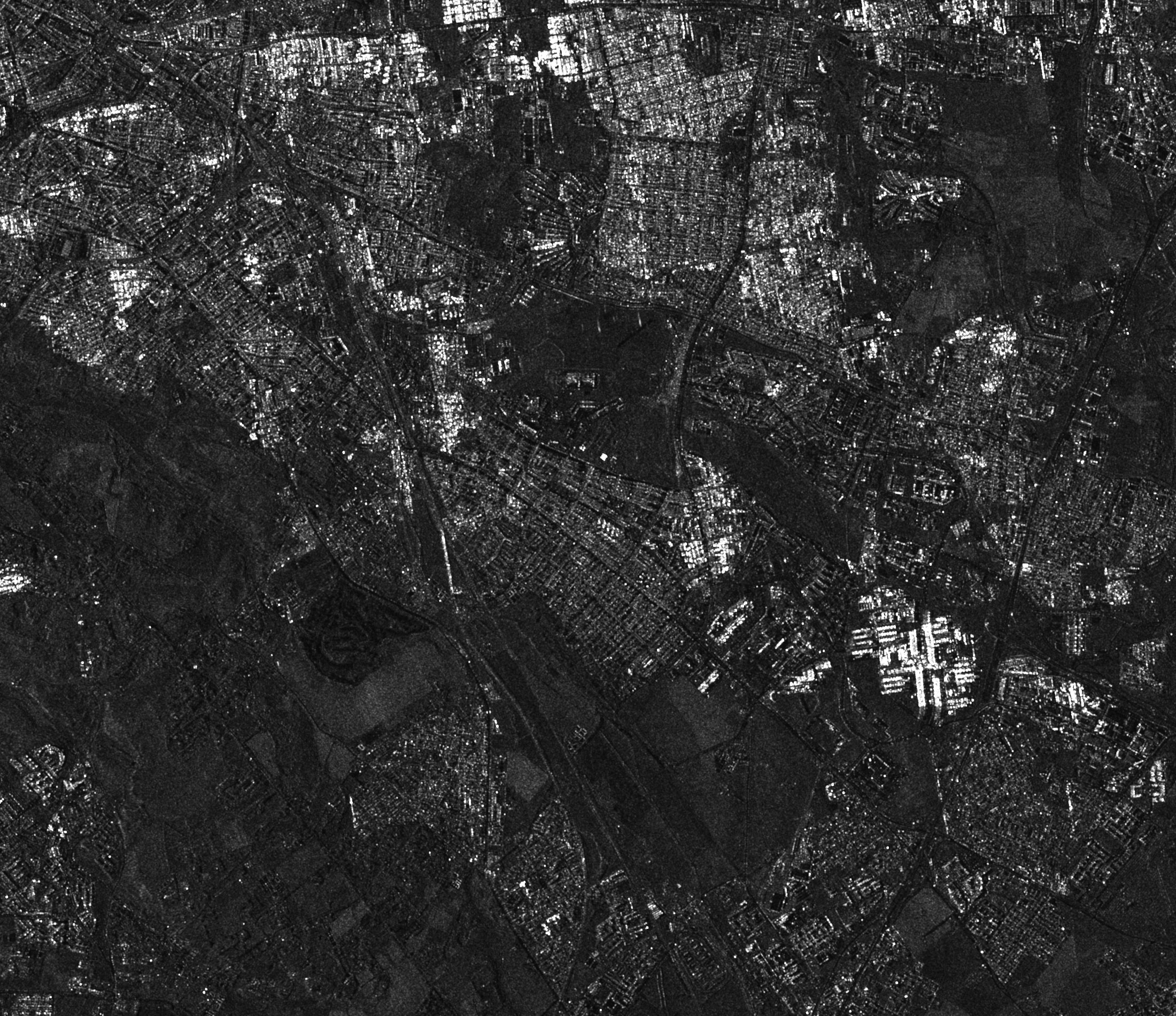
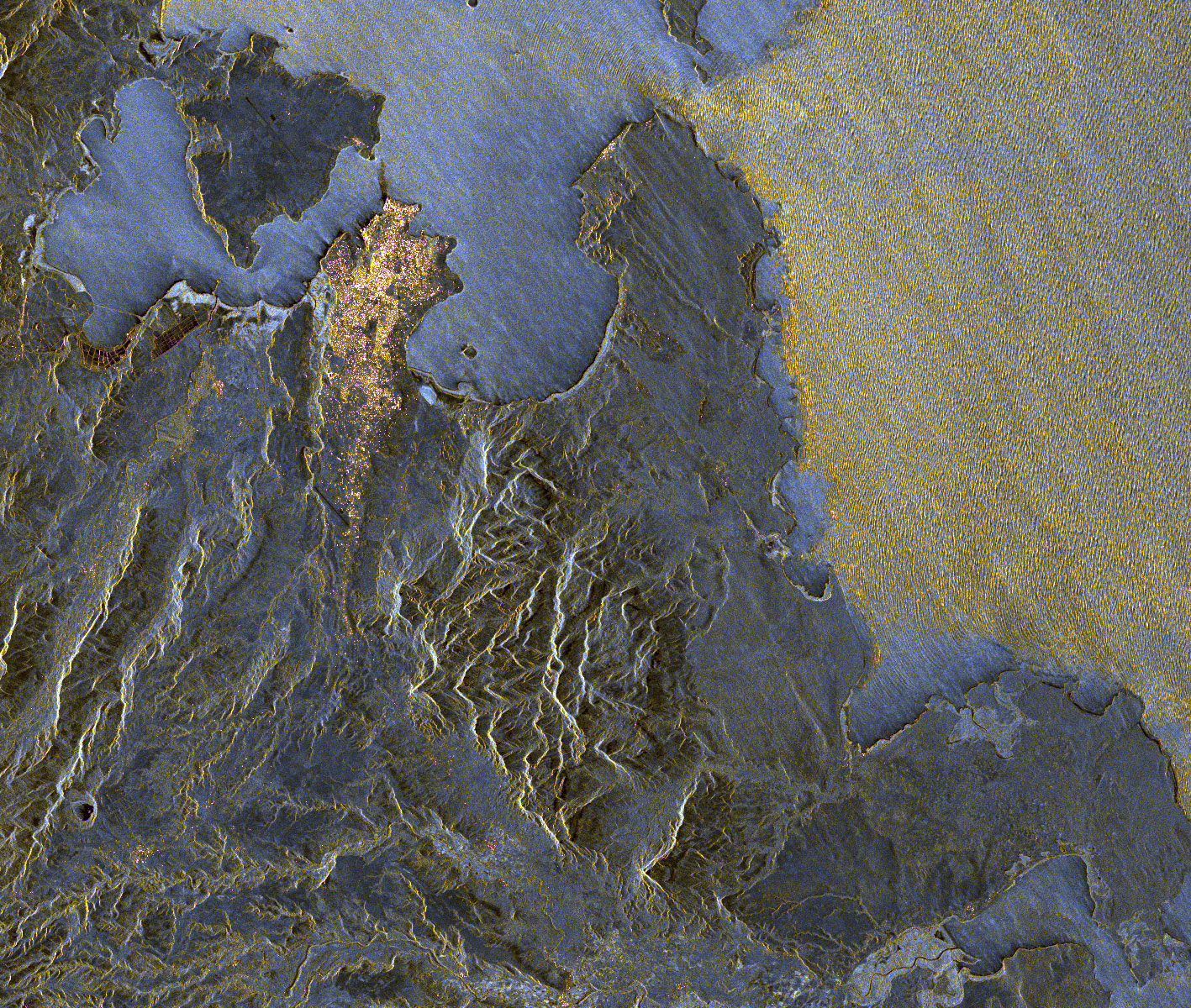
The radar surveys the earth's surface in the X-wavelength range (3.1 cm) with variable polarization of radiation (HH, VH, HV, VV), in the range of shooting angles from 20 ° to 55. The probability of performing the ordered survey is approximately 95%, as the radar survey is weatherproof and does not depend on the time of day. Also, the radar data from the TerraSAR-X satellite are provided within a few hours, which makes them in demand when solving operational problems.
Specifications:
|
Parameter |
Value |
Parameter |
Value |
|
Antenna type |
Active phase array |
Beam scan angle range |
±0,75° (az), ±19,2° (el.) |
|
X-band center frequency |
9,65 GHz (3,1 cm wavelength) |
Incidence angle access range |
15° - 60° |
|
Antenna aperture size |
4,8 m × 0,8 m × 0,15 m |
Radiated peak power |
2260 W |
|
Phase centers |
12 (az.) × 32 (el.) |
Stripmap duty cycle |
18% (on transmit) |
|
Polarization modes |
HH/VV/HV/VH |
Spotlight duty cycle |
20% (on transmit) |
|
System noise figure |
5,0 dB |
Operational PRF range |
3000 – 6500 Hz |
|
Selectable BAQ compression rates |
8 to 4, 3, 2, by-pass |
ADC sampling rates (8 bit, I&Q) |
110, 165, 330 MHz |
|
Max receive duty cycles |
100%, 67%, 33% |
Chirp bandwidth range |
5 – 300 MHz |
|
SSMM capacity |
320 Gbit (BOL) |
TSX-SAR instrument mass |
394 kg |
|
Quantization of signal |
8 bit I, 8 bit Q |
SAR data compression |
Online BAQ |
|
Nominal look direction |
Right side of groundtrack |
Yaw steering |
Yes |
Scanning modes and types of commercial products
Images can be obtained in three shooting modes: SpotLight, StripMap and ScanSAR. Single, double and quadruple polarization is possible, the use of which depends on the shooting mode.
TerraSAR-X has a unique response time, which allows you to select any shooting mode and polarization option within 1-3 seconds, which corresponds to a displacement of the shooting area of 7-20 km. Multipolarization and left / right side shooting options are available. The satellite’s turn for two-sided shooting is carried out in less than 5 minutes.
Satellite programming is carried out twice a day with the prioritization of tasks for data acquisition and a short time of two-way exchange of information during data transfer and subsequent changes in tasks is provided.
The data obtained have the following levels of processing according to the CEOS standard:
Level 0. Restored raw instrumental data at the original resolution with all available additional information for use in subsequent processing.
Level 1A. Unpacked, reformatted level 0 data at full resolution with all additional information for use in subsequent processing.
Level 1B. Radiometric corrected and calibrated data with full instrumental resolution, as they were obtained.
Levels 2,3 and 4. Different degree of extraction of environmental parameters (for example, ocean wave height, soil moisture, ice concentration) with the same resolution and location as in Level 1 data.
Based on the data obtained by the three shooting modes, Basic images (products) are created, allowing the user to choose according to needs, whether they are amplitude-phase parameters for interferometry or already orthorectified data array for real-time mapping.
Basic Products are images processed up to level 1B of the CEOS format, which contain the following geometric projections and data representations:
Single Look Slant Range Complex (SSC) – complex radar images with slant range with amplitude-phase parameters in slant range geometry.
Multilook Ground Range Detected (MGD) – adjusted by WGS84 with an average height of the terrain for a projection with a slant on the horizontal range.
Geocoded Ellipsoid Corrected (GEC) – adjusted for WGS84 with an average terrain height.
Enhanced Ellipsoid Corrected (EEC) – adjusted by WGS84 with digital terrain model (DTM).
Together with TerraSAR-X Basic Products, Infoterra offers the following Advanced and Geo-Information Products:
- Orthorectified images (ORI)
- Radiometric Calibration (RC)
- Radiometric Normalization (RN)
- Mosaics (MC)
- Oriented Images (OI)
- Merging up and down scenes (ADM)
- Ortho Maps (OM)
- Updated maps (CDM)
|
Scanning modes |
SpotLight |
StripMap |
ScanSAR |
|
|
HS |
SL |
|||
|
Spatial resolution, m |
1 |
2 |
3 |
16 |
|
Swath width, km |
10×5 |
10×10 |
30×50 – simple |
100×150 |
|
Polarization |
Simple VV/HH; |
Simple VV/HH; |
Simple VV/HH |
|
|
File format |
CEOS |
|||
|
Processing |
Radiometric, sensory and geometric correction, leading to a cartographic projection, creating DEM and derived cartographic products |
|||
|
Frequency of shooting |
In 95% of cases – 2.5 days; Maximum – 4.5 days |
|||
|
Lead time |
1–3 days for archival data; 1–6 days for custom shooting 24 hours for priority order |
|||
|
Minimum order size |
One standard scene for any of 4 modes |
|||
|
Delivery format |
Direct transmission; On-Line FTP; courier services |
|||
Applications:
- creation of digital terrain models (DTM) of high accuracy;
- study of relief changes caused by various factors;
- measurement of ground movement by the interferometric method;
- highly accurate monitoring of the state of infrastructure networks (pipelines, railways, telecommunications);
- seismic hazard assessment, earthquake prediction;
- all-weather observation of natural and man-made disasters (floods, fires, accidents);
- control of coastal zones and observation of vessels;
- control over the use of natural resources;
- observation of natural disasters and their consequences;
- conducting research in various fields;
- mapping areas with high cloudiness.
For cost calculation of the TerraSAR-X/TanDEM-X imagery for your area of interest, send technical description of your proposal to: innoter@innoter.com. For consultations contact by the phone: +7 495 245-04-24