



Navigation maps, road centre lines, 3D models and HD route maps — from an archive or a new survey.
Search the site
What the service is used for
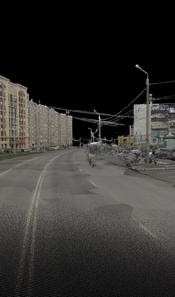
Road network and monitoring
Network study for emergency response, intelligent transport systems and real-time updates.
Traffic flows
Detection and counting of vehicles, aircraft at airports, vessels in ports and on rivers; assessment of highway congestion.
Infrastructure and 3D
Automated 3D-data analysis and machine learning to inspect large networks; GIS of capital assets.
Navigation maps
Digital navigation maps with an address base, electronic charts of inland waterways and traffic-organisation layers.
HD maps and pavement
Road centre lines, pavement assessment, elevation matrices and 3D route models for autonomous vehicles.
Need RS data for transport?
Describe the network, port, airport or route. A specialist will select the archive, a new survey and the set of maps.
What you will receive as a result of the work
01
Digital navigation maps
Digital navigation maps with an address base for navigation in the city and beyond: layers of roads, signs, interchanges and roadside infrastructure.
We create digital navigation maps from satellite imagery, cartographic materials, a layer classifier and an address base. We plot the road network, traffic organisation, infrastructure and other required objects.
What you get
- navigation layers: road network, structures, parking, hydrography, railways and territories
- signs, direction signs, interchange plans, roadside and tourist infrastructure
- a basis for dispatch tasks, road maps and atlases
The layer set, survey dates and coverage depend on the archive, cloud cover and the terms of reference.
02
Inland waterway navigation
Electronic river navigation charts: depths, current, bridges, hydraulic structures and coordinates of above-water objects.
Satellite survey of water areas and the shoreline with photogrammetric processing refines object positions. Channel surveys, hydrology and topographic-geodetic surveys are added to the imagery; the charts are loaded into a cell-coverage database.
What you get
- new and updated electronic navigation charts of the sections
- refined coordinates of the shoreline and navigation objects
- basin cell-coverage schemes and the database specification
The layer set depends on the river section, survey availability and survey materials.
03
Centre lines and pavement condition
Geometry of road centre lines and pavement assessment from optics and hyperspectral data: concrete and asphalt, surface quality.
Optical and hyperspectral data make it possible to extract road centre lines, distinguish pavement types and assess surface condition. The detail of the source data is selected for the required accuracy and the scope of work.
What you get
- vectorised centre lines of transport objects
- classification of pavement types and quality
- materials for infrastructure asset management
The interpretation method and degree of automation are selected with regard to the sensor, the required accuracy and the terms of reference.
04
3D models and HD route maps
Very-high-resolution three-dimensional models, road and railway databases and HD maps for autonomous vehicles.
We supplement the models with semantic attributes. We add semantic data on roads, buildings, terrain and land use to the 3D models. For autonomous-vehicle tasks we form the basis of high-accuracy HD route maps.
What you get
- a 3D model of the territory or route at the agreed resolution
- road, building and land-use layers for transport models
- an HD-map basis where high-resolution or UAV survey is available
Model accuracy depends on the survey, ground control and the requirements of the terms of reference.
How the work goes
Real projects — real results
We solve complex challenges using advanced technologies and expertise in geospatial data.

Cost and timeline
The cost and timeline of work on transport and logistics depend on the network length, survey type and the set of RS maps.
- task: road network, traffic flows, ports and airports, pavement centre lines, navigation maps, 3D models or HD route maps
- data type: satellite, airborne survey, UAV; optics, hyperspectral or ground measurements; archive or new survey
The cost of the work is calculated individually
Timelines depend on the area, survey type and product composition
The final estimate is agreed after the network and the map set are described
What is needed for a quote
To agree the terms of reference for transport and logistics, provide:
- task: road network, flows and congestion, ports and airports, navigation maps, pavement centre lines, a 3D model or an HD route map
- area of interest — outline of the network, route, port, airport, water area or SHP file
- period: operational control, specific construction dates or a retrospective
- whether you have your own images or need archival / new satellite imagery, aerial photography, UAV or hyperspectral
- whether digital navigation maps with an address base, electronic river navigation charts, centre lines, clutter, DEM or 3D are needed
- requirements for the format of maps, coordinate system and layers, if they are already known
If survey parameters have not been defined yet, send the territory outline and describe the task — we will select an archive or a new survey and propose the set of maps and RS data.
Why Innoter
Prompt access to archives
Suitable archive imagery can be obtained faster when the required area and date are already available from operators.
No aviation clearances
A new satellite survey does not require the flight clearances typical of aerial surveys.
Large and remote areas
A single satellite pass covers large areas and makes it possible to work in hard-to-reach regions.
Direct agreements with operators
Distribution agreements help select archive imagery and order new surveys from different providers.
Software and server infrastructure
Modern software and computing capacity for quality control and processing of large data volumes.
Experienced specialist team
Years of experience on complex projects and specialists in cartography, photogrammetry and remote sensing.
RS data, maps and monitoring scope
The composition depends on the transport type, archive or new survey and requirements for maps and 3D.
1
The transportation industry is a system of transport enterprises, infrastructure, vehicles and control systems. Main types: rail, sea, road and air.
Rail: high carrying and throughput capacity, independence from climate and time of day, regularity, relatively low tariffs, transit discounts, speed over long distances. Limitations: few carriers, weak accessibility of end points, insufficient service.
Sea: intercontinental freight, low cost over long distances, high throughput. Limitations: speed, geography, navigation and weather, complex port infrastructure, low frequency of departures.
Road: door-to-door delivery, manoeuvrability, route flexibility, small consignments. Limitations: weather and roads, cost over long distances, environment, cargo capacity.
Air: highest speed, reliability and cargo safety, remote areas. Limitations: highest tariffs, dependence on weather.
2
One of the largest transport schemes has formed on the territory of Russia: links between regions, national security, international freight and humanitarian aid. Transport ensures the economic integrity of the state.
The global market for transport services grew from USD 6,559.71 billion in 2021 to USD 7,210.41 billion in 2022 at a CAGR of 9.9%. Growth to USD 10,394.13 billion in 2026 at a CAGR of 9.6% is expected. On average 13.2% of a household budget is spent on transport goods and services. Transport depends on oil resources and is a source of CO2.
Network reliability is limited by infrastructure condition: technologies, efficiency and the cost of medium- and long-term monitoring are needed. Remote sensing (ground, satellite, airborne / UAV) is suitable for collecting data at large scales with the accuracy required by inland transport networks.
3
Study of the road network — for emergency response, intelligent transport systems and real-time network updates.
Traffic-flow analysis: detection and counting of vehicles on roads, civil aircraft at airports, vessels in port water areas and on river arteries. Highway monitoring and congestion assessment.
Automated 3D-data analysis (segmentation, features, classification) for mass inspection of large infrastructure networks, including machine learning. Creation and update of very-high-resolution 3D models and road and railway databases with semantic attributes. Image processing and GIS for infrastructure capital-asset management.
4
Multi-temporal remote-sensing methods complement field analysis (GPR, laser scanner, accelerometers): greater spatial coverage, detection of defects and damage at lower cost relative to traditional monitoring.
Integration of BIM infrastructure with geospatial data and information modelling of the full life cycle. RS image sets for analysing transport hubs and passenger-attraction zones that traditional methods cannot cover.
Video-satellite monitoring — flow density and speed; at sea and ocean — vessel registration, route tracks and cargo types. Autonomous vehicles rely on high-precision elevation matrices and 3D route models (HD maps): they can potentially reduce transport problems and freight costs.
5
For digital navigation maps with an address base, a new satellite survey, additional cartographic material, a classifier of layers, object types and semantics, editorial and technical instructions and an address base were used.
The digital navigation maps were created in the State Coordinate System, in the Baltic height system, with division into topographic-map nomenclature sheets. A set of layers with navigation information for road transport and dispatch centres was added.
After digitising the object composition, warning and prohibitory signs, direction indicators, interchange and detour plans, roadside and tourist infrastructure were plotted; then field work was carried out. Layer composition: road network and structures, buildings, parking, blocks, hydrography, green spaces, railways, metro, monorail, tram, settlement territories.
6
Electronic river navigation charts contain depths, current, rapids, bridges and hydraulic structures. Satellite survey of water areas with photogrammetry refines the shoreline; channel surveys, hydrology and topographic-geodetic data are added, then the maps are loaded into a database with cell-coverage schemes.
For centre lines and pavement: a combination of 4-metre 224-band hyperspectral satellite images and about 6,000 field spectra. The methods distinguish concrete and asphalt. 30-metre images — for motorway right-of-way; 5 cm aerial photography — for asset inventory. Automatic interpretation from a spectral library in the study scored above average but is inferior to manual interpretation.
A multimodal approach for city transport models: VHR 3D for building storeys, land use and population estimates by blocks. Deep learning extracts geodata from high- and very-high-resolution images when official data are insufficient.





Frequently asked questions
Answers to key questions about service parameters, timelines, deliverable formats and workflow. If you did not find what you need — contact us and we will help.
The transportation industry is an economic sector that deals with the movement of goods, passengers, and information from one place to another. It plays a crucial role in facilitating international and domestic trade, tourism, communication, and other aspects of daily life.
The transportation sector includes various modes of transport, such as road, rail, air, maritime, and river transport, along with transportation infrastructure, including roads, railways, airports, ports, and terminals.
The key functions of the transportation industry include:
- Freight transportation: Transport enables the movement of goods from producers to consumers. It plays a vital role in supplying markets with products and materials.
- Passenger transportation: Transport allows people to travel between different locations for work, education, tourism, and other purposes. This includes both local transportation within cities and long-distance travel.
- Logistics: The transportation industry plays a key role in logistics operations, including warehousing, packaging, cargo handling, and supply chain management.
- Communication: Transport facilitates the transmission of information and communication between people and organizations. This includes both traditional communication methods (telephone, postal services) and modern technologies (internet, email).
The transportation industry has a significant economic impact and influences various aspects of society. It contributes to economic growth, improves access to goods and services, facilitates international trade, and strengthens connections between different regions and countries.
The transportation industry is one of the key sectors of Russia's economy. It plays a crucial role in the country's development by ensuring the efficiency and scale of freight and passenger transportation.
Rail transport, in particular, holds significant importance within Russia’s transportation sector. It facilitates large-scale freight transportation across the country, contributing to economic growth and ensuring the availability of goods and resources in various regions.
The development of road transport is also of great importance. It provides flexibility and mobility for freight and passenger transportation within the country and between different regions. Thanks to road transport, goods are delivered on time, and people can travel conveniently.
The transportation industry actively contributes to Russia’s economic development. It creates new jobs, stimulates trade and investment, and enhances interactions between regions and countries.
The development of the transportation sector directly influences the country's economic growth. The optimization of freight and passenger transportation, modernization of transport infrastructure, and implementation of new technologies all contribute to the efficient functioning of the transport sector and the strengthening of Russia’s economy.
Freight transportation plays a critical role in supplying and supporting various economic sectors. Reliable and efficient cargo transportation facilitates the growth of industry, construction, and trade.
The development of the transport sector is a priority for Russia's state policy. The adoption of new technologies, improvements in logistics, and increased transport efficiency all contribute to the advancement of the industry and the strengthening of Russia’s economic position.
The transportation industry in Russia also promotes the expansion of international freight services. Due to its geographical location, Russia serves as a transit hub for cargo shipments between Europe and Asia, creating additional opportunities for the development of the transportation sector and attracting investments.
One of the key aspects of transport sector development is the improvement of transport systems and infrastructure. This includes the construction and modernization of roads, railways, airports, and ports, as well as the implementation of modern management and control systems.
For the effective functioning of the transportation sector, economic and environmental factors must be considered. The rational use of resources, reduction of emissions, and increase in energy efficiency are becoming increasingly important goals in the context of transport development.
In conclusion, the transportation industry in Russia plays a significant role in the country’s economic development. It ensures efficient freight and passenger transportation, fosters trade, enhances infrastructure, and strengthens regional connections. The development of transport is a priority for state policy and requires continuous attention and investment to ensure sustainable economic growth and prosperity in Russia.
The transportation industry consists of various components that collaborate to ensure the movement of goods, passengers, and information. The key elements of the transportation industry include:
- Rail Transport: Railways provide the ability to transport cargo and passengers over long distances. This includes freight trains, passenger trains, and specialized railcars.
- Road Transport: Cars and trucks provide flexibility and mobility in transportation. They are used for delivering goods to their final destination and for local passenger transportation.
- Air Transport: Aviation enables fast and long-distance transportation of cargo and passengers. Airlines offer a wide range of flights that connect various cities and countries.
- Maritime and River Transport: Sea and river vessels play a crucial role in international freight transportation. They enable cargo movement across maritime and inland waterways.
- Pipeline Transport: Pipelines are used to transport liquids and gases, such as oil, natural gas, and other chemicals. They provide efficient and safe delivery of energy resources.
- Logistics and Warehousing Services: Logistics companies organize and coordinate transportation. They manage warehouses, packaging, cargo handling, and supply chain management.
- Transport Infrastructure: This includes roads, railways, airports, ports, terminals, and other facilities necessary for the functioning of transportation systems.
- Information and Communication Technologies: These include software and systems used to manage and coordinate transportation operations. This covers various software applications, cargo tracking systems, logistics management platforms, and communication technologies for information exchange.
Each component of the transportation industry interacts with the others, ensuring efficiency and reliability in transportation. For example, cargo may be shipped from one country to another via maritime transport and then further transported by rail or road to its final recipient.
The development of the transportation sector involves continuous improvement and modernization. This includes the adoption of new technologies, the development of more efficient and environmentally friendly vehicles, improvements in infrastructure and communication networks, and the enhancement of logistics and management practices.
The transportation industry plays a vital role in economic development by connecting different regions, facilitating trade, and supporting business growth. It also has a significant social impact, allowing people to travel and access goods and services.
Overall, the transportation industry is an integral part of modern society, ensuring the movement of people, goods, and information. Its development and effective functioning are crucial for sustainable economic growth and prosperity.
The digitalization of the transportation industry is the process of applying digital technologies and innovations to enhance the efficiency, safety, and convenience of transportation. It involves the use of modern information and communication technologies, process automation, data collection and analysis, as well as the implementation of digital platforms and services.
One of the key aspects of transportation digitalization is smart management of transport infrastructure. This includes traffic management systems, intelligent traffic lights, road condition monitoring, and the automation of railway crossings. These technologies help optimize traffic flow, reduce congestion, and improve road safety.
Digitalization also extends to logistics and supply chain management. By utilizing digital platforms and logistics management systems, it becomes possible to track shipments in real-time, optimize delivery routes, automate warehouse processes, and improve coordination among various stakeholders in the supply chain.
In the field of passenger transportation, digitalization offers new opportunities to enhance comfort and convenience. Mobile applications allow passengers to purchase tickets online, track schedules and delays, and receive information about available seats and onboard services. Additionally, electronic ticketing systems and contactless payment methods are being developed to simplify the travel experience.
The digitalization of the transportation industry improves overall productivity, optimizes resource usage, and reduces the negative impact on the environment. The collection and analysis of large volumes of data help predict and manage transportation flows, reduce downtime, and save fuel. Technologies such as the Internet of Things (IoT), artificial intelligence (AI), and Big Data are used to collect information about vehicle conditions and load levels, analyze passenger behavior, and optimize routes.
One example of transportation digitalization is the use of autonomous and unmanned vehicles. This includes the development of self-driving cars, buses, and trucks capable of operating without human intervention. These autonomous vehicles rely on advanced technologies, including sensors, cameras, radars, and AI, enabling them to interact with their environment and make decisions based on data analysis.
The digitalization of transportation also involves the development of electric mobility and the use of alternative energy sources. Electric vehicles, such as electric cars and buses, are becoming increasingly popular due to their energy efficiency and low emissions. Additionally, research is being conducted on the use of hydrogen fuel cells and other renewable energy sources in the transportation sector.
The digitalization of the transportation industry has a significant impact on the economy. It enhances the productivity and competitiveness of transport companies, creates new job opportunities in the IT sector, and drives innovative solutions in transportation and logistics.
Overall, the digitalization of the transportation industry opens up new possibilities for improving efficiency, safety, and convenience. It leads to a more integrated and modern transportation system, fostering economic growth and enhancing the quality of life.
The transportation industry plays a vital role in Russia's economy and offers several advantages:
-
Geographical Position: Russia spans a vast territory, making its transport system crucial for ensuring connectivity and movement between different regions of the country.
-
Infrastructure Development: In recent decades, Russia has actively invested in developing transport infrastructure, including railways, highways, seaports, river ports, airports, and more.
-
Resource Availability: Russia is one of the world’s largest producers of resources such as oil, gas, coal, timber, and metals. This ensures a constant flow of cargo for the transport sector and drives logistics operations.
-
Transit Potential: Due to its strategic location, Russia serves as a transit corridor between Europe and Asia, enabling the development of international transport routes such as the Trans-Siberian Railway.
-
Railway System Development: Rail transport is strategically important for Russia. The Trans-Siberian Railway, which connects Moscow to Vladivostok, is the longest railway line in the world and facilitates cargo transit between Asia and Europe.
-
Potential for Freight and Passenger Air Transport: Air transport also has growth potential, particularly in long-distance freight and passenger transportation.
-
Maritime Prospects: Russia has an extensive coastline, offering potential for maritime transport development, especially in the Arctic region, which is becoming more accessible due to climate change.
-
Logistics Development: With the expansion of trade and production, logistics services are gaining importance. Russia has the potential to become a logistics hub for many global trade routes.
-
Technological Advancements: The adoption of modern technologies, such as automation and transport management systems, enhances efficiency and improves service quality.
-
Economic Growth Support: The development of the transportation industry contributes to economic growth, job creation, infrastructure improvements, and increased investment.
Despite these advantages, Russia's transportation industry also faces several challenges, including the need for modernization, ensuring safety and efficiency, and addressing environmental concerns.
Analysis of the transportation industry in Russia includes an assessment of its current state, challenges, and prospects. Let's examine the key aspects:
1. Infrastructure:
- Railway System: Russia has one of the largest and longest railway networks in the world. However, parts of the infrastructure require modernization to improve speed and freight capacity.
- Highways: The road network is expanding, but issues such as poor road surface quality and traffic safety remain relevant.
- Air Transport: Russia has a large aviation sector, but there is a need for airport modernization and fleet renewal.
2. Maritime and River Transport:
- Seaports: Russia has significant potential for the development of maritime transportation, especially in the Arctic region. However, seasonal changes, ice conditions, and infrastructure limitations may affect efficiency.
- River Transport: Russian rivers provide opportunities for freight transportation, but challenges such as hydro-technical barriers and outdated fleet infrastructure need to be addressed.
3. Modernization:
- The transport infrastructure in many cases is aging and requires modern technologies and investments. The modernization process takes time and financial resources.
4. Logistics:
- The development of the logistics network can be a key factor in increasing the efficiency of the transport industry, especially through the integration of multiple transportation modes.
5. Environmental Concerns:
- Certain types of transport, especially those relying on fossil fuels (road transport, aviation), have a negative impact on the environment and climate. The development of greener alternatives is necessary.
6. International Transit:
- Russia has the potential to become a key transit hub between Europe and Asia due to its geographical location.
7. Technological Innovations:
- The introduction of modern technologies such as automation, the Internet of Things (IoT), and artificial intelligence (AI) can significantly improve the efficiency of the transportation system.
8. Management and Safety:
- Enhancing transport system management, including improving safety and reducing accidents, is essential.
9. Investments:
- Significant investments are required to implement large-scale projects for the development and modernization of transport infrastructure.
Need satellite imagery or help choosing the right data?
Describe your task, area of interest, and desired outcome. We will check data
availability, assess new acquisition options, and propose the optimal solution in terms of timelines, cost,
and quality.
Discuss the project
clients who trust us
25+ years in the geodata market






