Contact

Hyperspectral imaging – an effective tool in mineral exploration

01

Introduction

Over recent decades, the Russian Federation has experienced a relatively low level of investment in the search for and exploration of new mineral deposits compared with leading countries. Therefore, improving the efficiency of geological prospecting and exploration through Earth observation technologies, machine learning, and cloud computing is becoming an important factor in reducing financial and time costs.
tradicional methdots.png
advanced methods.png
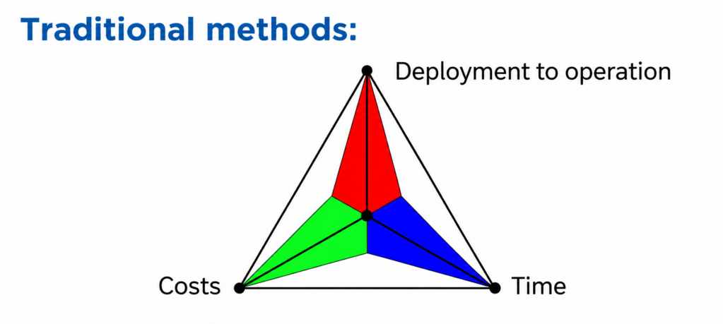
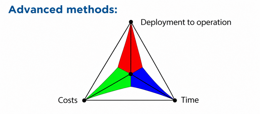
Fig. 1. Projected effects of using Earth observation materials

Multispectral and hyperspectral satellite and aerial imagery make it possible to identify minerals by their spectral “signatures” in the visible, near-infrared, and short-wave infrared ranges. Hyperspectral imagery is the most informative, as it records reflected radiation in hundreds of narrow bands and provides a detailed spectral profile of the surface. This makes it possible to distinguish between mineral groups with similar compositions, including rock-forming minerals and the products of their hydrothermal alteration.
02

The main approach

Main Approach

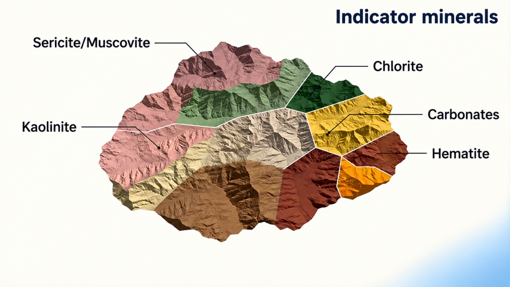
Direct detection of ore bodies and gold using Earth observation data in the optical range is generally not possible. Therefore, the primary focus is placed on indicator minerals associated with hydrothermal alteration. These include sericite, muscovite, kaolinite, illite, chlorites, carbonates, as well as iron oxides and hydroxides, which form diagnostic anomalies primarily in the SWIR range. The spatial distribution of these minerals makes it possible to infer the probable location of gold-bearing zones even at the early stages of exploration.

minerals.png
Fig. 2. Indicator minerals of hydrothermal near-ore alteration derived from Earth observation data.

In the exploration of gold deposits, both satellite imagery and aerial survey data are used. Aerial survey data are effective at the local stage, when it is necessary to delineate zones of mineralized alteration as accurately as possible, while satellite imagery is used for regional analysis and the initial selection of anomalous zones across large territories, including hard-to-access areas. Airborne hyperspectral systems provide high spectral and spatial detail, whereas satellite data offer advantages in coverage and оперативность; the best results are achieved when they are used together.


03

Working Methods

Methodology

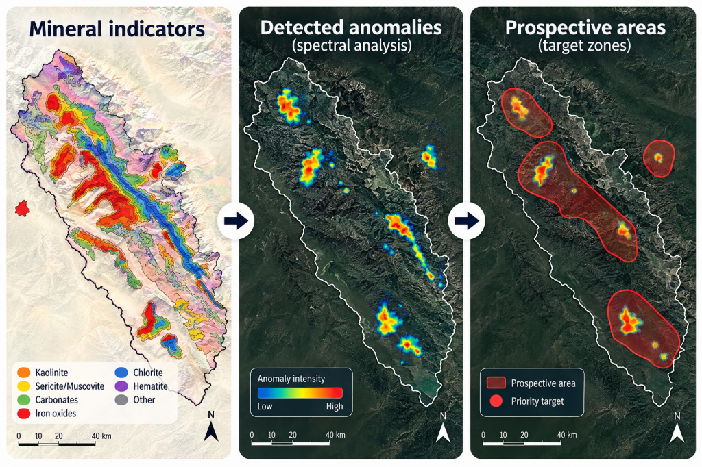
The methodology for identifying indicator minerals includes several key stages. First, Earth observation data are selected and pre-processed, including atmospheric, radiometric, and geometric correction, orthorectification, and vegetation masking using the NDVI index. This is followed by spectral analysis using reference mineral libraries and the calculation of mineral indices, after which the results are integrated with structural and geological data. On this basis, a GIS project is developed, including a predictive map of indicator minerals and recommendations for identifying areas for ground verification.

mineral indicators.png
Fig. 3. Predictive map of gold deposits
04

Practical results

Practical Results

GEO INNOTER’s practical experience confirms the high effectiveness of Earth observation technologies in mineral exploration. In the Republic of Sakha (Yakutia), spectral analysis of hyperspectral aerial survey data covering approximately 600 km² identified around 40 prospective areas with a total area of about 8 km². In the Republic of Tuva, satellite data analysis over an area of approximately 300 km² revealed about 20 anomalous zones with a combined area of roughly 16.5 km². In both cases, Earth observation methods made it possible to significantly narrow down the areas requiring detailed ground surveys and to improve the targeting of subsequent exploration activities.


05

Conclusion

Hyperspectral Earth observation data are an effective tool for the predictive identification of zones of hydrothermal near-ore alteration that may be associated with gold mineralization at the early stages of geological exploration. The application of this methodology makes it possible to remotely identify mineralogical indicators of near-ore alteration, reduce investment risks and time costs, and more accurately delineate prospective areas for further investigation. The methodology has been implemented in a number of GEO INNOTER projects in the Republic of Sakha (Yakutia), the Republic of Tuva, and other regions.


clients who trust us
25+ years in the geodata market
clients who trust us
25+ years in the geodata market
Request a call back
Back to page top
Мы используем Яндекс.Метрика и собственные Сookies для обеспечения наилучшего опыта работы на нашем сайте, персонализации сайта для наших пользователей и аналитики. Продолжая использовать сайт вы соглашаетесь с условиями Пользовательского соглашения.