of geospatial solutions
Sat-Sun: Non-working days
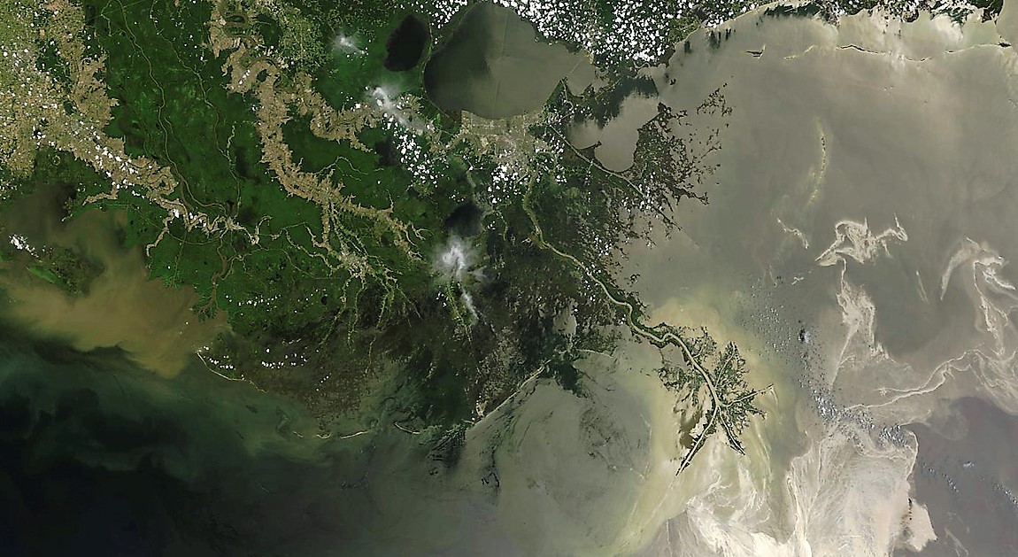
Over the past 30 years, the number of natural disasters on the planet has significantly increased. Floods and inundations are among the most frequent incidents in our country, often linked to seasonal changes when water levels in water bodies rise due to snowmelt and heavy rains. To ensure normal life for the population, flood and inundation monitoring is employed today, allowing the early prediction of emergencies. One of the largest floods in Siberia in 2019 once again underscored the necessity of predicting natural disasters, for which space systems can be utilized. Monitoring systems enable timely alerts to the population and the implementation of appropriate precautionary measures, thereby reducing the risk of significant human casualties and financial losses.
Features of Studying Natural Disasters Related to River Flooding
Monitoring the progress of floods or spring floods requires the collection of various data:
- Satellite photos.
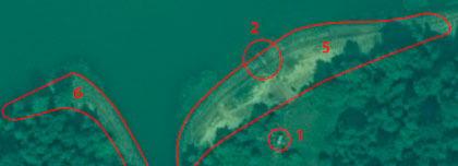
- Vector layers of areas prone to ice jams.
- Vector layer of flood-affected areas.
- Images of buildings and structures affected by flooding.
- For predicting river floods, information on terrain relief (DEM), snow cover volume, and meteorological data (weather, climate) is necessary.
Study Methods
Continuous observation of spring floods and inundations utilizes satellite monitoring data, as well as information from SAR and optical satellites.
Application of Monitoring Results
Real-time monitoring data on floods and inundations is used for the following purposes:
- Identifying potential ice jam locations.
- Preparing advisory materials for specific areas where flood control measures are implemented.
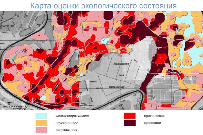
- Estimating the total area of inundation.
- Assessing buildings and structures affected by emergencies.
Required Information
To accurately forecast possible natural disasters, studying optical and SAR images of various resolutions is essential. When identifying potential jams in riverbeds, radar monitoring data is recommended. During spring flood monitoring, data from multiple satellite systems are used simultaneously, providing timely information in the required area. Currently, the following information is applied:
- Operational satellite photo data with spatial resolutions of 0.5-5.0 m over municipal territories.
- Operational information from radar satellite imaging systems with spatial resolutions ranging from 1-3 m.
- Satellite imaging data in potentially hazardous areas prone to ice jams.
Operational situation analysis in disaster-prone zones significantly reduces disaster risks, enabling preemptive actions such as population evacuation, preparation of social and industrial facilities for potential flooding, and protecting infrastructure from destruction.
You can order from us


Sat-Sun: Non-working days