of geospatial solutions
Sat-Sun: Non-working days
Modern and Professional Land Monitoring Using Space Technologies
Recording, assessing, and utilizing land plots is impossible without high-quality information support and reliable, up-to-date cartographic materials. Having modern information support about a land plot, as well as creating reliable cartographic materials, allows not only monitoring the condition of the land plot but also assessing its suitability for construction, agricultural, and other types of activities. In addition, having information and cartographic support for a land plot is a crucial element for creating cadastral and reference documentation.
What Land Monitoring Represents and Why It Is Necessary
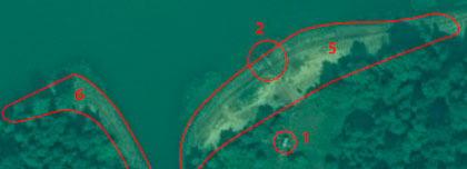
Land monitoring, essentially, involves conducting timely, systematic, and high-quality observations of the state of a land plot to identify changes in its ecological and natural conditions. Systematic land monitoring enables landowners to obtain timely and detailed information for preventing and rectifying various negative processes that may arise due to commercial or other agricultural activities conducted on the land plot. Furthermore, using such monitoring technologies allows for an accurate assessment of the land plots' value and forecasting potential increases or decreases in their market value.
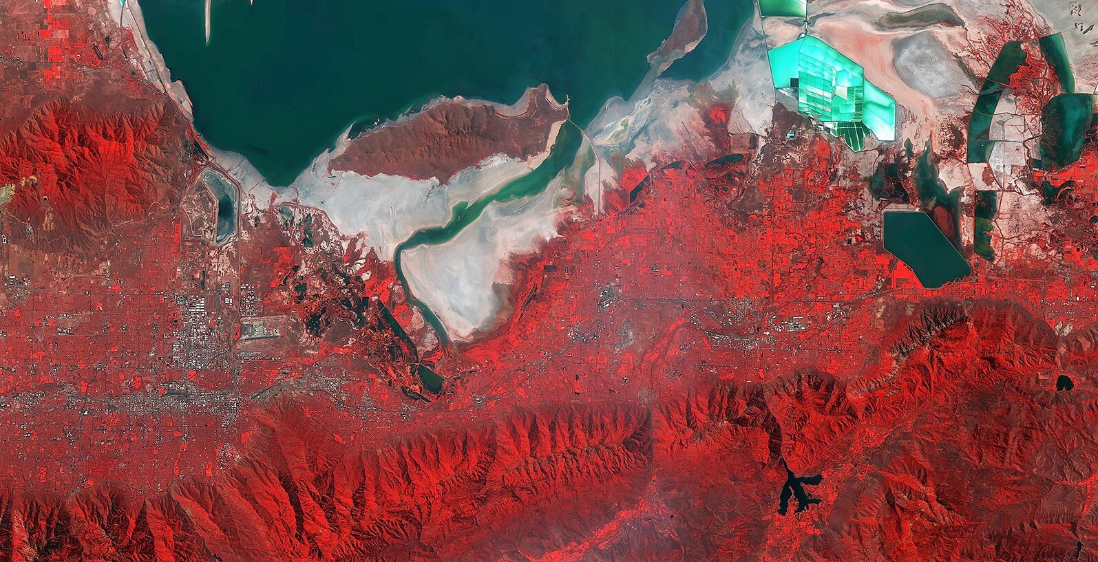
What Information Does Land Monitoring Using Space Technologies Provide?
Using land monitoring based on space technologies allows solving the following important tasks:
- Timely identifying the condition of land plots and assessing their state, providing professional recommendations to prevent or rectify negative processes arising from human activities.
- Informational support for land cadastres, natural resource cadastres, land management, and proper land use.
- Conducting environmental activities and obtaining timely and reliable information about the state of the environment and natural surroundings on the studied land plot.
Where Can You Order Land Monitoring Services?
The Russian Geospatial Agency "Innoter" offers professional land monitoring services using advanced technologies and expert analysis conducted by specialists with extensive practical experience. Established in 2000, "Innoter" is currently a leader in creating and processing satellite images, performing engineering surveys, and producing cartographic and geospatial products based on obtained information. During their operations, "Innoter" utilizes modern, professional, innovative equipment and technologies, ensuring every client opting for land monitoring of resources or plots receives timely, high-quality, and detailed analytical information, as well as satellite images. Moreover, during the provision of land monitoring services, "Innoter's" analysts provide clients with prompt and detailed information on the occurrence of negative processes due to the client's economic activities on the land plot and forecasts regarding changes in its real value.
How Does "Innoter" Conduct Land Resource Monitoring?
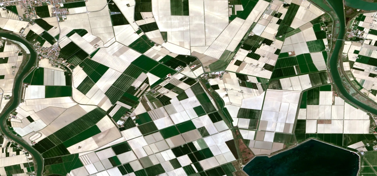
"Innoter" conducts land monitoring using modern technologies and equipment based on normative-technical and methodological documentation. During monitoring and analysis, all obtained indicators are integrated into a unified system, allowing the client to obtain the most detailed analytical information. Land resource monitoring can be conducted using the following equipment and technologies:
- Aerial and space-based imaging, enabling remote sensing data acquisition.
- Utilization of operational polygon networks.
- Conducting studies, surveys, and observations directly on the land plot.
- Accessing necessary information from state funds, cadastral offices, or archives.
The specific technologies and equipment used for land monitoring directly depend on the client's assigned tasks and requirements as provided to "Innoter" specialists.
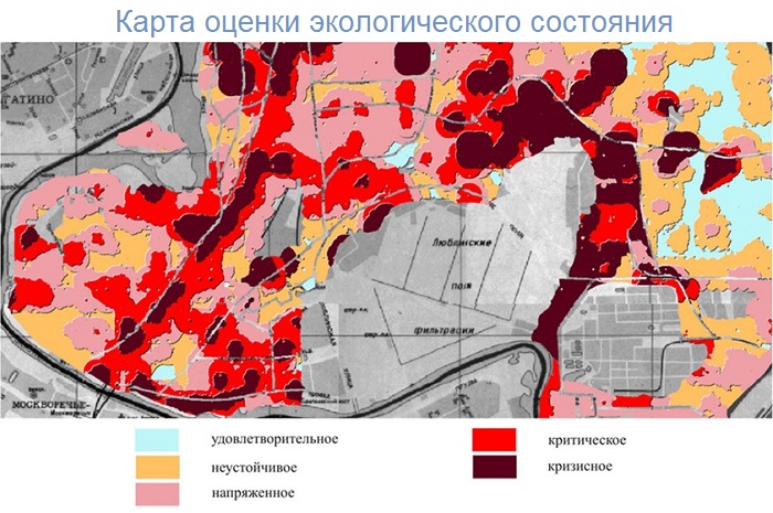
"Innoter" - Conducting Environmental Land Monitoring
If necessary, the Geospatial Agency "Innoter" is prepared to conduct environmental monitoring of regions or land plots. This service allows clients to obtain detailed and reliable information about the environmental condition of the land and the development of the situation. By conducting environmental land monitoring, "Innoter" performs the following actions:
- Through modern research, obtaining and analyzing information about all processes present in the environment.
- Gathering information about the presence of negative environmental impacts and identifying their level and nature of danger.
- Based on analytical data, making forecasts about changes in the environment.
- Identifying the connection between the client's activities on the land plot and changes in nature.
- Providing the client with an analytical report on ways to reduce negative impacts on the environment.
- Conducting a systematic, detailed analytical assessment of the client's conservation activities, evaluating the effectiveness and quality of this activity.
- Creating a modern and detailed database containing comprehensive data on all processes occurring in the environment.
Clients can use all this information for submission to government authorities, departmental organizations, as well as interested citizens and legal entities.
You can order from us


Sat-Sun: Non-working days