of geospatial solutions
Sat-Sun: Non-working days
Project's objective
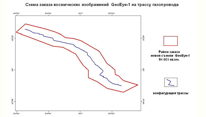
The purpose of these works was to create orthophotomaps of a scale of 1: 5000 for the area of the gas pipeline route in the Yamalo-Nenets Autonomous Okrug based on the ordered GeoEye-1 satellite images. The location of the work site and georeferenced cartographic materials were transferred to the Customer in digital form to substantiate investments in the development of the North Kamennomyssky gas field.Completed work
Work description
Work content in accordance with the Terms of Reference:
-
Ordering and receiving a new space survey from the spacecraft GeoEye-1 to the object;
-
Orthorectification of GeoEye-1 digital images using the coefficients of rational functions of the GeoEye-1 satellite camera (RPC polynomials);
-
Creating a mosaic of images from GeoEye-1 space imagery materials;
-
Registration of reporting documentation.
Object’s characteristics
The object is in the Tyumen region, Yamalo-Nenets Autonomous Okrug. The central part of the Ob Lip. Taz Peninsula. The route of the linear part of the gas pipeline from the coast of the Gulf of Ob in the area of Cape Parusny to the GCS of Yamburg gas condensate field, about 90 km long and 10 km wide. The beginning of the route is the point of coastal junction near m. Sailing. The end of the route is a connection point at the GKS compressor station of the Yamburg gas pipeline system.
Special conditions for the location of the object within the subarctic continental arctic tundra and typical tundra. The favorable time period for the new GeoEye-1 space survey starts on June 15 and ends on September 1. The duration of the unfavorable period is 9.5 months - from September 1 to June 15.
Working process
Regular monitoring of the performance of customized surveys and analysis of the quality of the surveys carried out was carried out with constant contact with the sales director of GeoEye in order to accelerate the implementation of customized surveys for the entire work area.
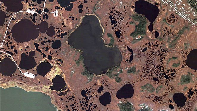
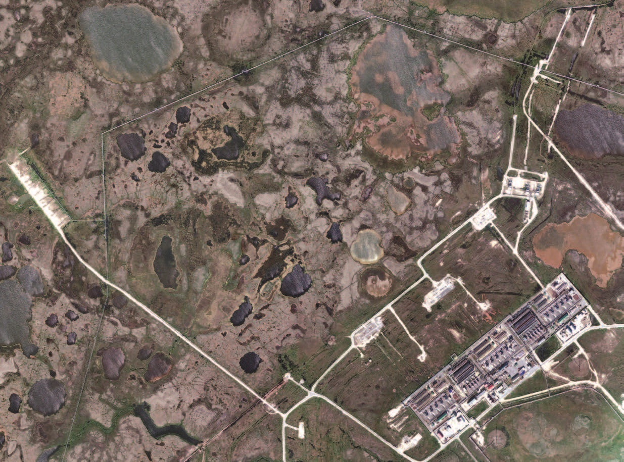
An analysis of the entire GeoEye-1 survey taken from July 15 to September 15 showed that 42 attempts were made to shoot. But due to difficult meteorological conditions, some of the images were not suitable for processing, because there was a very large percentage of cloudiness in the pictures. The cloud spread on all 42 images was from 0% to 97%. After selecting images with acceptable clouds, 8 images with clouds from 0% to 69% are left. Of these images, only those areas were selected that had a maximum allowable percentage of cloudiness - 15%. From the cloud images, only those areas that were suitable for processing were cut.
Orthorectification was performed using rational polynomial functions, the accuracy of which is declared in 3-5 meters. To eliminate systematic errors, several points were identified on vector fragments provided by the customer. Transformation was carried out in the UTM projection, 43 zone on the WGS-84 ellipsoid. Accordingly, the coordinates of the points of the vector fragments provided in the coordinate system SK-42 were converted into a projection of UTM, 43 zone on the ellipsoid WGS-84.
A mosaic was created from the orthorectified images in four specified areas. The final cutting of the fragments was carried out in accordance with the location of maps of scale 1: 25000. The output is in GeoTIFF and ERDAS IMG. Dynamic range 16 per channel. To reduce the size of the pictures, they were additionally divided into 2 parts.
Results
A set of orthorectified images was transferred to the customer. The final cutting of which was carried out in accordance with the location of maps of scale 1: 25000. The output was provided in GeoTIFF and ERDAS IMG formats. Dynamic range 16 per channel.Need for consultation?
Fill the form and we will contact you
Sat-Sun: Non-working days