Sat-Sun: Non-working days
Customer
Perm National Research Polytechnic UniversityProject's objective
Design and exploration work in the Serginsky, Aprelsky, Sredne-Nazymsky, Galyanovsky, Yuzhno-Kustovoye fields, as well as the city of Kogalym in the Khanty-Mansi Autonomous District using interferometry using radar data.Work description
Innoter LLC performed work on providing the Customer with remote sensing data from the TerraSAR-X (StripMap) and COSMO-SkyMed (StripMap Himage) satellites in the above fields in KhMAO-Yugra.
A new survey from the TerraSAR-X satellite in the StripMap mode in the amount of 30 (thirty) scenes has been ordered. Mode - StripMap. Polarization - VV.
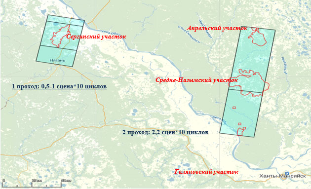
The peculiarity of the mutual geographical location of the sites determined the sounding scheme (Fig. 1):
1. The shooting of the Serginsky area was carried out with 1 standard or reduced passage (25-50 km in azimuth of shooting) in the amount of 10 cycles.
2. The shooting of the April, Middle Nazym, and Galyanovsky areas was carried out with a common passage with a size of at least 2.2 of the standard scenes (120 km of standard shooting) in such a way that the corresponding sections of 10 cycles were entered.

Outlines of scene in the AOI
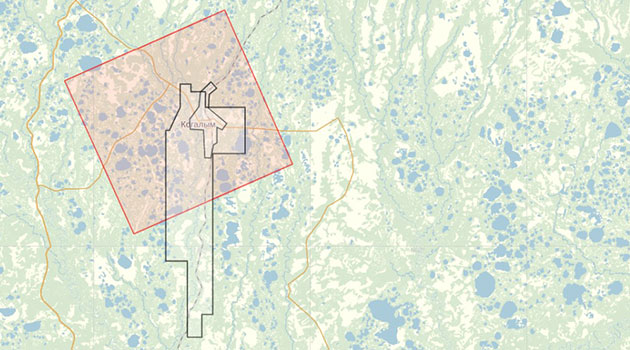
At the next stage, a satellite survey of the COSMO-SkyMed satellite (StripMap Himage) was carried out in the amount of fifteen scenes in the South Kustovoye field, including the city of Kogalym (total of 15 scenes). Mode - StripMap Himage. Polarization - HH.

The coverage scheme of the AOI
Results
Perm National Research Polytechnic University received the latest radar survey data, which was used for further interferometric processing and fulfillment of obligations to the main customer.Need for consultation?
Fill the form and we will contact you
