Contact

Creation of a map of mineralized zones

01

About the project

Creation of an integrated remote base at a scale of 1: 50,000 for two promising areas, with the allocation of areas favorable for the identification of gold-rare-metal, silver-polymetallic deposits for subsequent field verification.

Industry Geology and mining
End date 09/30/2019
02

Project goal

Creation of an integrated remote base at a scale of 1: 50,000 for two promising areas, with the allocation of areas favorable for the identification of gold-rare-metal, silver-polymetallic deposits for subsequent field verification.

03

Completed works

The geological structure of the area of interest was clarified using space imagery (at a scale of 1:50 000)

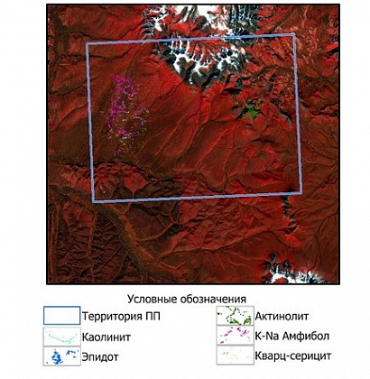
  • Using spectral and structural interpretation, the location of kaolinite, epidote, actinolite, quartz-sericite was found (Fig. 1).
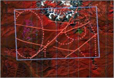
  • Structural deciphering in the area revealed structural violations of different vergences, as well as many ring elements of different ranks (Fig. 2).
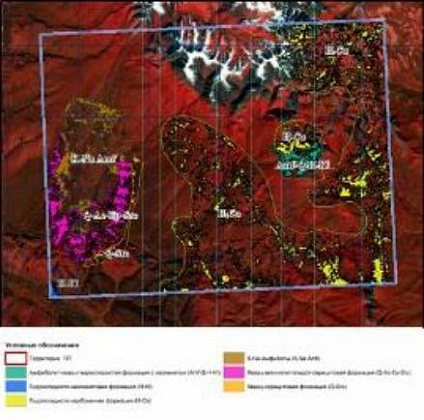
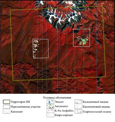
  • Considering the complex results of spectral and structural interpretation in the predicted area, the most expected detection of silver-polymetallic and gold-rare metal formation types (Fig. 3, Fig. 4)
04

Result

Transferred to the customer:

  • Factographic PMDO (per channel and RGB composites).
  • Schemes of spectral anomalies (by mineral indicators and complex).
  • Geological-structural diagram of the prospective area of scale 1: 50,000.
  • 3D model of the territory of the promising area, MDZ and DEM preparations.
  • Information report including recommendations on the allocation of promising areas for gold-silver, silver-polymetallic mineralization.
Figure 1. Distribution of kaolinite, epidote, actinolite, quartz-sericite, according to the spectral angle method (SAM
Figure 2. Cosmostructural scheme of the forecast area
Figure 3. Complex diagram of spectral anomalies for indicator minerals based on ASTER
Figure 4. Ore-promising areas identified based on space survey materials

Need satellite imagery or help choosing the right data?

Describe your task, area of interest, and desired outcome. We will check data availability, assess new acquisition options, and propose the optimal solution in terms of timelines, cost, and quality.
clients who trust us
25+ years in the geodata market
Request a call back
Back to page top
Мы используем Яндекс.Метрика и собственные Сookies для обеспечения наилучшего опыта работы на нашем сайте, персонализации сайта для наших пользователей и аналитики. Продолжая использовать сайт вы соглашаетесь с условиями Пользовательского соглашения.