of geospatial solutions
Sat-Sun: Non-working days
Project's objective
Creation of a Digital Regional Model (2D) that includes a Digital Elevation Model, Vector Model, Clutter Model, and Population Distribution Model.Completed work
- Selection and ordering of satellite images that meet the terms of reference (TOR), control of the received data;
- Selection, analysis and acquisition of initial vector data on the area of interest, archival topographic maps at scales 1:100 000 - 1:200 000 in raster and vector form;
- Obtaining and processing a Digital Elevation Model;
- Preparation of vector layers and creation of Vector Territory Model;
- Creating a Clutter Model;
- Creating a Population Distribution Model.
Work description
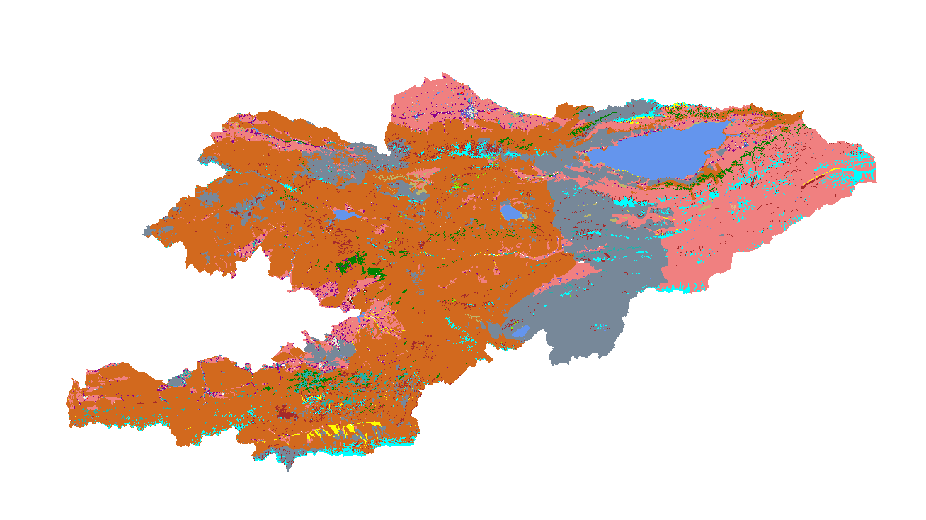
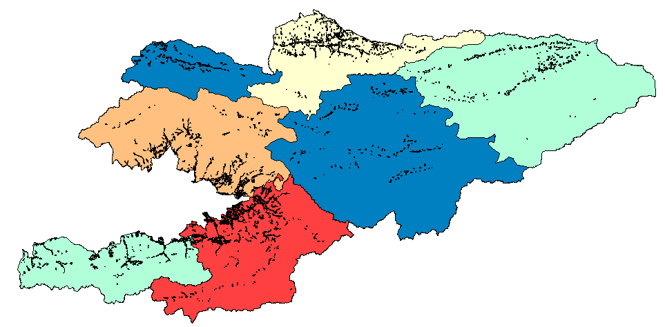
Types of work performed in the creation of a digital 2D model:Results
- Digital Terrain Model;
- Vector Model;
- Clutter Model;
- Population Distribution Model.
1. In accordance with the technical specifications, creating a 2D model required the use of a digital orthophotomap, created from up-to-date remote sensing materials (RS) with a resolution of up to 10 meters. The primary materials used were images with a resolution of up to 5 meters.
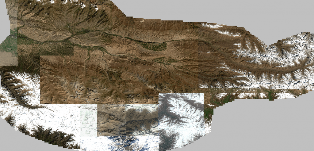
2. Selection, analysis, and acquisition of initial vector data and archival topographic maps at scales of 1:100,000 – 1:200,000 in raster and vector formats include systematization of source material, data completeness check, accounting, and storage. All source materials used for the work undergo incoming inspection. The vector data and topographic maps in raster and vector formats used to create the digital model form the basis for the initial set of vector layers, which are later updated and corrected using the digital orthophotomap.
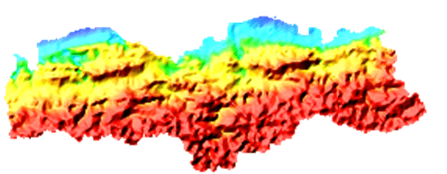
3. To create the terrain, a publicly available elevation matrix with a resolution of 10 meters was used. This matrix was used to create the terrain with a contour interval of 10 meters. For more accurate terrain construction based on the elevation matrix, hydrography vector objects were used. Subsequently, the obtained contours were checked and adjusted according to the digitized hydrography objects.
4. The prepared vector layers were supplemented with semantic data about the objects and formed into a dataset (or product) called "Vector Model" in *.tab format.
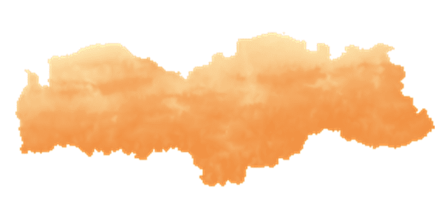
5. To create the "Clutter Model" product, the vector layers were brought to the necessary form and filled with the required information according to the requirements of the Technical Specifications.
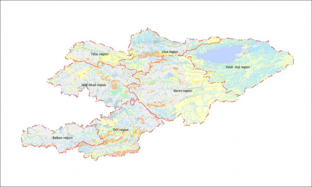
6. To create the digital population distribution model, vector data, administrative boundaries, and census data were used.
The set of materials delivered to the Customer includes:
Need for consultation?
Fill the form and we will contact you
Sat-Sun: Non-working days