Orthophotomap creation and update of cartographic materials
Orthophotomap creation and update of cartographic materials
01
About the project
Delivery of a new space survey and creation of orthophotomaps within the framework of land surveying and update of cartographic material on the license areas of the customer.
Industry
Mapping, Oil and gas
Customer
Gazprom Neft-Yamal LLC
End date
05/31/2017
02
Project goal
Delivery of a new space survey and creation of orthophotomaps within the framework of land surveying and update of cartographic material on the license areas of the customer.
03
Completed works
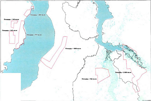
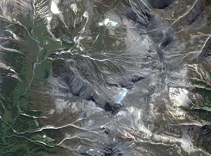
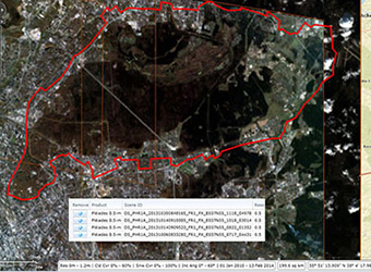
In accordance with the terms of the contract, Innoter LLC has made an order for a new high-resolution space survey (up to 0.5 m in nadir) on the territory of several license areas in the Tyumen region with a total area of 5800 sq. km.
The obtained satellite images corresponded to the requirements of the customer’s technical specification, namely:
multispectral shooting range
coordinate systems: MSC 89, SC 63, SC 95
permissible percentage of cloudiness per work area: 10%
The general scheme of license areas, 5800 sq. km.
The second stage of the work was to create a digital orthomosaic based on the obtained remote sensing materials on a scale of 1:10 000. The images were color-corrected and brought into nadir, stitched and released in a format compatible with MapInfo, AutoCAD and ArcGIS with a trapezoid breakdown into according to the coordinate systems used.
At the final stage, a layout of sheets for the work area and an explanatory note reflecting the methodology, technology and accuracy of the work performed were drawn up. In addition, at the request of the customer, “rude” orthoimages with a spatial resolution of 3-5 m were created.
Общая-схема-лицензионных-участков.jpg
04
Result
As a result of the fulfillment by LLC Innoter of its obligations under the contract, the following materials were transferred via FTP to the customer:
Digital orthomosaics in the framework of the “trapezoid” scale of 1:10000 in MSC-89;
Digital orthomosaics in the framework of the “trapezoid” scale of 1:10000 in SC-95;
Space images in natural color and in synthetic colors with near-IR channel;
“Rude” orthoimages with a spatial resolution of 3-5 m;
Need satellite imagery or help choosing the right data?
Describe your task, area of interest, and desired outcome. We will check data
availability, assess new acquisition options, and propose the optimal solution in terms of timelines, cost,
and quality.
Fast feedback during business hours
We will select the best data for your task
Confidentiality guaranteed
Discuss the project
clients who trust us
25+ years in the geodata market
Мы используем Яндекс.Метрика и собственные Сookies для обеспечения наилучшего
опыта работы на нашем сайте, персонализации сайта для наших пользователей и аналитики.
Продолжая использовать сайт вы соглашаетесь с условиями
Пользовательского соглашения.
Request a call
Leave your contact details — we will get back to you during business hours, clarify the task and suggest suitable data or services.
Write to e-mail
Send a message, technical specification or task description. We will review your request and reply to the specified e-mail.
Fill in the order form
Describe the area, object and imagery requirements. We will check archive availability, the possibility of a new acquisition and offer a suitable option.