01
About the project
| Industry | Agriculture |
|---|---|
| Customer | Ministry of Agriculture and Food of the Moscow Region |
| End date | 12/20/2020 |
| Industry | Agriculture |
|---|---|
| Customer | Ministry of Agriculture and Food of the Moscow Region |
| End date | 12/20/2020 |
Updating the geographic information database on agricultural land in the Moscow Region to provide staff of the Moscow Region Ministry of Agriculture and Food with information on agricultural land in the Moscow Region.
To achieve the stated objective, the following services must be provided:
To eliminate distortions and improve georeferencing accuracy, all satellite images underwent orthorectification using rational polynomial coefficients (RPCs). As a result of geometric correction, georeferencing accuracy improved from 10–20 m to 2–3 m.
The results of the services provided under the State Contract “Updating the Geospatial Database of Agricultural Lands of the Moscow Region” make it possible to draw the following main conclusions.
The database was updated with refined boundaries of agricultural lands. In addition, land plots with an area of less than 2 hectares were extracted from the dataset.
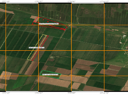
Based on the acquired Gaofen-1 satellite imagery, which underwent pansharpening to a spatial resolution of 2 m, a layer of refined agricultural land boundaries showing signs of non-use was created through expert visual interpretation and NDVI (Normalized Difference Vegetation Index) analysis for each object in the agricultural land layer.
The boundaries of agricultural lands not registered in the cadastral system as of 01.10.2020 were refined by reviewing areas where no information was available on the Public Cadastral Map, while corresponding objects were present in the agricultural land layer.
The boundaries of agricultural lands unsuitable for agricultural activities were identified through expert visual interpretation based on Gaofen-1 satellite imagery and the SRTM DEM. The digital elevation model was used to identify very steep ravines, gullies, and river valleys.
Geospatial datasets were prepared for import into the Unified Federal Information System for Agricultural Lands (EFIS ZSN).