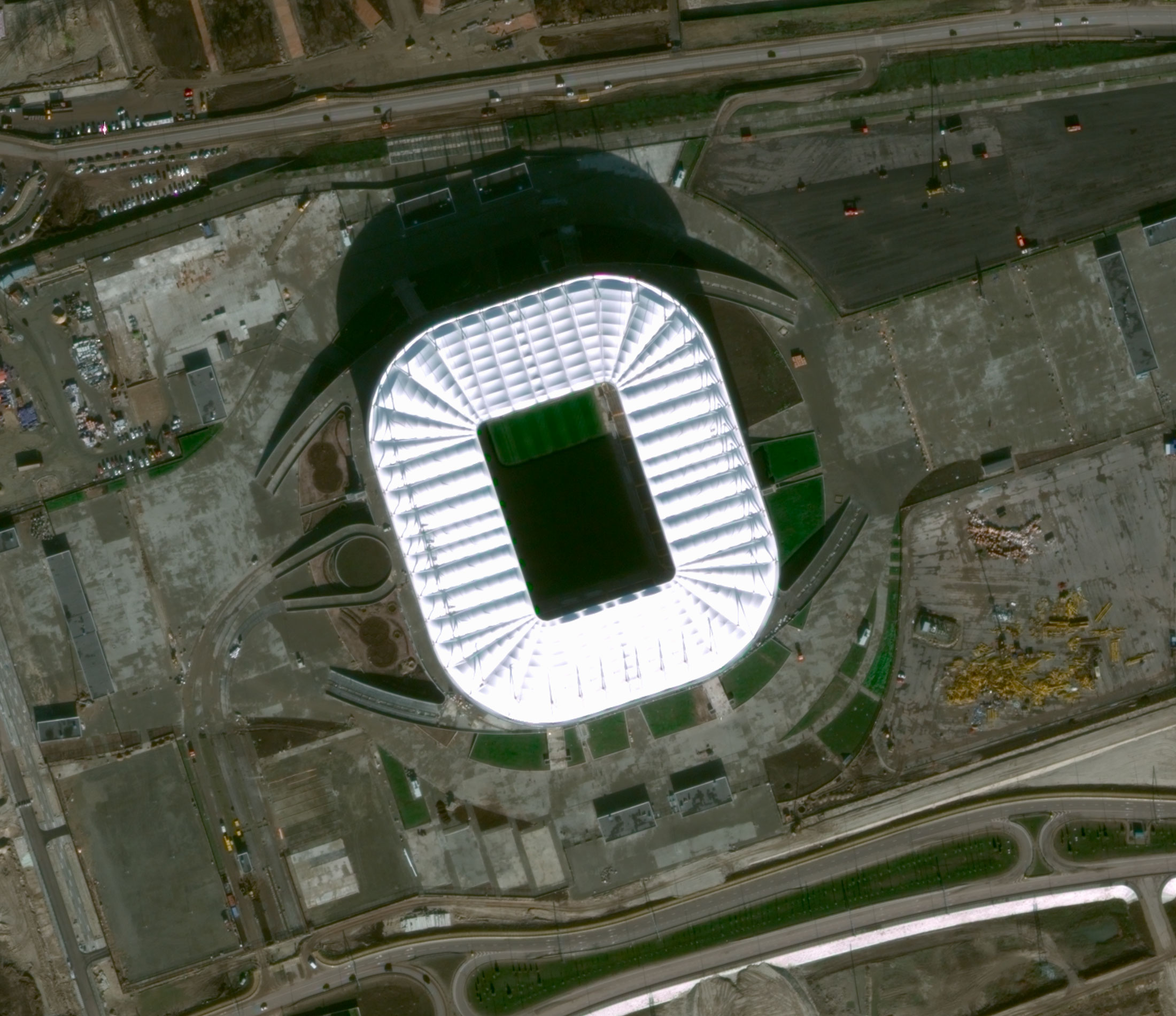
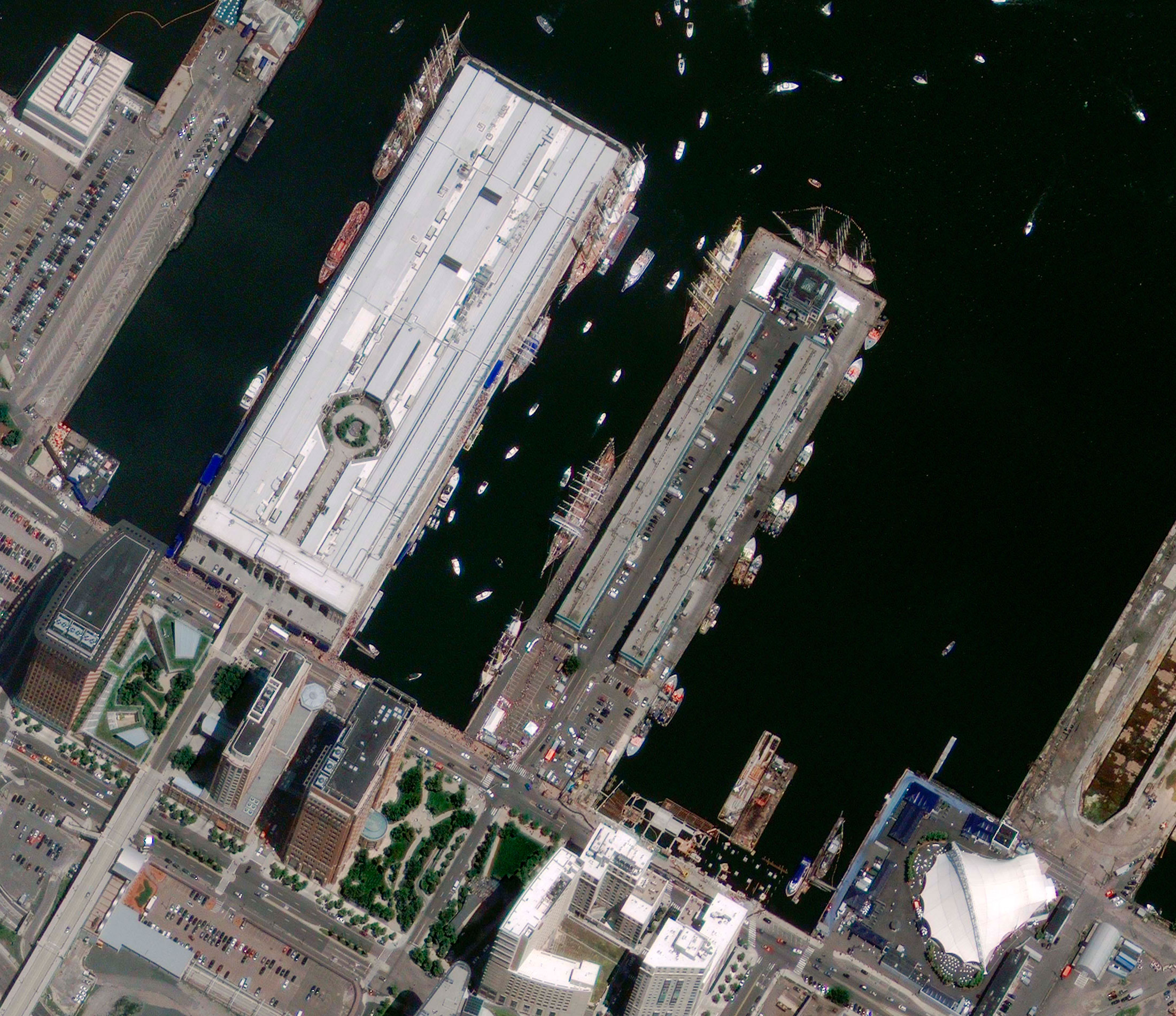
GeoEye-1 satellite images
Spacecraft design and mission details
| Name | GeoEye-1 |
|---|---|
| Country | USA |
| Developer | General Dynamics, ITT, IBM, Kodak, MDA |
| Operator | DigitalGlobe |
| Launch vehicle | Delta II 7420-10 |
| Launch date | September 6, 2008 |
| Date of deactivation | – |
|
Orbit: Type Altitude, km Inclination, deg. |
Sun-synchronous 684 98,0 |
| Mission duration, years | 10 |
| Revisit frequency, days | 1-3 |
| Power, W | 3862 |
| Spacecraft dimensions, m | 4,4×2,7 |
| Mass, kg | 1955 |
Specifications
| Spectral bandwidth, μm |
Panchromatic: 0,45–0,80 |
|---|---|
| Dynamic range, bits per pixel | 11 |
| Sensor resolution (at nadir), m |
0,41 (PAN) 1,64 (MS) |
| Swath width, km | 15,2 |
| Attitude determination and control |
Type: 3-axis stabilized Sensors: Star tracker/IRU/reaction wheels, GPS |
| Retargeting agility | Time to Slew 200 km: 20 sec |
| Image transmission, Mbit/s | 740 |
Coverage specification
| Swath widths and representative area sizes |
Standard swath width at nadir: 15,2 km Coverage of one image: 225 km2 (15×15 km) Maximum coverage: 15,000 km2 (300×15 km) Square area 1°×1°: 10,000 km2 (100×100 km) In stereo mode: 6,270 km2 (224×28 km) |
|---|---|
| Daily acquisition capacity |
Total amount of shots in the PAN mode: 2400 Coverage in PAN mode: 700,000 km2 Coverage in MS mode: 350,000 km2 |
Products
|
Product |
Geo |
GeoProfessional |
GeoStereo |
|---|---|---|---|
|
Radiometric correction |
Yes |
Yes |
Yes |
|
Geometric correction |
Yes |
Yes |
Yes |
|
Georeferencing |
Yes |
– |
– |
|
Orthorectification |
– |
Yes |
Yes |
|
Horizontal accuracy (CE90%) |
5 |
5 |
5 |
|
Vertical accuracy (LE90%) |
– |
– |
3 m |
|
Datum |
WGS84, NAD83… |
||
|
Projection |
UTM |
||
|
Spectral bands |
Panchromatic, Multispectral (8 bands), Bundle (PAN+8-bands MS) |
||
|
Minimum order size |
49 km2 – for archive data |
||
|
Delivery formats |
TIFF, GeoTIFF 1.0, NITF 2.1 or NITF 2.0, UTM |
||
|
Delivery method |
CD, DVD, FTP, Hard Drive |
||
Collection scenarios (30° off-nadir angle):
- Long strip: 360 × 15,2 km
- Large Area Collect: 112 × 44 km
- Multiple Point Targets: 15,4 × 15,4 km
- Stereo Area Collect: 224 × 28 km
Benefits:
- Highly detailed imagery for mapping, change detection and in-depth image analysis;
- Geolocate features to less than 5 m to create maps in remote areas, maximizing the utility of available resources;
- Frequent update of imagery;
- Stereoscopic collection on a single pass provides image continuity and consistency of quality.