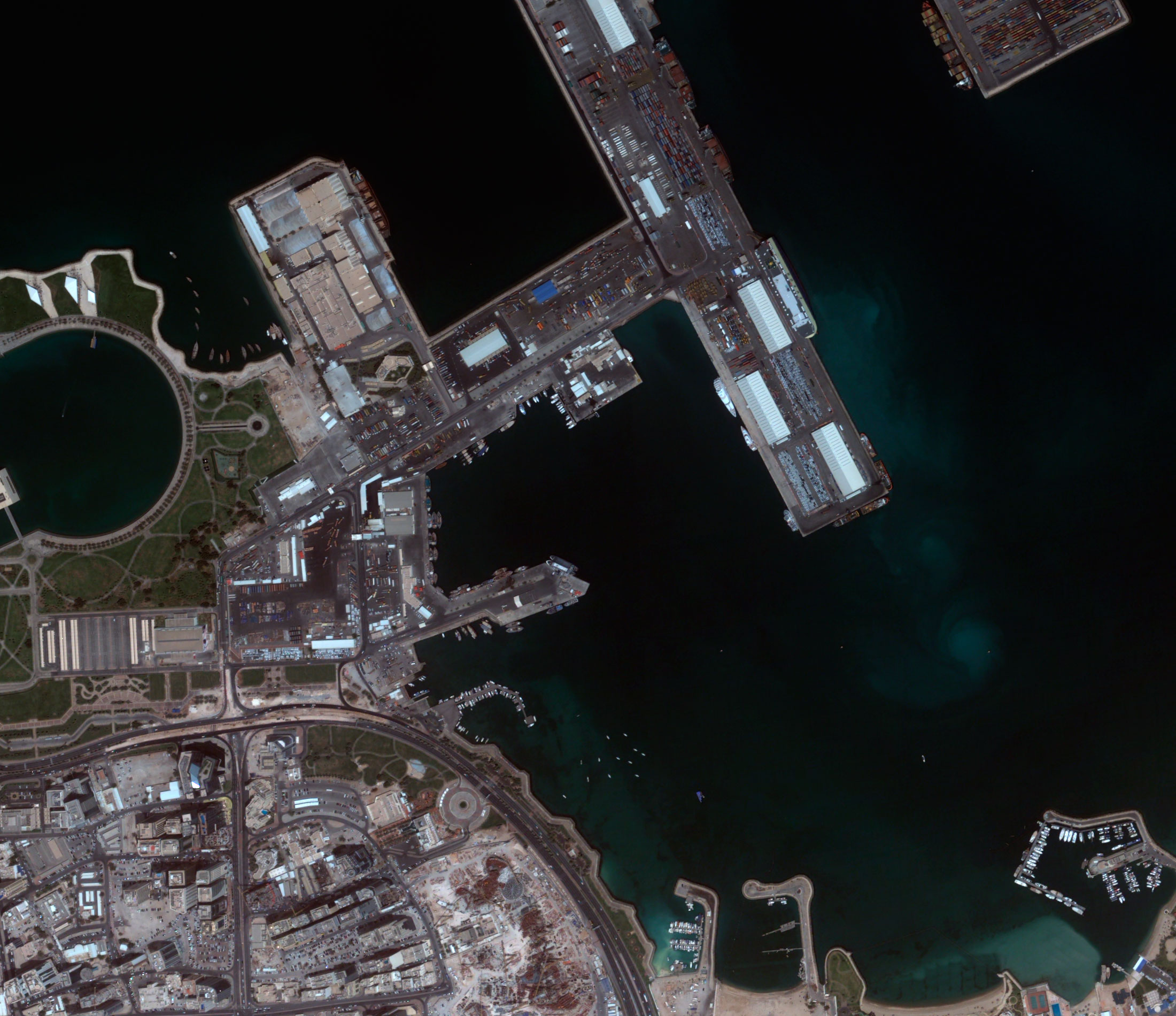
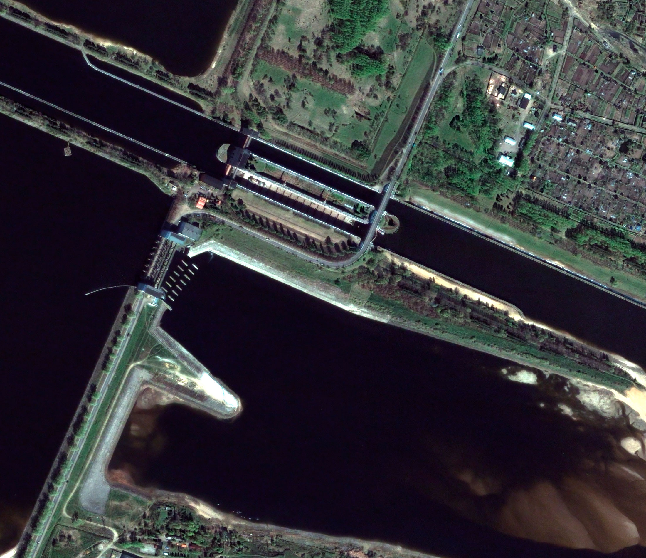
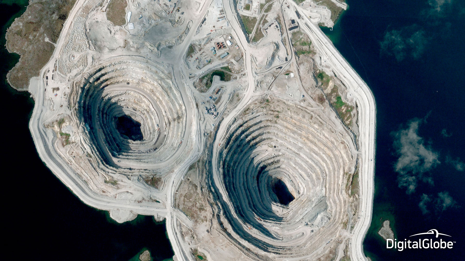
DigitalGlobe’s QuickBird satellite continues to offer sub-meter resolution imagery with high geolocational accuracy. With global collection of panchromatic and multispectral imagery, QuickBird is designed to support a wide range of geospatial applications.
Spacecraft design and mission details
|
Name |
QuickBird |
|---|---|
|
Country |
USA |
|
Developer |
Ball Aerospace, Kodak, Fokker Space, DigitalGlobe |
|
Operator |
DigitalGlobe |
|
Launch vehicle |
Delta II |
|
Launch date |
18 October 2001 |
|
Launch site |
Vandenberg Air Force Base, California |
|
Date of deactivation |
27 January 2015 |
|
Orbit: Type |
Sun-synchronous |
|
Mission duration, years |
13 |
|
Revisit frequency, days |
At 40°N latitude: revisit time may vary from 2 to 12 days depending on target location as the orbit decays. |
|
Spacecraft dimensions, m |
3,0 × 1,8 |
|
Power, W |
3200 |
|
Mass, kg |
1028 |
Specifications
| Sensor bands |
Panchromatic: 405–1053 nm Blue: 430–545 nm Green: 466–620 nm Red: 590–710 nm Near-IR: 715–918 nm |
|---|---|
| Dynamic range, bits per pixel |
11 |
| Sensor resolution (at nadir), m |
PAN: 61 cm GSD MS: 2,44 m GSD |
| Swath width, km | 16,5 |
| Attitude determination and control |
Type: 3-axis Stabilized Actuators: Control Moment Gyros (CMGs) Sensors: Star trackers, precision IRU, reaction wheels, GPS |
| Horizontal accuracy (CE90%) | 23 m (without ground control) |
| Retargeting agility | Time to Slew 200 km: 37 sec |
| Onboard storage | 128 Gb |
Products
Basic – Basic products are designed for customers with advanced image processing capabilities. These imagery products, when combined with supplied attitude, ephemeris, and camera model information, are suitable for advanced photogrammetric processing (for example, orthorectification). Each unique image in a Basic Product is processed individually; seamlines will be visible in products requiring multiple images to cover the area of interest. Basic products are available in Panchromatic, Multispectral, and as a Bundle. The pansharpening option is not available with a Basic Product.Standard – Standard Imagery products are suitable for users requiring modest absolute accuracy and/or large area coverage. Users of Standard Imagery products usually possess enough image processing tools and knowledge to manipulate and exploit the imagery for a wide variety of applications.
Orthorectified – Ortho Ready Standard Stereo Imagery products are suitable for customers with a high level of image expertise and software that is capable of ingesting, processing and/or displaying stereo imagery. They are typically used to create Digital Elevation Models (DEMs) or for 3D feature extraction. Customers ordering stereo products who require a small area of interest (AOI) should order the Ortho Ready Standard Stereo Product while customers requiring large area coverage should opt for the Basic Stereo Product.
CitySphere – CitySphere products are orthorectified images in natural colours with >60 m resolution, that display 300 cities worldwide. All city images have geo-reference, topographic accuracy, high resolution. This fact makes CitySphere images an ideal database for GIS-projects, navigation systems, mobile LBS-devices. The data is represented as a mosaic of different scale – 1:4800, 1:12000 or 1:50000.
Basic Stereo Pair – Basic Stereo Pair Imagery products are suitable for customers with a high level of image expertise and who have software that is capable of ingesting, processing, and/or displaying stereo imagery. Basic Stereo Pair Imagery products are typically used to create Digital Elevation Models (DEMs) or for three-dimensional feature extraction. Basic Stereo Pair Imagery products are comprised of one or more pairs of Basic Images with 100% overlap over the customer’s Area of Interest (AOI). Stereo mates are collected on the same satellite orbit and with specific look angles in order to attain imagery appropriate for stereo viewing. Basic Stereo Imagery is available in Panchromatic, 4-band Multispectral, or Pan + 4-band Multispectral Products.
| Product | Basic | Standard | Orthorectified | CitySphere | Basic Stereo |
|---|---|---|---|---|---|
| Radiometric correction | Yes | Yes | Yes | Yes | Yes |
| Geometric correction | Yes | Yes | Yes | Yes | Yes |
| Georeferencing | Yes | Yes | - | - | - |
| Orthorectification | - | - | Yes | Yes | - |
|
Horizontal accuracy (CE90%), m |
23 | 23 |
1:50000-25,4 |
1:50000 |
6,5 |
|
Vertical accuracy (LE90%), m |
- | - | - | - |
6,5 |
| Spectral bands | Panchromatic, multispectral (4 bands) or Bundle (PAN+4 bands); Natural colours: Infra-red; Synthesized (PAN+4 bands) | ||||
| Minimum order size, km2 | 230 | 25 | 100 | - |
210 |
| Maximum order size, km2 | 10000 | ||||
| Delivery formats | GeoTIFF 1.0, NITF 2.1 or NITF2.0 | ||||
Applications:
- Creation and update of maps and plans;
- Creation of DTMs;
- Engineering survey for construction works of oil and gas facilities;
- Inventory of forests and forest management;
- Monitoring of the crops’ state, yield forecasting;
- Creation of maps for urban planning purposes;
- Emergency monitoring;
- Researches.