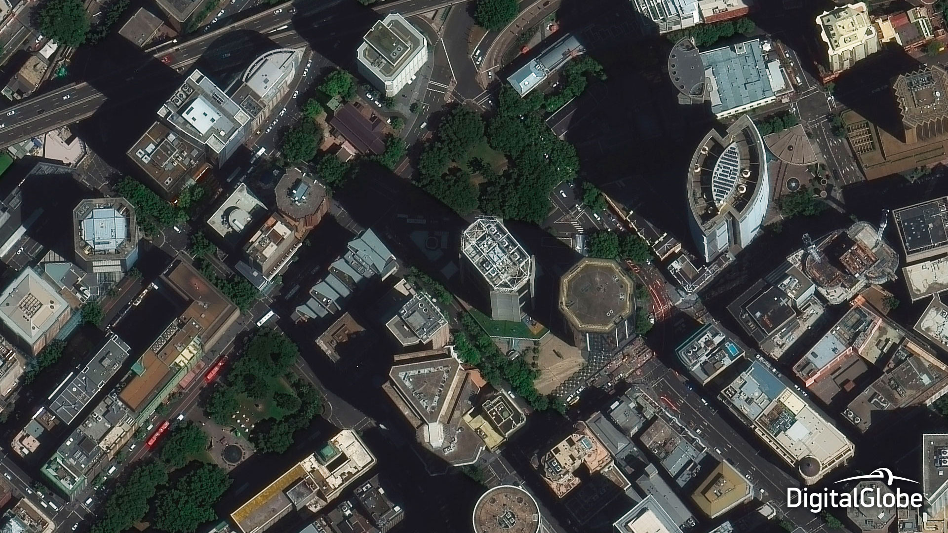
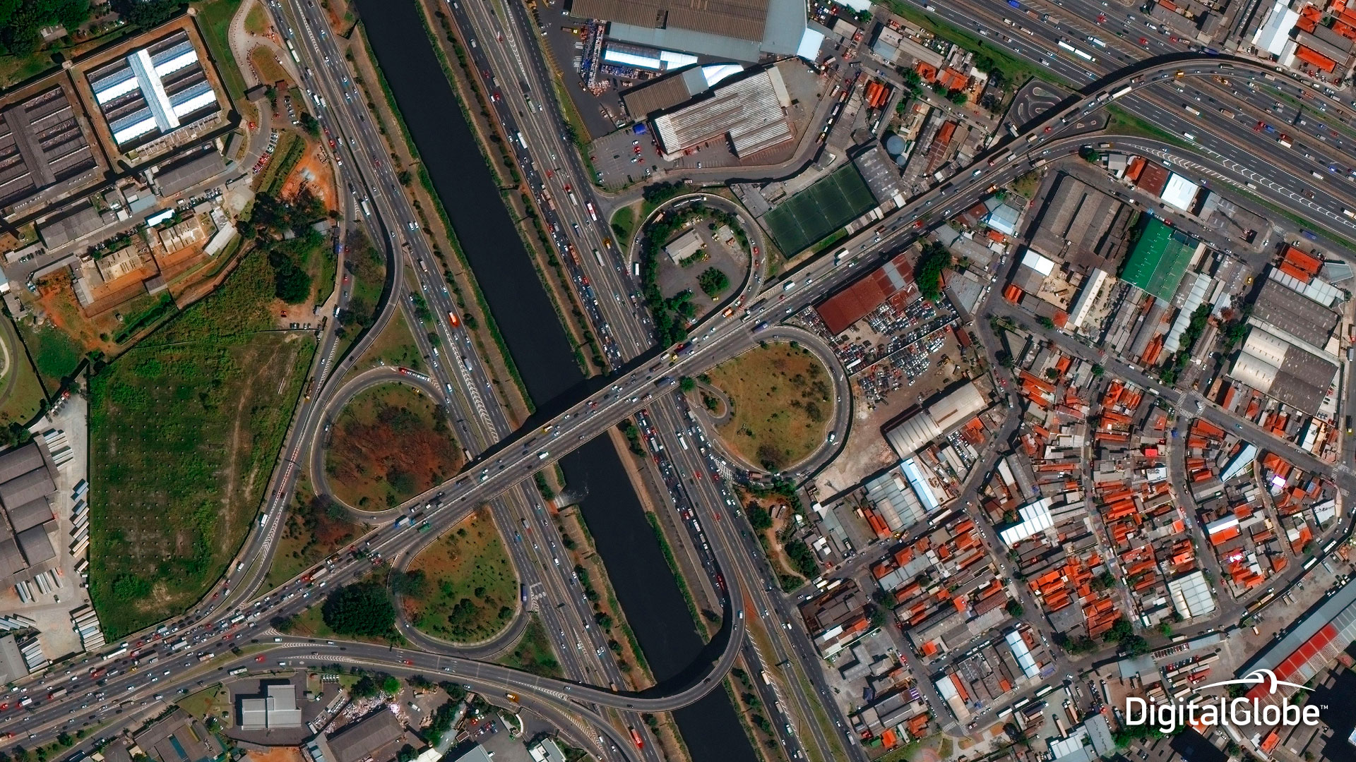
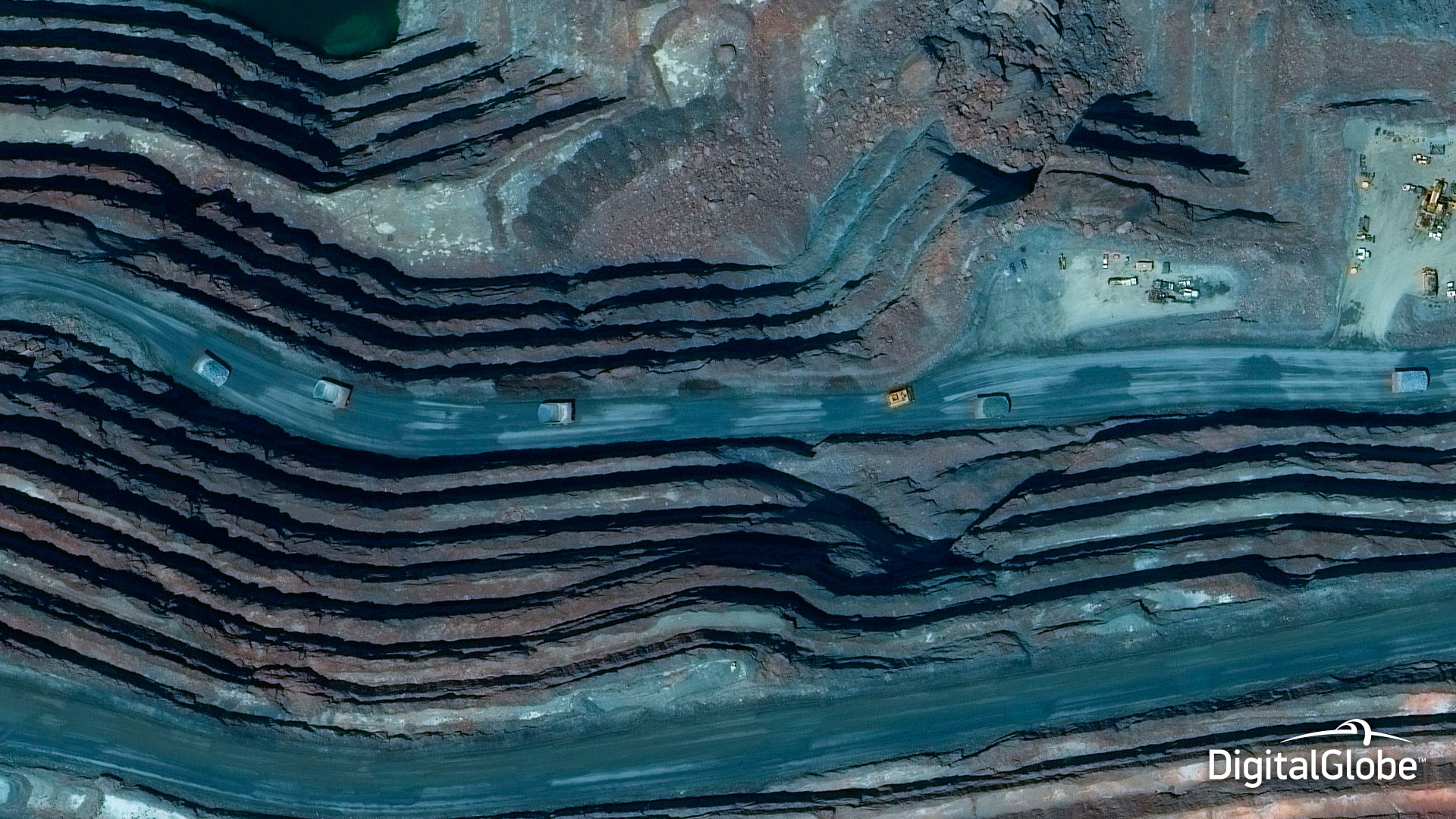
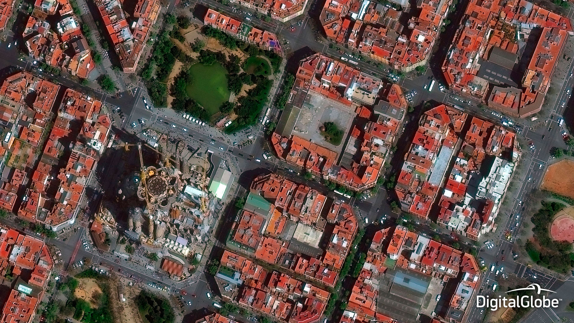
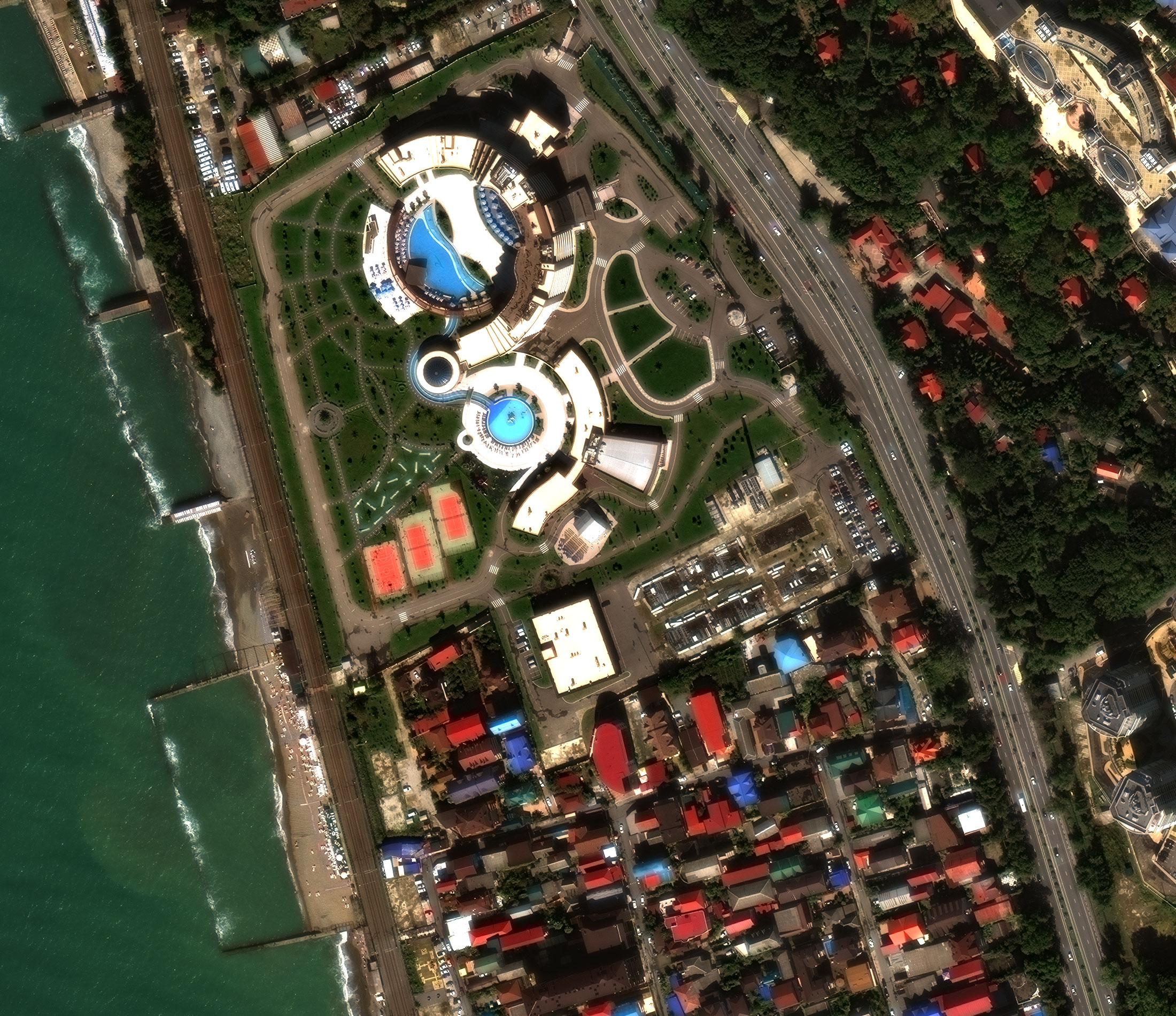
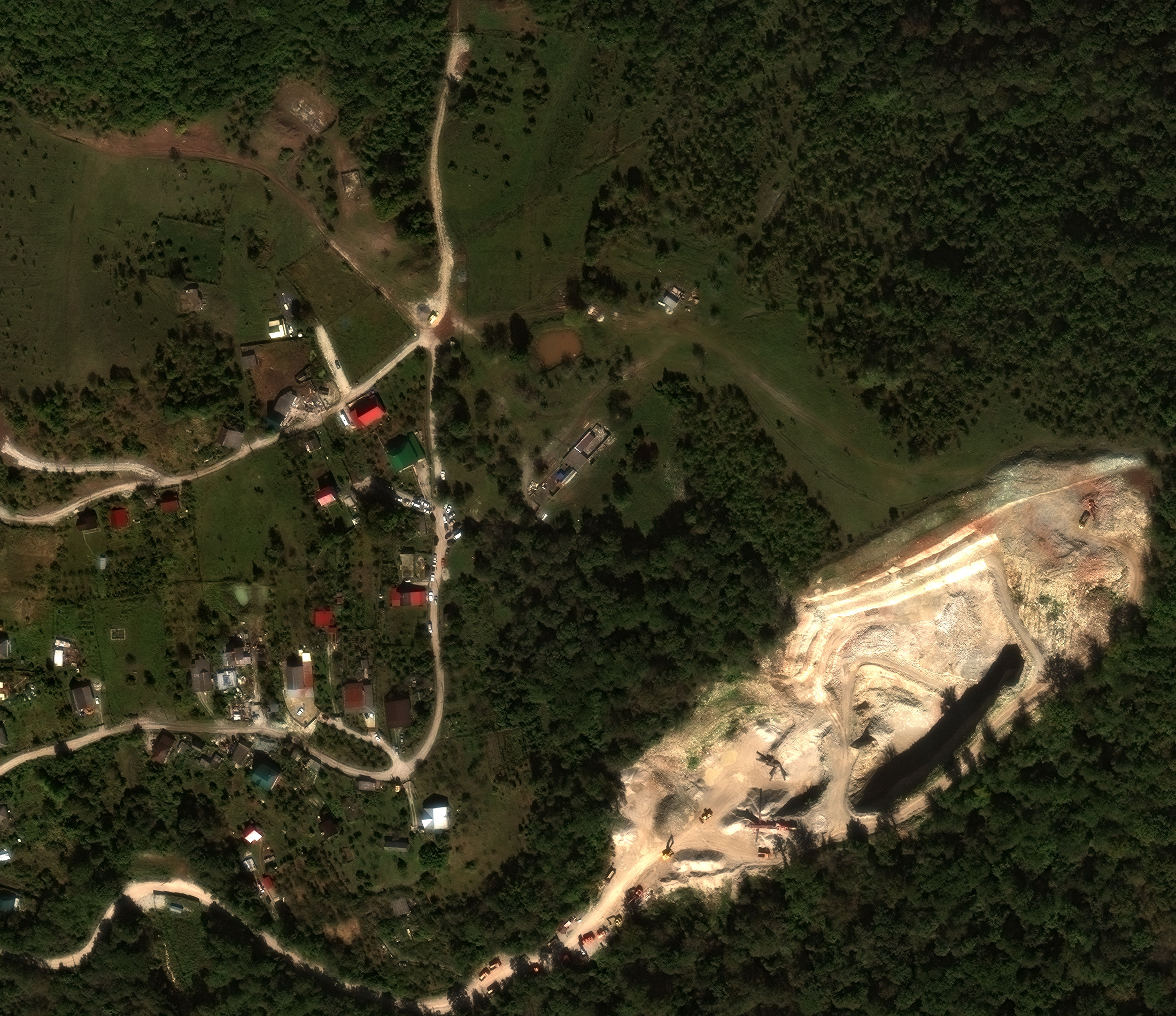
WorldView-3 is the first in the industry commercial satellite with multi-payload, super-spectral and high-resolution. It operates at an altitude of 617 km and provides 31 cm panchromatic resolution, 1.24 m multispectral resolution, 3.7 m short-wave IR resolution and 30 m CAVIS resolution. WorldView-3 can collect up to 680,000 km2 per day due to the average revisit time of <1 day. The satellite is urged to enhance the DigitalGlobe collection capacity.
Spacecraft design and mission details
| Name | WorldView-3 |
|---|---|
| Country | USA |
| Developer | Ball Aerospace |
| Operator | DigitalGlobe |
| Launch vehicle | Atlas V |
| Launch date | 13 August 2014 |
| Launch site | Vandenberg SLC-3E |
| Date of deactivation | - |
|
Orbit: Type Altitude, km Inclination, deg. |
Sun-synchronous 617 km 97 |
| Mission duration, years | Planned: 7,25 years Elapsed: 4 years |
| Revisit frequency, days | <1 |
| Power, W | 3100 |
| Spacecraft dimensions, m | 5,7×2,5 |
| Mass, kg | 2800 |
Specifications
| Sensor bands |
Panchromatic: 450–800 nm 8 Multispectral: Coastal: 397–454 nm Red: 629–696 nm Blue: 445–517 nm Red Edge: 698–749 nm Green: 507–586 nm Near-IR1: 765–899 nm Yellow: 580–629 nm Near-IR2: 857–1039 nm 8 SWIR bands: SWIR-1: 1184–1235 nm SWIR-5: 2137–2191 nm SWIR-2: 1546–1598 nm SWIR-6: 2174–2232 nm SWIR-3: 1636–1686 nm SWIR-7: 2228–2292 nm SWIR-4: 1702–1759 nm SWIR-8: 2285–2373 nm 12 CAVIS bands: Desert Clouds: 405–420 nm Water-3: 930–965 nm Aerosol-1: 459–509 nm NDVI-SWIR: 1220–1252 nm Green: 525–585 nm Cirrus: 1365–1405 nm Aerosol-2: 635–685 nm Snow: 1620–1680 nm Water-1: 845–885 nm Aerosol-1: 2105–2245 nm Water-2: 897–927 nm Aerosol-2: 2105–2245 nm |
|---|---|
| Dynamic range, bits per pixel |
11 (PAN and MS); 14 (SWIR) |
| Sensor resolution (at nadir), m |
PAN: 0,31 MS: 1,24 SWIR: 3,70 CAVIS: 30,0 |
| Swath width, km | 13,1 |
|
Attitude determination and control |
Type: 3-axis Stabilized Actuators: Control Moment Gyros (CMGs) Sensors: Star trackers, precision IRU, GPS |
| Horizontal accuracy (CE90%) | <3,5 m without GCP |
| Retargeting agility< | Time to Slew 200 km: 12 sec |
| Onboard storage | 2199 Gb solid state with EDAC |
Collection scenarios:
- Long strip: 360 × 13,1 km
- Large Area Collect: 112 × 65,5 km
- Multiple Point Targets: 13,1 × 13,1 km
- Stereo Area Collect: 112 × 26,2 km
Benefits:
- Very high resolution
- Daily revisits
- Bi-directional scanning
- Industry-leading geolocation accuracy
- Spectral diversity:
- Panchromatic band
- 4 standard VNIR colors: blue, green, red, near-IR1
- 4 added VNIR colors: coastal, yellow, red edge, near-IR2
- 8 SWIR bands: penetrates haze, fog, smog, dust and smoke
- 12 CAVIS bands: maps clouds, ice and snow, corrects for aerosol and water vapor
Applications:
- Mapping
- Land classifications
- Disaster preparedness/Response
- Feature extraction/Change detection
- Soil/Vegetative analysis
- Geology: Oil&Gas, Mining
- Environmental monitoring
- Bathymetry/Coastal applications