Spacecraft ALOS (Advanced Land Observing Satellite) under the provisional name Daichi was launched on January 24, 2006 from the Japanese Tanegashima cosmodrome in Kagoshima Prefecture on the Japanese island of Kyushu at 10: 33 local time. The owner of the satellite is the Japanese aerospace Agency JAXA. The satellite was launched into a solar synchronous orbit with an altitude of 691.65 km. on April 22, 2011, the satellite began to lose control. It could not be restored. The operation of satellite was terminated on 12 may 2011 only Available archival data.
Data obtained from the satellite are used for mapping, observing using of natural resources and for scientific research. One of the main tasks of ALOS was mapping Japan and other countries in the Asia-Pacific region.
Specifications of the ALOS spacecraft
| Name of the spacecraft | ALOS |
|---|---|
| Country | Japan |
| Developer | NEC Corp. |
| Operator | NASDA |
| Launch date | 24.01.2006 |
| Decommissioned | 12.05.2011 |
| Launch vehicle | H-IIA F8 |
|
Orbit: height, km inclination, degree |
Sun-synchronous 692 93.2 |
|
Platform: filming equipment the angles of deflection, deg crossing time of the equator, hours |
– PRISM, AVNIR-2, PALSAR 44 10:30 |
| Period of active existence, years | 5 |
| Power, W | 7000 |
| Mass of spacecraft, kg | 4000 |
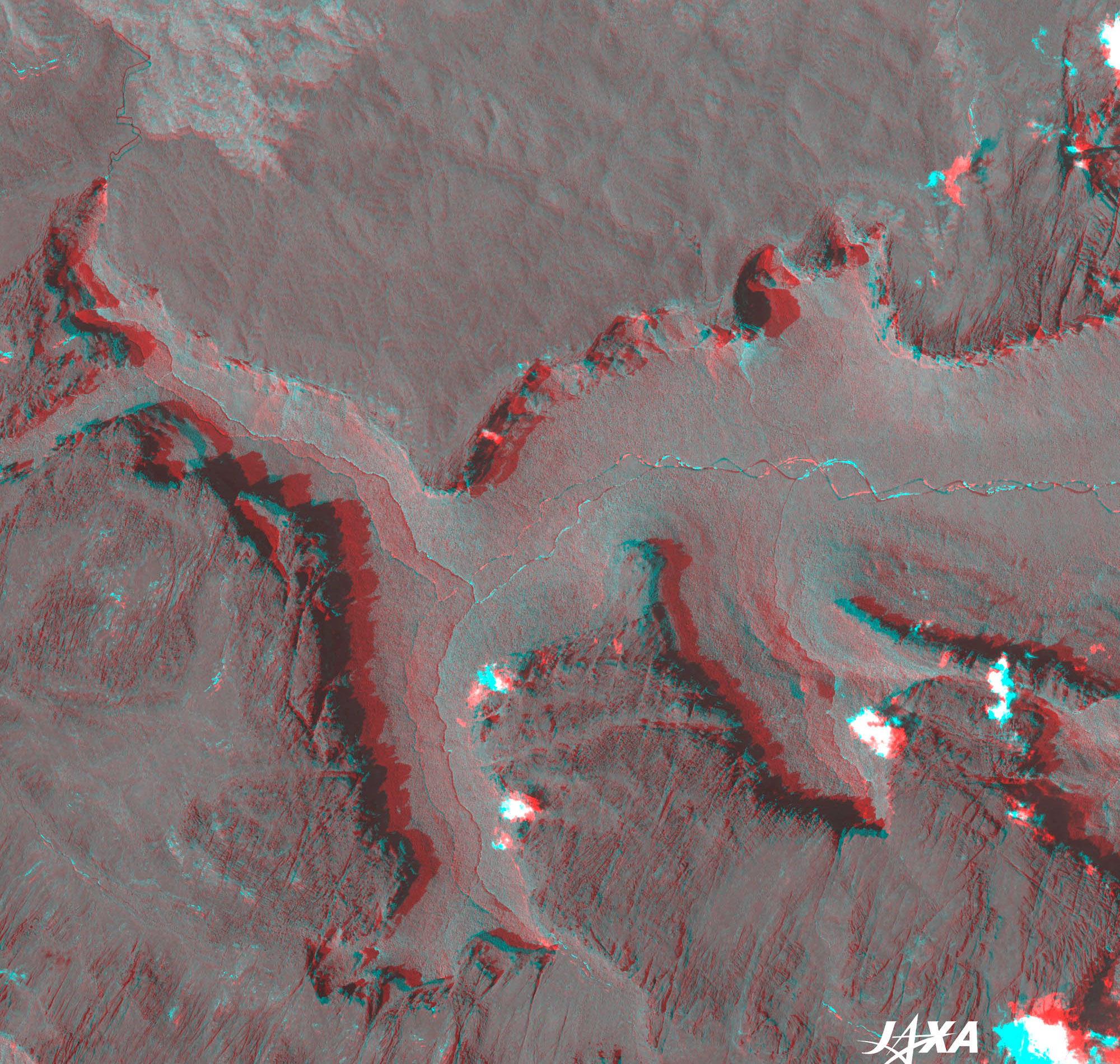
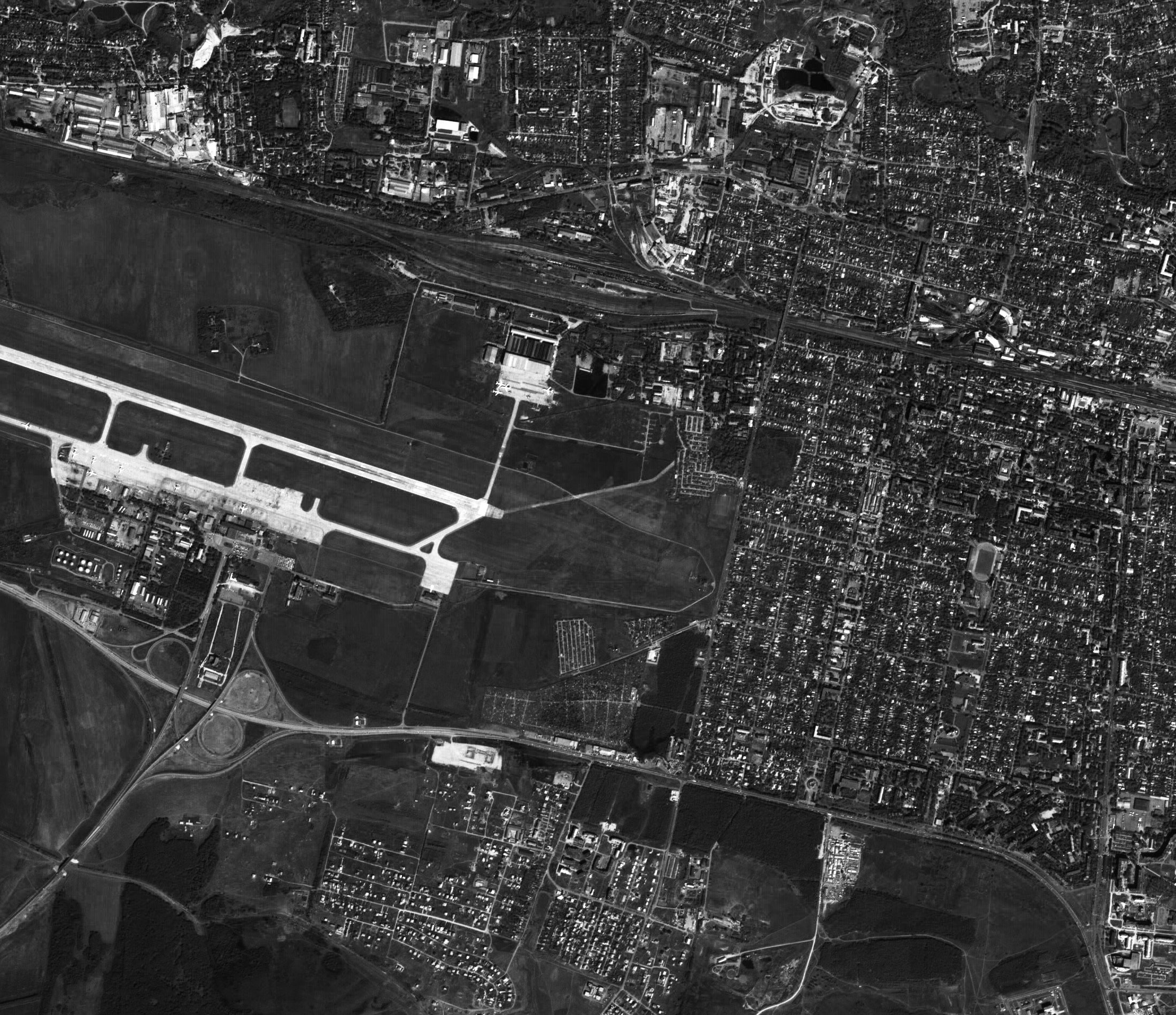
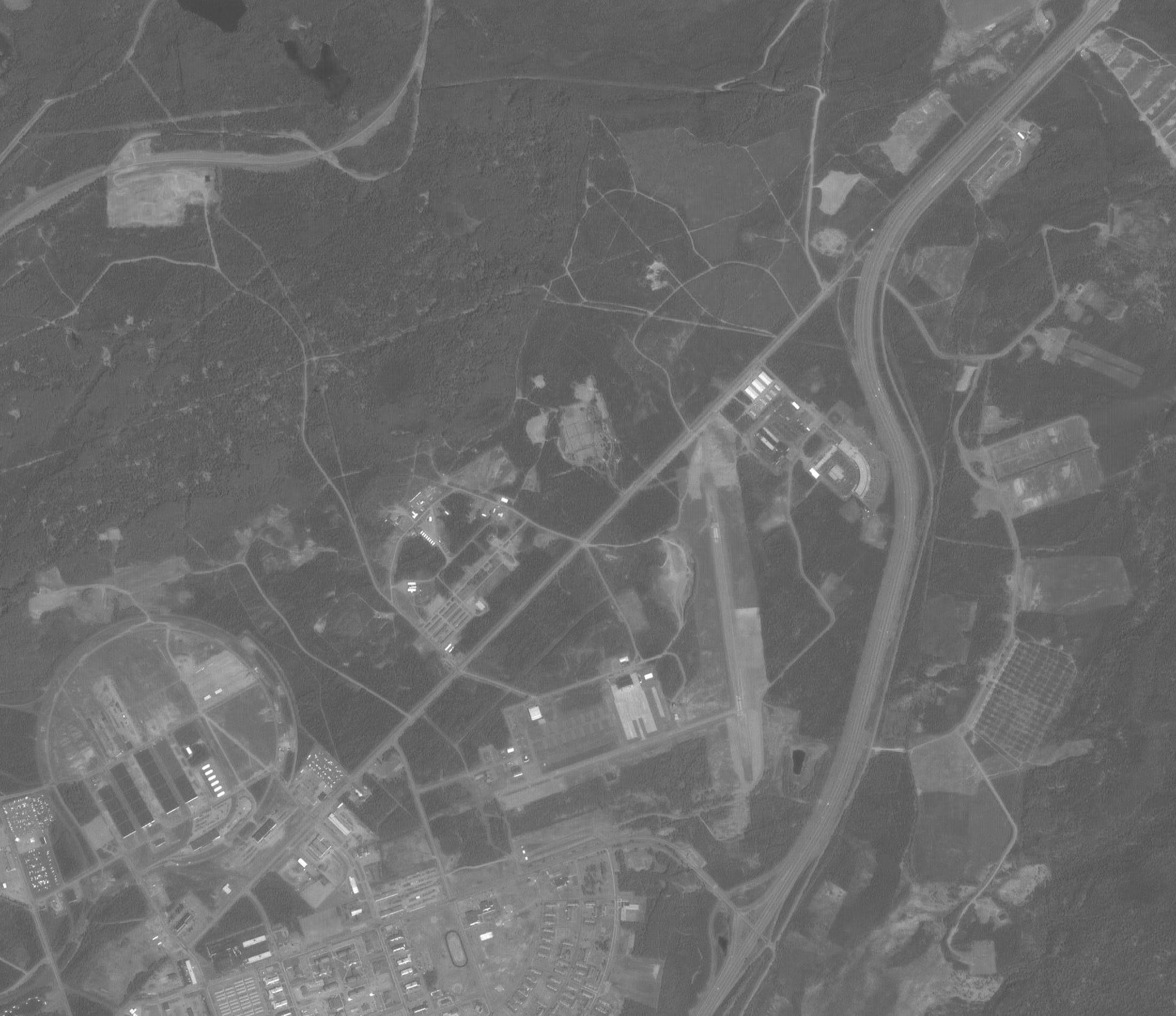
ALOS satellite is equipped with a stereo mapping camera (PRISM) to capture images with a resolution of up to 2.5 m, a multispectral camera (AVNIR-2) to capture color images with a resolution of 10 m, as well as an L-band radar (PALSAR) designed for round-the-clock and all-weather Earth observation and to capture images with a resolution of 7 to 100 m.
The PRISM sensor consists of three lenses for forward, down and back sight. PRISM provides not only high resolution, but also a bandwidth of up to 70 km. the Equipment is characterized in that it allows you to receive not stereo pairs, and triplets of images, which, in turn, makes it possible to significantly increase the accuracy of the resulting three-dimensional models of the earth's surface.
The AVNIR-2 sensor is the successor to ADEOS/AVNIR (JAXA, 2004). The AVNIR-2 changed sensors and related electronic systems. These changes contribute to the achievement of the 10-meter spatial resolution. Another difference from AVNIR is the ability to change the angle of sight in the range of ±44 degrees relative to the Nadir across the flight path. With this flexible guidance, it is possible to realize more frequent observations of the same areas of the earth's surface, for example, every 48 hours, in the area of higher latitudes.
Technical characteristics of PRISM and AVNIR-2 equipment
| Name of shooting equipment | PRISM | ANVIR-2 |
| Focal length, m | 2.0 | 0.8 |
| Diameter of the main mirror, cm | 30 | 24 |
| Relative aperture | 1:6.6 | 1:3.3 |
| Angle of view, deg | 7.6 | 5.8 |
| Spectral ranges, microns | 0.52-0.77 | 0.42-0.50 0.52-0.60 0.61-0.69 0.76-0.89 |
| Number of elements in the ruler | 14000 | 7000 |
| Dynamic range, bit | 8 | 8 |
| Spatial resolution, m | 2.5 | 10.0 |
| Of swath width, km | 35 | 70 |
| Data transfer rate, Mbit / sec | 960 | 160 |
For more information about the PALSAR sensor, click here.
- creation and updating of topographic and special maps;
- scales up to 1: 25,000;
- creation of digital elevation models (DEM) of high accuracy;
- study of relief changes caused by various factors;
- measurement of earth surface movements by interferometric method;
- control over the use of natural resources;
- observations of natural disasters;
- conducting research in various fields;
- solution of applied problems.