On September 9, 2012, the innovative SPOT-6 SPACECRAFT was launched into a solar synchronous orbit by an Indian PSLV launch vehicle from the Satish Dhawan cosmodrome on Sriharikota island. The SPOT-6 spacecraft has higher capabilities compared to its predecessors — the SPOT-4 and SPOT-5 spacecraft — it allows to survey the Earth with a resolution of up to 1.5 m in panchromatic mode and up to 6 m in multispectral mode.
Spot-6 and 7 – two identical characteristics of the optical remote sensing spacecraft of high resolution. Spot-7 launched on June 30, 2014. Width of the SPOT 6 survey band, as well as the similar SPOT 7 spacecraft, is 60 km. Each of the SPOT-6 and -7 spacecraft can shoot up to 3 million square kilometers daily.
Spacecrafts represent a new generation of the Spot series. Decision to create them was made by the EADS Astrium consortium in 2009 to ensure the continuation of high-detail photography for years to come (up to 2023).
The new generation of SPOT spacecrafts together with the Pleiades spacecrafts forms a single system. Four spacecrafts Pleiades-1/2 and SPOT 6/7-are placed in the same orbital plane and are evenly spaced in the phase angle at 90° from each other. This allows commercial and government customers to capture the same area twice a day in both the wider high-resolution band using SPOT satellites and the ultra-high-resolution detailed shooting mode using Pleiades vehicles.
Specifications SPOT-6,7 spacecrafts
| Name of the spacecraft | SPOT-6,7 |
|---|---|
| Country | France |
| Developer | Airbus Defence and Space (ex.EADS Astrium satellites) (France) |
| Operator |
Airbus Defence and Space (France; SPOT-6), Azerkosmos (Azerbaijan; SPOT-7/Azersky) |
| Launch vehicle | PSLV-C21 and PSLV-C23 |
| Launch date | 09.09.2012 and 30.06.2014 |
|
Orbit: height, km inclination, degree rossing time of equator |
Sun-synchronous 694 98.2 10:30 |
| Period of active existence, years | 9 |
| Power, W | 1200 |
| Mass of spacecraft, kg | 800 |
| Follow-up period, day | 3 |
Technical characteristics of onboard equipment
| Name of shooting equipment | NAOMI |
|---|---|
| Spectral ranges, microns |
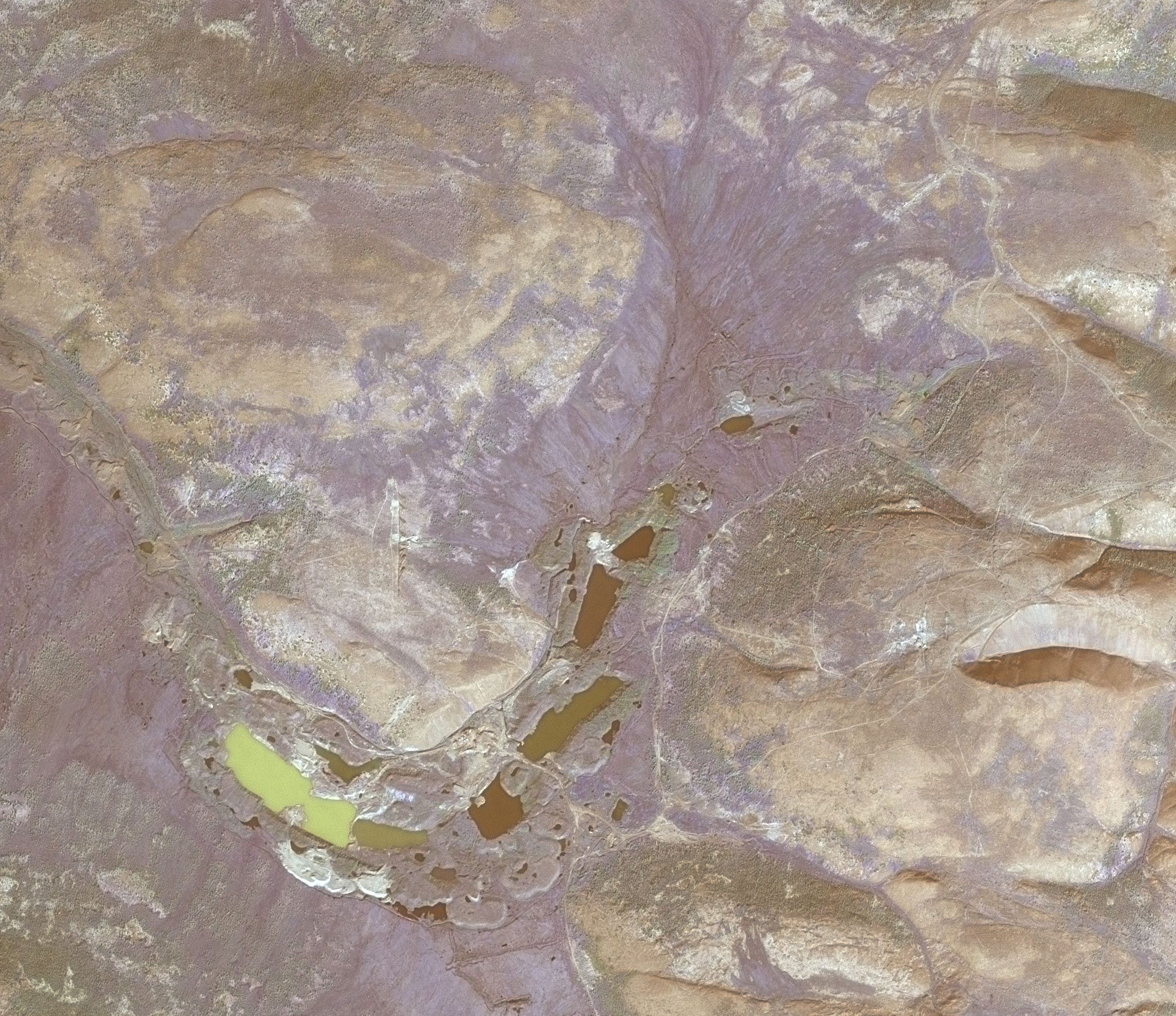
Panchromatic: 0.45-0.75 Blue: 0.45-0.52 Green: 0.53-0.60 Red: 0.62-0.69 Near IR: 0.76–0.89 |
| Number of elements of MS, microns | 6892 |
| Dynamic range, bit | 12 |
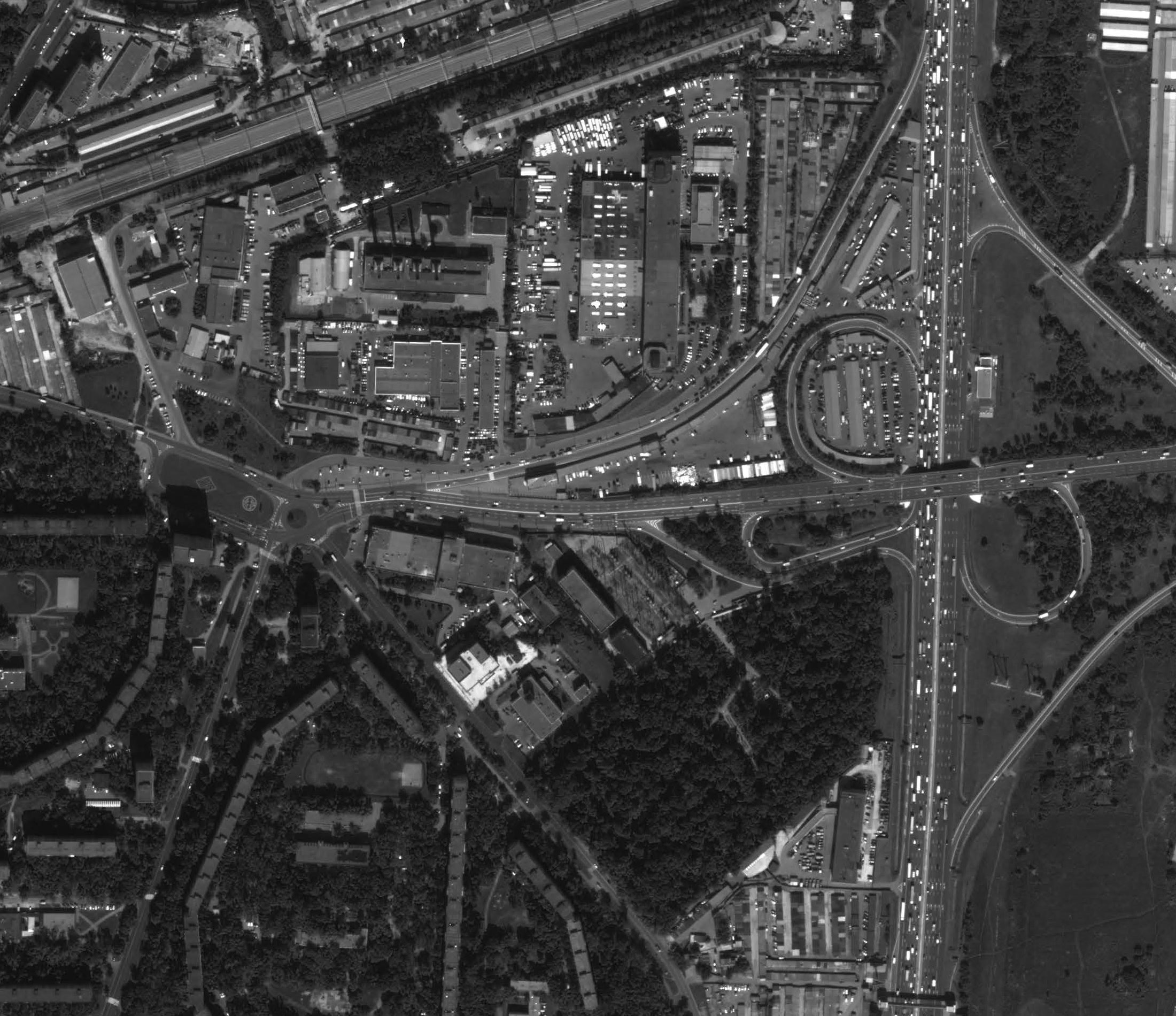
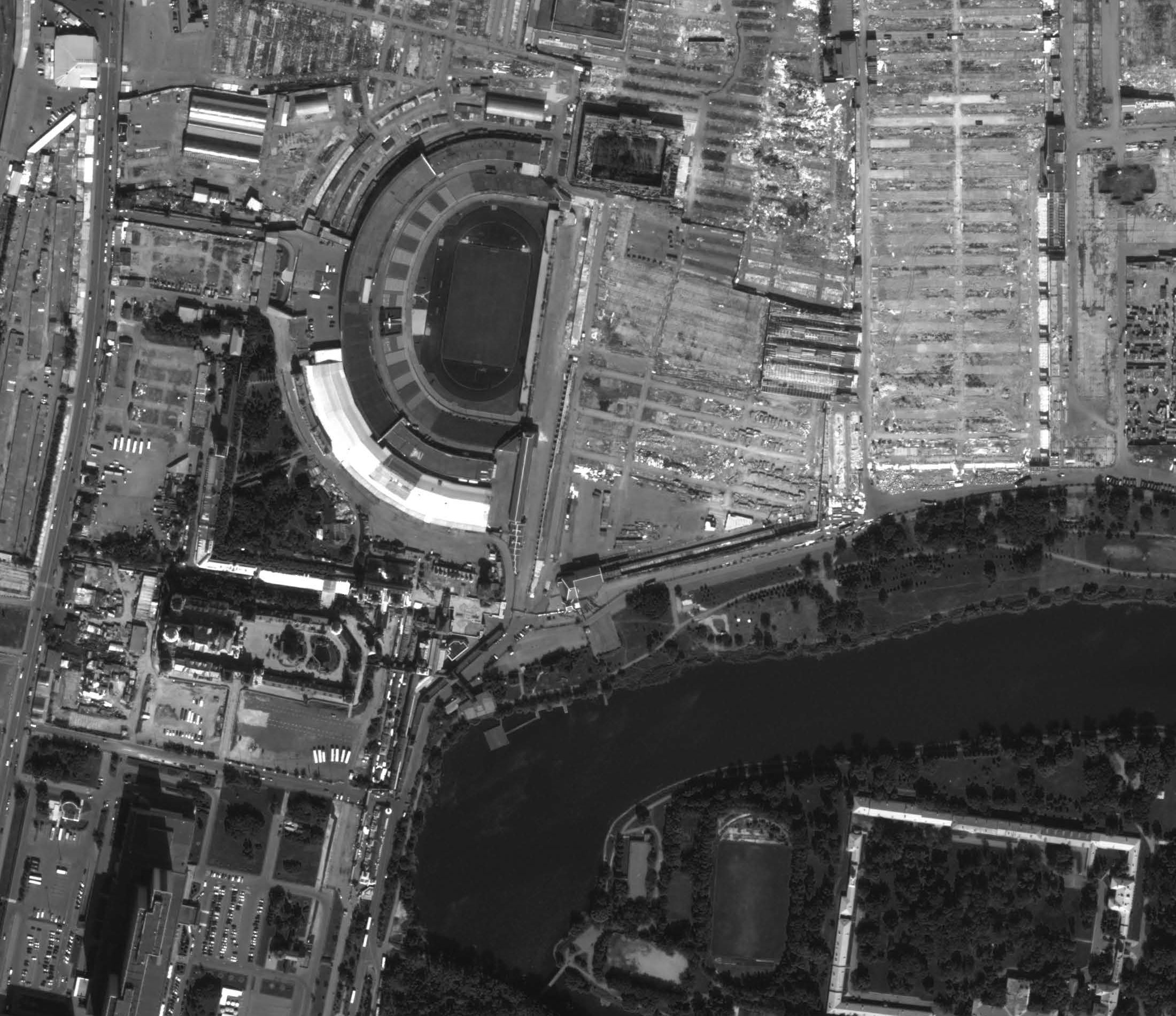
| Spatial resolution PAN, m | 1.5 |
| Spatial resolution MS, m | 6 |
| View bandwidth, km | 800 |
| Shooting bandwidth, km | 60 |
| Geolocation accuracy, m | CE90 = 10 |
| Shooting performance, million sq km/day | 3 |
| Data transfer rate, Mbit / sec | 60 |
- The following delivery options are available:
- 1.5 m-panchromatic
- 6 m-multispectral
- 1.5 m-pan-sharpened (color, 3 channels; R, G, NIR or R, G, B, in natural and pseudo-natural colors)
- 1.5 m-pan-sharpened (color, 4 channels; R, G, B, NIR)
- Bundle (1.5 m-panchromatic + 6 m-multispectral)
- Stereo
- Tri-stereo
- Two levels of data processing are available:
- Primary geometric (RPS) and radiometric correction
- Ortho Correction (Ortho)
- For all orders for new shooting, up to 10% is considered acceptable, except for specially specified cases of ordering cloudless images and instant Tasking.
Conditions for placing an order for a new shooting:
Priority shooting (Priority service) is used to achieve maximum success in each period. This service provides privileged access to resources, which increases the number of shooting attempts.
Urgent survey (Emergency service) is used when it is necessary to quickly obtain data, for example - in the event of an emergency. In this shooting mode, the first attempt is made within the next 24 hours. There is always the highest priority.
| Standard survey | Priority survey | Urgent survey | ||
|---|---|---|---|---|
| Tailored | Instant Tasking | |||
| Minimum order area |
1000 sq km, >20 km in any direction |
100 sq km, >5 km in any direction |
||
| Maximum area of order | not limited | 100 km x 50 km | ||
| Duration of the shooting period | user defined | 4 days after the first attempt | 1 attempt in a 7-day period | |
| Stereo/tri-stereo | 100% surcharge for stereo and 200% for tristereo products | No | No | |
| Cloudiness |
<10% 0% surcharge |
<10% | <10% | not regulated |
- creating and updating topographic and specialty maps up to 1:25,000 scale;
- creation of digital terrain models with accuracy of 5-10 m in height;
- inventory and control of construction infrastructure transportation and production of oil and gas;
- monitoring of the ecological state of the territories in the areas of production, processing, transportation of oil and gas and other minerals;
- updating the topographic sub-basis for the development of projects of territorial planning schemes of municipal districts and subjects of the Federation;
- implementation of forest management activities, forest inventory. Regular monitoring of forest management and monitoring of the state of forests;
- inventory of agricultural land, monitoring of crops, assessment of contamination, identification of pests and diseases of crops, forecasting yields;
- monitoring and forecasting of waterlogging and desertification, salinization, karst, erosion, steppe fires, etc.