Sat-Sun: Non-working days
The first photograph from space was taken on October 24, 1946, from a V-2 rocket (USA), but it is considered that the era of space imaging began in 1972 with the launch of the first spacecraft of the Landsat program. Over nearly 50 years, space imaging has transformed beyond recognition: film has been replaced by digital media, spatial resolution has improved from 1000 m to 0.3 m, and the number of possible spectral channels has increased from 1 to 256.
Today, space imaging varies by several characteristics: application direction, number of spectral channels, spatial resolution, type of imaging equipment, etc.
Types of Spatial Resolution of Satellite Images:
- Very low (worse than 100 m).
- Low (15–100 m).
- Medium (5–15 m).
- High (1–2.5 m).
- Very high (0.3–1 m).
Types of Spatial Resolution of Satellite Images:
- Very low (worse than 100 m).
- Low (15–100 m).
- Medium (5–15 m).
- High (1–2.5 m).
- Very high (0.3–1 m).
There is currently no unified classification of spatial resolution types, so we will use the one we have proposed as a sample.
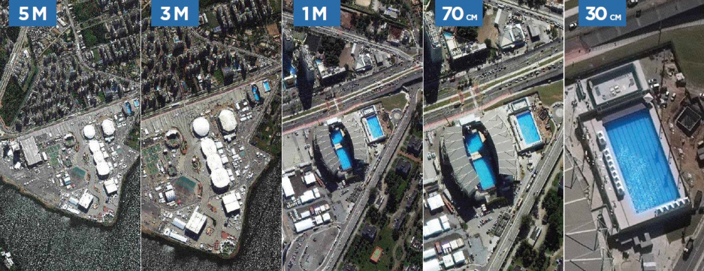
Fig. 1 Comparison of spatial resolution: medium, high, and very high.
Satellite imagery with very low spatial resolution is extremely important for human life, and indirectly, each of us uses this data daily. Very low spatial resolution imagery is used in meteorology and global process monitoring on Earth. With their help, specialists promptly receive all the information about the Earth's atmosphere and the processes occurring in it, such as the formation of hurricanes, dust storms, etc. Satellites with very low spatial resolution are the main source of information about the state of seas and oceans, such as ice conditions. The main advantages of very low spatial resolution images are the speed of data acquisition (up to once an hour) and global coverage. For example, the Terra Modis satellite has a coverage width of 2330 km (Figure 2).
Examples of satellites with very low spatial resolution: Terra, Aqua (Modis scanner), ENVISAT/MERIS, SPOT/Vegetation, "Meteor"/MSU-SM, NOAA, etc.
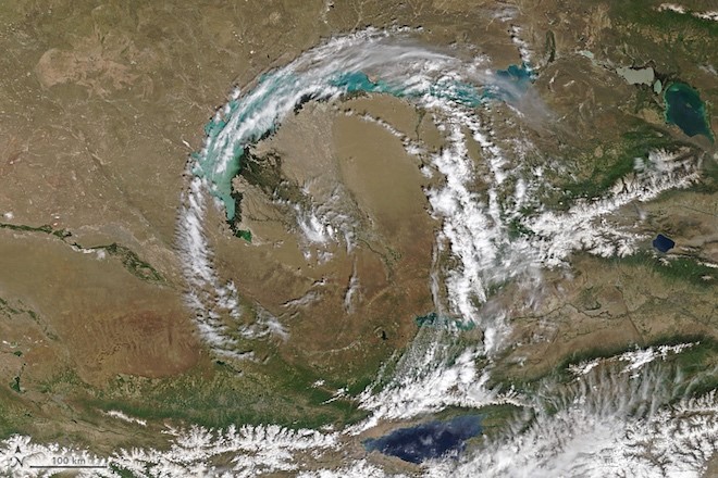
Fig. 2 Image from the Terra Modis satellite over Kazakhstan, spatial resolution 250 m
Satellite imagery with low spatial resolution is crucial for solving several tasks of state structures, such as the Ministry of Emergency Situations and the Hydrometeorological Center. They are used for global environmental monitoring, emergency situation control (floods and natural fires), snow cover monitoring, etc. This type of satellite is used for weather analysis and forecasting on a regional scale and climate monitoring at the state level (Figures 3, 4).
Examples of satellites with low spatial resolution: "Meteor-M", GaoFen-4, Deimos-1, UK-DMC2, etc.
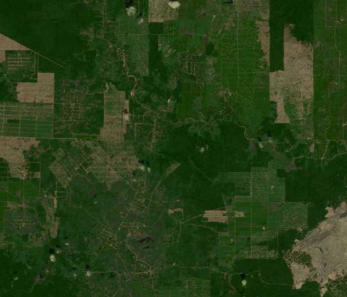
Fig. 3 Image from the Deimos-1 satellite, spatial resolution 22 m
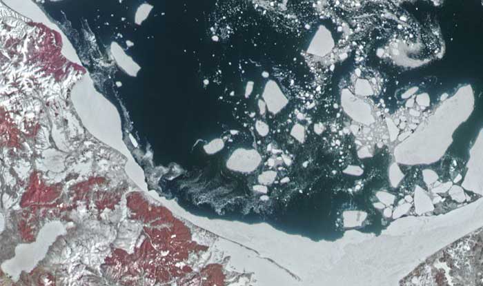
Fig. 4 Image from the Meteor-M satellite, spatial resolution 50 m
The most popular is satellite imagery with medium spatial resolution. And this is easily explained, since it is this type of imagery that includes free images with the highest spatial resolution of up to 10 m. The entire scientific community actively uses them for a wide variety of tasks, for example, students study satellite imagery and processing methods using them. Satellites like Landsat-8 have an important feature of having a large number of spectral channels, which allows for solving extremely diverse tasks:
- Monitoring the condition of agricultural crops.
- Inventory of agricultural lands, creation of land use plans, precision farming.
- Mineral exploration.
- Monitoring of small and medium-sized water bodies.
- Monitoring emergency situations.
- Inventory and assessment of the state of forests.
- A wide range of tasks in the field of environmental protection, etc.
Medium spatial resolution data can also be used for creating and updating topographic maps on a scale of 1:100,000 and smaller. Most popular applications use medium spatial resolution data as a single base layer with satellite images for the entire Earth's territory.
The advantages of medium spatial resolution images do not end there. Due to the relatively large image area (200–300 km wide), coverage is updated with enviable regularity—every 2–3 days over the same territory (Figure 5).
Examples of satellites with medium spatial resolution: Landsat-8, Sentinel-2, Terra Aster, etc.
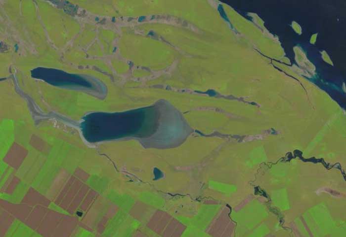
Fig. 5 Image from the Landsat-8 satellite, spatial resolution 15 m
Despite many advantages, medium spatial resolution images cannot solve all tasks. For many areas of human activity, images with much higher spatial resolution are required.
The first high spatial resolution satellite images were obtained in the 1980s. These imaging systems were on military satellites, created specifically for intelligence purposes, and provided data for mapping enemy territories during the Cold War. On Soviet satellites "Kometa," there was a KVR-1000 camera, which allowed for detailed images with a spatial resolution of 2 m.
Now the range of applications for high spatial resolution data has become much wider, and with the emergence of the PlanetScope constellation, coverage is updated almost daily.
A brief list of tasks solved using high spatial resolution images:
- Creation and updating of topographic and special maps up to a scale of 1:25,000.
- Creation of digital terrain models with an accuracy of 5–10 m in height.
- Inventory and control of linear objects (pipelines, power lines, roads).
- Inventory of agricultural land and monitoring of crops.
- Creation of inventory plans for settlements.
- Satellite monitoring of water areas and bank lines.
- Monitoring the progress of construction.
- Monitoring and assessment of damage caused by emergencies.
- Control over illegal land use.
- Development of environmental management projects.
Examples of satellites with high spatial resolution: WorldView-2, GeoEye-1, Pleiades-1, PlanetScope, etc.

Fig. 6 Image from the GeoEye-1 satellite, spatial resolution 0.5 m
The highest spatial resolution in commercial satellites today is 30 cm. Such images are used to solve the most demanding tasks:
- Detailed mapping and updating topographic maps on a scale of up to 1:5,000.
- Creation of orthophotoplans and orthomosaics of territories.
- Detailed inventory of engineering communications of settlements.
- Inventory of land use.
- Creation of three-dimensional models of settlements.
- Detailed environmental monitoring.
- Detailed monitoring of industrial objects.
- Monitoring of forests and agricultural crops.
Examples of satellites with very high spatial resolution: WorldView-3, GeoEye-2, Pleiades Neo, WorldView Legion, etc.

Fig. 7 Image from the Pleiades Neo satellite, spatial resolution 0.3 m
It should be noted that an increase in spatial resolution entails a decrease in the territory of the covered surface and a less frequent frequency of survey updates. In other words, the higher the spatial resolution, the narrower the image strip. For example, for WorldView-3, it is 13.1 km, and for Pleiades Neo—14 km.
Applications: Now that we have examined the basic types of spatial resolution and examples of satellite images for each of them, let's look at specific examples of data application with different spatial resolutions.
We have selected five types of remote sensing tasks that are most often performed using satellite imagery. For each of them, we will show the main examples of application.
Large-scale mapping with satellite data is widely used to create and update maps of various scales and types, including topographic maps. Images from satellites with high and very high spatial resolution are usually used.
Examples of completed projects:
- Updating topographic maps of urban agglomerations.
- Creation of a unified base map for GIS systems.
Environmental monitoring is an essential task performed using satellite imagery with different spatial resolutions.
The advantages of using high-resolution images are obvious—providing detailed information about the studied object or territory. However, the combination of images with different resolutions allows for more comprehensive and accurate data analysis. For example, low-resolution images can be used for general monitoring, while high-resolution images can be used for detailed analysis of specific areas.
Examples of completed projects:
- Monitoring of deforestation and illegal logging.
- Monitoring the state of agricultural lands.
- Monitoring pollution of water bodies and coastal zones.
Infrastructure monitoring is another area where satellite imagery is widely used. Images with different spatial resolutions are used depending on the task.
Examples of completed projects:
- Monitoring the construction of large infrastructure projects (roads, railways, pipelines, etc.).
- Monitoring the condition of existing infrastructure.
Emergency response is an important area of application for satellite imagery. Images with different spatial resolutions are used depending on the type of emergency and the required level of detail.
Examples of completed projects:
- Monitoring natural disasters (floods, earthquakes, landslides, etc.).
- Monitoring man-made disasters (industrial accidents, fires, etc.).
Urban planning and management is another important area where satellite imagery is used. Images with high and very high spatial resolution are usually used for these tasks.
Examples of completed projects:
- Monitoring the development of urban areas.
- Creation of detailed urban plans and models.


