of geospatial solutions
Sat-Sun: Non-working days
Advancements in remote sensing satellites continue at a rapid pace, opening new possibilities in both civilian and military sectors. On August 13, 2014, from Vandenberg Air Force Base (California, USA), the Atlas V 401 rocket launched the satellite WorldView-3.
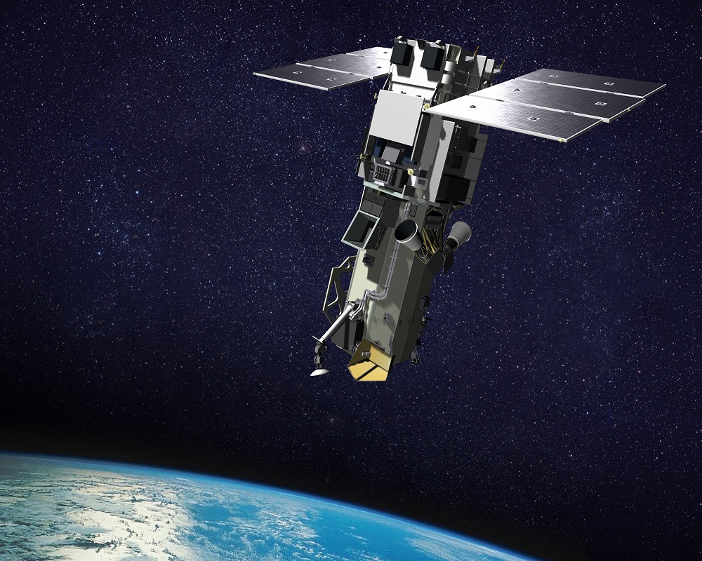
Figure 1. WorldView-3 Satellite
With the launch of WorldView-3, DigitalGlobe significantly enhanced its technological capabilities. WorldView-3 enables imaging with a resolution of up to 0.31 meters. In multispectral mode, the system achieves a resolution of 1.2 meters, and in the near-infrared spectrum, it achieves 3.7 meters. Adding a new infrared range required incorporating an additional 8-channel module with infrared detectors into the satellite's optical system.
Two years ago, U.S. authorities agreed to reduce the limit on the maximum resolution of commercial satellite images from 50 cm to 25 cm. WorldView-3 became the first commercial satellite with enhanced resolution capabilities. Currently, DigitalGlobe is advocating for the U.S. government to relax restrictions further to allow resolutions down to 10 cm.
The primary contractor for the WorldView-3 satellite project is Ball Aerospace & Technologies. The satellite's electro-optical system was developed by the Geospatial Systems division of ITT Exelis. The program's total expenses are estimated at $650 million, which includes satellite launch costs.
The WorldView-3 satellite was placed into a polar orbit at an altitude of 617 kilometers above Earth's surface and operates alongside five other DigitalGlobe satellites. The satellite weighs 2,812 kilograms, with dimensions of 5.7 by 7 meters with solar panels deployed. Technical specifications of WorldView-2 and WorldView-3 satellites are shown in Table 1.
Table 1. Technical Specifications of WorldView-3 Satellite
|
|
|
|
|
|
|
|
|
|
|
|
|
|
|
|
|
|
|
|
|
|
|
|
|
|
The imaging equipment is similar to that installed on the WorldView-2 satellite. The WorldView-3 satellite is equipped with a telescope with a 110 cm mirror diameter and an aperture filter. The equipment will conduct imaging using sensors VNIR (Visible and Near Infrared – multispectral visible and near infrared range; 8 channels), SWIR (Shortwave Infrared – mid-infrared range; capable of imaging through haze, fog, smoke, dust, and clouds; 8 channels), and CAVIS (clouds, aerosols, vapors, ice, snow – allows for atmospheric correction; 12 channels).
The VNIR multispectral sensor differs slightly in capabilities from the sensor on WV-2, with the difference being only in slightly higher resolution. Continuity of spectral characteristics is important for maintaining methods developed using data from the WorldView-2 satellite.
The SWIR sensor is fundamentally new. Previously, such data were obtained by satellites with lower resolution, such as Landsat, which had a resolution of only 30 meters per pixel, whereas WV-3 offers 3.7-4.1 meters per pixel with a vertical image and an angle of 20°. The SWIR sensor also has eight channels covering the spectrum from 1195 to 2365 nanometers. The selection of ranges is related to vegetation properties, atmospheric processes, and the four farthest from the visible range can be used for geological research tasks.
Another innovative solution in the sensor suite of the WorldView-3 satellite is the CAVIS sensor, with a relatively low resolution of just 30 meters, covering a selective range from 405 nm to 2245 nm with individual channels. Its main purpose is to determine the state of the atmosphere and identify specific cases of the Earth's surface that affect image quality. The set of channels is selected so that, for example, it is possible to distinguish white clouds from snow and ice, and various types of dust and smoke in the air from water vapor. A similar solution has been used on the Landsat satellite, but WorldView has a more advanced and versatile system that allows for more precise and efficient image correction.
The spectral channels of the WorldView-3 satellite can provide higher detail in analyzing vegetation status, object delineation, coastline analysis, and coastal waters. The CAVIS sensor allows the satellite to capture clear surface images despite atmospheric disturbances such as dust, soot, and other atmospheric interference.
The geolocation accuracy in terms of planimetry will be 3.5 meters CE90 without additional planimetric correction using ground control points.
The technical characteristics of the onboard equipment of the WorldView-3 satellite are shown in Table 2:
Table 2. Technical characteristics of the onboard equipment of the WorldView-3 satellite
|
Focal length, m |
13.3 |
|||
|
Mirror diameter, cm |
110 |
|||
|
Relative aperture |
1:12 |
|||
|
Field of view angle, degrees |
1.28 |
|||
|
Spectral ranges, µm |
VNIR |
SWIR |
CAVIS |
|
|
Panchromatic 0.45-0.80 Violet 0.42–0.45 Blue 0.45–0.51 |
1.195–1.225 2.295–2.365 |
0.405–0.420 (Desert Clouds) |
||
|
Dynamic range, bits |
11 |
14 |
11 |
|
|
Resolution, m |
PAN-0.31; MS-1.24 |
3.7 |
30 |
|
|
Capture swath width, km |
13.1 |
|||
The agreement with DigitalGlobe allows obtaining archive and real-time materials from optical-electronic spacecraft WorldView-4, WorldView-3, WorldView-2, WorldView-1, GeoEye-1, QuickBird, and Ikonos, providing image resolution of 0.3 – 0.8 meters.
Additionally, DigitalGlobe offers a new service based on cloud computing, My DigitalGlobe. DigitalGlobe's cloud services reveal to customers the capabilities of the world's largest online library of ultra-high-resolution data, providing access to the latest satellite images through geoportals, intranet networks, and mobile devices anywhere on the planet. My DigitalGlobe includes data from services such as Global Basemap, FirstLook, Daily Take, and may also include user corporate data.
For more information about the Global Basemap service, please contact employees of the company "Innoter".
To order ultra-high-resolution satellite images from DigitalGlobe satellites, as well as to calculate the cost of covering the necessary territory, please contact us by phone: +7 495 245-0424 or by e-mail: innoter@innoter.com.


Sat-Sun: Non-working days