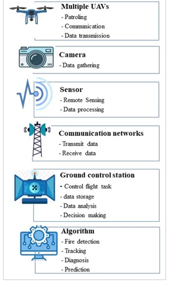
Aviation monitoring
1.2 Registration and Monitoring of Fires from Satellites
The global remote sensing community has relatively well-established fire registration through satellite observations. There are five accessible portals (NASA, ESA, Global Forest Watch, Global Wildfire Information System (GWIS), CTIF - The International Association of Fire & Rescue Services), and the Global Fire Monitoring Center (GFMC) that provide data on fires worldwide.
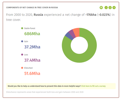
Mapping fires is the primary mode of representation. Typically, mapping of forest fires is based on satellites like TERRA (MODIS), LANDSAT, SENTINEL, and PLANET. Subsequently, statistical and phenomenological analysis is conducted. Interactive diagrams and maps summarize key statistical data, such as information about forests in Russia. Statistical data includes forest change rates, forest area, deforestation factors, as well as warnings about deforestation and fires. It also includes data on regions with the highest number of fire alerts and a comparison of current fires with historical trends.
Satellite remote sensing is currently capable of: creating models for climate and hydrological applications based on images (pre-fire); detecting forest fires based on vegetation (pre-fire); actively monitoring fires (during the fire); smoke modeling and forecasting; Earth system modeling for climate and hydrological applications (post-fire); detecting forest fires based on vegetation data (post-fire).
Previous satellite experiments - the FireBIRD mission conducted by the German Aerospace Center (Deutsches Zentrum für Luft- und Raumfahrt; DLR), a pair of satellites — TET-1 (technology experiments carrier) and BIROS (bistable infrared optical system) confirmed the capabilities mentioned above.
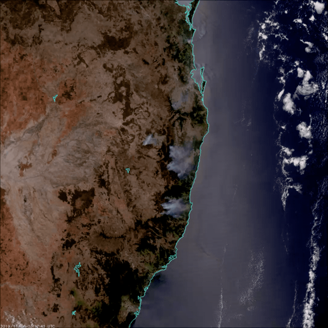
Fig. 3 Satellite images of fires in Australia
Satellite remote sensing can confidently detect forest fires in areas ranging from 10–15 hectares when the fire area is not covered by clouds. The main task of satellite forest fire monitoring is to provide forest management authorities in the subjects of the Russian Federation with operational information on the forest fire situation.
Additionally, there is a significant issue with obtaining cloud-free data, as high-quality images with high spatial resolution can only be obtained when cloud cover is no more than 15%.
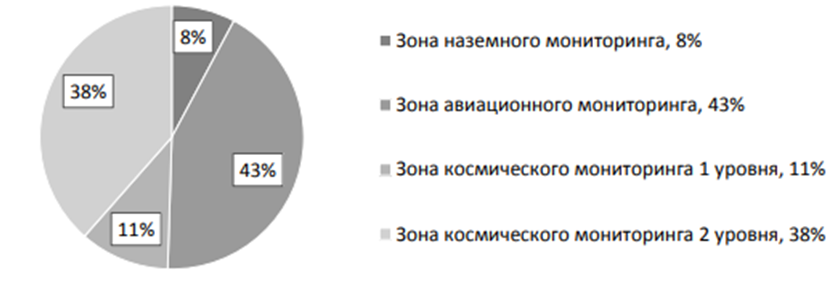
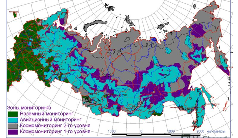
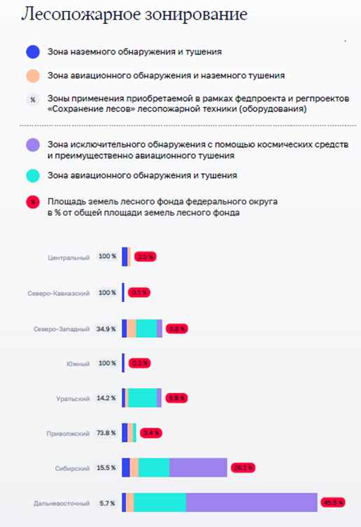
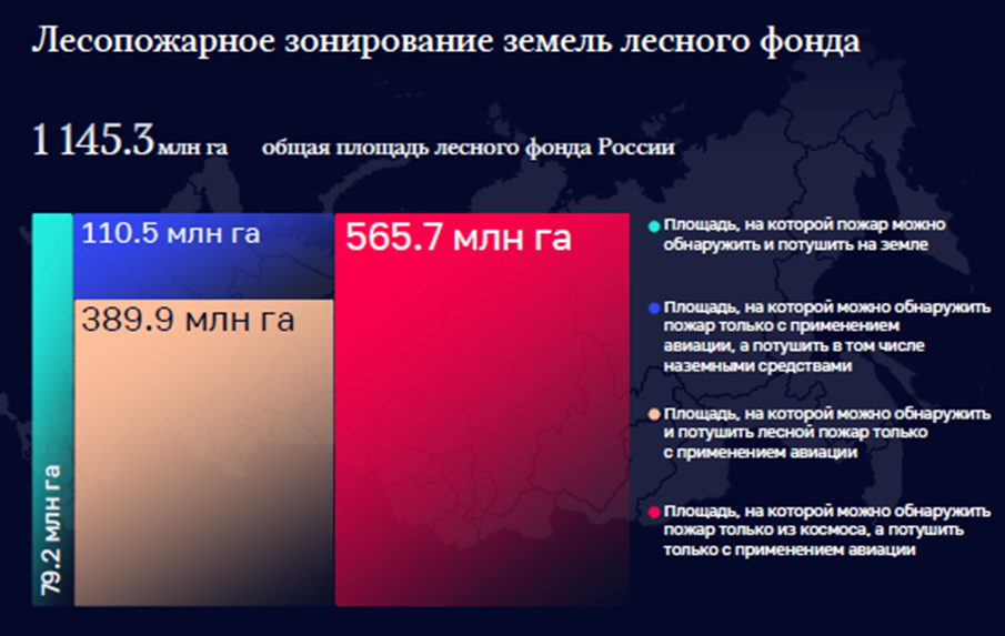
Forest land, where satellite monitoring of forest fires is carried out, is divided into two levels:
- 1st level – remote areas (11% of forest land), where planned aviation patrolling is not carried out, and ground and aviation zones are not allocated. Extinguishing forest fires can be done using aviation forces and means. Patrol flights are recommended for areas with high fire hazard levels across the entire protected territory;
- 2nd level – remote and hard-to-reach areas (38.5% of forest land), where aviation patrolling is not carried out, and extinguishing forest fires is only done when there is a clear threat to settlements or economic facilities. The main method of detecting forest fires is the data from the ISDM–Rosleskhoz.
The Information System for Remote Monitoring (ISDM) of forest fires by Rosleskhoz successfully uses data from remote sensing with spatial resolutions ranging from 250 meters to 1000 meters in the thermal IR range (data from satellites such as Terra, Aqua, Noaa, Suomi NPP, Meteor M).
Fires can be tracked on a large scale from satellite remote sensing. However, the response time is from 2 to 10 days. Monthly fire maps from NASA show active fire locations worldwide based on observations from the Moderate Resolution Imaging Spectroradiometer (MODIS) on NASA's Terra satellite Terra. The targeted MODIS equipment on Terra and Aqua satellites allows capturing images with a spatial resolution of 250–500 m/pixel, in the spectral range of 3,660–14,385 µm (16 different channels), with a swath width of 2300 km. Imaging repetition for a specific area is four times a day, and the imaging equipment's productivity reaches up to 700,000 km2 per day.
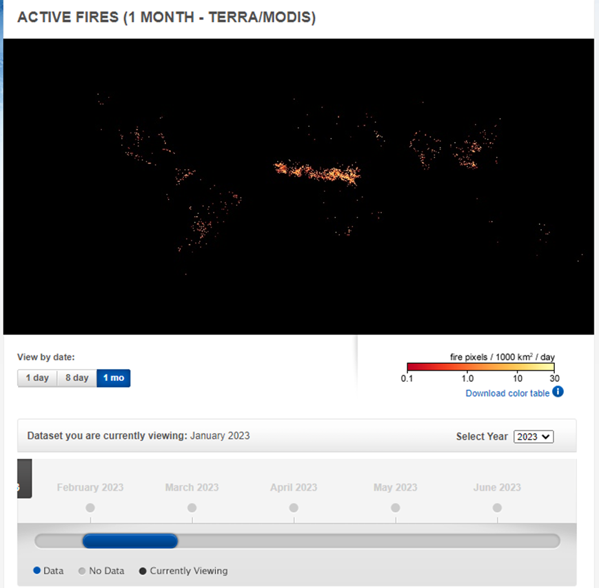
Figure 4
The colors are based on the count of fires (not size) observed in an area of 1000 square kilometers. White pixels indicate the upper limit of the count — up to 30 fires in the area of 1000 square kilometers per day. Orange pixels show up to 10 ignitions, and red areas represent only 1 ignition per day.
Some global patterns that emerge on fire maps over time are the result of natural cycles of rain, drought, and lightning. For example, natural fires often occur in the boreal forests of Canada during the summer. In other parts of the world, patterns result from human activity. For instance, intense burning in the heart of South America from August to October is the result of human-caused fires, both intentional and accidental, in the tropical forests of the Amazon and the Cerrado (a pasture/savannah ecosystem) to the south. Across Africa, a belt of widespread agricultural fires sweeps from north to south across the continent as the dry season sets in each year. Agricultural burnings occur annually in late winter and early spring in Southeast Asia.
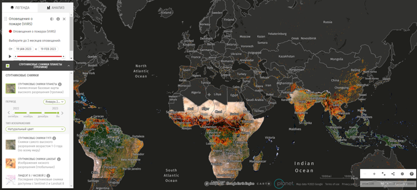
Figure 5
Algorithms have been developed that approximate the results by sampling the selected area. Results are more accurate at closer levels of scaling and are complemented by current results from UAVs in multispectral, hyperspectral, and lidar ranges.
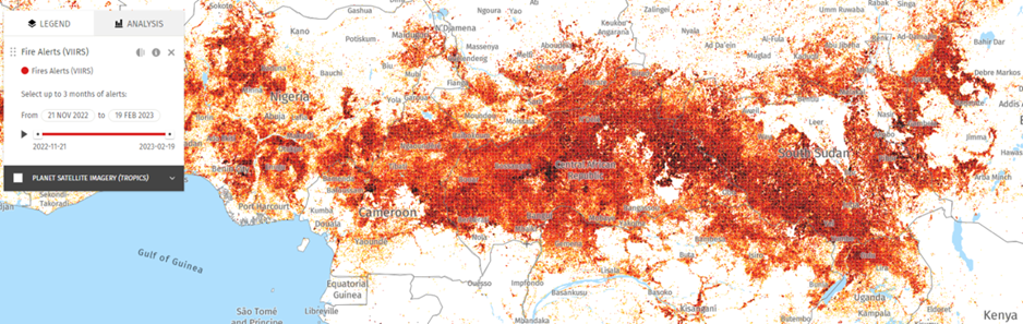
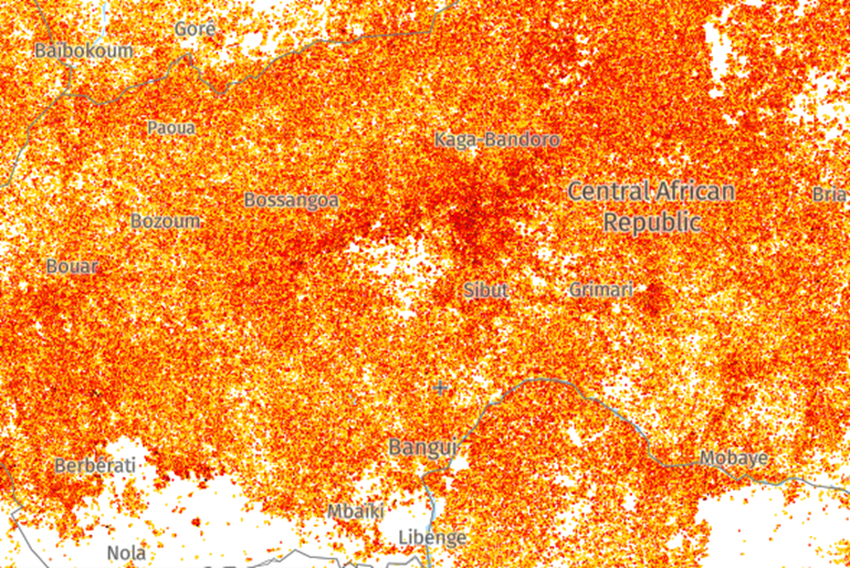
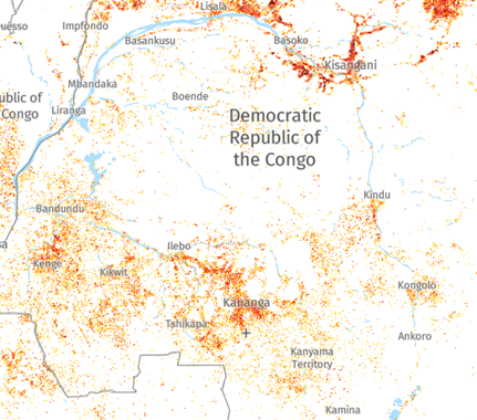
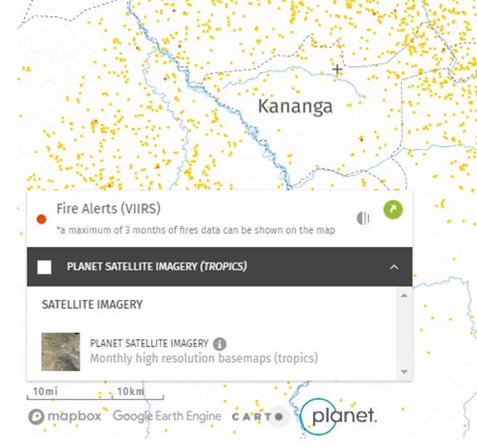
Figure 6 As of February 20, 2023
An automatic forest fire detection system has been developed using data from NOAA meteorological satellites. The system has been tested in four pilot experiments in Finland and neighboring countries, including Estonia, Latvia, Russian Karelia, Sweden, and Norway. For each detected fire, a message with data about the ignition location, observation time, and a map indicating the location is sent directly to local fire authorities. The smallest detected forest fires covered an area of 0.1 hectares. The average time delay between receiving the NOAA scene and sending the fire alert was 31 minutes. Almost all detected fires were forest fires or prescribed burns. In a pilot experiment in the summer of 1997, 363 fires were recorded and warned. The verification showed that 83% of the issued warnings related to real fires. According to authorities, none of the genuinely significant forest fires, for example, in Finland, went unnoticed. The good results of the check show that the satellite forest fire detection system is reliable, fast, economical, and has potential in sparsely populated areas if continuous delivery of mid-infrared satellite data can be guaranteed in the future.
The domestic Information System for Remote Monitoring (ISDM) of forest fires by Rosleskhoz successfully uses data from remote sensing with spatial resolutions ranging from 250 meters to 1000 meters in the thermal IR range (data from satellites such as Terra, Aqua, Noaa, Suomi NPP, Meteor M).
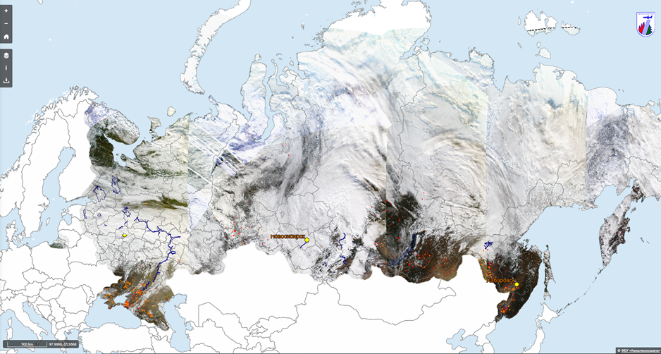
The developed unified space information processing system designed for mapping forest fires and burns is regularly used in the European (Planet Research Center, Moscow), West Siberian (Novosibirsk), and Far Eastern (Khabarovsk) centers of Roshydromet.
To refine "burned" areas in automatic mode, materials from remote sensing with a spatial resolution of 250 meters are used (data from satellites such as Terra and Aqua); with the participation of the operator, materials from remote sensing with a spatial resolution of 10-30 meters in the visible spectral range (data from satellites such as Landsat-7, Landsat-8, Sentinel-2, Kanopus-V, Resource-P). Thus, the entire forest fund is covered by remote sensing. High spatial resolution images should cover the entire area "passed" by the fire for further detailed interactive visual analysis of forest fires, smoke, and burning dynamics.
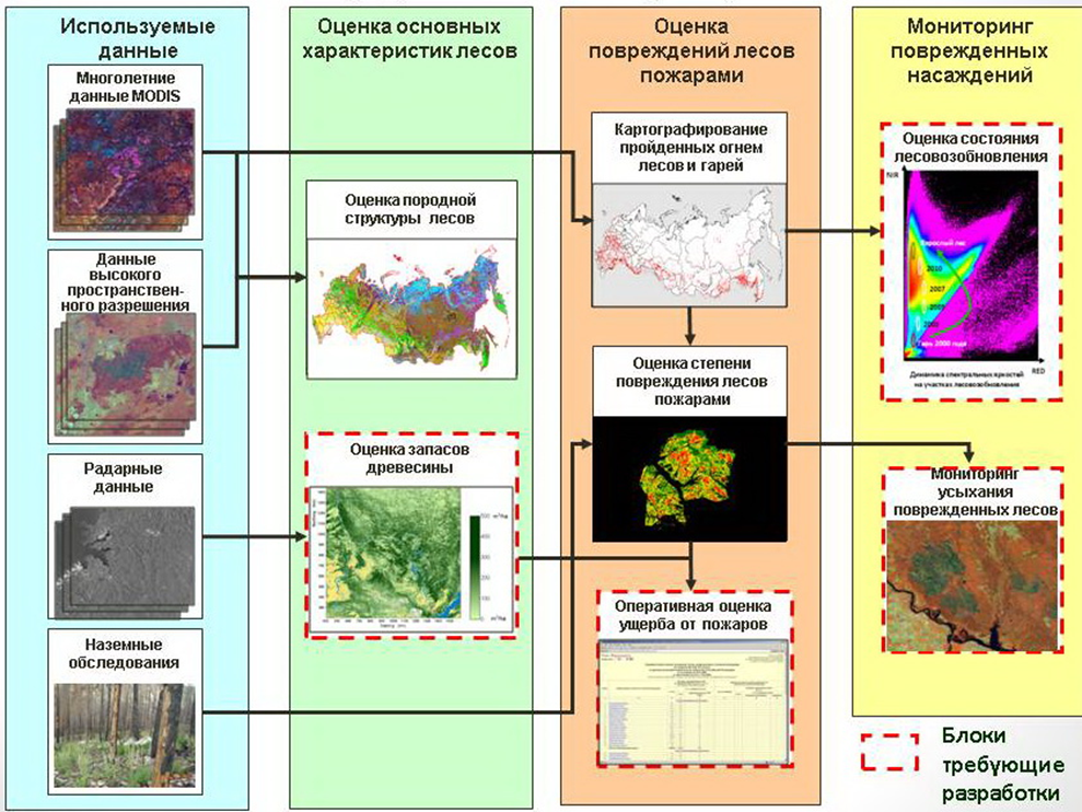
Figure 7 Information on the use of space remote sensing materials in the Rosleskhoz Remote Monitoring Information System (ISDM-Rosleskhoz)
The processed results obtained daily are regularly transmitted to Russian fire services. The ISDM has at its disposal aviation assets (Avialesookhrana units) to work with space information and carry out observation and firefighting measures.
For monitoring the occurrence and spread of fires, various methods are used. Fire detection is based on the detection of an increase in local temperature and brightness on the ground. Detecting fires in satellite images is possible due to the temperature difference between the Earth's surface and the fire source, which, in turn, leads to a difference in the thermal radiation of fire objects by orders of magnitude. In visual fire detection, identification is based on the presence of a burning source in the field of view, such as a smoke plume.
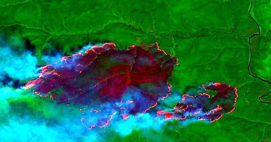
Figure 8 Fragments of synthesized multispectral images from the "Sentinel-2 L1C" satellite dated July 31, 2019, Evenki district of Krasnoyarsk Krai
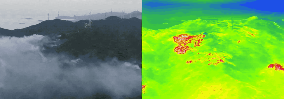
Aerial photography from an airplane or helicopter has undeniable advantages over space-based methods since the user determines the time (schedule) of flights, the configuration of the surveyed area (flight path direction), acceptable weather conditions. These shots are characterized by higher spatial resolution, immediacy, high mobility in choosing the object and shooting parameters, and no cloud influence (sub-cloud shooting).
As disadvantages of satellite monitoring, it is necessary to note the large area of the minimum detectable ignition source, ranging from 0.2 to 0.5 km2 when analyzing high-resolution images, low data acquisition frequency (several times a day), and strong influence of weather conditions.
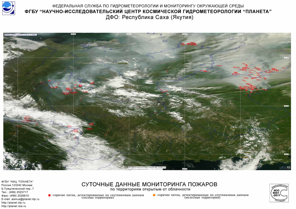
Figure 9 Fire monitoring data presented by the Federal Center for Integrated Arctic Research of the Russian Academy of Sciences (FCIARctic)
Domestic satellites RESURS, KANOPUS with imaging equipment MSU-E, MSU-SK allow obtaining images with a spatial resolution of 90 cm/pixel in the spectral range of 0.5–1.01 μm. The satellite's pass frequency over the same point on the Earth's surface is called the shooting frequency, and for the RESURS satellite, it is 6 times a day. Despite all the drawbacks, satellite monitoring is necessary for large forested areas and when monitoring by other means is not possible (the cost of satellite monitoring is also relatively low). Information obtained from satellite imagery is essential for monitoring large fires and assessing their consequences.