Delivery of stereo imagery from the Pleiades satellite, creation of a DTM, orthorectification of materials to the customer’s coordinate system
Delivery of stereo imagery from the Pleiades satellite, creation of a DTM, orthorectification of materials to the customer’s coordinate system
01
About the project
In the course of the project, the full cycle of creating new orthotransformed photoplans of the terrain was worked out, starting with the order of new stereo filming and ending with the creation of products ready for further use.
Industry
Oil and gas
End date
02/28/2014
02
Project goal
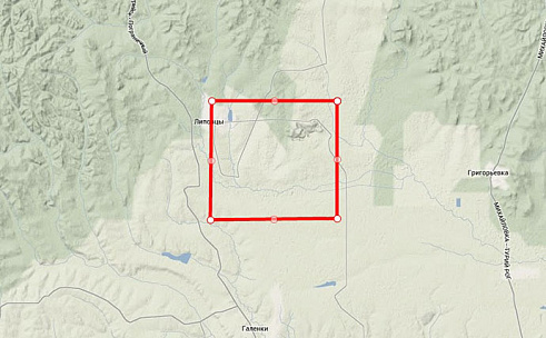
As a result of the work, according to the customer’s specifications, it was necessary to create a terrain orthophotomap (cut into sheets of 1: 5000 scale) to an area of about 100 square meters. km near the town of Lipovtsy, Primorsky Krai.
03
Completed works
At the preparatory stage, due to the lack of archival stereo filming on the customer's territory, the order of new stereo images from the Pleiades spacecraft was carried out. As a result, pan-chromatic stereo photography was obtained, the spatial resolution on the ground - 0.5-0.7 meters per pixel. Primary processing level (ready for orthorectification), which implies radiometric and geometric correction of images, as well as the presence of RPC polygons, which are later used for orthorectification.
Based on the data obtained, a digital elevation model (DTM) was created using specially designed software PHOTOMOD (using shutter glasses and special monitors) using GGS points of support provided by the customer in 1942 SK. The product contained information about the terrain, shown by contours drawn with a section height of 1 meter with a rms error corresponding to the guidelines for creating topographic plans of 1: 5000 scale.
At the final stage, orthoretification of space imagery materials from UTM WGS84 (SK image) to SK-1942 (SK customer) was carried out at reference points of GGS points provided by the customer. The average error in terms of objects and clear contours did not exceed 2.5 m in accordance with the technical specifications and accuracy requirements.
The finished orthorectified materials were brought to a single geometry, cut into sheets of 1: 5000 scale and delivered in panchromatic colors (shades of gray), in the GeoTIFF format.
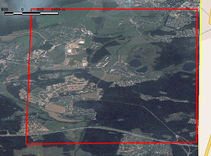
The scheme of the site around the Lipovtsy settlement (area about 100 sq. km.)
Схема-участка-территории-около-н.п.jpg
04
Result
In the course of the project, the full cycle of creating new orthorectified photomaps of the terrain was worked out, starting with the order of new stereo photography and ending with the creation of products ready for further use.
Need satellite imagery or help choosing the right data?
Describe your task, area of interest, and desired outcome. We will check data
availability, assess new acquisition options, and propose the optimal solution in terms of timelines, cost,
and quality.
Fast feedback during business hours
We will select the best data for your task
Confidentiality guaranteed
Discuss the project
clients who trust us
25+ years in the geodata market
Мы используем Яндекс.Метрика и собственные Сookies для обеспечения наилучшего
опыта работы на нашем сайте, персонализации сайта для наших пользователей и аналитики.
Продолжая использовать сайт вы соглашаетесь с условиями
Пользовательского соглашения.
Request a call
Leave your contact details — we will get back to you during business hours, clarify the task and suggest suitable data or services.
Write to e-mail
Send a message, technical specification or task description. We will review your request and reply to the specified e-mail.
Fill in the order form
Describe the area, object and imagery requirements. We will check archive availability, the possibility of a new acquisition and offer a suitable option.
Order software
Order TK
Your application is accepted
We will contact you during working hours.
Выбрать город
Россия
Другие страны
Белоруссия
Contact via WeChat
Feliks Fokin
Open WeChat and scan the QR code to add the contact. On a phone, save the code and select it in the WeChat scanner.