Supply of the AW3D30 digital model of the entire terrestrial surface
Supply of the AW3D30 digital model of the entire terrestrial surface
01
About the project
Delivery of a digital model of the earth's surface and its certification in order to form a geo-information basis for the aeronautical information database.
Industry
Transport infrastructure
Customer
Airborne Navigation Systems OJSC
End date
10/31/2017
02
Project goal
Delivery of a digital model of the earth's surface and its certification in order to form a geo-information basis for the aeronautical information database.
03
Completed works
The staff of Innoter LLC ordered a digital model of the entire earth's surface, providing full coverage in latitude – from 83° north to 83° south and full coverage in longitude - from 180° west to 180° east. The ALOS World 3D digital model – 30m (AW3D30) of the Japan Center for Remote Sensing Technology (RESTEC) and NTT DATA Corporation was chosen as the main source of information.
In accordance with the customer’s technical specification, a digital surface model (DSM) was created as a model of the first reflective surface in accordance with the requirements of Annex 15 to the Convention on International Civil Aviation of the Air Navigation Information Service.
DSM was created in the international coordinate system WGS-84 in accordance with the requirements of ICAO Doc 9674 Guidance on the World Geodetic System – 1984 (WGS-84).
The obtained data was processed, the “holes” and incomplete data were replaced with actual data from alternative sources. DSM was linked in a single project. Additionally, certification measures and an accuracy study were carried out, which resulted in accompanying documentation in the form of technical reports.
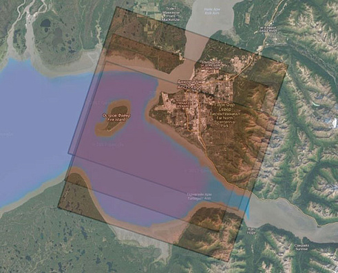
Example of stereoscopic coverage (triplet) of the territory uncovered by the original DSM
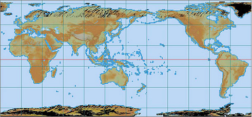
General look of the original AW3D30 DSM
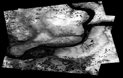
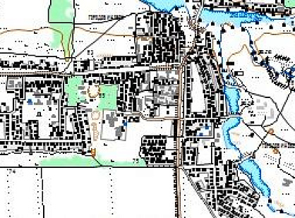
Fragment obtained as a result of processing DSM, the reference area for conducting research on accuracy (Perm and its environs).
Need satellite imagery or help choosing the right data?
Describe your task, area of interest, and desired outcome. We will check data
availability, assess new acquisition options, and propose the optimal solution in terms of timelines, cost,
and quality.
Fast feedback during business hours
We will select the best data for your task
Confidentiality guaranteed
Discuss the project
clients who trust us
25+ years in the geodata market
Мы используем Яндекс.Метрика и собственные Сookies для обеспечения наилучшего
опыта работы на нашем сайте, персонализации сайта для наших пользователей и аналитики.
Продолжая использовать сайт вы соглашаетесь с условиями
Пользовательского соглашения.
Request a call
Leave your contact details — we will get back to you during business hours, clarify the task and suggest suitable data or services.
Write to e-mail
Send a message, technical specification or task description. We will review your request and reply to the specified e-mail.
Fill in the order form
Describe the area, object and imagery requirements. We will check archive availability, the possibility of a new acquisition and offer a suitable option.
Order software
Order TK
Your application is accepted
We will contact you during working hours.
Выбрать город
Россия
Другие страны
Белоруссия
Contact via WeChat
Feliks Fokin
Open WeChat and scan the QR code to add the contact. On a phone, save the code and select it in the WeChat scanner.