of geospatial solutions
Sat-Sun: Non-working days
Project's objective
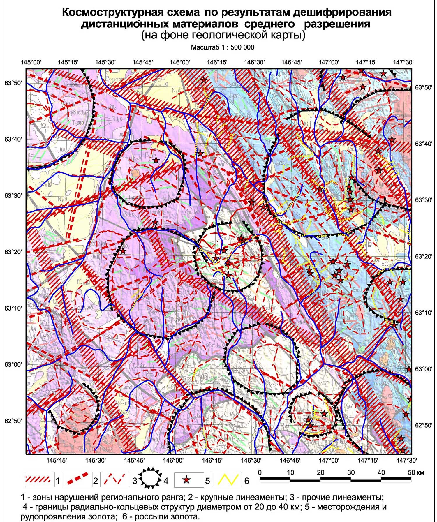
Ensuring the search for ore gold within the Verkhne-Khakchansk ore field of remote space and structural-formational foundations
Completed work
Work description
To create ortho-cosmophotomaps on a scale of 1: 100,000, it is recommended to use multispectral imagery materials of medium spatial resolution with the Landsat-8 spacecraft as source materials.
It is recommended to use multispectral high-resolution satellite images with the Spot-6spacecraft as source materials for creating 1:25 000 ortho-cosmophotomaps. It is recommended to use multispectral ultra-high resolution satellite images with the WorldView-2 spacecraft as source materials for creating 1: 5 000 ortho cosmophotomaps.

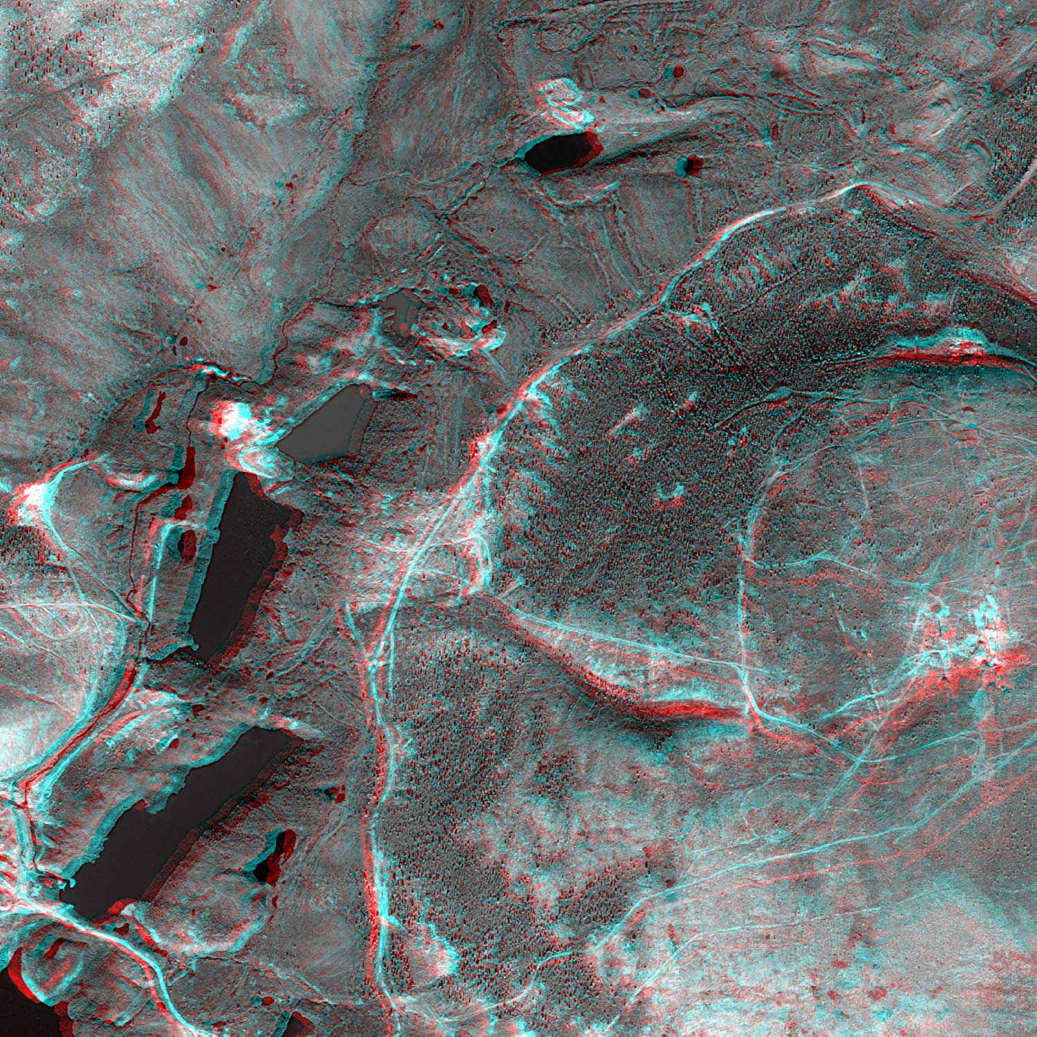
Fragment of the ortho-cosmophotomap of the Verkhne-Khakchansk ore field
Thematic interpretation involves the solution of specific tasks defined by the terms of reference. In this project, this is the compilation of structural-tectonic schemes of a scale of 1:50 000 for an area of 397 sq. Km of the Banno-Karymshinsky ore cluster and a scale of 1:10 000 for an area of 41.8 sq. Km.
In order to increase the informativity of decoding, all primary materials of remote surveys were prepared for analysis using a variety of specialized computer programs. It allowed us to:
-
get a lot of images of the analyzed areas in pseudocolours (synthesis) and as a result of arithmetic manipulations with spectral channels;
-
classify the various communities of landscapes by the selected parameters;
-
to identify gradient areas of tone characteristics associated with the relief, vegetation and geological boundaries of multi-competence complexes;
-
to form three-dimensional images of digital terrain and space images of areas in perspective;
-
create relief geological images of the area to study the links with the modern structure of the territory;
-
construct distribution schemes of modern watercourses based on the results of radar surveys.
The whole complex of photogrammetric works on the creation of an orthorectified mosaic plan was carried out by using the PHFOMOTOD version 6 of the program and included:
-
preparation of the planning and altitude bindings;
-
preparation of digital elevation models;
-
preparation of working coordinate systems;
-
identification of tie points in blocks of space images;
-
equalization of blocks of space images;
-
vertical alignment;
-
creating orthorectified images;
-
creation of an anaglyph image of a three-dimensional terrain model.
As a digital elevation model for creating an orthophotomap for a given territory, the SRTM 30 digital elevation model was used.
All transitions to the coordinate system SK-42 zone 25 in the process of preparing orthophotomaps were carried out using the transition keys presented in the PHOTOMOD.
Results
A remote base (DL) on Verkhne-Khakchanskaya area was created and handed over to the customer, consisting of:
-
Ortho-cosmophotomaps and 3D models on a scale of 1: 100,000 per sheet area Р-55-IX.
-
Ortho-cosmophotomaps and 3D models of the territory on a scale of 1:25 000 per area of the ore cluster.
-
Ortho-cosmophotomaps and 3D models of 1: 5,000 scale on the area of the ore field and the nearest adjacent territories.
-
Preparations of digital relief and MDZ at all scale levels.
The decoding of the entire set of materials of the subsidiary, with the involvement of stock materials and its results, compiled structural-tectonic schemes in the scale of 1:50 000 and 1:10 000 on the area of the Verkne-Khakchansk ore cluster.
A report was prepared with forward-looking recommendations.
Need for consultation?
Fill the form and we will contact you
Sat-Sun: Non-working days