Contact

Project "Omorinsky plot"

01

About the project

The use of GeoEye-1 satellite images and the corresponding technology of their photogrammetric processing has provided significant savings for the Customer’s financial resources and significantly reduced the time it takes to create a DEM in the regions of the Far North compared to traditional field methods.

Industry Oil and gas
End date 12/01/2011
02

Project goal

Construction and processing of a regular digital elevation model, with a step of 5 m, with an accuracy in the plan – 2-3 m, in height – 2 m. In the ARCGrid format. Removal of heights of points of seismic profiles with DTM.

03

Completed works

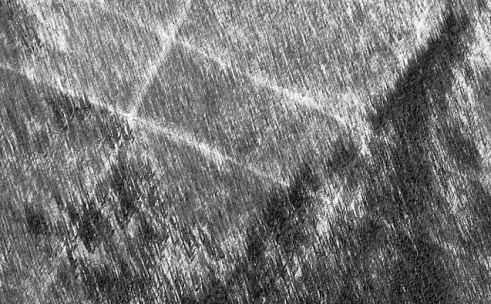
The object of work is in Eastern Siberia. The area belongs to the Far North of Russia. The survey from the GeoEye-1 satellite was conducted in March 2011 with a resolution of 0.5 meters. In the pictures there is a solid snow cover.

A total of 12 GeoEye-1 stereo pairs were received per area, Geo processing level (Standard Geometrically Corrected), GeoTIFF format, 11-bit radiometric resolution, option in natural colors (RGB composite).

The area of ​​work was 471 sq. km.

The complex of photogrammetric works was carried out in automatic mode and interactively (in stereo mode) based on the program system Photo mode 5.1.

The stereo was received using NVIDIA 3D Vision stereo glasses and a Viewsonic VX2268wm monitor with a frequency of 120 Hz.

The following work steps were executed:

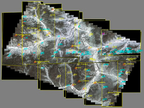
  • Construction and adjustment of phototriangulation network. 40 reference points and 35 binders located in the ceiling were used.

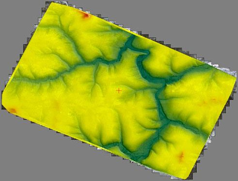
  • The construction of a DEM using stereo pairs of satellite images was performed by automatically constructing pickets on a given grid. After that, interactive structural lines were constructed for the main thalwegs and ridges. TIN was built by vectors and pickets. After the final correction, a matrix of heights was constructed on an area of ​​500 sq. Km. The accuracy of the construction of the height matrix of about 2 meters.

  • The removal of the heights of the points of seismic profiles from the obtained DEM, in automatic mode.

04

Result

The coordinates of the seismic profile points were recorded with an accuracy not exceeding the requirements of the customer who conducted the control in the field.

In practice, it was possible to use images with snow cover to create digital elevation models in the regions of the Far North. An important feature of these regions is: a short summer (snowless) season and high summer clouds. In winter, a large number of cloudless days are due to the Central Asian anticyclone that dominates the region. In addition, remote sensing satellites in winter in Russia have a low load.

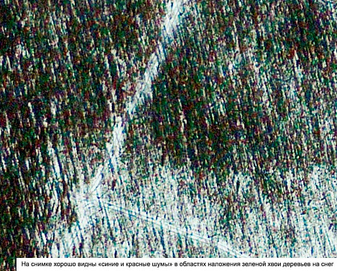
The use of color composite images of half-meter resolution (for similar conditions of the terrain) in the construction of the DEM is considered inexpedient. The use of color images does not provide additional information, while increasing the space occupied by the images on the disk three times. In places of growing coniferous trees on the background of snow cover, "color noise" is clearly visible.

GeoEye-1 satellite image. Level processing: Geo (Standard Geometrically Corrected)
GeoEye-1 satellite image at 100% zoom.
Block installation with reference points.
Resulting height matrix
Creation of DTM by stereopairs.

Need satellite imagery or help choosing the right data?

Describe your task, area of interest, and desired outcome. We will check data availability, assess new acquisition options, and propose the optimal solution in terms of timelines, cost, and quality.
clients who trust us
25+ years in the geodata market
Request a call back
Back to page top
Мы используем Яндекс.Метрика и собственные Сookies для обеспечения наилучшего опыта работы на нашем сайте, персонализации сайта для наших пользователей и аналитики. Продолжая использовать сайт вы соглашаетесь с условиями Пользовательского соглашения.