



A geological map with a structural 3D model; combining heterogeneous data improves modelling accuracy.
Search the site
What the service is used for
Resource estimation
Reliable data and the resulting model are the basis for mineral-resource estimates and financial decisions along the project chain.
Volume and grade
Models help determine the volume and grade of minerals subject to economic constraints.
Mineralisation control
They account for mineralisation factors, geotechnical stability, geometallurgical recovery and waste characterisation.
3D instead of 2D
Implicit modelling visualises geology in 3D and incorporates extended datasets faster than the classic 2D sectional approach.
Uncertainty reduction
Early modelling reduces geological uncertainty and grade-control drilling costs, and speeds up model updates.
Need a geological model?
Send the site coordinates, questions and analysis dates — we will assess feasibility and the 2D/3D model scope.
What you will receive as a result of the work
01
Geological map and 3D model
A geological map with a structural 3D model is the main result of the work.
Synthesising heterogeneous data improves modelling accuracy and efficiency. The model represents the spatial structure of sedimentary sequences and internal hydrogeological and engineering-geological features.
What you get
- geological map of the site
- structural three-dimensional model
- synthesis of available observations in an agreed composition
The map composition, model format and set of source data are fixed in the terms of reference.
02
Integration of observations
Visualisation and clear interpretation: heterogeneous observations are combined into 3D geomodels.
The model includes geological mapping data, well data and interpretations, seismic images, prospect data and well tests — in the composition agreed in the ToR.
What you get
- a single 3D geomodel from the available observation types
- a basis for hydrodynamic and geodynamic modelling
- clear interpretation of sequence structure
The completeness of integration depends on which maps, wells and survey are provided or ordered.
03
Reserves and block models
Reserve estimation and grade assessment: wireframe, block models and geostatistics.
Models help determine the volume and grade of minerals subject to economic constraints. Grade interpolation uses conventional and geostatistical methods; variograms, kriging and recoverable-reserve estimates follow the ToR.
What you get
- wireframe models of bodies and surfaces
- deposit block models
- grade and reserve estimates in an agreed volume
Interpolation methods and the reserve-estimate category are set by the terms of reference; this is not a state reserve expert review.
04
Wells and engineering tasks
Well planning and specific tasks: from hyperspectral data and UAV DEM to tunnels and landslides.
The 3D model is used for well design and as a basis for hydrodynamic calculations. Source-specific setups: SWIR and UAV DEM for carbonates, Quaternary sequences, LiDAR DEM of landslides, placers, tunnels in a weak massif, predictive mineralisation at depth.
What you get
- well planning (design) from the agreed model
- materials for specific tasks: UAV, LiDAR, hyperspectral, SAR — if included in the ToR
- a basis for controlling geological risks and illegal mining — according to the order scope
The list of specific tasks is not part of every order: the survey and model scope are agreed before the contract.
How the work goes
Cost and timeline
The cost depends on the site area, terrain and geological complexity, seasonality of work, advance size and required computing capacity.
- consultation — free
- preliminary analysis of materials and preparation of the terms of reference — free
- work of technical specialists and expert(s) — from 100,000 rubles
- total cost — from 100,000 rubles (on the card and in the order steps — from 100,000 ₽ / RUB)
- timeline in the duration field — from 5 days; in the timeline block, order steps and execution stage — from 20 working days after the advance payment
- the timeline depends on the total area of interest, final-product requirements and work complexity
- payment by bank transfer only
Total cost — from 100 000 ₽
Timeline — from 20 working days after the advance
Consultation and preliminary ToR analysis — free
What is needed for a quote
To agree feasibility, cost and timeline, send:
- location of the study object (coordinates; specialists will refine coordinates provided in any convenient form)
- questions to be solved and dates for the analysis
- size, terrain type and requirements for the deliverables
- a set of optical, IR (near and thermal) and radar images, if already available
- all available geological maps for the search area
If images and maps have not yet been collected, describing the site and questions is enough — specialists will assess service feasibility (yes/no).
Provide the coordinates, questions and analysis dates — we will calculate the survey and model scope.
Why Innoter
Prompt access to archives
Suitable archive imagery can be obtained faster when the required area and date are already available from operators.
No aviation clearances
A new satellite survey does not require the flight clearances typical of aerial surveys.
Large and remote areas
A single satellite pass covers large areas and makes it possible to work in hard-to-reach regions.
Direct agreements with operators
Distribution agreements help select archive imagery and order new surveys from different providers.
Software and server infrastructure
Modern software and computing capacity for quality control and processing of large data volumes.
Experienced specialist team
Years of experience on complex projects and specialists in cartography, photogrammetry and remote sensing.
RS data, 3D models and source materials
The scope depends on the area, archive or new survey, geological complexity and 2D/3D model requirements.
1
Geological modelling (geomodelling) is the creation of representations or a numerical equivalent of parts of the Earth's crust on and beneath its surface. It is an applied science of computerised crust representations from geophysical and geological observations.
Geomodelling is linked to the concept of a comprehensive Earth model: an interdisciplinary, interoperable and updatable knowledge base about the subsurface. It is used to manage natural resources, identify natural hazards and quantify geological processes — mainly for oil and gas fields, aquifers and ore deposits.
2
Reliable geological data and the resulting model are the basis for mineral-resource estimates and financial and operational decisions along the entire project chain. Models help determine the volume and grade of minerals subject to economic constraints.
The model includes aspects that control mineralisation and affect geotechnical stability, geometallurgical recovery and waste characterisation. Implicit modelling visualises geology in 3D instead of the classic 2D sectional approach and incorporates extended datasets faster.
Time spent at early stages reduces geological uncertainty, saves expansion and grade-control drilling, and shortens model updates when new data arrive. 3D models describe the structure of rocks and deposits in the subsurface for decisions on ground, groundwater, resources and reserves.
3
The goal is an accurate representation of the spatial structure of sedimentary sequences to study Quaternary geological evolution and analyse the variability of internal hydrogeological and engineering-geological features.
Creating 3D models addresses: mineral reserve estimation; well planning (design); preparing a basis for hydrodynamic and geodynamic modelling; visualisation and clear interpretation; integrating heterogeneous observations into 3D geomodels — geological mapping, well data and interpretations, seismic images, prospect data, well tests.
4
The source lists specific setups: an integrative 3D model of SWIR hyperspectral mapping and a UAV-based DEM for carbonate outcrops (limestone and dolomite); co-registration of a hyperspectral map and a UAV DEM using SIFT descriptor pairs; a model of Quaternary loose sedimentary sequences from global stratigraphic discrete points; fossil prospecting by geological, geospatial and spectral features.
Further: deep landslide features on LiDAR DEM (double ridges, trenches, main scarps, tension cracks); placer-prospectivity modelling from geomorphology and landscape; a road or railway in a weak massif for a tunnel (crown and wall displacements, plastic zone); quantitative mineralisation forecast at great depth; machine- and deep-learning algorithms for 3D prospectivity mapping; prevention of geological disasters and control of illegal mining; core together with 3D photogeology and surface hyperspectral data.
Analytical methods combine LiDAR and digital elevation models, thermal IR sensors, hyperspectral and multispectral sensors, synthetic aperture radar (SAR), optics and high-resolution sensors.
5
Modern remote sensing tools: LiDAR and digital elevation models, very-high-resolution optics, thermal sensing, hyperspectral data, microwaves and SAR, historical aerial photographs and archive images — from a century ago to the present. This makes it possible to observe the Earth beyond visual capabilities and remove the temporal and spatial limits of ground observations.
According to the source: a LiDAR-based DEM is tied to the bare surface and is used to map topographic features at the appropriate scale and accuracy, including small landforms. 3D multiparameter modelling and microanalysis are applied to molybdenite mineralisation and oxidation at the hypergene stage. Lithology, porosity and water content of Quaternary loose sequences are modelled layer by layer, taking the 3D framework of each sequence as the basis.
Sketch-based systems rely on standard annotations of 2D geological maps and interpretive sketches; this is not always feasible in the field. Geological rules and constraints are evaluated during modelling to obtain a reliable 3D model. A new 3D modelling method combines heterogeneous data from multiple sources, large-scale high-accuracy modelling, geological grid subdivision, attribute modelling technology and RS image fusion.
6
Source-data requirements: precise geographic coordinates of the object in the required coordinate system (specialists will refine coordinates provided in any convenient form); a set of optical, IR (near and thermal) and radar images; all available geological maps for the search area.
Software used: GIS — QGIS, ArcGIS and others; processing — ERDAS, ENVI SARscape, SNAP and others; modelling — Datamine Studio. Execution stages: survey in all available electromagnetic spectrum ranges, preprocessing and delivery of RS data for the client's sites; creation of geological maps; construction of two-dimensional (2D) and three-dimensional (3D) geological models.
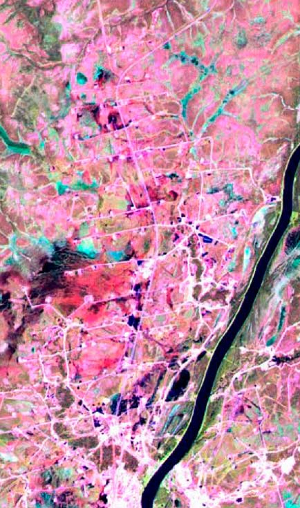
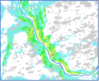
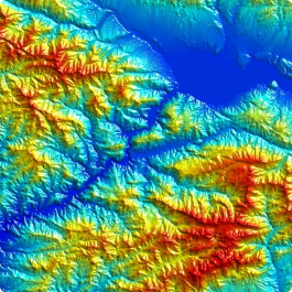
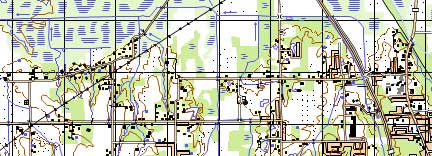
The “100% quality” warranty wording and the promise to exclude risks and losses were not transferred into a digital order warranty. Source illustrations (geomodelling examples, Datamine Studio, block model) were not transferred into the gallery.







Frequently asked questions
Answers to key questions about service parameters, timelines, deliverable formats and workflow. If you did not find what you need — contact us and we will help.
Geological modeling (geomodelling) for rapid creation of reliable volumetric models and basic resource estimation includes the following components:
- Wireframing of spatial bodies and surfaces. This involves a set of semi-automatic and interactive 3D tools for creating, modifying, displaying, and evaluating closed and topographic wireframe models.
- Intelligent mineral exploration based on machine learning algorithms and 3D modeling.
- Geostatistical analysis of deposits includes tools for variogram construction, analysis, and interactive fitting of models. It also involves cross-validation of selected variogram models, multiple types of 3D kriging, resource estimation, and more.
- Deposits modeling provides capabilities for constructing, viewing, evaluating, and editing block models of deposits. Metal grade interpolation and other indicators are performed using traditional and geostatistical methods. Visualization, interpretation, and modeling of project data (including Big Data) are also supported.
Accounting for the spatial position of the main boundaries of the geologic formation, including the effects of faulting, folding, and erosion. Therefore, the main rock stratigraphic lines are subdivided into layers of cells with different geometry with respect to bounding surfaces (parallel to the top, parallel to the base, proportional). The maximum size of rock cells is determined by the minimum size of rock composition objects to be resolved. Sometimes maximum resolution is required.
An important part of geological modeling (geomodelling) is related to geostatistics. To represent observed data, often not on a regular grid, we must use certain interpolation techniques. To reproduce more realistic spatial variability and to help estimate the spatial uncertainty between geologic data, geostatistical modeling based on variograms, training images, or parametric geologic objects is often used.

Need satellite imagery or help choosing the right data?
Describe your task, area of interest, and desired outcome. We will check data
availability, assess new acquisition options, and propose the optimal solution in terms of timelines, cost,
and quality.
Discuss the project
clients who trust us
25+ years in the geodata market







