



An orthophotomap or orthomosaic of the specified scale and format from satellite images, aerial photography or UAV survey.
Search the site
What the service is used for
Maps, plans and diagrams
Creation and updating of digital maps, plans and diagrams of the full scale series.
Land management and cadastre
Land management and cadastral work, including a unified digital cartographic base of the real-estate cadastre with vector layers of cadastral division.
Unified Electronic Cartographic Base
Up-to-date digital orthophotomaps as part of the Unified Electronic Cartographic Base (EECB).
Engineering surveys
Engineering-topographic maps for engineering and geodetic surveys.
Geological maps
A remote-sensing base for state geological maps.
Did not find your task?
Describe the territory, survey period, scale and purpose. A specialist will check the archive and orthophotomap parameters.
What you will receive as a result of the work
01
Orthophotomap or orthomosaic
A finished orthophotomap of the specified type and format: a photo of the terrain in orthogonal projection, specified CS and scale.
After orthorectification the frames are stitched, colours are corrected if needed, and sheets are cut by nomenclature or arbitrary sheets.
What you get
- an orthophotomap or orthomosaic in the agreed format
- cutting by nomenclature or arbitrary sheets
- materials in the coordinate system and projection per the ToR
Format, sheet layout and coordinate system are fixed in the contract and terms of reference.
02
Orthophotomap from satellite images
Orthophotomaps at scales up to 1:5,000 from high- and very-high-resolution satellite images — down to 15 cm per pixel.
Modern satellites provide wide coverage over large areas. Archival and new images with high-accuracy orbital georeferencing make it possible to produce orthophotomaps without ground topographic-geodetic work for GCPs.
What you get
- an orthophotomap from satellite images down to scale 1:5,000
- selection of the operator's archive or a new satellite survey
- a high-accuracy DEM for ortho-correction if required
Archive availability depends on the operator, cloud cover and the actual survey date. A new survey is agreed separately.
03
Orthophotomap from aerial photography and UAV
Orthophotomaps at scales up to 1:500 from aerial photographs and UAV surveys: resolution 2–5 cm per pixel.
Orthophotomaps from aerial photographs taken from an aircraft or UAV have high visual informativeness and excellent measurement properties. Such work usually requires a new survey: flight permits and a site visit.
What you get
- an orthophotomap at a scale up to 1:500 from UAV materials
- an orthophotomap from aerial photographs taken from an aircraft
- materials with high detail and measurement properties
Aerial images and UAV surveys as a rule require a new survey, permits and a site visit.
04
A base for maps, cadastre and surveys
An orthophotomap as a spatial base for maps, topographic site plans and diagrams, or as a standalone product for cadastre, surveys and geology.
It records the detailed situation on the Earth's surface: unaccounted objects and the actual state of the terrain on the survey date.
What you get
- a base of digital maps, plans and diagrams of the full scale series
- materials for land management, cadastre and the EECB
- an engineering-topographic and geological remote-sensing base
The layer composition and base scale are set by the purpose of using the orthophotomap.
How the work goes
Cost and timeline
The price depends on complexity: number of images covering the area, relief, whether stitching and ortho-correction are needed, and the overall scope. Images are paid separately.
- on the work card — from 10,000 ₽; lead time — from 1 day / from 1 working day
- in the FAQ the minimum term is from 1 (one) working day; it depends on area and survey requirements
- in the order steps — from 1 working day from the date of 100% advance payment for remote sensing materials, payment by bank transfer; remaining payment after completion
- creating an OFP at 1:500 and 1:1,000 (images and work), UAV: from 1 km², from 20,000 ₽
- creating an OFP at 1:2,000 and 1:5,000 (images and work): aerial photography from 25 km² from 200,000 ₽; UAV from 5 km² from 100,000 ₽
- creating an OFP at 1:10,000 (images and work): satellite from 25 km² from $300; aerial photography from 50 km² from 200,000 ₽
- creating an OFP at 1:25,000 and 1:100,000 (images and work), satellite: from 100 km² from $300
- processing of the client's images per 1 km², 1:500 and 1:1,000, UAV: from 1,000 rubles
- processing of the client's images per 1 km², 1:2,000 and 1:5,000: aerial photography from 100 rubles; UAV from 1,000 rubles
- processing of the client's images per 1 km², 1:10,000: satellite from 0.5 $; aerial photography from 100 rubles
- processing of the client's images per 1 km², 1:25,000 and 1:100,000, satellite: from 0.1 $
- the timeline depends on area, survey type (satellite, aerial photography, UAV), number of images, resolution, terrain complexity, seasonality, advance amount and whether remote sensing data must be purchased or the client supplies the materials
Order cost — from 10 000 ₽
Lead time — from 1 working day
Images are paid separately
What data are needed to quote an orthophotomap
To assess the archive, a new survey and the cost, provide:
- location of the object of interest: coordinates, district name, region, shapefile
- requirements for the survey period: period of archival data or a new survey is needed
- required scale and accuracy, purpose of using the orthophotomaps
If exact parameters are unknown, describe the purpose of using the orthophotomap — specialists will analyse the requirements and propose an option.
Describe the task in simple words — we will assess the archive and the possibility of a new survey.
Why Innoter
Without ground control from satellite images
Archival and new high- and very-high-resolution satellite images with high-accuracy orbital georeferencing yield orthophotomaps without ground topographic-geodetic work for GCPs.
Faster thanks to the operator's archive
Satellite data are obtained faster if the required territory is already in the operator's archive.
Measurement properties of aerial images
Orthophotomaps from aerial photographs taken from an aircraft or UAV have high visual informativeness and excellent measurement properties.
Experience since 2000
Priority is satellite images with resolution from 0.3 m for scales 1:10,000, 1:25,000, 1:50,000 and smaller; in the last 5 years also aerial photography and UAVs for 1:5,000, 1:2,000, 1:500 and larger.
Work under GOST and SP
Work is performed in accordance with SNiP, GOST and SP; quality under GOST R 58854-2020.
Scale series 1:500–1:50,000
Orthophotomaps at scales from 1:500 to 1:50,000 from satellite imagery, aerial photography and UAV surveys.
Scales, accuracy and source data
The composition depends on the survey platform, scale, control, DEM and whose images are processed: the operator's archive or the client's materials.
1
An orthophotomap (OFP) is a photographic image of the terrain in orthogonal projection, a specified coordinate system and the required scale. It is obtained by orthorectifying images using a DEM, GCPs or RPC coefficients to remove distortions caused by survey conditions, equipment, tilt angles and relief, then stitching frames and cutting sheets by nomenclature or an arbitrary grid. An orthophotomap records the detailed situation on the Earth's surface.
2
Orthorectification (ortho-correction) is precise geometric correction: relief displacement, central-projection distortions, lens distortion, deviations of the optical axis from nadir. A terrain DEM, camera exterior orientation elements and image interior orientation are required. Exterior orientation is set by GCPs with planimetric coordinates and height in one system. After correction, measurements can be taken on the image, feature positions determined, GIS data prepared, and frames merged with other orthorectified images.
3
Modern Earth observation satellites provide resolution down to 15 cm per pixel and wide coverage over large areas. UAVs provide images at 2–5 cm per pixel. Orthophotomaps at scales up to 1:5,000 are produced from satellite images, up to 1:500 from UAVs, plus a high-accuracy DEM for ortho-correction.
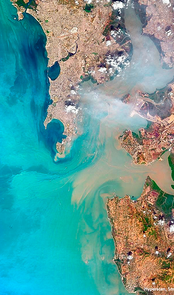
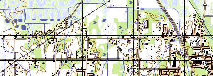
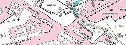
For orthophotomaps the following are used high- and very-high-resolution satellite images. Satellite data are obtained faster if they are already in the operator's archive. Also used aerial images from an aircraft or UAV. Example in the source: a WorldView-3 satellite image at 0.4 m resolution before orthorectification and the finished orthophotomap.
4
Regulatory documents on creating orthophotomaps impose accuracy requirements (RMSE, m) on source images, the plan-height control and the DEM:
| Indicator | 1:500 | 1:1000 | 1:2000 | 1:5000 | 1:10 000 | 1:25 000 | 1:50 000 |
|---|---|---|---|---|---|---|---|
| GCPs, plan / height | 0,14 / 0,10 | 0,28 / 0,10 | 0,56 / 0,10 | 1,40 / 0,21 | 2,80 / 0,21 | 7,00 / 0,52 | 14,00 / 1,04 |
| DEM in height | 0,10 | 0,10 | 0,10 | 0,20 | 0,20 | 1,00 | 2,00 |
| Contours, plan / height | 0,35 / 0,18 | 0,70 / 0,18 | 1,40 / 0,18 | 3,50 / 0,35 | 7,00 / 0,35 | 17,50 / 0,88 | 35,00 / 3,76 |
| Allowable resolution on the ground Lm | 0,02 | 0,05 | 0,10 | 0,25 | 0,50 | 1,25 | 2,50 |
Example from the process scheme: an orthophotomap at 1:10,000 needs planimetric accuracy no worse than 10 m, which requires materials with resolution no worse than 0.5 m.
5
Before the contract: purpose and accuracy; check of the remote sensing archive and/or planning of a new survey; check of images against the client's requirements; request to the operator for a new survey. Result — whether the service is possible (yes/no). Then agreement of the archive, satellite and parameters of the new survey, GCP and DEM accuracy, coordinate system and projection, labour, timeline and cost. Result — the contract.
Execution: selection of materials strictly to the requirements; check of channel co-registration, dead pixels, missing strips and coverage of the area; working technical design (terrain and built-up character, image quality, density of geodetic points, software). In the office-work scheme: photogrammetric densification for sparse field control, or processing from field control points, contours of older imagery or larger-scale maps. Primary processing: defects, radiometric, geometric and atmospheric correction. Photogrammetry: index mosaic; interior, relative and exterior orientation; DEM for stereo imagery; orthorectification; seamless mosaic; colour balancing. Export to the client's software formats, cutting by sheet layout, file weight or kilometrage. Control against standards and GCPs: relative and absolute georeferencing errors, correctness of stitching. Final analytical report: statistics, technical information and work progress.
6
After control and, if needed, correction of errors, a mosaic is assembled from several orthorectified images with a minimum of artefacts (clouds, haze, glare). Colour rendering is adjusted if required: colour balancing, histogram normalisation.
GEO Innoter has been producing orthophotomaps since 2000. Priority is satellite imagery with resolution from 0.3 m for scales 1:10,000, 1:25,000, 1:50,000 and smaller. Over the last 5 years specialists also produce orthophotomaps from aerial photography and UAV imagery for scales 1:5,000, 1:2,000, 1:500 and larger. Orthophotomaps at scales from 1:500 to 1:50,000 can be ordered from satellite imagery, aerial photography and UAV surveys. Work is performed in accordance with SNiP, GOST and SP; quality is guaranteed under GOST R 58854-2020.




Frequently asked questions
Answers to key questions about service parameters, timelines, deliverable formats and workflow. If you did not find what you need — contact us and we will help.
- Location of the object of interest (coordinates, name of the district, region, shapefile, etc.);
- Requirements for the imaging period (the period for which archival data can be used or the need for a new survey);
- Determination of the required scale and accuracy, purposes of using orthophotoplans.
This is a photographic image of terrain in orthogonal projection, specified coordinate system and required scale, obtained by ortho-transformation of images using DEM, reference points or RPS coefficients to eliminate distortions caused by survey conditions, survey equipment, image tilt angles and terrain relief, with subsequent stitching of transformed images and cutting orthophotomaps into nomenclature or arbitrary sheets.
- Location of the object of interest (coordinates, district name, region, shapefile, etc.);
- Requirements for the imaging period (the time frame for which archival data can be used or the need for a new survey);
- Determination of the required scale and accuracy, objectives of using orthophotoplans.
Depending on the required accuracy and the purpose of orthophotomaps use, initial photos, reference points and map materials are selected and acquired; primary processing of images is performed, including image defects removal, radiometric, geometric and atmospheric correction of images.
Depending on the volume and quality of plan-altitude preparation the technological scheme of cameral processes provides photogrammetric densification of survey support using single images or stereo pairs oriented on the points of field preparation or contour points identified on available images of previous years or on maps (plans) of larger scale or using RPS coefficients.
Sequentially performed are internal, mutual and external orientation of images, DEM creation (in case stereo imagery is used), orthotransformation of data, creation of seamless mosaic and alignment of color characteristics of the mosaic.
Depending on the Customer's requirements, the final product is exported to a specified format and orthophotos are sliced into nomenclature or arbitrary sheets.
Terms of orthoimagery execution depend on the area of the territory, requirements to the survey parameters. The minimum execution time is from 1 (one) working day
Orthoimagery refers to aerial or satellite images that have been orthorectified, correcting for distortions caused by terrain and sensor characteristics. Unlike standard aerial imagery, orthoimagery provides accurate and geometrically corrected representations of the Earth's surface.
Need satellite imagery or help choosing the right data?
Describe your task, area of interest, and desired outcome. We will check data
availability, assess new acquisition options, and propose the optimal solution in terms of timelines, cost,
and quality.
Discuss the project
clients who trust us
25+ years in the geodata market






