Identification of spontaneous, unauthorized waste dumps
Detection of spontaneous, unauthorized garbage dumps
As already noted, near cities and villages, dacha and resort settlements, industrial and agricultural enterprises, there are dozens of spontaneous dumps where household, construction waste, and sometimes industrial waste are disposed of. Low culture of waste management, overloaded official landfills, impunity of organizers of illegal waste disposal are reasons for the emergence of illegal, unauthorized dumps. Their sizes, as shown by illustrations, can be quite significant.
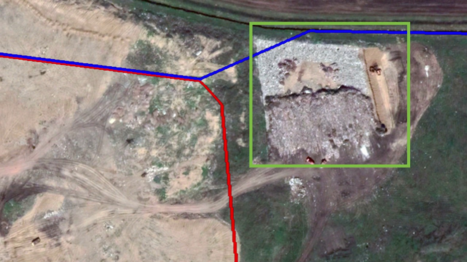
Fig. 12. Unauthorized dump near the city of Borisoglebsk, discovered by Rospotrebnadzor. The photo shows how perpetrators bury it with earth using construction equipment.
Identification and elimination of spontaneous dumps, land reclamation, and cleaning of forest lands and riverbeds in their place, identification of those responsible for violating environmental legislation are important tasks for local executive authorities, environmental, and land inspections.
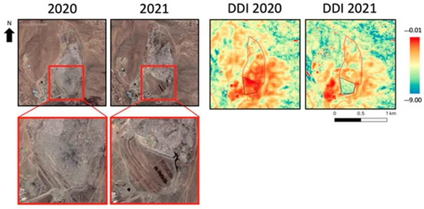
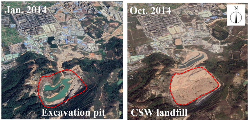
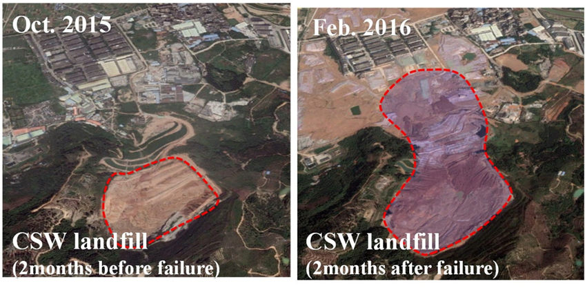
The main decryption properties of satellite images:
- mainly materials with high reflectance coefficients contained in dumps give a sharp increase in brightness in images - white, light yellow, light blue shades. Exceptions are less reflective agricultural, forestry, and some types of industrial dumps;
- dump contours are characterized by irregular shape, usually elongated along linear objects - highways, railways, slopes of river valleys, lake shores, and swamps;
- the most important characteristic displayed in high-resolution images (from 60 cm to 1 meter) is fine-grained texture formed due to surface irregularities of dumps, composed of various objects. A somewhat larger texture is characteristic of industrial and agricultural dumps.
These decryption features allow visually identifying and mapping dumps with a very high probability (up to 90–95%) based on high-resolution images. Additionally, developing a methodology for automatic decryption of dumps considering brightness characteristics of the image using texture analysis is possible. This task requires developing automatic decryption technologies based on ENVI software. To simplify and expedite the search for dumps, as well as increase the accuracy of their detection from the image, it is necessary during decryption to use knowledge about their possible location relative to other anthropogenic and natural objects.
The following regularities are observed in the placement of main types of dumps:
- construction, industrial, agricultural dumps and drains are mostly located in peripheral parts of the territories of corresponding enterprises, and such dumps can be located both within the boundaries of the enterprise and in close proximity, and in some cases at a considerable distance from enterprises. In such cases, the dump is often tied to one of the roads leading away from the enterprise;
- forestry dumps are located within fresh clearcuts;
- municipal household dumps and drains are mainly located in peripheral parts of settlements, dacha and garage areas, places with sparse development, vacant lots, ditches. In the case of remote location of the dump, they are also usually tied to the road network, often located along railways;
- recreational dumps are associated with places of unorganized recreation.
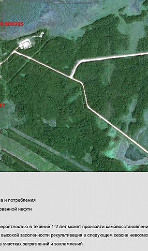
There is also a natural affinity for dumps: they are often located on slopes of river valleys, along lake and swamp shores, fill ravines and gullies, and sometimes valleys of small rivers, located on forest edges (Fig. 10). Dumps located in the forest are difficult to identify even from satellite images. To detect them, shooting should be done early in spring or late autumn when there is no foliage on trees and the crowns of trees are sparse. It is impossible to identify dumps under dense coniferous forests using satellite images.
Using all the above regularities allows decryptors to conduct a more effective and confident search for spontaneous dumps and drains, and in automatic processing, exclude from the search zone places where their location is clearly impossible.
Based on this, requirements for satellite imagery decryption (SID) can be formulated, compliance with which is necessary for clear identification of unauthorized solid waste disposal locations from images:
- when performing satellite imaging, a buffer zone around the settlement or economic object (5–25 km) must be defined in each case, within which the highest concentration of dumps is expected, and this territory must also be covered by the imaging;
- high spatial resolution imaging is required - not less than 1 meter; this pixel resolution on the ground allows decrypting clusters of solid waste with the highest degree of probability;
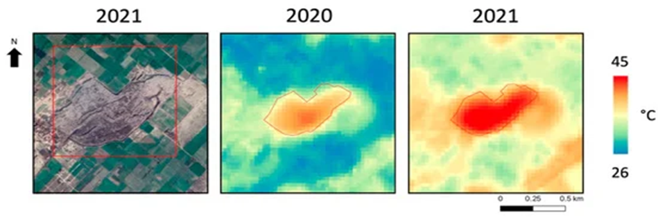
- multi-zone imaging is mandatory for obtaining color images and using the infrared channel (to detect drains);
- imaging must be repeated no less than once a year. For repeat imaging, in some cases, high-resolution images can be replaced with medium-resolution data (not less than 4 meters on the ground).
The result of image processing should be a full-fledged geographic information system (GIS) including thematic layers on the condition of dumps with all necessary attribute information.
Satellite images with a resolution of 1 meter or less (JL1KF01 A/B/C, SuperView, WorldView-2/3) provide a reliable basis for detecting and mapping such objects.