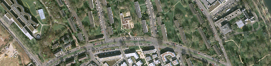
Municipal solid waste (MSW) is biological or artificial food products that are unusable as a result of loss of their consumer properties. It can also be household items or similar goods that have lost their appearance or become unusable.

You can order from us


Prices for services
| Activities | Free / cost per unit of measurement |
|---|---|
| Consultation | Free |
| Selection of images, preliminary analysis | Free |
| Ordering images | From $300 to $600 USD per image (number of images depends on the area of the territory) |
| Work of technical specialists | From 70,000 rubles (calculated individually) |
| Report preparation | From 50,000 rubles (calculated individually) |
| TOTAL COST | From 120,000 rubles (calculated individually) * |
*The price depends on the area of the surveyed territory and is calculated individually for each customer.
The cost of execution is calculated on an individual basis, taking into account a specific of task.
After receiving the task description, we calculate the cost and send you a commercial offer.
Period of execution
Harmonization of issues and applied images: from 1 to 15 days*Contract conclusion: from 1 to 3 days
Receipt of images: from 1 to 5 days **
Image processing: from 10 to 35 days
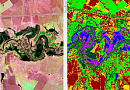
Space image interpretation, creation of training sample polygons for space image classification: from 1 to 20 days
Vectorization of the obtained classification: from 1 to 5 days **
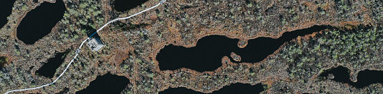
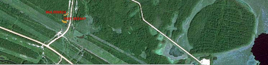
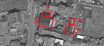
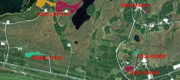
Detection of MSW storage sites: from 1 to 5 days **
Report writing: from 2 to 15 days
TOTAL TIME: from 20 days **
** working days
** from the date of receipt of 100% advance payment, when ordering a new survey the terms will increase
Lead time from 20 days depends on the area of the surveyed territory, calculated individually for each customer.
Need for consultation?
Fill the form and we will contact you
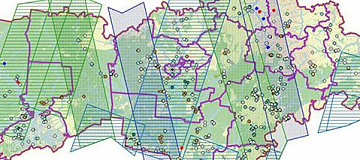
Stages of service provision
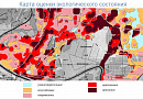
The result of the provision of services
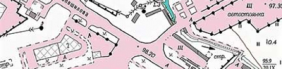
GEO INNOTER provides a report on the results of the analysis of the territory for the presence of solid waste disposal sites, presentation materials, thematic maps, georeferenced TIFF (Geo TIFF), and vector layers of detected objects in Mid/Mif format. All results are delivered on electronic media or through the Internet via FTP servers, and text materials are also duplicated in printed form.
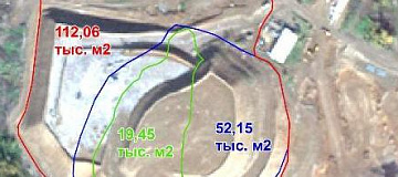
Based on the research conducted by GEO INNOTER specialists, it is also possible to perform forensic expertise on the presence of solid waste disposal sites and interpretation of geometric characteristics (area, shape, perimeter).
Requirements for Source Data
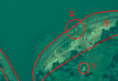
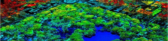
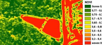
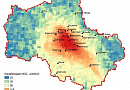
To detect solid waste disposal sites and obtain geometric parameters (perimeter, coverage area, etc.), it is necessary to use multispectral images with high and very high spatial resolution.
To obtain geometric parameters in 3D space (relief, volume, etc.), radar data or stereoscopic images are required.
If it is not possible to provide the specified information, please provide details about the intended use of the remote sensing data, and GEO INNOTER specialists will analyze the requirements and propose the optimal solution for the problem.
Related services
Completed projects

Customers


FAQ
- location of the object of interest (coordinates, name of the area, region, shp-file, etc.);
- survey period requirements (period for which archive data can be used or a new survey is required).
- The minimum order of archived super-resolution space images under the terms of suppliers is from 25 square kilometers.
- The minimum order of new ultra-high resolution space images according to suppliers' conditions is from 100 square kilometers.
Licenses


Warranty
The main regulatory legal documents defining the tasks and procedure for monitoring solid waste disposal sites are:
- Federal Law dated 10.01.2002 No. 7-FZ (as of 30.12.2021) "On Environmental Protection".
- Resolution of the Government of the Russian Federation dated 06.06.2013 No. 477 (as of 03.08.2020) "On the Implementation of State Monitoring of the State and Pollution of the Environment" (together with the "Regulation on State Monitoring of the State and Pollution of the Environment").
We guarantee 100% quality of service provision. By collaborating with GEO INNOTER specialists, you eliminate risks and losses!
The presence of qualified personnel with extensive experience in working with specialized software allows us to guarantee timely and high-quality execution of the work!
Our partners


")


")

Articles

Sat-Sun: Non-working days