Agriculture is the most important, fundamental, and in-demand economy in the world. Nothing is more crucial for a human being than being fed and surviving. Everything else is secondary.
The global agricultural infrastructure is scattered and heterogeneous, ranging from small household plots and farmers to medium and large agro-industrial holdings (in China – collective farms). All of them, in one way or another, depend on climate and natural living conditions on Earth.
The technology of food production exists in an annual cycle, from manual labor to high-tech modern machine-based land processing.
The main problems of agriculture are concentrated on the axiom of life: water, drought, weather, pests, and soil fertility.
Agricultural development is one of the most powerful tools for eradicating extreme poverty, increasing overall prosperity, and feeding the projected 9.7 billion people by 2050.
Growth in the agricultural sector is two to four times more effective in raising the incomes of the poorest populations compared to other sectors. Analyses conducted in 2021 showed that 65% of poor working adults earn their living from agriculture. Agriculture is also crucial for economic growth: in 2018, it accounted for 4% of the world's gross domestic product (GDP), and in some of the least developed countries, it can contribute more than 25% of GDP.
At the national level, in most countries, food security—the ultimate product of agriculture—is a top priority. It is clear that first and foremost, we should consider the countries of Africa and Asia.
In this regard, remote sensing technology is not just an auxiliary tool but a fundamentally important solution for ensuring agricultural crop yields. A trivial example is the modern development of agriculture in the USA and Europe, and partly in China.
Therefore, our target customers for remote sensing are, of course, in Russia (depleted lands of the Volga region, the North, and the Far East), in Asia (India, Cambodia, Indonesia, Vietnam), and the poorest African countries. Specific remote sensing directions include water resources in Arab countries, Algeria, Morocco, Tunisia, and several others.
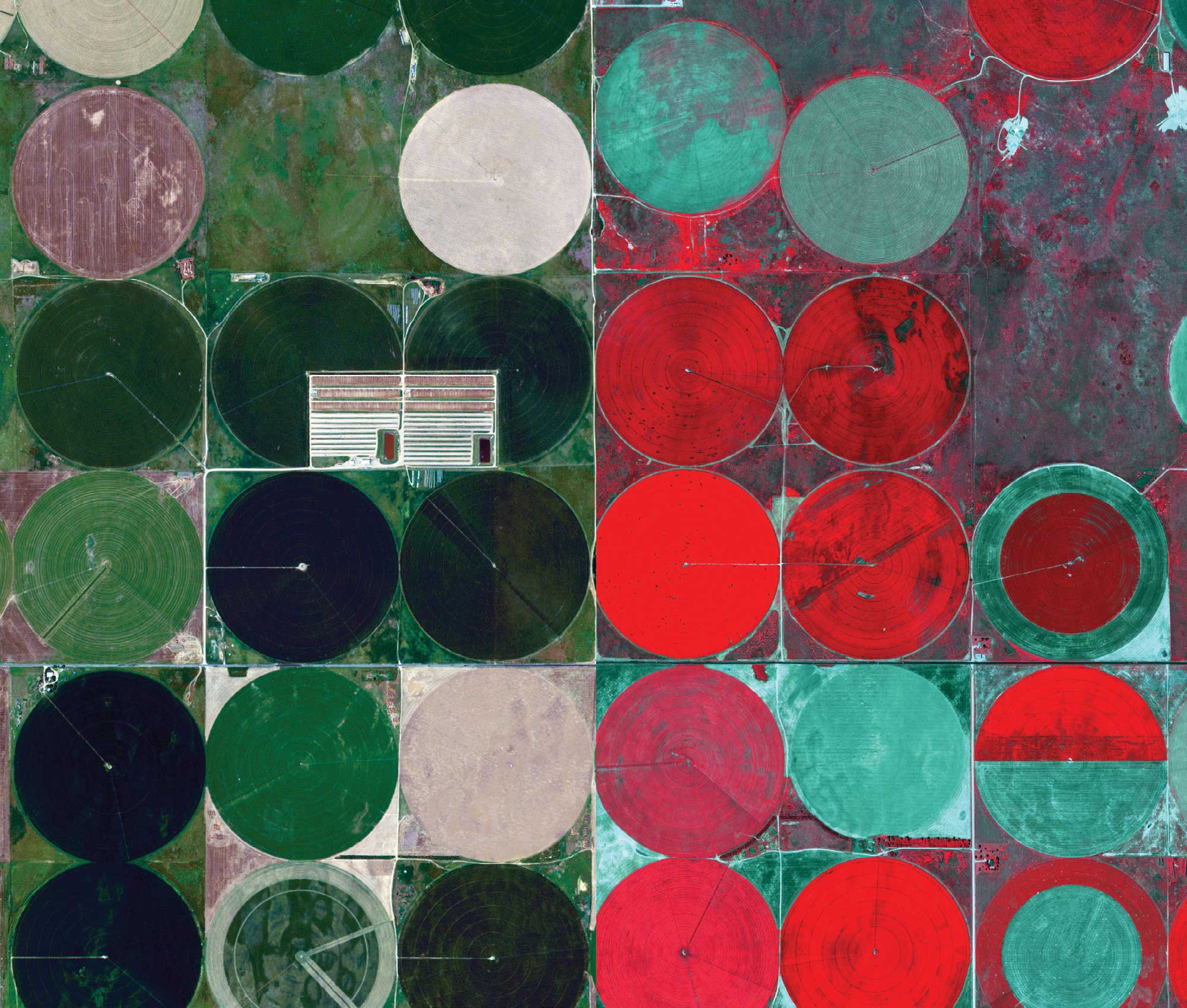
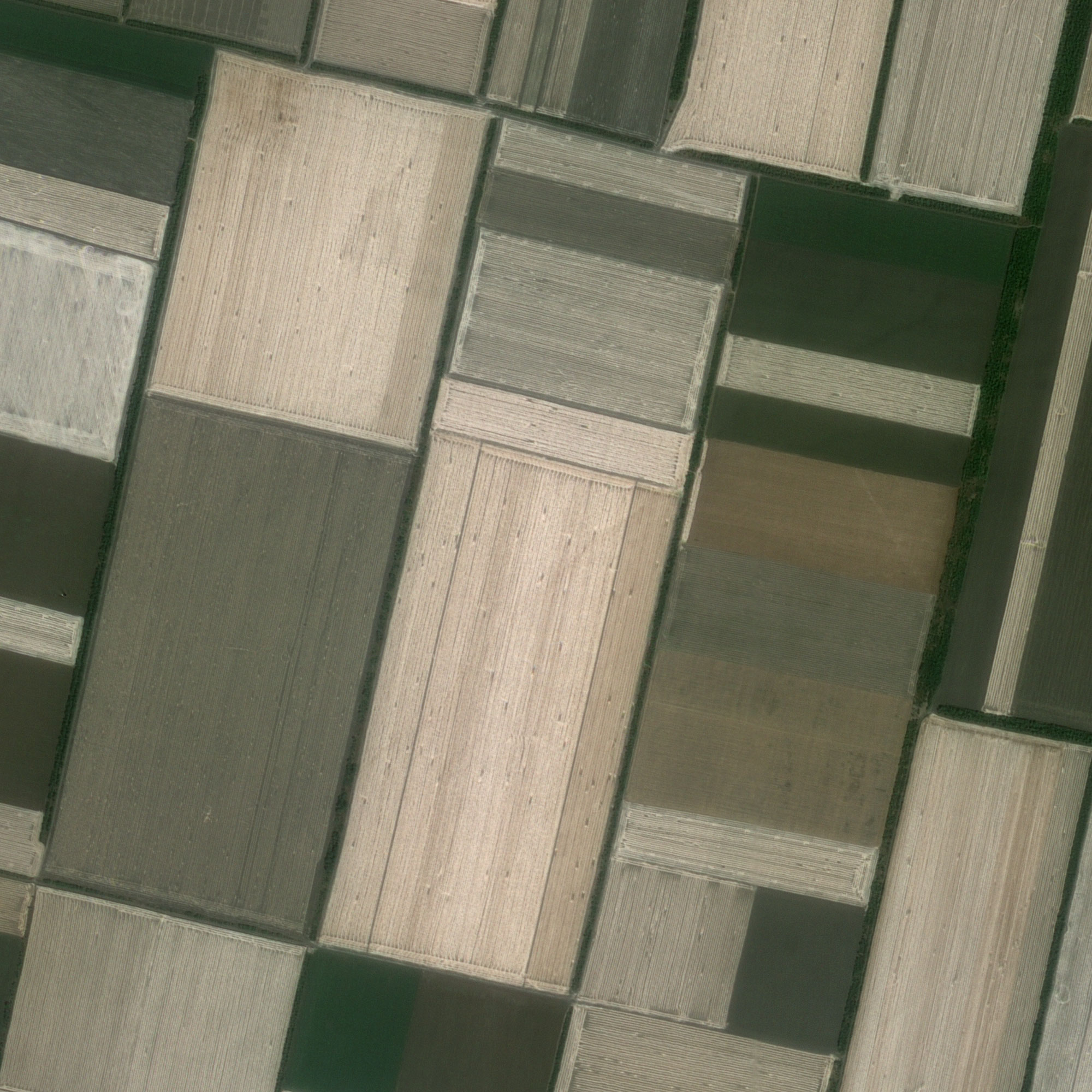
The remote sensing process in agriculture is based on information collected by various aerospace devices over a certain period (LULC technology for land condition assessment). The collected data can then be used to analyze various aspects of agricultural objectives: crops and yields.


Remote sensing data analysis is used to make adjustments to crops to ensure maximum industry productivity.
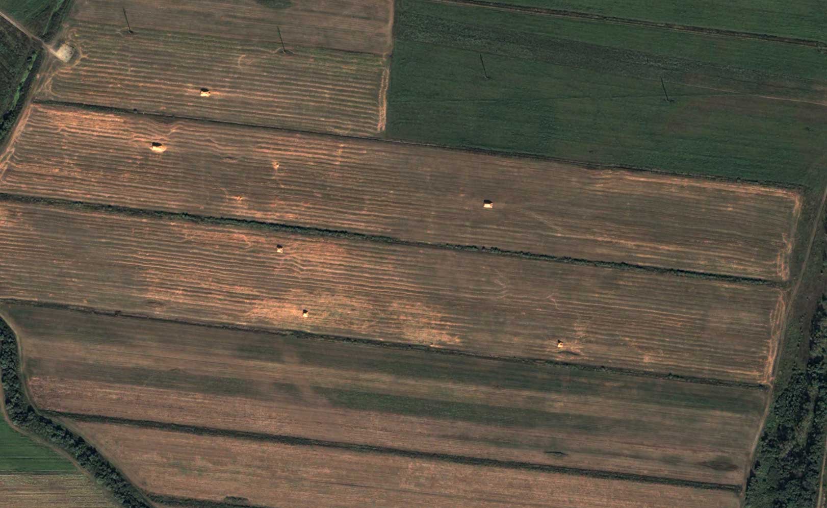
For example, the most detailed and widespread threats faced by agricultural producers, from a remote sensing perspective, are crop infestations by pests and weeds. Here, it is necessary to transition from satellite imaging to UAV-based imaging and field verification. Today, remote sensing in agriculture can realistically help detect such threats at an early stage and warn farmers about the need for necessary countermeasures to ensure crop health.

The use of satellite imagery in agriculture helps cover vast land areas and can assist in monitoring crop conditions.
By analyzing plant color with accurate UAV data provided by sensors, the chlorophyll level in a plant can be measured, allowing farmers to determine nutrient deficiencies or health problems in plants.
Using infrared and Red-Edge sensors, the NDVI model can easily identify damaged crops, giving farmers more time to take effective countermeasures to save the harvest.
The use of thermal sensors can help optimize irrigation systems.
Long-wave infrared (LWIR) sensors can be used to check which regions emit heat due to poor water supply systems.
GPS from satellites provides accurate location information, which is fundamental for new agricultural innovations such as self-driving agricultural machinery and autonomous farming equipment.

You can order from us

In general, the main topics of remote sensing in agriculture can be identified as follows:
- Land suitability classification. Inventory of agricultural plots (cadastre).
- Soil resource protection, land assessment, and land-use planning.
- Natural disasters (floods, droughts, fires, landslides, etc.).
- Spatial digital management of farms and agricultural lands.
- Precision farming, smart agriculture, and data collection using spatial digital technologies.
- Agricultural production and agroecosystem monitoring.
- Plant protection, pest, and disease control.
- Weeds.
- Invasive species.
- Soil nutrients and fertility management, fertilizers.
- Livestock and pasture management.
- Land mapping based on monitoring data over decades.
.png")
The development of new technologies for spatial data collection—drones, digital cameras, satellite data, indicator sensors, and much more—and their analysis using GIS provides enhanced capabilities and a significant boost for addressing modern agricultural challenges, as well as ensuring environmental sustainability and, ultimately, food security.
New innovative sensors installed on Earth observation instruments, tractors, and field measurement devices continuously collect multi-temporal and multi-spectral high-resolution data, supplementing and integrating information gathered through more traditional approaches. GIS and other geospatial technologies transform this data into accessible and interpretable information for farmers and landowners, enabling effective and informed decision-making.
At the same time, geospatial analysis, agricultural analytics, and human environmental impact assessment are crucial for a deeper understanding of underlying interconnections and processes.
Thus, GIS and spatial analysis applications such as aerospace data, geoinformatics, geospatial technologies, web GIS, GNSS and GPS, IoT, ground information systems, spatial intelligence analysis, spatial statistical models, spatial interpolation, geostatistics, neural networks, AI, cloud services for spatial data management—all these are advanced technologies that help study the entire agricultural industry. They pave the way for a better understanding of environmental interactions, early detection of environmental degradation signs, and improved risk assessment, timely forecasting, and response for agricultural producers.
Geospatial analysis of human environmental impact and land activities is essential for better understanding the fundamental relationships and processes involved in producing major food products.
Priority New Technological Directions in Remote Sensing for Agriculture:
• Phenotyping technologies for screening resistance, crop breeding, and precision agriculture.
• Spectral imaging technology with UAVs for detecting crop diseases.
• Derivation of biophysical crop parameters using remote sensing data.
• Assessment of crop coefficients and evapotranspiration using remote sensing.
• Precision farming using hyperspectral imagery.
• Mathematical modeling and plant growth simulation algorithms (above and below ground) based on contactless imaging.
• Applications of deep and machine learning in remote sensing data for crop monitoring and management using precision agriculture systems.
• Near real-time agricultural monitoring.
• Remote sensing of photosynthesis using solar-induced chlorophyll fluorescence and photochemical reflectance index.
• Proximal and remote sensing for precision crop management.
• Data-driven approaches and modern machine learning methods to support remote sensing and agriculture.
• Digital agricultural production based on remote sensing technologies, AI applications, and robotics systems.
• Synergy of aerospace imagery and artificial intelligence for agriculture.
• Evapotranspiration models based on remote sensing.
• 3D modeling and mapping for precision agriculture.
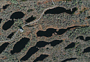
Modern remote sensing technology is well illustrated in the figure below.

Advantages of Agricultural Land Monitoring:
- Operational efficiency – up-to-date space images are available within days after the request is made.
- Objectivity – aerospace data is highly reliable and accurately reflects the actual condition of soil and vegetation.
- Simultaneity and periodicity – satellites and UAVs enable frequent, high-resolution imaging.
- Uniformity – data is collected from calibrated sensors, eliminating the need for additional processing or transformations.
- Coverage – modern satellites can capture large areas, allowing simultaneous observations in regions far apart.
- Solving a wide range of applied agricultural tasks.
Application Examples:
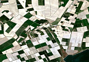
Assessment of Sown Areas
One of the most important applications of remote sensing in agriculture is the assessment of sown areas (mapping). Data from aerial and satellite sensors provide accurate analysis of cultivated areas and help assess risks in case of disasters or catastrophes.
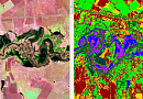
Normalized Difference Vegetation Index (NDVI)
Primarily used for monitoring vegetation dynamics, particularly in determining the health of agricultural crops. NDVI improves understanding of crop phenology as it explains the timeline of crops and their correlation with weather and climate (seasons). NDVI is measured using a mathematical calculation of spectral bands on a satellite image, providing a reliable correlation with green biomass, indicating healthy vegetation or crops.
Precision Agriculture
Soil monitoring is essential for precision agriculture. Critical soil parameters for optimizing crop management include soil organic matter (SOM), soil texture, pH level, moisture content, etc. Remote sensing technology ensures plant health monitoring, growth stages, yield estimation, biomass analysis, vegetation density, and environmental impact minimization.
Water Condition Monitoring
Due to increasing food demand, irrigated land areas are expected to double. Remote sensing in precision farming provides accurate and timely information on water bodies, irrigated farmlands, crop conditions, and soil moisture at various scales.
Crop Infestation Detection
Remote sensing in agriculture helps detect pest and weed infestations at early stages, allowing farmers to take preventive measures.
Modeling
Risk mapping and hazard assessment involve evaluating threats using computer-simulated disaster models. Remote sensing maps, created using historical and modern data collected from various sensors, help identify areas with a high likelihood of flooding or other hazards. This is beneficial for agriculture, as high-risk regions can be managed to improve protection, such as flood prevention measures for the next season.
The integration of AI and machine learning in agricultural modeling allows for more precise predictions of weather patterns, soil health, and crop yields, enabling proactive decision-making.
Yield Prediction
Remote sensing plays a vital role in forecasting agricultural productivity. By analyzing vegetation indices, soil moisture levels, and climatic conditions, farmers and agronomists can estimate potential yields and take necessary steps to enhance production efficiency.
Modern yield prediction models use satellite imagery, UAV data, and AI-based analysis to create detailed forecasts, helping optimize resource allocation and market planning.
Crop Rotation and Soil Management
Remote sensing data aids in determining optimal crop rotation strategies, assessing soil nutrient levels, and implementing sustainable farming practices. By monitoring soil degradation and fertility, farmers can make data-driven decisions to improve land productivity.
Climate Change Adaptation
With increasing climate variability, remote sensing provides crucial insights into how weather patterns affect agricultural productivity. Data on drought conditions, heat stress, and changing precipitation levels help in developing adaptive strategies for resilient farming.
Precision Irrigation
Using satellite and UAV-based thermal imaging, farmers can optimize irrigation systems by identifying water-stressed areas in fields. This leads to efficient water use, reducing waste and improving crop health.
Remote sensing technologies such as thermal infrared sensors and soil moisture analysis contribute to water conservation efforts and sustainable irrigation management.
Early Detection of Plant Diseases
High-resolution multispectral and hyperspectral imagery enables early detection of plant diseases and nutrient deficiencies before visible symptoms appear. AI-based image processing identifies stress factors affecting crops, allowing timely intervention.
Remote sensing plays a crucial role in integrated pest management (IPM), reducing reliance on chemical pesticides and promoting environmentally friendly farming methods.
Food Security and Supply Chain Optimization
Remote sensing supports national and global food security initiatives by providing real-time monitoring of agricultural production. Governments and organizations use this data for policy-making, disaster response, and market stabilization.
Agricultural supply chains benefit from geospatial analysis, which enhances logistics planning, reduces post-harvest losses, and improves distribution efficiency.
Soil Erosion and Land Degradation Monitoring
Satellite imagery helps track soil erosion, deforestation, and land degradation, allowing for timely conservation efforts. Remote sensing supports reforestation projects, soil rehabilitation, and sustainable land management.
Conclusion
The integration of remote sensing, AI, and GIS technologies is revolutionizing modern agriculture. By providing accurate, timely, and actionable insights, these technologies enable farmers to improve productivity, minimize environmental impact, and ensure food security for future generations.
As remote sensing innovations continue to evolve, the agricultural sector will benefit from enhanced decision-making capabilities, increased efficiency, and sustainable growth.
Need for consultation?
Fill the form and we will contact you
Customers


FAQ
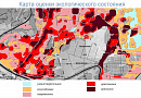
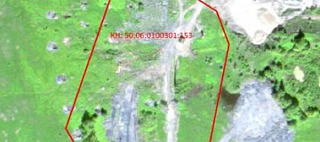
Agricultural land monitoring holds a special place in land monitoring. The use of land in agriculture has its own unique characteristics, the most important of which is its irreplaceability for food production.
Agricultural land monitoring is categorized as follows:
- By administrative and territorial division
- By land categories
- By anthropogenic impact
- By user categories
- By intended use
- By agricultural land utilization

Fundamentals of Agricultural Land Monitoring
In recent years, the land resource management authorities established in our country have failed to develop an effective resource management system and have lost control over land use and protection.
This is evidenced by the following factors: a decline in humus content, increased physical soil degradation processes. The soil is subject to degradation, losing its resistance to destruction and its ability to regenerate fertility.
Analyzing the multifaceted relationships emerging in land use processes indicates an unsatisfactory state of land monitoring. This explains the incomplete information regarding the size and forms of land ownership, the owners of land shares, the conditions of land leases, land tax amounts, and land cadastral valuation. Farms do not conduct a systematic analysis of land relations.
All of this negatively impacts land use, land management activities, the formation of an optimal land ownership and land use structure, and the enforcement of legally established measures against improper land use.
It is now evident that a modern land resource management system based on land monitoring is necessary.
Land monitoring can be defined as a system of observations over the state of land resources to promptly identify changes, assess them, predict trends, prevent negative processes, and mitigate their consequences.
Improving agricultural land monitoring aims to prevent agricultural land loss, preserve and incorporate it into agricultural production, and provide all land-use stakeholders with accurate information on the state and actual use of agricultural lands.
Agricultural land monitoring includes systematic observations of the condition and use of crop rotation fields, soil fertility parameters, and vegetation cover changes on arable land, fallow land, meadows, and pastures, among others.
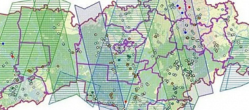
Agricultural Field Registry
Stage 1: Automated provision of satellite imagery
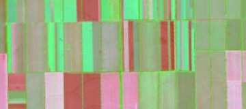
Soil composition maps.
Stage 2: Automated processing of satellite imagery to create a statistical database
Fire monitoring.
Stage 3: Generation of real-time statistical reports
Information on subsidy and funding volumes.
- Stage 4: Interpretation of information for automated data utilization
- Stage 5: Development of an online portal for various user categories
- Stage 6: Decision-making process
- Stage 7: Forecast development
- Automated provision of satellite imagery;
- Automated processing of satellite imagery to generate intermediate products, forming the basis for statistical reports, aggregate figures for the Voronezh region, and thematic maps;
- Real-time statistical reporting and analytics;
- Interpretation of obtained data for automated use in a system that determines specific land characteristics based on satellite imagery;
- Development of an online portal for different user categories;
- Implementation of rapid decision-making processes;
- Forecasting and predictive analytics.
Thanks to this innovative development, agricultural management specialists, as well as agricultural producers and landowners, will be able to visualize crop development in a unified system and respond promptly to emerging issues.
Licenses


Our partners


")


")

Sat-Sun: Non-working days