Oil and natural gas are the main sources of fuel in the world. The processes and systems associated with oil and gas extraction and distribution are highly complex, capital-intensive, and require the use of the most advanced technologies. The constantly changing dynamics of this industry drive continuous efforts to improve efficiency and reduce risks.
The industry is broadly divided into three sectors:
- exploration and production of oil and gas;
- transportation and storage;
- refining and marketing, including processing and distribution.
Geological exploration and oil and gas extraction is a multi-stage process of discovering resources, transporting them to a refinery, and converting them into a finished product ready for sale.
Despite attempts by some "green" activists to eliminate this industry, it is impossible to dismantle its established structure and well-developed technology before 2050. The ongoing energy transition, including the ban on the sale of internal combustion engine (ICE) vehicles in several countries starting in 2035, will undoubtedly have a significant impact on the structure of energy consumption in transportation. However, given the overall population growth and the increasing share of the middle class in Africa and Asia, the demand for oil and gas as fuel for transportation and power generation will remain high.
For the geospatial industry, it is important to note that, according to global estimates, 80% of the technological processes in the oil and gas sector rely on data with a spatial component. This is the only industry that utilizes spatial information at every stage of the life cycle, from opportunity analysis and exploration to assessment, production, and infrastructure management.
The industry demonstrates an annual growth of 6%.

New innovative trends are generally based on the development of digital technologies and geospatial analysis.
Remote sensing information is essential in the oil and gas industry. For example, crude oil has become a reliable source of wealth for many countries that possess this vast resource. The largest oil producers are Saudi Arabia, Canada, the United States, China, and Russia. The first four countries primarily rely on remote sensing technologies for oil, natural gas, and geothermal energy exploration and extraction.

The top 10 trends in the oil and gas industry for the next decade:
- Internet of Things;
- Artificial Intelligence;
- Big Data and Analytics;
- Robotics and Automation;
- 3D Modeling and Visualization;
- Cloud Computing;
- Augmented and Virtual Reality;
- Manufacturing Execution Systems;
- Predictive Maintenance;
- Blockchain.
In this regard, these trends are effectively implemented through remote sensing methods. The life cycle of the oil and gas industry is closely linked to remote sensing.

What Tasks Does Remote Sensing Solve in the Oil and Gas Industry?
Remote sensing and related technologies in the oil and gas industry are not new—they have existed for several decades. For many years, ground-based remote sensing analytics faced several limitations in the oil and gas sector. Twenty years ago, the low spatial and spectral resolution of many data sources made it difficult, for example, to quantify and delineate oil spills or identify hydrothermal minerals beyond a regional scale. These barriers were real, but they no longer exist. Modern remote sensing solutions using spaceborne and airborne sensors have practically eliminated most challenges in the oil and gas industry, not to mention the detailed mapping of infrastructure.
Assets, offices, sites, workers, and operations in the oil and gas industry are geographically dispersed. Thematic maps and models have proven to be the most effective way to visualize and communicate information. There is great potential for using geospatial technologies and developing software in the industry:
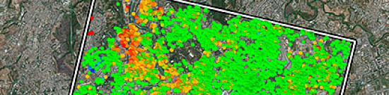
- Hydrocarbon Accumulation Potential Map — hydrological modeling; mapping subsurface secondary fluid migration networks; flow direction visualization – accumulation mapping using DEM; possible migration pathways, etc.

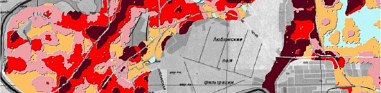
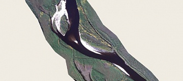
Fig.4 Hydrocarbon Accumulation Potential Map - Field Analysis — risk segmentation mapping for each oil field element; regional risk mapping; geological maps; ground verification or image verification through field surveys.
- Oil and Gas Area Analysis (incl. 3D UAV and LiDAR models) — rapid assessment and ranking of opportunities using interdisciplinary asset data with weighting and criteria assignment; ranking of sites, oil leases, blocks, and companies; exploration statistics in a visual platform, etc.
- Reserves or Hydrocarbon Volume Estimation — raster analysis based on deterministic prospective reservoir volumes; reserve estimation and spatial analysis of well data for unconventional hydrocarbons such as shale, etc.
- Seismic Planning — terrain analysis; seismic survey maps and data; satellite image processing and spatial analysis; etc.
- Well Planning — planning wells considering multiple drilling constraints; GIS tools used in workflows to optimize well layouts.
- Drilling — spatial analysis to optimize drilling patterns and efficient configurations.
- Production — geospatial technology allows the integration of data and visualization of production volumes, injection rates, and extraction efficiency almost in real time.
- Exploration (Onshore) — a visual framework for asset exploration; 3D modeling of geological, geophysical, and petrophysical hierarchical data.
")
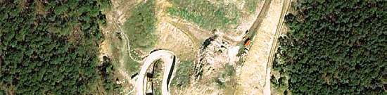
Fig.5 Exploration (Onshore) - Bathymetric Mapping — seafloor research; navigation route maps with integrated data; 3D seismic analysis; satellite imagery processing for marine exploration and mapping.
- Field Operations — geospatial technology supports drilling around surface and geological constraints; enhancing extraction efficiency at the reservoir/basin level; integrating and visualizing data in real time for production dashboards; coordinated workflows and field personnel; dynamic hazard modeling for resource distribution; real-time asset tracking; updated DEMs to detect subsidence caused by extraction, and more.
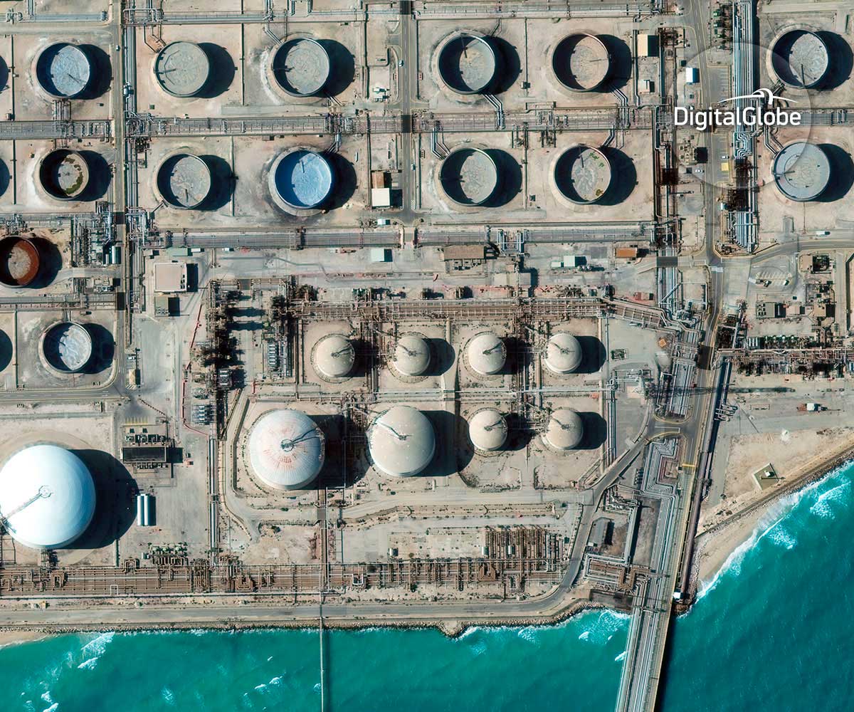
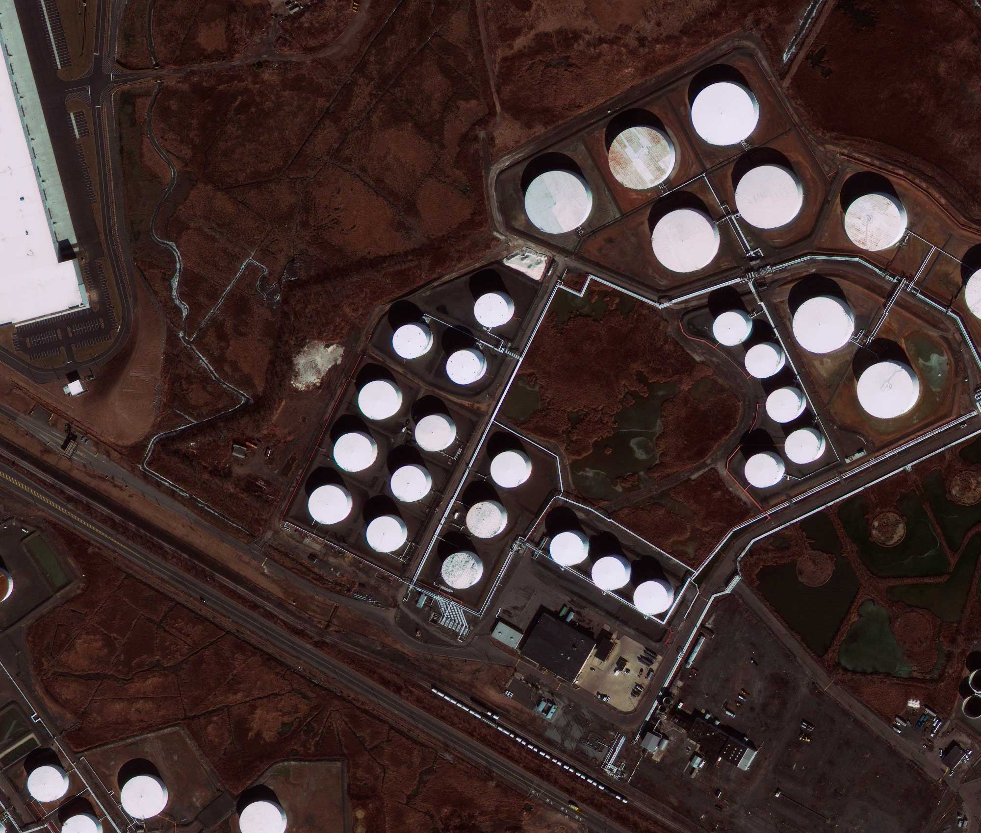
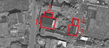
- Facility Management — 3D GIS with UAV-based mapping enables precise tracking of relevant environmental changes almost in real time for health, safety, and environmental monitoring and emergency response (e.g., refineries, gas stations) during oil spills, leaks, explosions, or site fires.
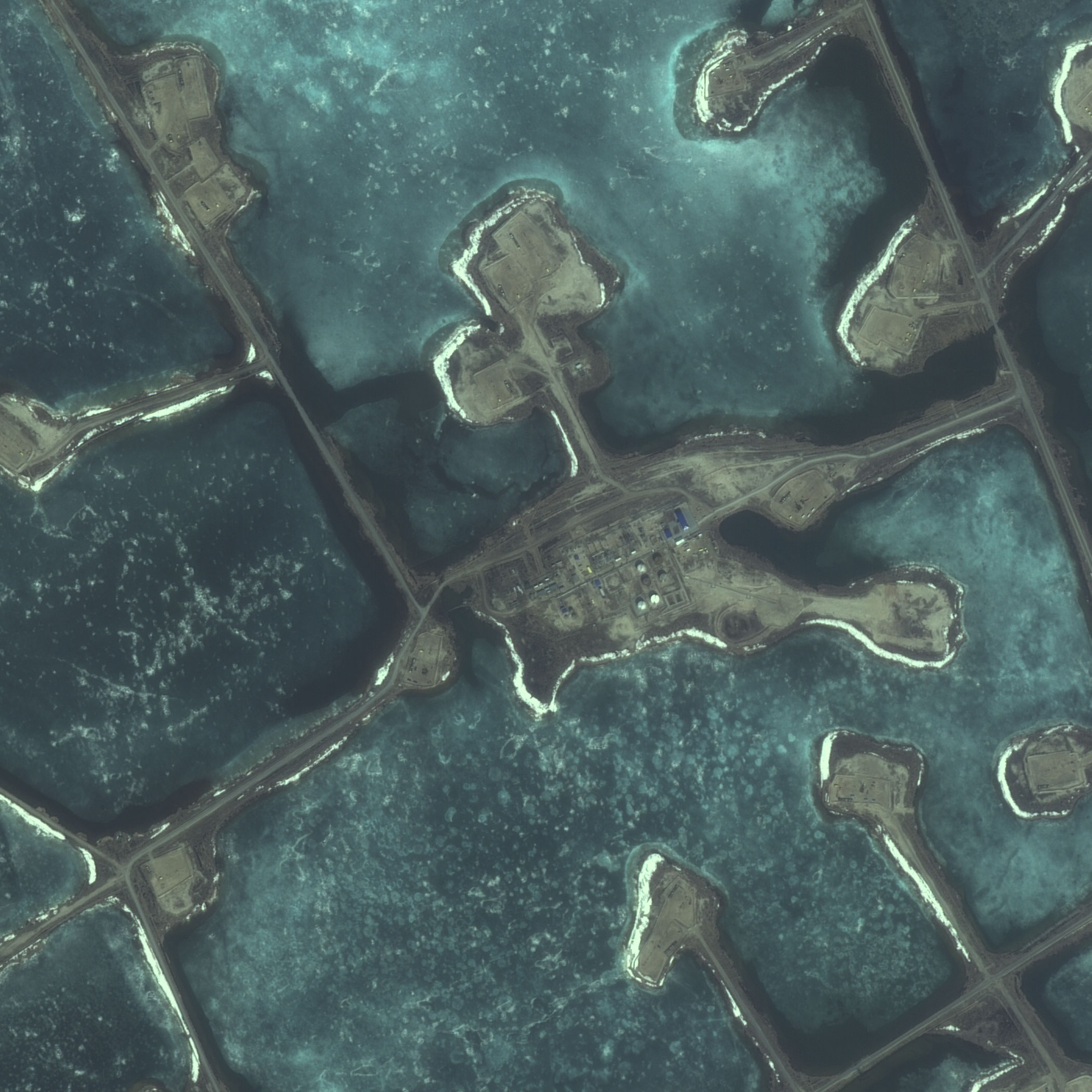
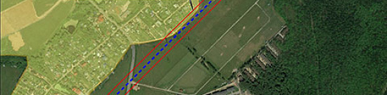
- Transportation System Management — cost-effective route analysis for distribution networks; network analysis for environmentally safe and economical routes; pipeline monitoring for geological hazards and leaks; tracking inspections using remotely obtained data; real-time monitoring and spatial data analysis; seafloor surveying and asset management in offshore operations, etc.

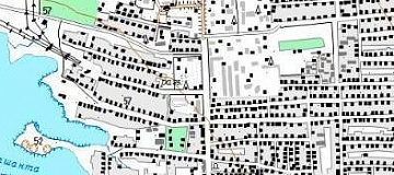
Fig.6 Transportation System Management 
Fig.7 Pipeline Routing and Vehicle Tracking - Pipeline Routing and Vehicle Tracking — the ecosystem supports tracking valuable assets in this capital-intensive sector. Precise location tracking of vehicles and vessels ensures timely delivery of goods and services as well as effective emergency response.
- Decommissioning — remote sensing data from earlier oil field life cycle stages, centralized in a corporate GIS, helps make optimal decisions regarding infrastructure decommissioning and land reclamation.
The company GEO INNOTER quickly and efficiently carries out thematic mapping work for the oil and gas industry (including vector thematic layers in GIS), the main remote sensing segment in the industry, namely:
In Hydrocarbon Exploration:
- Updating topographic maps and plans of exploration and development areas.
- Identifying oil and gas prospective areas from aerial and satellite images using principal component analysis of geological structures.
- Creating engineering-geological zoning maps at scales of 1:100,000 – 1:200,000 and smaller.
- Developing photogeological maps, structural element maps, deep structure maps, neotectonic movement maps, and maps for optimal placement of exploration and appraisal wells.
- Analyzing remote sensing data for seismic microzonation studies.
In Hydrocarbon Field Development, Including Design, Construction, Operation, Conservation, and Decommissioning of Oil and Gas Facilities:
- Acquiring and providing remote sensing data at various stages of field development.
- Creating and updating digital cartographic bases at scales from 1:5,000 to 1:100,000.
- Generating digital orthophoto maps at scales from 1:500 to 1:5,000.
- Producing mine surveying and geodetic plans and topographic maps of field development at scales from 1:2,000 to 1:10,000.
- Creating topographic maps (plans) with existing and planned infrastructure at scales of 1:10,000 – 1:25,000.
- Satellite monitoring of construction progress.
- Monitoring changes within licensed areas.
In Pipeline Transport Operations:
- Pipeline monitoring (for Russia via satellite, for international markets, potentially developing GIS systems).
- Creating predictive environmental impact maps for pipeline routes at scales from 1:5,000 to 1:100,000.
- Generating situational plans of regions with delineated exploration areas and gas transport systems (scale as per technical requirements).
- Creating pipeline layout plans and longitudinal profiles at scales of 1:200, 1:500, 1:1,000, and 1:2,000.
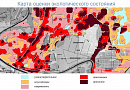
In Environmental Monitoring and Natural Resource Management:
- Creating schematic environmental maps at scales of 1:25,000 and smaller.
- Developing maps of significant environmental impact zones at scales from 1:5,000 to 1:10,000.
- Generating retrospective environmental assessment maps at scales from 1:5,000 to 1:50,000.
- Creating predictive environmental change maps at scales from 1:5,000 to 1:50,000.
- Inventorying and documenting polluted and disturbed lands and water bodies.
- Monitoring oil spills and contamination of water bodies.
- Assessing environmental damage from emergency situations.
- Evaluating anthropogenic impact.
In Industrial Safety:
- Identifying areas affected by hazardous geological, technogenic, and natural processes.
- Monitoring ground surface deformation using spaceborne radar data.
- Monitoring the condition of potentially hazardous facilities based on aerial and satellite imagery.
Advantages of Using Remote Sensing:
- Facilitates decision-making — determining which area or field to explore, how to optimize the workflow portfolio, how to plan the optimal pipeline route, integrate seismic survey results, plan emergency response, improve asset management, handle pipeline leaks, etc.
- Supports future actions and ongoing exploration — by standardizing processes and reducing technical uncertainty, it enhances exploration efficiency. The GIS platform models coordinated research processes for all company assets. This supports a consistent, verifiable corporate portfolio of potential leads for ongoing portfolio decisions.
- Increases efficiency — integrating interdisciplinary data for risk and uncertainty assessment, improving accessibility to reduce unnecessary downtime, optimizing maintenance schedules.
- Real-time fleet movement analysis, least-cost route analysis for pipeline routing, standardized portfolio workflows, reducing decision-making cycle times, etc.
- Cost savings — reducing operational costs by 10-30%, preventing and managing unforeseen expenses, efficient pipeline and fleet management reduces costs, optimized drilling and production workflows enhance return on investment, etc.
- Seamless management with real-time map visualization and remote/offshore site, operation, and asset analysis.

Fig.8 Seamless management with real-time map visualization - Improved communication between spatially distributed locations.
- Data management — massive data sets uploaded into a centralized GIS provide a strong foundation for data governance with full transaction support and reporting tools.
Advantages of Remote Sensing Sensors:
- Synthetic Aperture Radar (InSAR) can be highly useful for assessing terrain stability. It enables enhanced monitoring and control of potential geological hazards in the oil and gas sector. This is an excellent way to improve pipeline safety and performance.

Fig.9 Enhanced monitoring and control of potential geological hazards - Interferometry allows continuous satellite-based object monitoring. Additionally, ground-based images cannot provide as broad a field of view as satellite images.
- Satellites, global positioning systems, remote sensing devices, and 3D and 4D seismic exploration technologies help detect oil reserves with fewer exploratory wells.
- Environmental monitoring (satellite imagery analysis) — for instance, hydraulic fracturing requires significant water usage and employs potentially hazardous chemicals to release oil from rock formations. In some regions, excessive water use for oil extraction can impact water availability for other needs and potentially affect aquatic habitats. Improper well design or handling can lead to leaks and fluid spills during fracking. Oil contamination is one of the most critical risks to marine environments.
- Satellite SAR — detection of spills, hydrocarbon leak detection, spill assessment, oil and gas seeps.
- Satellites (e.g., MAXAR's WorldView-3) provide high spatial and spectral resolution in strategically located visible and near-infrared (VNIR) bands useful for vegetation analysis, as well as shortwave infrared (SWIR) wavelengths useful for mineral identification. For instance, underground hydrocarbon leaks alter soil chemistry, which manifests as changes in vegetation health.
- A satellite takes multiple images from space and then merges them into one. Exploration costs are reduced fivefold for unexplored areas and sevenfold for well-studied sites compared to traditional methods.

Fig.10 Satellite image from space - UAVs provide detailed data for 3D seismic planning.
The oil and gas industry was relatively late in adopting remote sensing alongside GIS. However, it is rapidly evolving into the industry with the highest potential for remote sensing-GIS applications throughout the entire life cycle. Moreover, it enables seamless integration of geospatial technologies, such as UAVs, sensors, and existing computer systems, within the remote sensing-GIS framework. This helps companies compete in the global race for new energy sources and maximize the value of their assets.
Application Examples
Accurate and Intuitive Database Design – Fully Customizable Classification of Oil and Gas Infrastructure Maps Using Remote Sensing Data
Planimetric maps are essential for supporting planning and decision-making throughout the entire lifecycle of oil and gas operations, including exploration, infrastructure management, environmental planning, and spatial analysis. Advanced methodologies for extracting oil and gas-related objects ensure fully customizable maps with layers that can be grouped and classified for optimal data visualization and analysis. Extracted objects are also used to populate geographically coded databases that can be easily referenced in tabular formats.

Monitoring Oil Pollution in Vegetated Areas Using Optical Remote Sensing
Monitoring soil pollution caused by oil and gas industry activities remains challenging in vegetated regions. Over the past decade, optical remote sensing has proven useful for this purpose. By tracking biochemical changes in vegetation through its optical properties, multi- and hyperspectral remote sensing allows the detection and quantification of crude oil and petroleum products that have seeped into the environment due to accidental spills or improper site closure practices. Recent advancements in this field have led to the development of various methods that can be applied in the field using portable spectroradiometers or on a larger scale using aerial and satellite imagery. Experiments conducted in controlled environments have significantly contributed to understanding the key factors affecting oil detection (e.g., plant species, mixture composition, etc.). From an operational perspective, significant efforts are still required to make optical remote sensing a reliable tool for oil and gas companies. Current image-based methods need to expand their applicability to a broader range of contexts, and their integration with upcoming hyperspectral satellite sensors should be explored in future research.

Major sources of environmental pollution resulting from oil activities include: (a) oil sludge pits, (b-c) vegetation and soil contaminated by crude oil spills near refineries, (d) pipeline leaks, (e) crop contamination due to well blowouts, (f) oil leaks from damaged storage tanks after hurricanes, and (g) wastewater pollution near production sites.
Using Radar Remote Sensing for Offshore Oil and Gas Exploration and Environmental Protection: Detection and Interpretation of Oil Spills (Seeps and Spills)
Airborne and satellite-based radar remote sensing technologies are used for detecting oil spills in operational contexts. An oil layer on the sea surface dampens so-called "capillary waves," which are responsible for ocean surface roughness. Research results are presented as "field examples" along with R&D developments related to emerging detection methods. An evaluation of the most important polarimetric parameters for detecting and characterizing oil slicks is provided. Various radar frequencies (X, L bands, etc.) are utilized for detection, characterization, and relative thickness assessment. Finally, in the event of a significant spill, the "Spill Watch" procedure is activated to monitor and predict the oil slick's drift, helping response teams determine where anti-pollution efforts should be concentrated.

Oil Well Data Acquired Using Satellite Remote Sensing
Assessing the number and geographic locations of oil wells is crucial for policymakers due to their impact on energy resource planning. Thanks to recent advancements in optical remote sensing, it has become possible to identify oil wells using satellite imagery. Moreover, the latest developments in deep learning for object detection in remote sensing images make it possible to automatically detect oil wells from satellite data. In this study, a dataset named Northeast Petroleum University-Oil Well Object Detection Version 1.0 (NEPU-OWOD V1.0) was created based on high-resolution remote sensing images. It includes 1,192 oil wells across 432 images from Daqing, the largest oil field in China. This study compared nine different state-of-the-art deep learning models for object detection in optical remote sensing images. Experimental results show that modern deep learning models achieve high accuracy on this dataset, demonstrating significant potential for oil well detection using remote sensing.


Need for consultation?
Fill the form and we will contact you
Related services

Customers


FAQ
The Russian oil and gas sector is one of the largest in the world and serves as a key source of economic growth and prosperity in the country. The development of Russia’s oil and gas industry includes the following main directions:
-
Extraction and production. Russia is one of the world’s largest producers of oil and gas, and the government continues to invest in the extraction and production of these resources. An important factor in the development of Russia’s oil and gas sector is the modernization and expansion of the production base, as well as the introduction of new technologies to increase efficiency and reduce environmental impact.
-
Transportation and storage. Russia has an extensive system for transporting and storing oil and gas, including not only pipelines but also marine terminals, ports, ships, and tankers. Further development of transportation and storage infrastructure is a key factor in increasing oil and gas production and export volumes.
-
Refining and distribution. Russia continues to expand its capabilities in refining oil and gas into highly efficient fuel and chemical products. The country is also actively engaged in exporting oil and gas to global markets and developing new sales markets, particularly in Asia.
-
New technologies. Russia is also actively developing new technologies for the extraction, production, and refining of oil and gas, including the use of deepwater deposits and secondary recovery of oil wells. Additionally, efforts are being made in Russia to develop renewable energy sources, such as wind and solar energy.
Overall, Russia continues to develop its oil and gas sector by focusing on modernizing and expanding its production base, improving transportation infrastructure, increasing production and export volumes, and implementing new technologies to enhance efficiency and reduce environmental impact.
One of the key directions in the development of Russia’s oil and gas industry is increasing the share of natural gas in the country’s energy balance. Natural gas is a cleaner fuel, and its extraction and utilization are more efficient in terms of profitability.
Another important factor in the development of Russia’s oil and gas sector is participation in international projects for oil and gas extraction and transportation, such as "Nord Stream 2" and "TurkStream." These projects contribute to strengthening Russia’s economic ties with other countries and ensuring stable demand for Russian gas in global markets.
Finally, a crucial aspect of the development of Russia’s oil and gas industry is the sustainability and reliability of production and exports. To achieve this, the government continues to improve technologies and safety standards, develop infrastructure, and implement environmental protection measures. Only in this way can Russia maintain its leading position in global oil and gas markets and continue its growth in the future.
The state policy in Russia’s oil and gas industry holds strategic significance for the country’s economy. The government actively participates in managing the industry, using various tools and mechanisms for its development and regulation. State policy in the oil and gas sector includes measures such as setting tax rates, licensing activities, ensuring compliance with environmental regulations, and supporting innovation and technological development.
An important element of state policy in the oil and gas industry is the support of national companies such as Gazprom and Rosneft, which play a key role in the country’s economy. State support includes providing loans and benefits, facilitating deals and contracts, and ensuring stability in the domestic market.
Licenses


Our partners


")


")

Sat-Sun: Non-working days