Contact

Geodynamic examination to determine changes in terrain objects in Bashkiria

01

About the project

The purpose of the examination is to determine the geodynamic changes of terrain objects.

Industry Forensic expertise
Customer

Investigation Department of the Ministry of Internal Affairs of the Russian Federation

End date 08/03/2014
02

Project goal

The purpose of the examination is to determine the geodynamic changes of terrain objects. Changes occurred during a certain period, if so, which specific objects were changed (buildings, trees, shrubs, topsoil, etc.).

03

Completed works

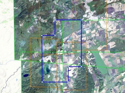
The examination was carried out in two areas located on the right bank of the Uryush river, the Republic of Bashkortostan. For the research materials of space imagery obtained at different times were used.

Were selected images obtained by the American space shooting systems QuickBird-2, WorldView-1, WorldView-2 and Ikonos, with a resolution of 0.5 - 0.9 m.

Multi-temporal space images were selected based on the date of work performed at the sites - November 2010. In principle, 3 images were selected by November 2010 (obtained in 2003-07-24, 2009-06-15, 2010-07-25) and after that date (received in 2011-06-21, 2012-03-02, 2013-03-29).

1) For the first district required to prove the appearance of real estate.

2) In the second district, it was necessary to obtain documentary evidence of the work performed, which was deforestation, cutting of shrubs and light forest along the roads.

04

Result

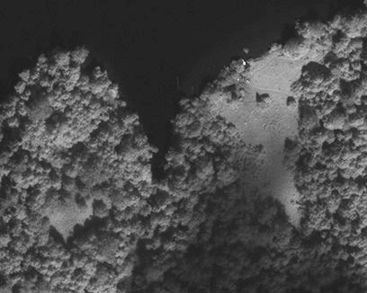
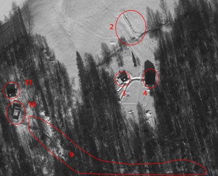
1) As a result of a comprehensive analysis of space images, a conclusion was made about the gradual emergence of objects of anthropogenic origin. (In Figure 1–2009, in Figure 2 – 2013).

2) As a result of the analysis of the materials, experts concluded that new objects and a new forest road appeared. Decreases of woody vegetation (felling) at the borders of roads were not found.

Figure 1 – 2009 year
Figure 2 – 2013 year

Need satellite imagery or help choosing the right data?

Describe your task, area of interest, and desired outcome. We will check data availability, assess new acquisition options, and propose the optimal solution in terms of timelines, cost, and quality.
clients who trust us
25+ years in the geodata market
Request a call back
Back to page top
Мы используем Яндекс.Метрика и собственные Сookies для обеспечения наилучшего опыта работы на нашем сайте, персонализации сайта для наших пользователей и аналитики. Продолжая использовать сайт вы соглашаетесь с условиями Пользовательского соглашения.