Sat-Sun: Non-working days
Customer
Oil and gas company
Project's objective
Creation of a digital terrain model (DMM) and creation of a digital topographic plan (DTP) at a scale of 1:5000 with the use of satellite stereo images on the territory of interest, for performing planned work on underwater crossings of main pipelines and cable communication lines.
Work description
Types of work performed when constructing a digital terrain model and a 1:5000 scale topographic plan using space stereo images:
1. Selection and ordering of space stereo images that meet the conditions of the TS, control of the received data.
2. Photogrammetric processing of stereo images using reference points received from the customer.
3. Performing stereo vectorization of the terrain.
4. Creating a DEM as a TIN model. Export, convert, and reproject data.
5. Creating digital orthophoto of the area.
6. Performing off-site decryption of objects using digital orthophotoplans.
7. Creating a digital topographic plan, monitoring the work performed.
Results
1) Coverage analysis. Data selection, according to the survey parameters specified in the terms of reference. Order of the original data. Acquisition of space stereo images, verification and transmission for photogrammetric processing.
2) Photogrammetric processing of space stereo images. Performing a full cycle of photogrammetric processing using outlines and catalogs of reference points in the conditional coordinate system and WGS84.
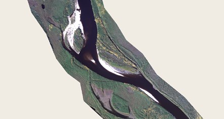
Fig. 1 Fragment of the orthophotoplane
3) Creating a digital model of the terrain and horizontals was carried out in stereo mode with the help of anaglyphic and frame-by-frame glasses.
The arrangement of structural and regular pickets was carried out. The height of the pickets and horizontals corresponds to the height of the earth's surface in the Baltic Elevation System. Horizontal lines were created based on the received pickets. The horizontal lines were adjusted in stereo mode (the height difference in stereo mode) and for hydrographic objects.
4) Creating a TIN model in the working coordinate system was implemented using edited horizontals (isolines) and pickets. When creating the TIN surface model, the elements of the drawing of the underwater part of hydrographic objects received from the customer were considered.
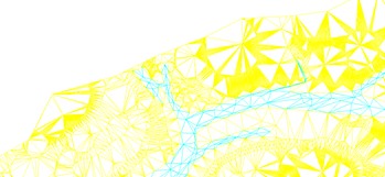
Fig. 2 DEM fragment
5) The creation of orthophotoplanes was performed using reference points, DEM, obtained as a result of stereo vectorization. Orthophotoplanes were divided into individual sections, according to the divisions on the sheets corresponding to the plan of the customer, passed the stage of radiometric color correction and cropping along the border of the work. Was passed for the creation of digital topographic maps in geotiff format.
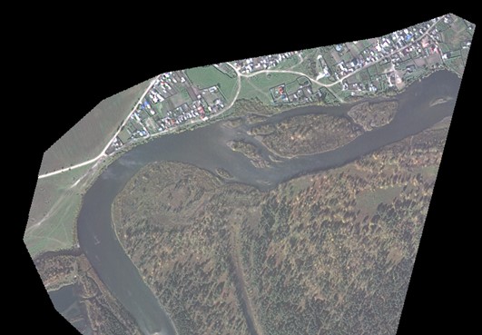
Fig. 3 fragment of the orthophotoplane
6.) Cameral decoding of objects was performed using orthophotoplans obtained as a result of photogrammetric processing and passed the control of the accuracy of the position of objects, using reference and control points. During the work on cameral decoding, the main vector layers (point, areal, linear) were determined to create a digital topographic plan at a scale of 1:5000. The plan displayed: hydrographic objects; soils, microforms of the earth's surface; road network, road structures; municipal and social facilities; power lines and communications; coating; industrial facilities; vegetation; buildings and structures; pipelines, etc.
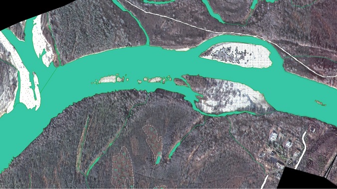
Fig. 4 Hydrography on an orthophotoplane
7) The digitization of vector layers by orthophotoplanes was carried out in the Panorama software version 13.0.4, in the *.sxf format, using the map5000 digital classifier, in the WGS-84 coordinate system. The creation of a digital topographic plan was carried out in accordance with the current regulatory documentation:
- GKINP 02-118 Basic provisions for creating topographic scale plans 1:5000, 1:2000, 1:1000 and 1:500
- GKINP 02-127-80 Manual for editing topographic large-scale maps and plans
- GKINP 45 Guide to updating topographic maps
- Conventional signs for topographic plans of scales 1: 500 - 1:5000. M., Nedra, 1989
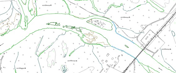
Fig. 5 Fragment of the final topographic plan 1:5000
As a result of the digitization work, several types of quality control of the vector map were performed: topology control, control of filling in the necessary semantic characteristics, control of the metric position of objects.
According to the terms of reference, the final vector map was reprojected from the WGS-84 coordinate system to the conditional coordinate system, and also converted from the *.sxf format to the*. dwg format.
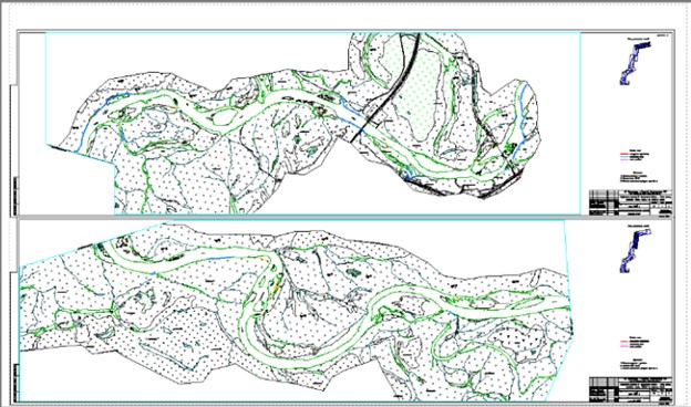
Fig. 6 Fragment of the final orthophotoplane M 1:5000 with a frame design
Having received a digital topographic plan in a conditional coordinate system in the *dwg format, a combination of the created digital terrain model (DMM) and a digital topographic plan (DTP) at a scale of 1:5000 was performed using the AutoCAD Civil 3D 2012 software.

Fig. 7 Fragment of the final DEM in the form of a TIN model
Need for consultation?
Fill the form and we will contact you
