
You can order from us


Prices for services
| Consultation on Photogrammetry | Free of charge |
|---|---|
| Photo Image Retrieval, Preliminary Analysis | Free of charge |
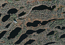
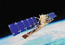
| Order of Remote Sensing Data (RSD) Images |
From 0.5 to 100 USD per 1 km2 depending on the characteristics of the images (archive-new, mono-stereo, resolution)* |
| Stereo Processing of RSD Materials | From 4 USD per 1 km2 |
| Point Cloud Processing | From 15 USD per 1 km2 |
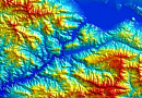
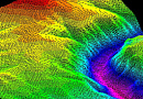
| Creation of Digital Terrain Models (DTM) / Digital Elevation Models (DEM) |
From 8 USD per 1 km2 Individually calculated for each specific order and depends on the amount of processed RSD data, the presence (or absence) of ground control points, and the type of DTM used. |
| Orthophoto or Orthomosaic (Digital Orthophoto Framework Production - DOFP) Cost |
From 1 USD per 1 km2 Individually calculated for each specific order and depends on the amount of processed RSD data, the presence (or absence) of ground control points, and the type of DTM used. |
| Photogrammetry Execution Time |
From 1–2 working days (depends on the volume, complexity category, and availability of archive aerial photography) |
The price of photogrammetry is directly determined by the cost of ordered images and the complexity of the execution (based on the number of images covering the area of interest, the availability of ground control points, and the digital terrain model). It is individually calculated for each customer's order.
The cost of execution is calculated on an individual basis, taking into account a specific of task.
After receiving the task description, we calculate the cost and send you a commercial offer.
Period of execution
Approval of the technical specification for photogrammetry: from 1 to 5 days*Conclusion of photogrammetry contract: from 1 to 5 days
Receipt of images: from 3 days **
Then space image processing: from 3 days
TOTAL: from 3 days **
** working days
** from the date of receipt of 100% advance payment
Estimation of photogrammetry rendering time usually depends on the total area, number of processed materials and their type (mono-stereo) and is calculated individually for each customer.
How to place an order:
Need for consultation?
Fill the form and we will contact you
Stages of service provision
The result of the provision of services
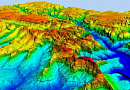
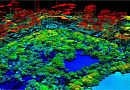
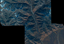
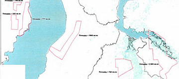
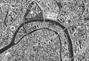
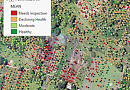
Creating an Intermediate or Final Product from Remote Sensing Data:
- 3D model based on stereoprocessing of materials;
- Obtaining Digital Terrain Model (DTM) or Digital Surface Model (DSM);
- Composing orthophotos or orthophotomosaics.
GEO INNОTER provides the Customer who requested photogrammetric services with the finished product according to the Technical Task on electronic media or through the Internet via FTP servers.
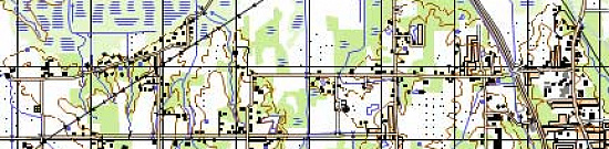
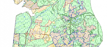
Requirements for Source Data for Photogrammetry:
Accurate coordinates of the area of interest, requirements for Remote Sensing data (resolution on the ground, type, maximum viewing angle, minimum solar angle, maximum allowable cloud cover, period).
| Indicator Name | Scale | ||||||
|---|---|---|---|---|---|---|---|
| 1:500 | 1:1000 | 1:2000 | 1:5000 | 1:10000 | 1:25000 | 1:50000 | |
|
GCP accuracy: - in the plane, m - in height, m |
0.14 0.10 |
0.28 0.10 |
0.56 0.10 |
1.40 0.21 |
2.80 0.21 |
7.00 0.52 |
14.00 1.04 |
|
Contour accuracy: - in the plane, m; - in height, m |
0.35 0.18 |
0.70 0.18 |
1.40 0.18 |
3.50 0.35 |
7.00 0.35 |
17.50 0.88 |
35.00 3.76 |
|
Image resolution on the ground Lм, m |
0.02 |
0,05 |
0,10 |
0,25 |
0,50 |
1,25 |
2,50 |
Related services


Completed projects

Customers


FAQ
- territory of interest (location of the object in any convenient form, and area of the object);
- date or time interval for which archival imagery can be selected or new imagery can be taken;
- survey requirements (angle of the image, sun angle, resolution, type of survey, cloud cover)
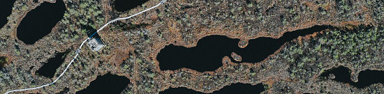
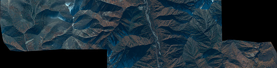
- Objects are studied using a non-contact (remote) method, which is of particular importance in situations where the object is inaccessible or when staying in the object's zone is unsafe for human life.
- The ability to obtain information about the condition of the entire object and its individual parts in a short period, for example, satellite images of the Earth's surface can be obtained within a few days.
- High labor productivity due to the fact that measurements are made not on the objects themselves but on their images.
- Complete objectivity and reliability of measurement results, as images of objects are obtained through imagery means.
- High measurement accuracy, as the imaging of objects is done with precision cameras, and the images are processed using strict methods with the help of precise instruments and electronic digital computers.
Licenses


Warranty
We guarantee 100% quality of services. Cooperating with GEO Innoter specialists, you exclude risks and losses!The availability of qualified personnel with extensive experience and specialized software allows us to ensure timely and high-quality execution of photogrammetric works!
Our partners


")


")

Articles
Sat-Sun: Non-working days