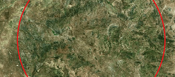
Mineral exploration is the process of finding commercially viable concentrations of minerals to mine. It involves a range of activities aimed at discovering new mineral deposits, evaluating the potential of existing deposits, and determining the feasibility of mining these resources.
Geological exploration for mineral resources (Geological mapping) using Remote Sensing (RS) methods - non-traditional exploration for indirect presence of mineral resources based on satellite, aerial, and UAV sensors in a wide electromagnetic spectrum.
Images are collected either through optical sensors or radar sensors with synthetic aperture. Optical sensors measure spectral data of sunlight reflected from the Earth's surface. Synthetic aperture radar (SAR) sensors can detect electromagnetic data by transmitting microwave radiation and receiving backscattered waves from the Earth's surface.
Remote sensing images are used for indirect exploration of valuable mineral deposits in two key ways:
- Mapping and analyzing the geology, faults, and fractures of the ore deposit.
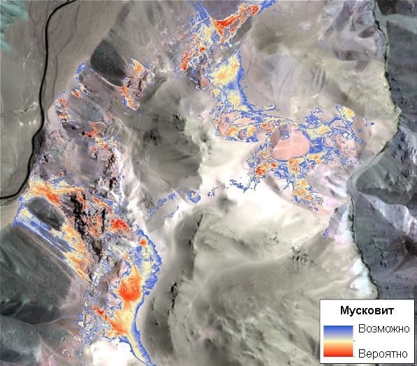
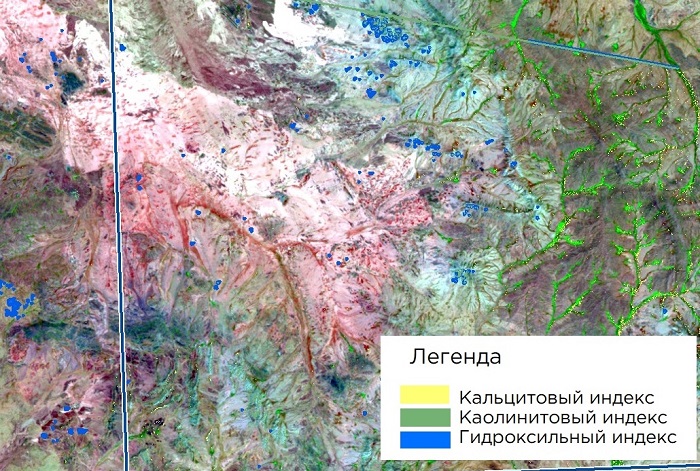
- Identification of hydrothermally altered rocks based on their spectral characteristics.
Mapping hydrothermal alteration minerals and structural lines, for example, using multi-spectral images from satellites like Landsat 8 (or Aster), provides valuable information for mineral exploration. For instance, gold mineralization occurs as quartz veins and stringers associated with hydrothermal alteration halos. Faults are interpreted as pathways for mineralizing fluids, where the interaction between host rocks and hydrothermal fluids causes variations in composition. Detecting these features using RS methods is a key indicator for targeting new prospective areas of orogenic gold mineralization. For example, remote sensing image processing methods such as band combinations, band ratios, and principal component analysis (PCA) have been applied to visible, near-infrared, and short-wave infrared ranges from Landsat 8 satellite.

You can order from us
Prices for services
| Consultation | Free |
|---|---|
| Selection of Images, Preliminary Analysis, and Technical Task Compilation | Free |
| Ordering of Images |
The cost of remote sensing materials is calculated individually for each order and may vary: - Using free satellite images - and/or using commercial satellite images* |
| Work of Technical Specialists and Expert(s) | From 10,000 USD |
| TOTAL COST | From 10,000 USD |
* - if the Client does not provide their own materials, or it is not possible to use free images.
The cost depends on various factors, including:
- Area of interest (region);
- Type of imagery - archive / new, free images / paid;
- Number of images;
- Quality characteristics of the images;
- Complexity of the terrain;
- Seasonality;
- Advance payment size;
- Required computational power;
- Geological complexity of the area;
- Whether materials need to be purchased or provided by the Client;
- And more.
The cost of execution is calculated on an individual basis, taking into account a specific of task.
After receiving the task description, we calculate the cost and send you a commercial offer.
Period of execution
The completion timeframe for geological exploration of mineral deposits is 20 working days from the date of receiving the advance payment. However, it is important to note that the actual timeframe for providing the service will be determined individually for each customer based on specific project requirements and needs. The service completion timeframe depends on several factors, including:- Total area of the area of interest;
- Availability of archived remote sensing materials and the need for new imaging;
- Requirements for remote sensing materials and the final product.
How to place an order:
Need for consultation?
Fill the form and we will contact you
Stages of service provision
The result of the provision of services
Our team, during project execution, relies on a comprehensive interpretation of both medium and high-resolution satellite images, thematic maps of the area's structure, and classical representations of the region's geology described in the literature. This approach helps achieve the best results, which will be taken into account in the search for deposits during subsequent field verification.
Using structural (lineament) and spectral analysis, we perform the following:
-
Cartography of linear, curvilinear, and circular structures that are potentially ore-hosting or ore-conducting channels.
-
Detection of contrasting geological formations (including based on machine learning classification).
-
Precise delineation of geological bodies outcropping on the surface and located under Quaternary deposits.
-
Tectonic zoning of the territory.
-
Refinement or optimization of the drilling plan, including existing ones.
-
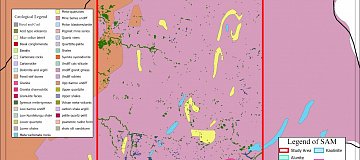
Geological and geomorphological mapping of the region.
The Customer receives a geological map indicating the areas for field exploration, which are close to achieving success.
The maps are provided in PDF, GeoTIFF, and contour lines (shp format).
In addition, geologists are involved in on-site laboratory studies and major geophysical work.
Requirements for source data
Accurate geographic coordinates of the object in the required coordinate system (specialists of GEO INNOTER will refine the coordinates provided by the Customer in any convenient form).
A set of optical, infrared (near and thermal), and radar images.
All available geological maps of the search area.
Software:
- GIS - QGIS, ArcGIS, etc.
- Processing - ERDAS, ENVI SARscape, SNAP, etc.
Related services


Completed projects

Customers
FAQ
- The algorithm of the remote sensing method in most cases is constructed as follows:
- Reference objects of similar deposits or mineral deposits close to the area of study (gold, diamonds, platinum, copper, etc.) are selected in geological funds.
- On the selected objects study the features of multispectral, radar, hyperspectral and geophysical surveys and identify patterns, create spectral signatures of reference objects.
- They create a data bank of spectral signatures and identify features that are used later as search criteria.
- Using these search attributes, an analysis is performed on all images of the electromagnetic spectrum for a given area.
- Comprehensive analysis helps to identify a promising area and structure for further mineral prospecting.
Licenses
Warranty
Guaranteed to be carried out in accordance with SNIP, GOST and SP., in accordance with advanced methods and the use of the most modern software.We guarantee 100% quality of services. Cooperating with GEO Innoter specialists, you exclude risks and losses.
The availability of qualified personnel able to work with specialized software and many years of experience allows us to provide these guarantees!


