Contact

Inspection of the Linear Sections of Main Gas Pipelines

01

About the project

Aerial and space-based monitoring of violations within protection zones and minimum clearance zones from the centerlines of operating main gas pipelines and branches leading to gas distribution stations

Industry Oil and gas
End date 05/05/2022
02

Project goal

Inspection of the main sections of trunk gas pipelines using space-based technology. Aerospace monitoring of violations within protection zones and minimum clearance zones from the axes of operating trunk gas pipelines.

03

Completed works

  • collection of as-built documentation data;
  • collection of data on the spatial location of objects;
  • production of orthophotos based on very-high-resolution satellite imagery acquired by WorldView-3 over the areas where the objects specified in the Terms of Reference are located, including their protection zones and minimum-distance zones. The orthophotos were created in UTM WGS-84 and local coordinate systems (MSK). Their horizontal accuracy corresponds to a map scale of 1:5,000;
  • acquisition of data from the State Real Estate Cadastre in XML format;
  • creation of a unified geospatial database;
  • identification of areas with violations;
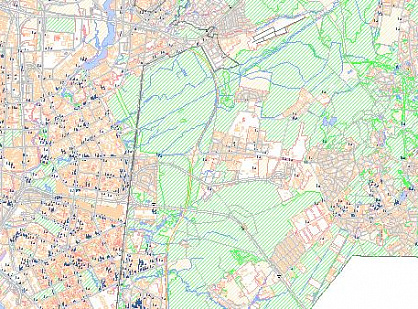
  • information on the identified areas with violations was compiled into an orthophoto map, including data on gas transportation facilities, protection zones and minimum-distance zones, as well as information from the State Real Estate Cadastre; the purpose of objects and/or land plots, address information, cadastral addresses, boundaries of objects and/or land plots, and ownership information were also included.
  • cartograms were prepared showing the spatial location of gas transportation facilities, protection zones, and minimum-distance zones for submission to municipal and city administrations.
04

Result

Information regarding identified violations of the protection zones and minimum clearance zones for main gas pipelines, branch gas pipelines, compressor stations, and gas distribution stations has been prepared and submitted. Information has been plotted on the cadastral maps of the territories regarding the spatial location of main gas pipelines, branch gas pipelines, gas distribution stations, and valve distribution sites, as well as their protection zones and minimum distance zones.

Need satellite imagery or help choosing the right data?

Describe your task, area of interest, and desired outcome. We will check data availability, assess new acquisition options, and propose the optimal solution in terms of timelines, cost, and quality.
clients who trust us
25+ years in the geodata market
Request a call back
Back to page top
Мы используем Яндекс.Метрика и собственные Сookies для обеспечения наилучшего опыта работы на нашем сайте, персонализации сайта для наших пользователей и аналитики. Продолжая использовать сайт вы соглашаетесь с условиями Пользовательского соглашения.