Computer simulation of flooding permits to take effective measures to prevent infrastructure and economic damage caused by the consequences of the flooding.
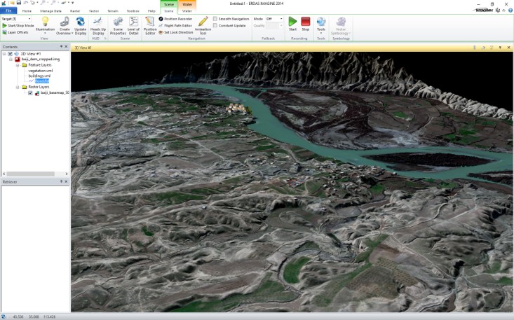
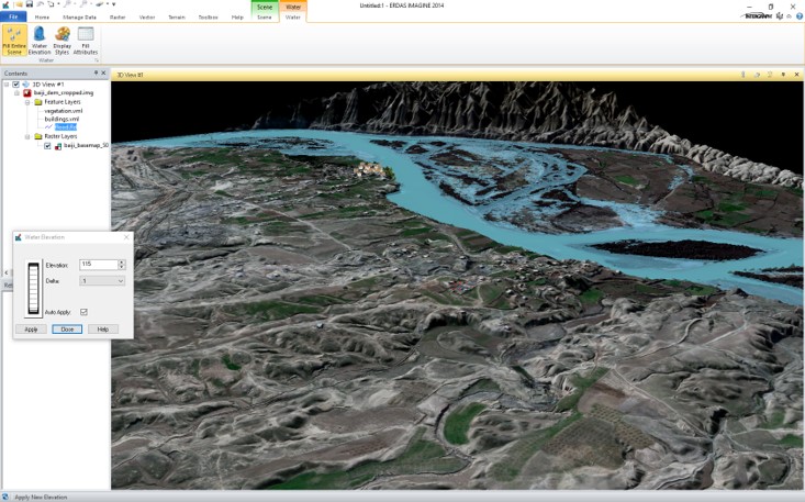
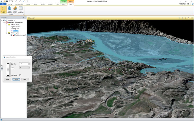
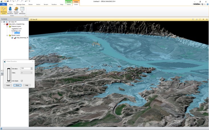
Since flooding is dangerous natural phenomena, it might cause harmful effects, such as loss of life, damage to buildings, bridges, sewerage systems, roadways, power system. GIS methods and remote sensing data is a helpfil tool for rlood safety planning. It can be used for observation, mapping, hydrologic model analysis, long-term land use planning (including construction of dams, weirs, detention basins).
For cost calculation or consultations contact by the phone: +7 495 245-04-24 or send us an e-mail to: innoter@innoter.com