Satellite Imagery evidence in legal proceedings is a procedural action that involves conducting investigations and providing expert opinions on issues that require the use of satellite and/or aerial photographs and specialized knowledge. It is requested by the authority or individual authorized to appoint forensic expertise, in order to establish facts that need to be proven in a specific case.
The basis for conducting forensic expertise is a ruling or decision of the authority or individual authorized to appoint forensic expertise.
The use of satellite imagery and aerial images, which provide information about the present and the past, georeferenced in space and time, is a relatively new and indispensable method of evidence presentation in judicial practice. These images are valuable for proper verification, investigation of crimes, and presentation of cases in court. Traditional forensic examinations involve the detection, identification, collection, and cataloging of physical evidence for presentation in court, and Earth remote sensing data serves as evidential elements in a wide range of legal proceedings.
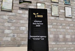
Geo Innoter LTD was recognized as the Best Expert Company in the field of forensic examination based on satellite and aerial imagery data for the year 2021 (Judicial and Expert Chamber of the Russian Federation, dated April 22, 2022).

You can order from us
Prices for services
| Consultation | Free of charge |
|---|---|
| Image search, preliminary analysis | Free of charge |
| Image order | From $300 to $600 per image (a minimum of two images is required)* |
| Work of technical specialists and experts | From 15,000 rubles |
| TOTAL COST | From 15,000 rubles |
* - free of charge if the Client provides their own materials or if free images can be used.
The price of conducting a forensic expertise depends on the cost of the ordered images and the complexity of the work (including the number of images over the area of interest, the terrain relief, the overall volume, the number and complexity of the questions posed), and is calculated individually for each client.
The cost of execution is calculated on an individual basis, taking into account a specific of task.
After receiving the task description, we calculate the cost and send you a commercial offer.
Period of execution
The deadline for completing the work is 3 (three) business days from the date of receiving a 100% advance payment.
The timeline for conducting a forensic expertise depends on the complexity of the work and is calculated individually for each client.
How to place an order:
Need for consultation?
Fill the form and we will contact you
Stages of service provision
The result of the provision of services
GEO INNOTER provides the person who appointed the judicial expertise with an expert conclusion - a written document (geodynamic study) reflecting the course and results of the conducted research using space or aerial imagery. The result of the research consists of conclusions on the questions posed to the expert. The provided written document by GEO INNOTER LTD holds evidentiary force in court.
In summary, the outcome of the work includes a set of documents and materials related to the expertise:
- Expert conclusion with the expert's signature and the organization's seal;
- Certificate confirming the absence of changes in the remote sensing material (metadata verification and anomaly detection due to machine or manual alterations);
- Copies of the license authorizing the organization to conduct such work;
- Copy of the expert's diploma;
- Space and aerial images, maps, and other materials, if they were separately acquired by the client and/or provided by the client to LTD "GEO INNOTER".
Requirements for the Source Data
- Accurate geographic coordinates of the object in the required coordinate system (GEO INNOTER specialists will clarify the coordinates provided by the client in any convenient form).
- Images that correspond to the research questions based on criteria such as the time of capture, spatial resolution, and availability of the required spectral channels, with an initial georeferencing using RPC.
- Orthorectified images (georeferenced on the ground) with the required accuracy.
Related services


Customers
FAQ
- Question to be investigated using satellite images evidence;
- Area of interest (location / coordinates of the object in any convenient format, and the object's area);
- Date or time interval.
- Identification phase.
- Preservation phase.
- Collection stage.
- Verification phase.
- Analysis phase.
- Presentation phase.
Licenses
Warranty
We guarantee 100% quality of service provision. By collaborating with GEO Innoter specialists, you eliminate risks and losses!We ensure that the work is carried out in accordance with the following requirements:
Federal Law dated May 31, 2001, No. 73-FZ "On State Judicial and Expert Activities"
Order of the Ministry of Justice of the Russian Federation dated December 20, 2002, No. 346 "On Approval of Methodological Recommendations for Conducting Judicial Expertise in State Judicial Expert Institutions of the Ministry of Justice of the Russian Federation."
The presence of experienced qualified personnel who are skilled in working with specialized software is the solid foundation of our guarantees!


