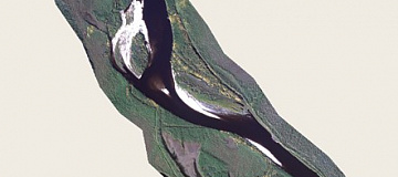
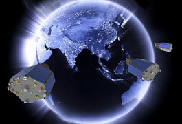
Satellite imagery / Satellite data - one of the methods of remote sensing of the Earth surface by means of spacecraft located in orbit and allowing obtaining images of the terrain in visible, infrared and radio bands of the spectrum with specified parameters and characteristics. 

Remote sensing of the Earth - observations and measurements of natural and reflected radiation of land, ocean and atmosphere of the Earth in different ranges of electromagnetic waves by means of specialized equipment installed on spacecraft and other aircrafts for the purpose of detecting changes, location and temporal variability of natural phenomena, Earth objects, the environment and anthropogenic objects.
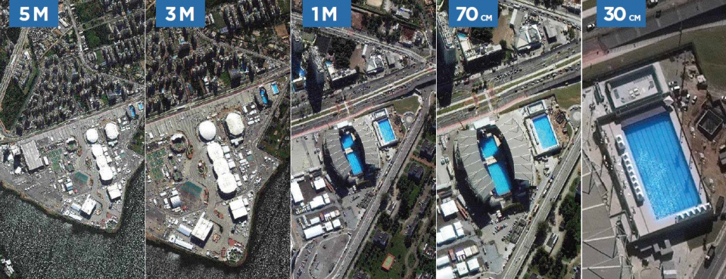
Satellite imagery / Satellite data is the most efficient and cost-effective way to obtain spatial data. Modern space images have high measuring and imaging properties and are presented in digital form. The spatial resolution of space images reaches 30 cm and the accuracy of orbital positioning is 2.5 m, which enables to solve various tasks of the state, science and business. Read more about the extra-high resolution images here.

New and archived space imagery is ordered through authorized partners of space imagery operators.

GEO Innoter is the leader in the CIS and Eastern Europe in processing of aerial
and space images processing and creation of derivative products. It has been repeatedly recognized the best partner of the world leading RS satellites operators.

Space imagery - an objective and independent information source! 

Space imagery allows: 

  • analyze socio-economic development of territories; 
  • to track the dynamics of changes in the area
  • acquisition of information regardless of the object of interest location 
  • use both archived and fresh information; 
  • detect objects and events with high accuracy;

Работник
The purpose and tasks of satellite imagery / satellite data
The purpose of space imagery is to promptly obtain up-to-date geometric and semantic information about the terrain required to solve numerous tasks in various fields of activity, the main of which are:

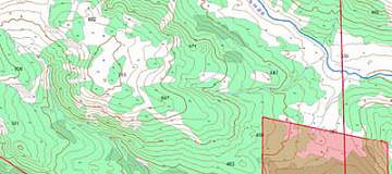
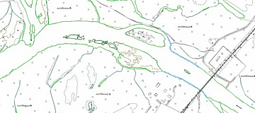
creation and updating of topographic maps and plans, as well as other cartographic products;
creation of engineering-topographic maps during engineering and geodesic surveys;
creation of remote basis of geological maps;
assessment of the situation on the ground for a certain period of time including dynamics of changes;
monitoring of changes on the ground in the time lag mode from 30 minutes;
business intelligence;
expertise on the basis of space images as evidence in court;
creating engineering and geological maps in geological surveys
execution of land surveying and cadastre works;
creation of digital terrain models for planning and development of telecommunications networks;
agricultural research, identification of plant diseases, determining the phase of vegetation;
conducting industrial and environmental monitoring.
administrative-territorial management, creation and maintenance of urban and land cadastre.
monitoring of emergency situations and their consequences, control of the course of emergency and recovery works;
and many other tasks.
Benefits of Using Space Imagery Data
Super-high resolution and high resolution space imagery data can be acquired more expeditiously as they may already be in the operator's archives and the new imagery does not require any coordination with the state agencies. The area of this image is much larger than that of an airborne or UAV image.

Satellite imagery / satellite data received from an airplane or a UAV has high visual informative capacity and excellent measurement properties, but requires longer time for surveying, as it requires time for coordinating permission for flight, movement of aircraft (UAV with operators) to the survey area and higher (multiples) cost of data per 1 km2.

Another indisputable advantage of space imagery is its objectivity (the human factor is minimized).

The image of the Earth is constantly changing and any map is gradually aging. Space images contain up-to-date and reliable terrain data and are successfully used for updating maps not only at small, but at large scales as well. They allow correcting maps of large territories of the world. Space imagery is especially efficient in hard-to-reach areas where fieldwork is very labor- and cost-consuming.

Types of spatial resolution of satellite images:
  • Very low (worse than 100 m).
  • Low (15-100 m).
  • Medium (5-15 m).
  • High (1-2.5 m).
  • Extra high (0.3-1 m)
At the moment there is no unified classification of spatial resolution types. An actual visual comparison of the spatial resolution of aerial images is given below.
Сравнение пространственного разрешения

Prices for services

Consultation free 
Imagery selection, preliminary analysis free 
Ordering space imagery Buy space imagery from $0.1 to $200 per 1 km2 depending on the survey (archive-new, mono-stereo, spatial resolution, panchromatic / multispectral / hyperspectral imagery ) *
Period of performance From 5 working days (depends on volume, category of complexity, availability of archived images)

* - Free of charge, if the customer provides his own materials, or it is possible to use free images.

The cost of execution is calculated on an individual basis, taking into account a specific of task.

After receiving the task description, we calculate the cost and send you a commercial offer.

Period of execution

Duration of work is from 5 (five) working days and is calculated individually for each customer.

The term of work performance depends on the total shooting area, the number of images to be processed and their type (mono-stereo) and is calculated individually for each customer.

How to place an order:

STEP 1: Leave an application on the site stating:
  • description of the task requiring application of space imagery materials;
  • location of the object of interest (coordinates, name of district, region, shp-file, etc.)
  • imaging period requirements (period, during which the archived data can be used or a new imaging is required);
  • requirements to survey quality (mono-stereo, image angles, terrain resolution, cloud cover, sun angle, panchromatic or multispectral survey, etc.).


STEP 2: Agreeing on the terms of reference and cost:
  • cost of work - the price is negotiated on a case-by-case basis;
  • Photographs are paid for separately (from $ 0.1 to $ 200 per 1 km2 depending on the survey (archive-new, mono-stereo, resolution).


STEP #3: Sign a contract and get to work
Deadline of 5 working days from the date of receipt of 100% advance payment for satellite imagery materials - payment by bank transfer only. The rest payment after implementation.

We work with individuals and legal entities, private entrepreneurs, state and municipal authorities, foreign customers, etc.).

Need for consultation?

Fill the form and we will contact you

By clicking the «Send» button, you give your consent to the processing of your personal data, in accordance with Federal Law No. 152-FZ of July 27, 2006 «On Personal Data», on the conditions and for the purposes specified in the Consent to the processing of personal data.

Stages of service provision

Stage № 0 (before the conclusion of the contract):
  • Approval of the task requiring the use of satellite imagery materials;
  • Assessment of technical feasibility of solving the Customer's task through application of remote sensing methods;
  • Determination of the dates and parameters of the survey of interest (survey period, survey type, etc.);
  • Verification of availability of archived space imagery materials for the area of interest;
  • Verification of the selected archive images for compliance with the Customer's requirements;
  • Execution of a request to the operator(s) for new or speculative imagery (if necessary).

RESULT: possibility (YES/NO) to provide the service

Stage #1 (BEFORE the contract):
  • Coordination with the customer of the space imagery data available in the operators' archives;
  • Agreement with the customer, if necessary, the spacecraft from which the new or speculative survey will be performed, the terms and parameters of the new survey;
  • Final determination of labor and material costs, coordination of delivery terms and cost.

RESULT: a signed contract.

Stage 2 (Execution of the contract):
  • Receipt of 100% advance payment;
  • Ordering of space imagery materials;
  • Incoming space imagery quality control;
  • Processing of space images with the help of specialized software;
  • Drawing up a report and other documents, the list of which is specified in the contract.

RESULT: The results of the completed work are sent to the customer electronically in the formats agreed upon with him in advance according to the terms of reference.

The result of the provision of services

Creation of the final product based on space imagery materials:

archived space imagery of different kinds: black and white, color, multispectral, synthesized;
materials of new space imagery of different types;
Space radar imagery materials.
GEO INNOTER delivers the end products to the customer, requesting the space imagery materials, in accordance with the Technical Assignment on electronic media or via the Internet via FTP-server.

Requirements to raw data
Exact coordinates of the area of interest, requirements to the space imagery materials (ground resolution, imagery type, maximum image angle, minimum sun angle, maximum permissible cloud cover percentage, imagery period).

If there is no possibility to provide the above information, provide information for what purposes the remote sensing data is to be used, and the specialists of LLC "GEO INNOTER" will analyze the requirements and offer the best option to solve the problem.

Related services

Digital orthoimagery (Orthorectification)
Find out the price
Satellite Imagery as evidence in legal proceedings
Find out the price
Remote sensing imagery Interpretation & spectral analysis
Find out the price
LIDAR Aerial Survey
LIDAR Aerial Survey
Find out the price
Photogrammetric processing (Image Processing)
Find out the price
Nighttime Satellite Imagery
Find out the price
Zazulyak Evgeny Leonidovich
The material was checked by an expert
Zazulyak Evgeny Leonidovich
Engineer, 28 years of experience, Education - Moscow Topographic Polytechnic Technical School, St. Petersburg Higher Military Topographic Command School named after Army General A.I. Antonov, Military Engineering University named after V.V. Kuibyshev. Kuibyshev Military Engineering University.

Customers

FAQ

The problem to be solved using space imagery;
area of interest (location / coordinates of the object in any convenient form, and the area of the object);
date or time interval for which the archived imagery can be picked up or a new imagery can be performed;
imaging requirements (image angle, sun angle, spatial resolution, type of imaging, cloud cover, permissibility of snow cover)
As a rule, the minimum ordering area for archived space imagery is 25 km2, and for new space imagery - 100 km2.

The minimum order strip width (distance between two nearest points) can be from 2 to 5 km depending on the spacecraft operator, imaging mode and product.
  • For new imagery: if the area of work is known in advance, but there are no images with the required parameters in the archives of spacecraft operators and the allowed time interval for new imagery is long enough to complete it in standard mode (without extra charge for acceleration and priority), there is an option of speculative imagery - that is de facto new imagery, but without obligations to buy out. Since archived remote sensing materials are cheaper than ordering new imagery, as soon as the speculative imagery is archived, it can be purchased at a reduced price. After 60 days the price is usually further reduced.
  • For new and archived imagery: If the area of interest is a set of separate unconnected polygons, each smaller than the minimum order area (25 km2 for archival imagery or 100 sq.km. (see point 1)), it is reasonable to combine them into polygons, each larger than the minimum order area to reduce the total cost.
The time of work performance depends on the area of the territory, requirements to the parameters of the survey. Minimal term of work execution is from 4 hours. Standard delivery time - 5 working days
100% prepayment on the bill for remote sensing materials after signing the contract, the rest of the payment after the execution of works.
YES. We work with individuals and legal entities, individual entrepreneurs, state and municipal authorities, foreign customers, etc.
The main criteria of orthophoto suitability are spatial resolution, accuracy of objects georeferencing, etc. The main criteria of orthophoto suitability are spatial resolution, accuracy of objects georeferencing, etc. For more details see here
The resolution of satellite photos varies depending on the instrument and the orbital altitude of the satellite. For example, the Landsat project captured images of the Earth's surface with a resolution of 30 m, but most of these images have not yet been processed. Commercial QuickBird series satellites by DigitalGlobe have the highest resolution to date - 60 cm, i.e. they allow identification of objects on the Earth surface smaller than half a meter. Satellite imagery is often supplemented by aerialimagery, which allows to obtain a higher resolution, but has a higher unit cost (expressed in expenditures of monetary units per m²). Also satellite images can be combined with ready vector or raster images in GIS-systems (provided that perspective distortions are eliminated on the images and they are appropriately aligned and scaled).
The first satellite imagery from space was taken on October 24, 1946 from the V-2 rocket (USA), but it is believed that the era of space imagery began in 1972 when the first Landsat satellite was launched. During almost 50 years of its history space imagery has changed beyond recognition: the film was replaced with digital media, the spatial resolution improved from 1000 m to 0.3 m and the number of possible spectral channels increased from 1 to 256. In 1977, the KH-11 reconnaissance program produced the first "real-time" image. The first space images of high spatial resolution were obtained in the 1980s. Such imaging systems were on military satellites, were created specifically for intelligence purposes and supplied data for mapping enemy territories during the Cold War. The Soviet Kometa satellites had a KVR-1000 camera, which allowed taking detailed images with a spatial resolution of 2 m.
Satellite imagery is carried out by different methods. According to the nature of coverage of the Earth's surface by space images, the following surveys can be distinguished:

  • single imagery;
  • route;
  • targeted;;
  • global imagery.


Single (selective) imagery is performed by cosmonauts with handheld cameras. The images are usually perspective with significant tilt angles.

Routine imaging of the Earth's surface is done along the satellite's flight path. The width of the imaging strip depends on the flight altitude and the viewing angle of the imaging system.

Targeted (selective) imaging is intended for obtaining images of specially specified areas of the earth's surface away from the route.

Global imagery is performed from geostationary and polar-orbiting satellites. Four or five geostationary satellites on the equatorial orbit provide practically uninterrupted obtaining of small-scale survey images of the whole Earth (space patrol) except for the polar caps.
Remote sensing data processing is divided into two stages: preliminary processing and thematic processing. Pre-processing is usually understood as a set of actions (processes) transforming the initial information received by a ground receiving station into some remote sensing products of standard processing levels suitable for archiving and further use. As a rule, preprocessing includes such processes as radiometric correction, geo-referencing and geometric correction of images.
Satellite imagery / satellite data is a type of survey performed by means of spacecraft (SC) from an altitude of more than 150 km, as well as imaging the Earth or other planets by means of satellites.

Advantages of satellite imagery. Flying satellite doesn't experience vibrations and sharp fluctuations, therefore space images can be acquired with higher resolution and image quality than aerial images. Images can be digitized for further computer processing.

Disadvantages of space imagery: The information cannot be automatically processed without preliminary transformations. During space imagery the points are shifted (due to the curvature of the Earth), their value on the edges of the image reaches 1.5 mm. The consistency of scale is disturbed within the image, the difference between the edges and the center of the image may be more than 3%.

The disadvantage of imageryy is its inefficiency, because the container with the film comes down to the Earth no more often than once in several weeks. Therefore imagery space images are rarely used for operational purposes, but represent information of long-term use.
High costs for the creation and deployment of the CS due to the complexity of space technology and the need to launch expensive boosters to reach the working orbit of the spacecraft.

The most popular is medium spatial resolution space imagery. And it is easy to explain, because free images with the highest spatial resolution up to 10 m belong to this type of imagery. All the scientific community actively uses them for a variety of tasks, for example, students use them to study space imagery and processing methods. An important feature of such satellites as Landsat-8 is the availability of a large number of spectral channels, which enables to resolve an extremely diverse range of tasks:


  • Crop condition monitoring.

  • Inventory of agricultural land, creation of land use plans, precision farming.

  • Mineral prospecting.

  • Monitoring of small and medium-sized water bodies.

  • Monitoring of emergencies.

  • Inventory and assessment of forests.

  • Wide range of tasks in environmental protection etc.

Based on medium spatial resolution data it is also possible to create and update topographic maps at 1:100 000 and finer scales. It is the medium spatial resolution data that most popular applications use as a single substrate with space images for the whole territory of the Earth.

  • Creation and updating of topographic and special maps up to 1:25 000 scale.
  • Creation of digital elevation models with 5-10 m elevation accuracy.
  • Inventory and control of oil and gas transportation and production infrastructure construction.
  • Monitoring environmental condition of the territories in the areas of production, processing, transportation of oil and gas and other minerals.
  • Updating the topographic basis for the development of projects of territorial planning schemes of municipal districts and regions of the Russian Federation.
  • Performing forest surveys, forest inventory, regular control of forest use and forest condition monitoring.
  • Agricultural land inventory, crop condition monitoring, weed assessment, crop pests and diseases detection, yield forecasting.
  • Monitoring and forecasting of waterlogging and desertification processes, salinization, karst, erosion, steppe fires, etc.
Space images are acquired from heights above 100 km, i.e. when the carrier is moving outside the atmosphere, in outer space, from rockets, manned spacecrafts and orbital stations, automatic satellites and other spacecrafts.
At present, with the development of modern technology, we can divide the areas of use of space imagery into different types, since the coverage of the earth's surface by satellites is very large.

  • meteorology (study of cloud cover, snow cover, etc.);
  • oceanology (study of currents, bottom, shallow waters, etc.);
  • geology and geomorphology (especially of formations of large extent);
  • studies of glaciers, swamps, deserts, forests;
  • recording cultural lands, natural and economic zoning of areas;
  • creation and updating of small-scale thematic and general geographic maps.

We use data from space imagery every day, whether it is meteorology, with the help of which specialists make weather forecasts for a certain period of time or the creation of all kinds of maps, which have become an integral part of everyone's life.
  • scale;
  • spatial resolution;
  • visibility;
  • spectral characteristics.

These parameters determine the possibilities of interpretation of various objects on space images and the solution of those geological problems, which are expedient to solve with their help.
1. Global, covering the entire planet. The width of the coverage area is more than 10 thousand kilometers, and the territorial coverage is hundreds of millions of square kilometers.

2. Large-region images, reflecting the continents, their parts and large regions - images from meteorological satellites in near-Earth orbits, as well as low and medium resolution images from resource satellites. The swath width varies from Z thousand km with low resolution images to 500 km with middle resolution ones, spatial coverage makes up millions of square km. One image of this type would cover Western Europe, almost the whole of Australia, Central Asia and Tibet.

3. Regional, which depicts regions and their parts, are images from resource and mapping satellites, as well as from manned spacecraft and orbital stations. The most typical coverage is 350 x 350 km2, 180 x 180 km2, and 60 x 60 km2. An image of similar coverage would show a state like Belgium, a small region like Moscow, large megalopolises.

4. Local - images of relatively small area, - satellite images for detailed observation and large-scale mapping with the coverage of 10 x 10 km2. Such an image will show an industrial complex, a large farm, a small town, and for Moscow several images will be required.
Spatial resolution - the size of the smallest detail of the terrain reproduced on the image is determined by the pixel size. That is, for an image with spatial resolution of 1 m a pixel has a size of 1x1 m.
According to the nature of coverage of the Earth's surface by space images, there are several types of space imagery, such as single imageryy, route imageryy, targeting and global imagery: 1) Single (selective) imagery is performed by cosmonauts with handheld cameras. Images are obtained perspective with significant angles of inclination. 2) Routine imaging of the Earth's surface is performed along the orbital flight of the satellite. The width of the imaging swath depends on the flight altitude and the view angle of the imaging system. In order to increase the field of view, a "fan" imaging is practiced - across the flight direction by two or three high resolution imaging systems. 3) Targeted (selective) imaging is intended for obtaining images of specially defined areas of the earth's surface away from the route. 4) Global imagery is carried out from geostationary and polar-orbiting satellites. From 4 to 5 geostationary satellites on the equatorial orbit provide practically continuous small-scale survey images of the whole Earth except for the polar caps.
GEO INNOTER cooperates with all major operators of remote sensing satellites and supplies images from both optical and radar satellites.
Images with different characteristics are available for ordering, from extra-high resolution images with a spatial resolution of 30 cm, to medium resolution overview images for regional scale tasks.
The differences of these images are based on different principles of their formation and, accordingly, on their visual properties. Optical images are close in their visual properties to human perception of the surrounding reality (color, shape, structure, etc.) and are used for a wide range of visual and automated interpretation tasks. Radar images allow to obtain images of earth surface regardless of weather conditions and at any time of the day, but the properties of these images imply specialized knowledge for their interpretation, as well as highly specialized directions of their use (oil films, ice structure, geodynamic monitoring, operational monitoring of emergencies, etc.).
GEO Innoter specialists will be happy to provide samples of different types of data and give advice on the best choice of data for your task. Contact a specialist in the chat on the company's website, or write to innoter@innoter.com. Be sure to include your last name, contact information and the name of your organization
Our company provides such a service, more reference.
Our company provides photogrammetric processing, thematic processing, as well as other services
The satellite imagery are delivered in standard raster formats, the complete delivery set also includes metadata files, and georeferencing files. All standard projection types are also supported.
Upon agreement with the customer, the data can be converted to meet the customer's special requirements
To buy satellite images of high and ultra-high resolution you can place an order on the site and we will contact you!
Satellite imagery refers to visual or non-visual data captured by satellites orbiting the Earth. It is acquired through sensors onboard satellites that capture electromagnetic radiation, providing information about the Earth's surface, atmosphere, and oceans. These images serve diverse applications, including environmental monitoring, agriculture, urban planning, and disaster management.
The resolution of satellite imagery determines the level of detail it can provide. There are three main categories of resolution: spatial, spectral, and temporal. Spatial resolution refers to the size of each pixel on the ground, spectral resolution relates to the number of bands capturing different wavelengths, and temporal resolution indicates how often the satellite revisits a specific location. Higher resolutions enhance the precision of applications such as land cover mapping and change detection.
Common satellite sensors include optical sensors, radar sensors, and thermal infrared sensors. Optical sensors capture visible and infrared light, suitable for applications like land cover classification and vegetation monitoring. Radar sensors operate in various bands, offering all-weather and day-and-night capabilities for applications such as ground deformation monitoring. Thermal infrared sensors measure temperature, supporting applications like urban heat island analysis and environmental studies.
Satellite data contributes to climate monitoring by providing information on various parameters such as sea surface temperatures, atmospheric composition, ice cover, and land surface temperatures. Observing these parameters from space allows scientists to study climate trends, analyze changes over time, and enhance our understanding of climate-related processes.
Satellite imagery plays a crucial role in disaster management by providing real-time information on the extent of damage caused by natural disasters such as hurricanes, floods, and earthquakes. It supports response and recovery efforts by aiding in damage assessment, identifying affected areas, and facilitating the coordination of emergency response activities.
Very Very High-resolution satellite imagery (VVHS) ranges from 0.3 m spatial resolution to 0.5m spatial resolution. Very High-resolution satellite imagery (VHS) ranges from 0.5 m spatial resolution to 1 m spatial resolution. High-resolution satellite imagery (HS) ranges from 1 m spatial resolution to 5 m spatial resolution. Mid-Resolution Imagery ranges from 5 m to 10m spatial resolution.
Atmospheric compensation is a competitive differentiator that makes imagery to be of higher quality than the competition since it reduces haze in images and the effects of aerosols in an image. Less haze leads to higher aesthetics and a more accurate spectral response leads to more accurate feature/change detection.
Corridors must be at least 5km in width in order to be collected. The minimum order size for archive imagery is 100 sq. km while the minimum order size for new imagery is 500 sq. km.
By applying advanced software techniques, GEO Innoter specialists are reducing the number of artifacts and sharpening the visual quality of the imagery so that it is easier to discern the change.
The advancement of high resolution imagery technology has significantly impacted various industries by providing more detailed and accurate visual data. High resolution imagery is essential in fields such as environmental monitoring, urban planning, agriculture, and disaster management. For example, in environmental monitoring, high resolution imagery allows for precise tracking of deforestation, changes in water bodies, and wildlife habitats. Urban planners use high resolution imagery to analyze city landscapes, optimize traffic flow, and design infrastructure projects. In agriculture, high resolution imagery helps farmers monitor crop health, soil conditions, and irrigation systems, leading to better yield and resource management. Additionally, during natural disasters, high resolution imagery is crucial for assessing damage, planning rescue operations, and coordinating relief efforts. Overall, high resolution imagery has become a vital tool across multiple sectors, providing unparalleled detail and insights that drive informed decision-making.
The benefits of using high quality imagery in scientific research are substantial, as high quality imagery provides detailed and precise visual data that is essential for accurate analysis. High quality imagery allows researchers to observe minute details that might be missed with lower resolution images, leading to more accurate and reliable results. For instance, in fields such as astronomy, high quality imagery enables the observation of distant celestial bodies with unprecedented clarity, contributing to discoveries about the universe. In medical research, high quality imagery, such as that from advanced MRI and CT scans, is crucial for diagnosing conditions and understanding human anatomy in detail. Additionally, high quality imagery is vital in environmental science, where it helps track changes in ecosystems, monitor wildlife, and study climate change impacts. Overall, high quality imagery enhances the ability of scientists to conduct thorough and precise research, leading to a better understanding of complex phenomena and driving innovation across various scientific disciplines.
High quality satellite imagery is transforming modern industries by providing detailed and accurate visual data from space, which is essential for various applications. One of the primary benefits of high quality satellite imagery is its ability to cover large and remote areas that are otherwise difficult to access. For instance, in agriculture, high quality satellite imagery is used to monitor crop health, optimize irrigation systems, and predict yields, which helps farmers make data-driven decisions to improve productivity. In urban planning, high quality satellite imagery enables the analysis of city growth, infrastructure development, and traffic patterns, leading to better planning and management. Environmental monitoring also heavily relies on high quality satellite imagery to track changes in land use, deforestation, and the effects of climate change. Additionally, high quality satellite imagery is crucial for disaster response, providing real-time data to assess damage, coordinate relief efforts, and plan recovery strategies. Overall, high quality satellite imagery is an invaluable tool across multiple sectors, enhancing efficiency, accuracy, and decision-making processes.
The key advantages of using high resolution satellite images in various fields are numerous, as these images provide detailed and accurate visual data that enhance analysis and decision-making. High resolution satellite images are particularly valuable in environmental monitoring, where they allow scientists to track deforestation, monitor changes in ecosystems, and observe the impacts of climate change with great precision. In urban planning, high resolution satellite images help planners assess land use, design infrastructure projects, and manage city growth more effectively. Additionally, high resolution satellite images are crucial for disaster response, providing real-time information that aids in assessing damage, coordinating rescue operations, and planning recovery efforts. In agriculture, high resolution satellite images enable farmers to monitor crop health, optimize resource usage, and improve yield predictions. Overall, high resolution satellite images are an essential tool across various sectors, contributing to more informed and effective decision-making and planning by offering unparalleled detail and accuracy.
The integration of high res imagery high resolution technology significantly enhances the accuracy and efficiency of various industries by providing detailed and precise visual data. High res imagery high resolution is particularly beneficial in environmental science, where it allows for meticulous monitoring of changes in ecosystems, deforestation, and wildlife habitats. For instance, researchers rely on high res imagery high resolution to track climate change effects with unprecedented detail. In agriculture, high res imagery high resolution helps farmers analyze crop health, soil conditions, and irrigation systems, leading to better resource management and increased yields. Additionally, urban planners use high res imagery high resolution to design infrastructure projects, assess land use, and optimize traffic flow in growing cities. In disaster management, high res imagery high resolution is crucial for assessing damage, planning rescue operations, and coordinating relief efforts. Overall, high res imagery high resolution technology is a powerful tool that drives more informed and effective decision-making across multiple sectors.
Satelite images are utilized in a wide range of fields, providing numerous benefits for data analysis and decision-making. In environmental monitoring, satelite images are essential for tracking changes in land use, deforestation, and the health of ecosystems. These satelite images allow scientists to observe and analyze environmental changes with a high degree of accuracy. In agriculture, satelite images help farmers monitor crop conditions, manage resources more efficiently, and predict yields. By using satelite images, farmers can make informed decisions that improve productivity and sustainability. Urban planners rely on satelite images to assess city development, plan infrastructure projects, and manage traffic flow. Satelite images provide a comprehensive view of urban areas, facilitating better planning and development strategies. Additionally, in disaster response, satelite images are crucial for assessing damage, planning relief operations, and coordinating recovery efforts. Overall, satelite images offer invaluable insights and data across various sectors, enhancing the effectiveness and precision of decision-making processes.
VHR images, or Very High Resolution images, are satellite images that offer exceptional detail and clarity, significantly improving the capabilities of remote sensing across various industries. VHR images are particularly valuable in urban planning, where they provide detailed views of infrastructure, enabling precise analysis and efficient project planning. In agriculture, VHR images help monitor crop health, identify pest infestations, and manage irrigation systems more effectively. Environmental scientists use VHR images to track changes in ecosystems, observe wildlife habitats, and assess the impact of climate change with greater accuracy. Disaster management also benefits from VHR images, as they allow for rapid assessment of damage, coordination of rescue operations, and planning of recovery efforts. Overall, VHR images enhance the ability to make informed decisions, offering unparalleled detail and accuracy that drive progress and innovation across multiple sectors.
VHR imagery, or Very High Resolution imagery, consists of satellite images that offer exceptional detail and clarity, greatly enhancing the capabilities of remote sensing in various industries. VHR imagery is particularly valuable in urban planning, where it provides detailed views of infrastructure and land use, enabling precise analysis and efficient project planning. In agriculture, VHR imagery helps monitor crop health, identify pest infestations, and manage irrigation systems more effectively. Environmental scientists rely on VHR imagery to track changes in ecosystems, observe wildlife habitats, and assess the impact of climate change with greater accuracy. Disaster management also benefits from VHR imagery, as it allows for rapid assessment of damage, coordination of rescue operations, and planning of recovery efforts. Overall, VHR imagery significantly improves the ability to make informed decisions, offering unparalleled detail and accuracy that drive progress and innovation across multiple sectors.
Very high resolution images are satellite images that offer exceptional detail and clarity, greatly enhancing the capabilities of remote sensing in various industries. Very high resolution images are particularly valuable in urban planning, where they provide detailed views of infrastructure and land use, enabling precise analysis and efficient project planning. In agriculture, very high resolution images help monitor crop health, identify pest infestations, and manage irrigation systems more effectively. Environmental scientists rely on very high resolution images to track changes in ecosystems, observe wildlife habitats, and assess the impact of climate change with greater accuracy. Disaster management also benefits from very high resolution images, as they allow for rapid assessment of damage, coordination of rescue operations, and planning of recovery efforts. Overall, very high resolution images significantly improve the ability to make informed decisions, offering unparalleled detail and accuracy that drive progress and innovation across multiple sectors.
Very high resolution imagery consists of satellite images that offer exceptional detail and clarity, greatly enhancing the capabilities of remote sensing in various industries. Very high resolution imagery is particularly valuable in urban planning, where it provides detailed views of infrastructure and land use, enabling precise analysis and efficient project planning. In agriculture, very high resolution imagery helps monitor crop health, identify pest infestations, and manage irrigation systems more effectively. Environmental scientists rely on very high resolution imagery to track changes in ecosystems, observe wildlife habitats, and assess the impact of climate change with greater accuracy. Disaster management also benefits from very high resolution imagery, as it allows for rapid assessment of damage, coordination of rescue operations, and planning of recovery efforts. Overall, very high resolution imagery significantly improves the ability to make informed decisions, offering unparalleled detail and accuracy that drive progress and innovation across multiple sectors.
High resolution imagery refers to satellite images that offer exceptional detail and clarity, significantly enhancing the capabilities of remote sensing in various industries. High resolution imagery is particularly valuable in urban planning, where it provides detailed views of infrastructure and land use, enabling precise analysis and efficient project planning. In agriculture, high resolution imagery helps monitor crop health, identify pest infestations, and manage irrigation systems more effectively. Environmental scientists rely on high resolution imagery to track changes in ecosystems, observe wildlife habitats, and assess the impact of climate change with greater accuracy. Disaster management also benefits from high resolution imagery, as it allows for rapid assessment of damage, coordination of rescue operations, and planning of recovery efforts. Overall, high resolution imagery significantly improves the ability to make informed decisions, offering unparalleled detail and accuracy that drive progress and innovation across multiple sectors.
High resolution satellite images refer to images captured by satellites that offer exceptional detail and clarity, significantly enhancing the capabilities of remote sensing in various industries. High resolution satellite images are particularly valuable in urban planning, where they provide detailed views of infrastructure and land use, enabling precise analysis and efficient project planning. In agriculture, high resolution satellite images help monitor crop health, identify pest infestations, and manage irrigation systems more effectively. Environmental scientists rely on high resolution satellite images to track changes in ecosystems, observe wildlife habitats, and assess the impact of climate change with greater accuracy. Disaster management also benefits from high resolution satellite images, as they allow for rapid assessment of damage, coordination of rescue operations, and planning of recovery efforts. Overall, high resolution satellite images significantly improve the ability to make informed decisions, offering unparalleled detail and accuracy that drive progress and innovation across multiple sectors.

Licenses

Our partners