Oil exploration is the process of locating and evaluating potential sites for extracting petroleum.
Oil and Gas (Hydrocarbon) Exploration and Prospecting (oil prospecting) using Remote Sensing Methods - auxiliary solutions for exploration work before conducting 3D seismic surveys and drilling wells.
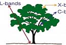
Thanks to the LANDSAT satellite and SAR (Synthetic Aperture Radar) systems, remote sensing methods for oil and gas exploration have been actively developed since the late 1990s. The application of remote sensing in geological exploration for hydrocarbons has proven to be a mandatory (!) tool for operations related to oil and gas processing and extraction. It aids in infrastructure assessment for well planning and regional reconnaissance during exploration. Hydrocarbon exploration can be broadly divided into two classes: hydrocarbon seepage in water and offshore areas and areas focused on hydrocarbon reservoir content.
The relevance of aerial and space methods for geological tasks is increasing every year. This is due to the progressing development of imaging equipment, the availability of high and very high-resolution Earth images from space, and improved software for processing aerial and satellite images, significantly expanding the possibilities of geological interpretation.
To address hydrocarbon prospecting tasks, a combination of both traditional geophysical and geochemical methods and modern aerial and space methods is necessary. A substantial portion of classical tasks related to substance composition diagnostics, geological boundaries determination, and ore potential assessment can be solved using aerial and satellite imagery.
Implementing these innovative methods in the geological prospecting cycle allows reducing the scope of seismic surveys and drilling, thereby significantly reducing time and financial costs (reducing costs up to 5-15 times compared to traditional methods for unexplored areas and up to 3-5 times for previously well-explored areas) while significantly increasing the reliability of prospecting work.
The identification of prospective geological structures using aerial and satellite images is utilized by project and research organizations, construction companies, and institutions in the oil and gas industry, as well as other interested organizations, to enhance the efficiency of hydrocarbon exploration research.
Purpose of Oil and Gas Exploration (Oil prospecting)
Remote sensing methods help complement traditional geological prospecting work in oil and gas exploration by:
- identifying zones of anomalous hydrocarbon seepage;
- detecting increased thermal flow caused by active fluid-thermodynamic processes in reservoirs;
- assessing the dynamic state of the reservoir and the impact of contemporary tectonic movements on it.
Space imagery and visual observation allow the evaluation of the structural features of shelves, identifying large-scale geological structures that may contain (hydrocarbon) gas and oil deposits.
Studying geological structures in basins, especially lineament anomalies, through remote sensing methods, enables us to find a more precise and reliable approach to discovering hydrocarbon deposits formed under the influence of underground geological pressure and plate tectonics.

You can order from us


Objectives and Tasks of Oil and Gas Exploration (Oil prospecting):
Objective of hydrocarbon exploration using remote sensing (RS) methods: Providing reliable evidence and justification for traditional geologists to identify structures of oil and gas deposits (both onshore and offshore) and to pinpoint the locations for drilling exploratory wells.
In both the state and private contexts, the objective is to replenish oil and gas reserves for oil and gas companies.
Tasks of oil and gas exploration:
- Gathering and preliminary processing of multispectral aerospace information;
- Synthesis of rational space photoplans;
- Analysis and investigation of topographic and geological information;
- Comprehensive analysis of aerospace, geological, and topographic information;
- Compilation of space-geological maps.
Performing these tasks reveals zones of anomalous hydrocarbon seepage, identifies increased thermal flow caused by active fluid-thermodynamic processes in deposits, and provides an assessment of the dynamic state of the reservoir.
Advantages of using RS data:
Reliability of results obtained in oil and gas exploration:- Traditional methods ≈ 25%
- Systemic aerospace method ≥ 75%
Significant reduction in total costs for oil and gas exploration areas, from 3-5 to 10-15 times, including a reduction in time spent (aerospace methods are the most expedient).
Remote sensing technologies address existing geological issues in oil and gas exploration, including:
- Studying geomechanical processes using radar interferometry, determining the modern mobility of structures and fault disruptions in sedimentary basins, and their impact on reservoir structure and, consequently, the efficiency of oil and gas field development;
- Studying and analyzing thermodynamic processes using thermal infrared imaging, influencing the migration of hydrocarbons to the Earth's surface and causing contamination of soil and vegetation cover;
- Studying biogeochemical factors using infrared imaging, determining changes in spectral characteristics of soil and vegetation cover under the influence of hydrocarbons;
- In general, low-cost and efficient remote sensing methods provide evidence-based geological information for optimal placement of seismic profiles, exploratory, and production wells.
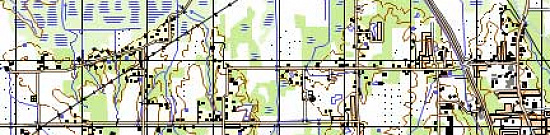
Thematic analysis of aerospace images for identifying oil and gas prospective areas:
The technology used by "GEO INNOTER" for forecast-prospecting works is based on thematic analysis, expert and automated decoding of aerospace images in all spectral ranges, and comprehensive interpretation of geological-geophysical materials. This technology is primarily aimed at refining the structure of oil and gas accumulation zones and identifying the most promising hydrocarbon traps within them by detecting local structures of various types and fault disruptions through structural analysis of images. Additionally, the technology includes the latest developments in spectral analysis of multispectral aerospace images.
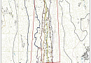
Structural Analysis Method:
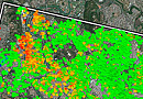
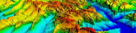
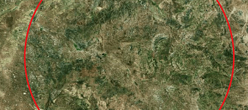
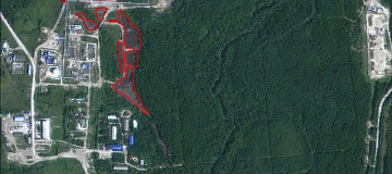
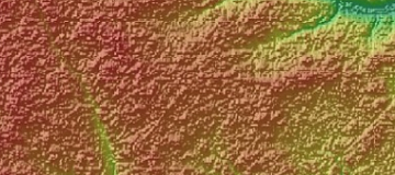
The structural analysis method involves visual decoding of aerospace images, as well as automated extraction of lineaments and circular structures capable of visualizing major tectonic disruptions and activations of varying depths. Materials with different levels of detail are subjected to analysis, allowing for information on the characteristics of these structures in different spectral ranges.
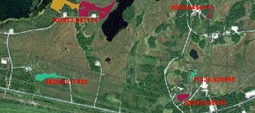
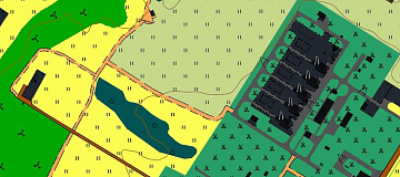
Example of a cosmic structural scheme
Each of these structures undergoes numerous shape recognition procedures, after which it can be determined whether the identified structure is prospective for oil and gas exploration, its depth and thickness of occurrence, as well as its volume and hydrocarbon saturation.
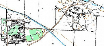
As a result of structural analysis of aerospace images, the following are created:
-
Medium-scale cartographic schemes for forecasting the evaluation of structures with hydrocarbon potential at a scale of 1:100,000;
-
Large-scale plans for forecasting the evaluation of structures with hydrocarbon potential at a scale of 1:10,000.
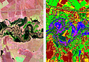
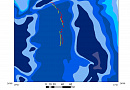
Spectral Analysis Method:
Multispectral data are essential for solving tasks related to both decoding and determining the real composition of rocks. When processing data, statistical processing methods and spectral analysis of images are employed. The degree of absorption and scattering of sunlight by any object is directly related to its wavelength. The spectral image is a measure of interaction between solar radiation and the Earth's surface, and each geological object has its individual reflective characteristic associated with its chemical composition, degree, and temperature of crystallization, and genesis.
The following spectral analysis methods have been studied and used by "GEO INNOTER":
- Principal Component Analysis (PCA);
- Spectral Angle Mapper (SAM);
- Calculation of mineralogical indices (BR).
Composite PC5, PC6, PC4. Violet pixel group indicates the presence of Al (OH) group. Northern Ural
Advantages of the technology:
- Significant reduction in project execution time due to the efficiency of aerospace research.
- Cost reduction by more effectively using geophysical methods based on the results of space research during the exploration stage. This is achieved by identifying a larger number of prospective geological structures and, accordingly, providing a higher assessment of hydrocarbon resources within the licensed areas.
- Increased reliability of obtained results through the integration of aerospace and geologic-geophysical data processing, leading to the discovery of oil and gas fields with fewer wells or the abandonment of drilling in unpromising local elevations.
- Integration with geological exploration to assess environmental protection measures on oil and gas fields, including conducting environmental monitoring.
Implementation mechanism:
Implemented by "GEO INNOTER" LTD:
- Acquisition and processing of aerospace images, thematic analysis of data, and creation of cartographic schemes and plans for forecasting the evaluation of structures with hydrocarbon potential.
Implemented through local partners:
- Field geophysical and geochemical work.
Prices for services
| Consultation | Free of charge |
|---|---|
| Selection of images, preliminary analysis, and technical task preparation | Free of charge |
| Ordering images |
The cost of remote sensing data is calculated individually for each order and may vary: - Using free satellite images - and/or using commercial satellite images* |
| Involvement of technical specialists and experts | From 10,000 USD |
| TOTAL COST | From 10,000 USD |
* - if the Customer does not provide their materials, or it is not possible to use free images.
The cost depends on:
- The area of interest (project location);
- Type of imagery - archive/new, free images/commercial images;
- Number of images;
- Quality characteristics of the images;
- Complexity of the terrain;
- Seasonality;
- Advance payment size;
- Required computing power;
- Geological complexity of the area;
- Whether it is necessary to purchase materials or they are provided by the Customer;
- And other factors.
The cost of execution is calculated on an individual basis, taking into account a specific of task.
After receiving the task description, we calculate the cost and send you a commercial offer.
Period of execution
The completion time is approximately 45 working days from the date of receiving the advance payment and is calculated individually for each customer.
The completion time depends on:
- Total area of the area of interest;
- Availability of archival remote sensing data, need for new imagery;
- Requirements for remote sensing data materials and the final product.
The service completion time varies depending on the complexity of the project and is calculated individually for each customer.
How to place an order:
Need for consultation?
Fill the form and we will contact you
Stages of service provision
The result of the provision of services
The Client receives a geological map indicating areas suitable for field exploration, specifically, for placing seismic and exploratory drilling rigs. Additional maps include lineament vectors and structural diagrams of faults, traps, and horizons in conjunction with remote sensing data from all working ranges of satellite imagery for the specified task.
The Client also receives prospectivity assessment data for the forecasted structures at the C2 level, which will allow them to make decisions regarding further fieldwork.
The analysis materials enable the Client to decide on further work on the investigated licensed areas through remote methods or their purchase.
The maps are provided in PDF, GeoTIFF, and isoline formats (shp).
In addition, geologists are engaged to conduct on-site laboratory research and essential geophysical and geochemical work to confirm the results of remote methods for methane and other associated and indirect elements.
Requirements for Initial Data for Oil and Gas Exploration (Oil prospecting)
To enhance the effectiveness of oil and gas exploration, data with significant density of original landscape and geological information should be used. Such possibilities are provided by spatial information obtained through aerial and space imaging in various electromagnetic spectrum ranges, which characterize the spectral image of objects (including geological) and physical processes occurring on the surface and in the depths of the Earth. This, combined with traditional methods, provides an integrated picture of their condition, composition, and the influence of exogenous and endogenous factors.
For solving tasks related to the search for hydrocarbon deposits, "GEO INNOTER" company plans to use:
-
Accurate geographical coordinates of the object in the required coordinate system (specialists from "GEO INNOTER" will clarify the coordinates provided in any convenient form by the Client).
-
A set of optical satellite images of various spatial resolutions, multispectral and infrared (near and thermal), hyperspectral, and radar images.
-
All available geological maps of the search area.
-
Software:
-
GIS - QGIS, ArcGIS, etc.
-
Processing - ERDAS, ENVI SARscape, SNAP, etc.
Related services


Completed projects

Customers


FAQ
Briefly, but for professionals:
- Collection and preliminary processing of multispectral aerospace and geological information for the search area.
- Evaluation of temperature values obtained from remote and ground-based methods, if such work has been conducted.
- Calculation of physical parameters of local structures.
- Analysis of the results of physical parameters.
- Calculation of physical fields.
- Thematic processing and creation of a multilayer model including lineament vector maps.
- Application of vegetation index.
- Analysis of background conditions to detect anomalies.
- Results of prospectivity assessment of local structures based on the use of relative radiance values.
- Analysis of patterns inherent in geological characteristics of reference oil-bearing deposits and empty structures.
- Assessment of prospectivity of forecasted structures.
Seismic exploration is based on studying the characteristics of elastic wave propagation in the Earth's crust. Elastic vibrations (or seismic waves, as they are also called) are most commonly induced artificially. Seismic waves propagate in rock formations at speeds ranging from 2 to 8 km/s, depending on the density of the rock; the higher the density, the greater the wave propagation speed.
On different stages of the exploration process, a complex of specific activities and research is carried out using modern equipment and tools, including the use of computers and programming, decoding of aerial and satellite images, drilling of wells for various purposes, testing of reservoirs for oil and gas, and other methods.
High efficiency in the search and exploration of oil and gas accumulations is possible only with the conduct of scientifically justified research in specific prospective areas and regions in terms of oil and gas potential, taking into account the general laws of oil and gas formation and distribution in the Earth's crust. When searching for and exploring oil and gas, it is essential to consider economic knowledge, as well as the environment, industrial conditions, and transportation in the areas where exploration activities are planned.
The exploration process for oil and gas includes three consecutive stages: regional, exploration, and development, each of which is subdivided into two phases.
Regional Stage is conducted in unexplored and poorly explored regions or their parts, as well as when searching for hydrocarbon accumulations in deep-seated, poorly studied parts of the section, for example, under rock salt at depths exceeding 4 km, as in the Caspian region.
During the stage of forecasting oil and gas presence, the study of litho-stratigraphic complexes of the deposit section is carried out, structural layers are identified, the main stages of tectonic development of the investigated territory and tectonic zoning are studied. Thus, at this stage, the main features of the geological structure and geological history are established. Then, prospective oil and gas horizons and zones of potential hydrocarbon accumulation are identified. Further, qualitative and quantitative assessments of oil and gas potential are conducted, as well as the selection of main directions and priority objects for further research.
On the next stage of assessing oil and gas accumulation zones, the oil and gas geological zoning is refined, and the largest traps, such as dome structures, with which hydrocarbon accumulation zones may be associated, are identified. Quantitative assessment of hydrocarbon potential is carried out, and areas and priority objects (regional traps) are selected for exploration activities.
Exploration Stage begins when the regional stage is fully completed, and geological justification for exploration activities for oil and gas is done on the identified prospective regional trap. In such traps, a zone of oil and gas accumulation, including a number of oil and gas fields within separate areas - local uplifts or other local traps complicating the regional trap, can be discovered. The exploration stage is divided into two phases, with the first phase further divided into two sub-phases.
The stage of identification and preparation of objects for exploration drilling is divided into sub-phases: 1 - identification of objects, and sub-phase 2 - preparation of objects. During the first sub-phase, conditions and parameters of prospective reservoirs, as well as the most promising local traps (objects, areas), are identified, priority objects are selected, and their preparation for exploration drilling is conducted. For example, if a regional trap is a fold, the largest and well-prepared local structures (anticlines, domes) are selected, among which the order of their preparation for exploration drilling is planned. The most well-prepared structures are those that, according to field geophysical data, are clearly defined in size (length, width, amplitude), configuration, and structural complexities (faults, etc.), if a complex structure is identified.
Large traps cover areas of 50-100 km² and more, medium-sized traps - 10-50 km², small traps - up to 10 km². Priority is given to structures whose resources exceed the average reserves in the region of the deposit. In addition, economic indicators (proximity to deposits, pipelines, distance from deep drilling bases, depth of productive formations, quality of hydrocarbon-bearing rocks, etc.) influence the priority of introducing structures into exploration drilling. During the second sub-phase, detailed studies of identified prospective traps are conducted; objects are selected, and the order of their introduction into exploration drilling is determined; quantitative assessment of hydrocarbon resources on objects prepared for exploration drilling is carried out; and the locations for exploration wells on the prepared objects are selected.
During the exploration stage of the geological exploration process for oil and gas, the main goal is the discovery of hydrocarbon accumulations: either the discovery of a new oil or gas field or the identification of new reservoirs within the explored fields. The tasks to be accomplished at this stage include: identifying productive reservoirs covered by impermeable layers (caprocks), determining reservoir parameters, testing and logging productive horizons and wells, obtaining commercial oil and gas flows, assessing reservoir properties and the physicochemical properties of fluids (oil, gas, condensate, water), estimating the reserves of hydrocarbons in discovered reservoirs, and selecting objects for detailed and evaluative studies.
The development stage is the final stage in the geological exploration process for oil and gas. Exploration is conducted in areas where commercial oil and gas flows have been obtained. The purpose of exploration activities is to assess the discovered oil and gas accumulations and prepare them for development.
The structure of the field is studied, productive reservoirs are identified, and potential oil, gas, condensate, water flow rates, reservoir pressure, and other indicators are determined.
At the first stage of exploration (assessment of fields or reservoirs), the following tasks are carried out: determining the parameters of reservoirs and fields to establish their industrial significance, calculating the reserves of hydrocarbons in reservoirs and fields, selecting objects and stages of exploration, determining the sequence of pilot production and preparing objects for development.
Currently, four main geophysical methods of research are used: seismic, gravimetric, magnetic, and electrical.
Licenses


Warranty
It is guaranteed to carry out works in accordance with SNIP, GOST and SP., in accordance with advanced methods and the use of the most modern software.We guarantee 100% quality of services. Cooperating with GEO Innoter specialists, you exclude risks and losses.
The availability of qualified personnel able to work with specialized software and many years of experience allows us to provide these guarantees!
Our partners


")


")

Articles
Sat-Sun: Non-working days