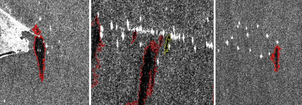
After entering the water, oil (or oil products) typically forms a thin film on the water surface, which is called an oil slick, marine surface slick, or oil sheen. Oil spills can also be present as a thick layer on the water surface in the form of oil-in-water emulsions, which rarely sink to the seabed.
Oil spill detection can spread both horizontally across the water surface and vertically within the water column. Wind and surface water currents are the primary factors responsible for the spread of oil across the water surface. The impact of an oil spill on the environment depends on factors such as the speed and direction of the oil movement, its location relative to human habitats and marine species, and the type and extent of its surface coverage in the ocean.
Monitoring oil spills and oil products(oil spill detection) in water bodies using satellite imaging is a crucial tool for quickly detecting and identifying the sources and locations of oil spills in closed water bodies and marine environments. This information helps in making decisions about effective measures for containment and cleanup.

You can order from us
Prices for services
| Consultation | Free of charge |
|---|---|
| Selection of images, preliminary analysis, and technical task preparation | Free of charge |
| Ordering of radar and optical images |
The cost of Earth remote sensing (ERS) materials is calculated individually for each order and may vary: - Application of free satellite images - And/or application of commercial satellite images* |
| Work of technical specialists and experts | From 300,000 RUB |
| TOTAL COST | From 300,000 RUB |
* - if the customer does not provide their materials or it is not possible to use free images.
The cost depends on:
- Area of the area of interest (work area);
- Type of imaging – archival / new, free images / paid images;
- Number of images;
- Quality characteristics of the images;
- Seasonality of work;
- Advance payment amount;
- Whether it is necessary to purchase materials or the customer provides them;
- And more.
The cost of execution is calculated on an individual basis, taking into account a specific of task.
After receiving the task description, we calculate the cost and send you a commercial offer.
Period of execution
The completion time for the work is 20 working days from the date of receiving the advance payment and is calculated individually for each customer.
The completion time for the work depends on:
- Total area of the area of interest;
- Availability of archival Earth remote sensing materials, need for new imaging;
- Requirements for Earth remote sensing materials and the final product.
The timeframe for providing the service depends on the complexity of the work and is calculated individually for each customer.
How to place an order:
Need for consultation?
Fill the form and we will contact you
Stages of service provision
The result of the provision of services
The Client receives an operational and accurate map of oil spills and an assessment of the environmental condition of the spill area and the surrounding environment.
The maps are provided in PDF, GeoTIFF, and isolines (shp) formats.
Requirements for source data:
Precise geographical coordinates of the object in the required coordinate system (specialists of GEO INNOTER LTD will clarify the coordinates provided by the Client in any convenient form).
Software:
- GIS - QGIS, ArcGIS, etc.
- Processing - ERDAS, ENVI SARscape, SNAP, etc.
Related services


Completed projects

Customers
FAQ
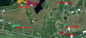
- crude oil;
- fuel oil, diesel fuel, etc.;
- removal of petroleum products with river runoff;
- technological discharges from ships;
- drilling waters and sludge;
- oil exits from griffins on the seabed;
- waste from the fishing industry, stained with petroleum products.
- simple geometric shape;
- edges (smooth border with a larger gradient than, for example, natural slicks (leaks) of natural origin);
- size (too large spots are usually slicks of natural origin, for example, clusters of algae or plankton);
- the geographical location of the spots (mainly oil spills occur in areas of oil production or transportation routes of petroleum products).
Licenses
Warranty
We guarantee the execution of works in accordance with building codes and regulations (SNIP), state standards (GOST), and regulatory documents (SP). We adhere to advanced methodologies and utilize the most modern software for our services.
By collaborating with GEO INNOTER specialists, you can be assured of 100% service quality and eliminate risks and losses.
Our team consists of qualified professionals with extensive experience in working with specialized software, ensuring the fulfillment of these guarantees!
Advantages of partnering with GEO INNOTER:
- Years of experience in the field;
- Direct distribution agreements with space imagery operators;
- Experience in handling projects of any complexity, both from aerial imagery and space imagery;
- Access to modern software for processing the latest remote sensing data;
- Robust server capabilities for processing remote sensing data.
The business mission of GEO INNOTER is to provide cutting-edge and efficient services based on remote sensing data.


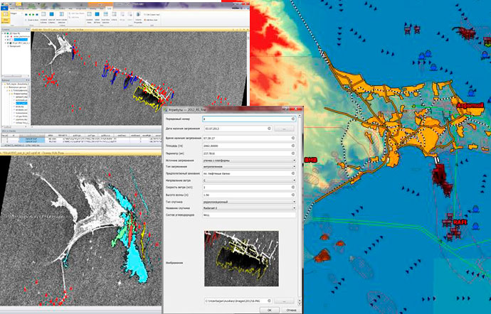
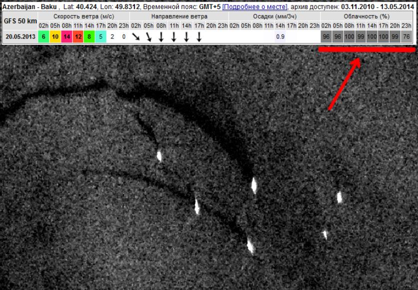 Oil spill in the sea from a platform in the Apsheron Peninsula area. Meteorological data on cloudiness at the time of the image is marked by an arrow. Independence from the time of day (illumination conditions). Radar imaging uses an autonomous source of radiation, allowing obtaining satellite images in the dark. This property, combined with all-weather capabilities, allows for a substantial increase in the amount of extractable information and ensures regular monitoring of the area of interest. Possibility of extracting additional information from satellite images. Besides information about oil contamination, radar images can provide data about the maritime situation at the time of the spill, ice conditions, as well as the extraction of surface wind speed and direction fields at the time of imaging (see figure below), which directly affects the dynamics of the spread of contamination.
 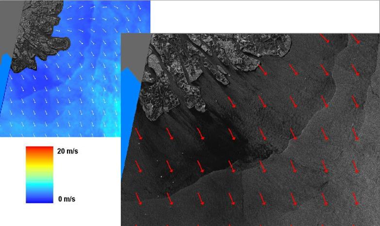 Extraction of the near-surface wind field. Both the direction and speed of the wind are extracted for each of the local areas.