



A digital navigation map with an address layer, orthophotomaps, source images, reference materials, editorial instructions and a technical report.
Search the site
What the service is used for
Terrain currency
Obtaining map products that match the actual state of the terrain as closely as possible.
Thematic enrichment
Adding thematic information to maps according to current technical regulations and the terms of reference.
Road graph
A single dataset on transport infrastructure: motorways, highways, dirt and field roads, driveways inside settlements.
Address layer
Service objects complement the description of roads with reference information.
Navigation
Maps for vehicle and pedestrian movement: roads, interchanges, stops, airports and related service objects.
Did not find your task?
Describe the territory, the digital navigation map scale (creation or update) and the purpose of the work. A specialist will assess the remote sensing archive and the composition.
What you will receive as a result of the work
01
Digital navigation maps
A DNM in the formats, projection, coordinate and height system according to the terms of reference.
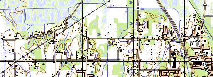
A digital navigation map is a vector thematic map with address information: a road graph and service objects that complement the road description with reference information.
What you get
- creation or update of a digital navigation map with address information
- export of the project to the required formats, projection and coordinate system
- sheet layout by nomenclature sheets or within the mapping territory
Object composition and thematic information are fixed in the terms of reference and the editorial and technical instructions.
02
Orthophotomaps and source imagery
Remote sensing materials: digital orthophotomaps and source images used for the DNM.
Orthophotomaps are needed for interpretation and vectorisation of terrain objects; source images are delivered together with the products.
What you get
- digital orthophotomaps for creating or updating a digital navigation map
- source remote sensing materials
- a set of additional and reference materials used in the work
Availability of a remote sensing archive and the need for a new survey affect the timeline and cost.
03
Editorial instructions and report
Editorial and technical instructions and a technical report on the completed task.
The documents accompany creation and update of a digital navigation map with address information.
What you get
- editorial and technical instructions for creating or updating the DNM
- technical report on the completed task
- delivery on electronic media or via FTP; text materials are also provided in printed form
The need to prepare and approve editorial and technical instructions is confirmed at the source-data stage.
04
Road graph and address layer
A single geoinformation set on transport infrastructure and service objects with reference information.
The road graph is drawn on roads of all categories connecting adjoining roads along the optimal route, including driveways inside settlements.
What you get
- road graph: motorways, improved highways, highways, improved roads, dirt country roads, field roads and streets
- address layer with service objects that complement the road description
- scales 1:10 000 for settlements, 1:25 000 for industrially developed regions, 1:50 000 and 1:100 000 for the entire territory
The road-graph and address-layer composition depends on the scale and the terms of reference.
How the work goes
Cost and timeline
The full cost of one DNM nomenclature sheet consists of remote sensing materials for the orthophotomap, production work, map scale, complexity category and timeline.
- consultation — free of charge
- image selection, preliminary analysis of source materials, additional and reference materials — free of charge
- image ordering — from 0.5 to 70 USD per 1 km² (price table); the order steps state from 8 to 70 USD per 1 km² depending on the survey (archive or new, mono or stereo, resolution)
- digital orthophotomap creation — from 1 USD per 1 km²; calculated individually and depends on the number of remote sensing materials processed, presence or absence of ground control points and the DEM used
- creation of 1 nomenclature sheet of a digital navigation map — from 40 000 rubles (scale, complexity category, turnaround time, number of nomenclature sheets)
- update — depends on the degree of map obsolescence, but not more than 50% of the creation cost
- work turnaround — from 20 working days (card, table, total in the stages block); in the FAQ the minimum time to create and deliver finished digital topographic maps is from 5 working days
- creation of orthophotomaps for interpretation and vectorisation — from 5 working days from the date of receiving 100% advance payment for remote sensing materials
- start of interpretation and vectorisation of features — from 3 days after orthophotomap production starts
- payment: 100% prepayment for materials by invoice after signing the contract (FAQ); remote sensing materials — 100% advance, bank transfer only
Creation of 1 DNM map sheet — from 40 000 rubles
Turnaround time — from 20 working days
Consultation and image selection — free of charge
What is needed for a quote
To agree the terms of reference and estimate creation or update of a digital navigation map with address information, provide:
- coordinates of the mapping area (in any convenient format)
- scale and type of the DNM being created or updated, presentation format, sheet layout (by nomenclature sheets or within the territory), projection, coordinate and height system
- availability of source map materials, additional and reference data
- availability of ground-control-point coordinate lists for photogrammetric processing of remote sensing materials
- requirements for object composition and thematic information of the DNM
- whether editorial and technical instructions need to be prepared and approved
If the listed information is not available, it is enough to describe the purpose of the digital navigation maps and the work planned with the DNM.
Specialists will analyse the task and prepare a proposal for creating or updating maps with address information.
Why Innoter
Prompt access to archives
Suitable archive imagery can be obtained faster when the required area and date are already available from operators.
No aviation clearances
A new satellite survey does not require the flight clearances typical of aerial surveys.
Large and remote areas
A single satellite pass covers large areas and makes it possible to work in hard-to-reach regions.
Direct agreements with operators
Distribution agreements help select archive imagery and order new surveys from different providers.
Software and server infrastructure
Modern software and computing capacity for quality control and processing of large data volumes.
Experienced specialist team
Years of experience on complex projects and specialists in cartography, photogrammetry and remote sensing.
Scales, source data and work stages
The composition depends on the digital navigation map scale, archive or new survey, ground control points and the terms of reference.
1
A digital navigation map is a digital (vector) thematic map with address information. It contains a road graph and service objects that complement the road description with reference information (address layer).
A road graph is a single geoinformation dataset describing transport infrastructure and its main parameters. The graph is drawn on all roads (motorways, improved highways, highways, improved roads, dirt country roads, field roads and driveways (streets) inside settlements) connecting all adjoining roads along the optimal route.
2
- 1:10 000 — for settlement territories;
- 1:25 000 — for industrially developed regions;
- 1:50 000 and 1:100 000 — for the entire territory.
3
The main material is archive remote sensing data from spacecraft operators for the most current date, or a new survey. In addition, geographic descriptions, maps and atlases of a larger (smaller) scale, directories and customer data are used.
For an update, digital navigation maps from funds or maps provided by the customer may be used. Before the contract, map products held by the customer and in the federal spatial-data fund are identified.
4
Very-high- and high-resolution satellite imagery can be obtained faster: it may already be in the operator archives, and a new survey does not require approvals from competent authorities. Satellite imagery does not require a field visit, unlike aerial photography and UAV survey.
Aerial photography provides images with high spatial resolution (down to 1 cm/pixel) and a higher level of detail of orthophotomaps and models, a root-mean-square error (RMSE) of point coordinates of less than 10 cm, and can be performed under continuous cloud cover.
5
Issue alignment, analysis of remote sensing data, source map materials, additional and reference materials: from 1 to 5 working days. Contract signing: from 1 to 5 working days. Receipt of images: from 3 to 10 days from the date of the 100% advance for remote sensing materials. Request and receipt of source map material from funds (if needed): from 1 to 20 working days. Digital orthophotomap creation: from 5 working days. Interpretation and vectorisation: from 15 working days. Adjacent-sheet joining and QC: from 5 to 10 working days. Report compilation: from 5 to 10 days. Total timeline: from 20 working days.
Timelines depend on the number of nomenclature sheets, scale and type of product, availability of archive remote sensing materials, additional and reference materials. Orthophotomap creation for interpretation and vectorisation — from 5 working days from the date of the 100% remote sensing advance; start of interpretation and vectorisation — from 3 days after orthophotomap start.
6
After 100% prepayment for the purchase of remote sensing materials: ordering of survey and fund data, collection of additional and reference materials, preparation and approval of editorial and technical instructions, incoming inspection of remote sensing materials, creation of digital orthophotomaps, interpretation of orthophotomaps (thematic processing of Earth remote sensing data) and vectorisation of terrain objects, visual and automated QC, export of the project to the required formats, projection and coordinate system, technical report.






Frequently asked questions
Answers to key questions about service parameters, timelines, deliverable formats and workflow. If you did not find what you need — contact us and we will help.
- area of interest (location / coordinates of the object in any convenient form, and area of the object);
- the specific problem to be solved using the digital topographic map
As the main material for navigation mapping, RS data available in archives of spacecraft operators for the most current date are used, or new imagery is ordered. Besides, when creating (updating) a digital navigation map additional and reference materials are used in the form of various geographical descriptions, maps and atlases of large (small) scale, reference books, as well as data available with the Customer. Digital navigation maps available in the collections or digital navigation maps provided by the Customer can be used as an updated digital navigation map.
- The terms of creating a digital topographic map based on space or aerial survey depend on the volume and complexity of the order. Minimum term - from 5 (five) working days;
- Delivery time of finished digital topographic maps from 5 (five) working days.
100% prepayment for materials by invoice after signing the contract.
Navigation maps are maps designed for use in navigation on roads and other places. They contain information about roads, streets, bridges, tunnels, intersections, junctions, public transportation stops, airports, and other locations that may be useful when driving or walking.
Navigation maps may also contain information about geographic features such as lakes, rivers, mountains, parks, etc. They may also contain information about landmarks, stores, restaurants and other places that may be useful to the user.
Nowadays, navigation maps are available in different formats and can be used in different devices such as navigation systems in cars, smartphones, tablets and computers. They are also widely used in applications for cab ordering, food delivery, route finding and other such services.
Navigational nautical charts are the main tool for navigating ships in the maritime environment. They contain information about geographical features and navigational hazards that may be encountered during navigation, as well as other information necessary for the safe navigation of a ship.
Nautical charts are divided into several types depending on the area of their use. For example, there are international charts, which are used for navigating the high seas and straits of the sea, and regional charts, which are designed for use in a specific region or coastline. Charts can also be categorized by scale, from large-scale charts that show fine detail to small-scale charts that show large areas but in less detail.
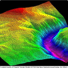
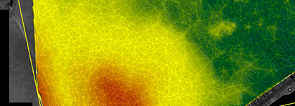
Navigational nautical charts are created using modern technology and geodata. Cartographers collect data using a variety of sources such as satellites, hydrographic surveys, laser scans and other methods. It is then processed and used to create digital terrain models, which in turn are used to create navigational nautical charts.
Various devices and technologies are used to navigate vessels in the maritime environment. A ship navigator is a device that is used to determine a vessel's position, plot a course and ensure safe navigation. It can be used in conjunction with navigation charts, which allows to find the optimal path and determine the ship's position at any time.
Special programs and systems are used to create electronic navigation charts, which allow them to be processed and displayed on the screen. This provides convenience and accuracy in using the charts and reduces the time required to plot a course.
Navigational nautical charts can also be used for navigation training and licensing to obtain permission to operate a marine vessel. In navigation training courses, students learn the principles of using navigational charts and the different instruments and devices used for navigation at sea.
One important aspect of navigating at sea is to take into account the topography of the seabed and sea surface. Some navigation charts contain material about the bottom topography that help navigators avoid hazardous areas such as underwater rocks or coral reefs. In addition, nautical charts may also contain information about tides, currents, buoys, and other navigational markers that help boaters navigate their vessel at sea.
Overall, navigational nautical charts are an integral part of safety at sea. They help boaters establish safe routes, avoid hazardous areas and manage their vessel at sea. Modern technology and methods of creating navigational charts make them more accurate and reliable, which in turn improves maritime safety and reduces the risks associated with navigation.
Navigation mapping are used in various situations related to sailing and navigation at sea. Some of the most common use cases for navigational charts include:
-
Route planning: Mariners use navigational charts to plot safe routes while sailing. The charts help them avoid hazardous areas such as underwater rocks, reefs, or shallows, ensuring safe navigation.
-
Location determination: Navigational charts are used to determine a vessel's position at sea. Navigators use instruments and devices like GPS or sonar to locate their position on the chart accurately.
-
Safety assurance: Navigational charts assist mariners in ensuring the safety of their voyages by helping them avoid hazardous routes and areas at sea.
-
Navigating in challenging conditions: Navigational charts are used to navigate in challenging conditions such as fog, nighttime, or poor visibility.
-
Preparation for voyages: Navigational charts are used to prepare for voyages, allowing mariners to study routes and conditions in advance.
-
Scientific and research purposes: Navigational charts are used for scientific and research purposes, such as studying tides, currents, and changes in seabed topography.
In general, navigational charts are crucial tools for mariners and navigators, ensuring safety at sea and assisting them in managing their vessels in challenging conditions.
There are several types of digital navigational charts used in modern sea navigation. Some of the most common types of digital navigational charts include:
-
Electronic Charts: These are digital versions of traditional paper navigational charts that can be used on computers and other electronic devices.
-
Radionavigation Charts: These charts are used for navigation using radionavigation systems such as GPS or GLONASS.
-
3D Charts: These are three-dimensional models of the terrain that allow mariners to visualize the seabed relief and other physical features of the area.
-
Aerophotomaps: These maps are created based on aerial images of the area, allowing mariners to see the surroundings at a high resolution.
-
Hydrographic Charts: These charts depict underwater relief and hydrographic features such as marine currents, tides, and depths.
-
Topographic Charts: These charts show the terrain and physical features of the land surface and can be used for navigation at sea near the coastline.
Depending on the navigation objectives and sailing conditions, mariners and navigators can use different types of digital navigational charts to ensure safety at sea and successfully accomplish their tasks.
Need satellite imagery or help choosing the right data?
Describe your task, area of interest, and desired outcome. We will check data
availability, assess new acquisition options, and propose the optimal solution in terms of timelines, cost,
and quality.
Discuss the project
clients who trust us
25+ years in the geodata market






